
Quetzaltenango
Quetzaltenango, or Xela, is a highland city known for Spanish classes and colonial streets, with hot springs and volcano hikes within reach.
We may earn a commission. It never decides our picks.
Quetzaltenango, usually called Xela, is a city in the western highlands of Guatemala, at about 2,300 meters (7,500 feet) above sea level. The center has colonial-era buildings around a central square, and the city has long been a base for Spanish language schools. Many people come for classes that run a week or several, and the same streets suit a few slower days in a working highland city.
Most trips pair the city with day trips to nearby volcanoes and hot springs. The dry season, roughly November to April, is the most reliable time for hiking, and nights stay cool at this altitude, so pack layers. Three days cover the city and one day trip, and a longer stay suits anyone studying Spanish. If you move on, plan a long road journey to Lake Atitlán or Antigua.
Quetzaltenango in five
- Pack for cold mornings and nightsThe city sits high in the western highlands, so bring warm layers and a rain shell, and ask hotels about heating before you book. Take the first evening quietly while you adjust to the altitude.Where to stay in Quetzaltenango
- Check volcano conditions before you climbUK advice says to check the Guatemalan Meteorological Office and CONRED, that there is no mountain rescue service and that deaths have occurred. Climb only with an experienced guide.Xela in 3 days
- Book a shuttle or driver, not a chicken busUK advice says to avoid public buses, the repainted US school buses, because of attacks, extortion and accidents. Travel by day and use the main highway.Xela to Lake Atitlán or Antigua
- Ask before you photograph peopleUK advice says not to take photographs without permission, especially of children, because attacks have followed fears of child kidnapping in more remote areas.
- Read the border advice before heading to MexicoUK advice is against all but essential travel within 5 km of the Mexican border from the Pacific coast up to and including the Gracias a Dios crossing. Check your exact crossing.UK regional advice
Things to do in Quetzaltenango
See all attractions in Quetzaltenango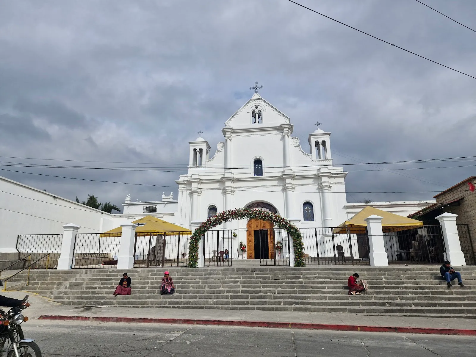



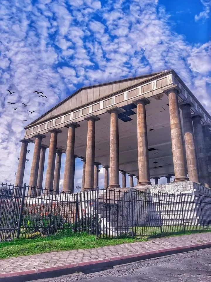
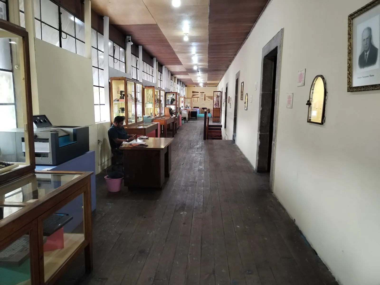
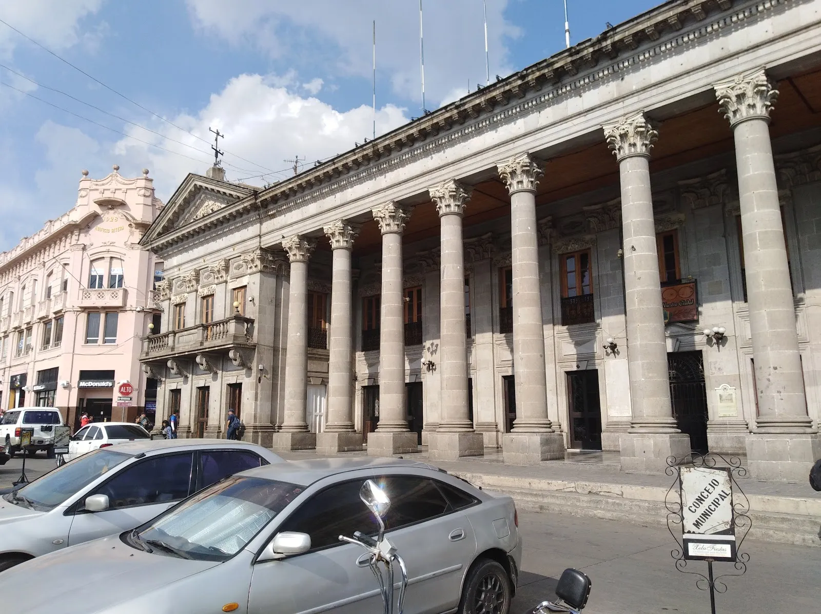
Need to know
- Airport
- Guatemala City (GUA) is the usual gateway
- Getting there
- Pan-American Highway by booked shuttle or driver
- Getting around
- Walking in the center; taxis for day trips
- Best base
- Historic center around Parque Centro América
- Time needed
- 2–3 days; more with Spanish classes
Weather by month
- Rainy days
- Days with storms
- Best
- Good
- Mixed
- Poor
- JanuaryRain16 rainy daysHigh19°Low10°Dry, cold nightsJanuaryRain
Best
- High
- 19°
- Low
- 10°
- Precipitation
- 50 mm
- Rainy days
- 16
- Snowy days
- 0
- Days with storms
- 0
Dry, cold nights
- FebruaryRain16 rainy daysHigh19°Low10°Dry, sunnyFebruaryRain
Best
- High
- 19°
- Low
- 10°
- Precipitation
- 59 mm
- Rainy days
- 16
- Snowy days
- 0
- Days with storms
- 0
Dry, sunny
- MarchRain25 rainy daysHigh20°Low11°Dry, warm daysMarchRain
Best
- High
- 20°
- Low
- 11°
- Precipitation
- 113 mm
- Rainy days
- 25
- Snowy days
- 0
- Days with storms
- 0
Dry, warm days
- AprilRain26 rainy daysHigh19°Low12°Dry, hazyAprilRain
Mixed
- High
- 19°
- Low
- 12°
- Precipitation
- 197 mm
- Rainy days
- 26
- Snowy days
- 0
- Days with storms
- 0
Dry, hazy
- MayRain30 rainy daysHigh19°Low13°Rains startMayRain
Poor
- High
- 19°
- Low
- 13°
- Precipitation
- 385 mm
- Rainy days
- 30
- Snowy days
- 0
- Days with storms
- 0
Rains start
- JuneRain30 rainy days1 day with stormsHigh18°Low13°Wet afternoonsJuneRain
Poor
- High
- 18°
- Low
- 13°
- Precipitation
- 555 mm
- Rainy days
- 30
- Snowy days
- 0
- Days with storms
- 1
Wet afternoons
- JulyRain27 rainy days1 day with stormsHigh19°Low13°Wet, some dry daysJulyRain
Mixed
- High
- 19°
- Low
- 13°
- Precipitation
- 321 mm
- Rainy days
- 27
- Snowy days
- 0
- Days with storms
- 1
Wet, some dry days
- AugustRain30 rainy days1 day with stormsHigh19°Low13°WetAugustRain
Poor
- High
- 19°
- Low
- 13°
- Precipitation
- 420 mm
- Rainy days
- 30
- Snowy days
- 0
- Days with storms
- 1
Wet
- SeptemberRain30 rainy days1 day with stormsHigh18°Low13°WettestSeptemberRain
Poor
- High
- 18°
- Low
- 13°
- Precipitation
- 517 mm
- Rainy days
- 30
- Snowy days
- 0
- Days with storms
- 1
Wettest
- OctoberRain29 rainy daysHigh18°Low12°WetOctoberRain
Poor
- High
- 18°
- Low
- 12°
- Precipitation
- 426 mm
- Rainy days
- 29
- Snowy days
- 0
- Days with storms
- 0
Wet
- NovemberRain22 rainy daysHigh18°Low12°Rains easeNovemberRain
Good
- High
- 18°
- Low
- 12°
- Precipitation
- 140 mm
- Rainy days
- 22
- Snowy days
- 0
- Days with storms
- 0
Rains ease
- DecemberRain18 rainy days1 day with stormsHigh18°Low11°Dry, very coldDecemberRain
Best
- High
- 18°
- Low
- 11°
- Precipitation
- 70 mm
- Rainy days
- 18
- Snowy days
- 0
- Days with storms
- 1
Dry, very cold
Average daily high and low in Quetzaltenango, 2016–2025. Rainy day: 1 mm of rain or more.
Right now in Quetzaltenango
Local time, today's weather and the exchange rate, refreshed through the day.

17
- Feels like
- 16°
- Humidity
- 56%
- Wind
- 4 km/h
- Chance of rain
- 100%
Quetzaltenango
06:20 PM
Monday, November 2
- Today19°8°100%Monday: Drizzle. High 19°, Low 8°. Chance of rain 100%.
- Tue18°5°100%Tuesday: Drizzle. High 18°, Low 5°. Chance of rain 100%.
- Wed19°6°100%Wednesday: Drizzle. High 19°, Low 6°. Chance of rain 100%.
- Thu18°5°100%Thursday: Drizzle. High 18°, Low 5°. Chance of rain 100%.
- Fri17°7°100%Friday: Drizzle. High 17°, Low 7°. Chance of rain 100%.
- Sat18°6°100%Saturday: Rain. High 18°, Low 6°. Chance of rain 100%.
- Sun17°6°100%Sunday: Rain. High 17°, Low 6°. Chance of rain 100%.
Updated 02:31 PM local time · Weather data by Open-Meteo.com
Money
Mid-market rate1 USD = 7.656 GTQ
Rates from Nov 2, 2026 · Rates By Exchange Rate API
Day trips by train
- Zunil and the hot springshalf a day with a driverA highland village, vegetable fields at Almolonga and thermal pools in the hills.
- Laguna Chicabalfull day with a guideA crater lagoon with local rules; ask your guide what is allowed.
- Lake Atitlánhalf a day by shuttleThe next stop east on the Pan-American Highway.Read the guide
Before you go to Quetzaltenango
We may earn a commission. It never decides our picks.
Rules for Quetzaltenango, checked
- Before you climb a volcano, check the Guatemalan Meteorological Office and CONRED; there is no mountain rescue service.Checked Oct 3, 2026 · Source
- Carrying ID is a legal requirement; in most parts of the country a copy of your passport photo page is accepted.Checked Oct 3, 2026 · Source
- FCDO advises against all but essential travel within 5 km of the Mexican border from the Pacific coast up to the Gracias a Dios crossing.Checked Oct 3, 2026 · Source

Plan around Quetzaltenango
Quetzaltenango FAQ
How many days do you need in Quetzaltenango?
Three days cover the center, a day south to Zunil and the hot springs and one highland excursion. Two work if you skip the excursion. Add days only for Spanish classes or an overnight volcano climb.
Is Quetzaltenango worth visiting?
Yes, if you want a working highland city with fewer tour groups than Antigua, plus hot springs, markets and volcano day trips. It is a poorer fit for a trip with only a few days or one that depends on warm weather.
Is Quetzaltenango cold?
Mornings and nights are cold because the city sits high in the western highlands. Bring a warm layer and a rain shell, ask hotels about heating, and plan a quiet first evening while you adjust to the altitude.
How do you get from Quetzaltenango to Lake Atitlán?
By booked tourist shuttle or private driver along the Pan-American Highway, in daylight. UK advice says to avoid public buses and names the Godinez bypass and the Cocales to San Lucas Tolimán road as routes to avoid.
Is it safe to climb a volcano near Xela?
Only with an experienced guide and after checking the Guatemalan authorities. UK advice says there is no mountain rescue service, that local tour organizers tend to underestimate the risks and that deaths have occurred.