
Bay of Kotor
A winding bay of walled towns, island monasteries and high mountains, with Kotor and Perast among its shore towns.
We may earn a commission. It never decides our picks.
The Bay of Kotor, also called the Gulf of Kotor or the Boka, is a long, twisting inlet in southwestern Montenegro. Mount Orjen rises above its western shore and Lovćen above the east, and the water links several smaller bays. Kotor, Risan, Tivat, Perast, Prčanj and Herceg Novi sit along the shore, with churches and monasteries close to the water. The Natural and Culturo-Historical Region of Kotor has been on UNESCO's World Heritage list since 1979.
The bay has a long maritime past. Kotor was a medieval salt-trade city, and Venice ruled the bay from 1420 to 1797. Most people here are Orthodox Christians, while Perast is largely Catholic. The area ranks among Europe's wettest. Most rain falls in autumn, August is often dry and fire-prone, and cold Bora winds blow down from the mountains in winter. Plan outdoor days around the weather.
Bay of Kotor in five
- Plan the bay as a loop of stops, not one driveKotor, Perast, Risan, Herceg Novi and Tivat all lie on shore roads. Pick two or three stops a day; UK advice notes that coastal roads slow in summer.
- Use the Verige strait ferry to shorten the loopA car ferry crosses the narrow Verige strait between Kamenari and Lepetane, which links the Herceg Novi side with Tivat. Check the operator's current schedule and price before you rely on it.
- Add a boat day for the Blue CaveThe board names the Blue Cave on the Luštica peninsula as a swimming stop on bay boat tours. Pick a licensed operator and check wind and sea conditions on the day.
- Pick the Tivat or Herceg Novi end of the bayTivat Airport is 4 km from the town center, while Herceg Novi lies near the Croatian crossings at Debeli brijeg and Kobila. Start at the end that matches your flight or your Dubrovnik leg.Tivat
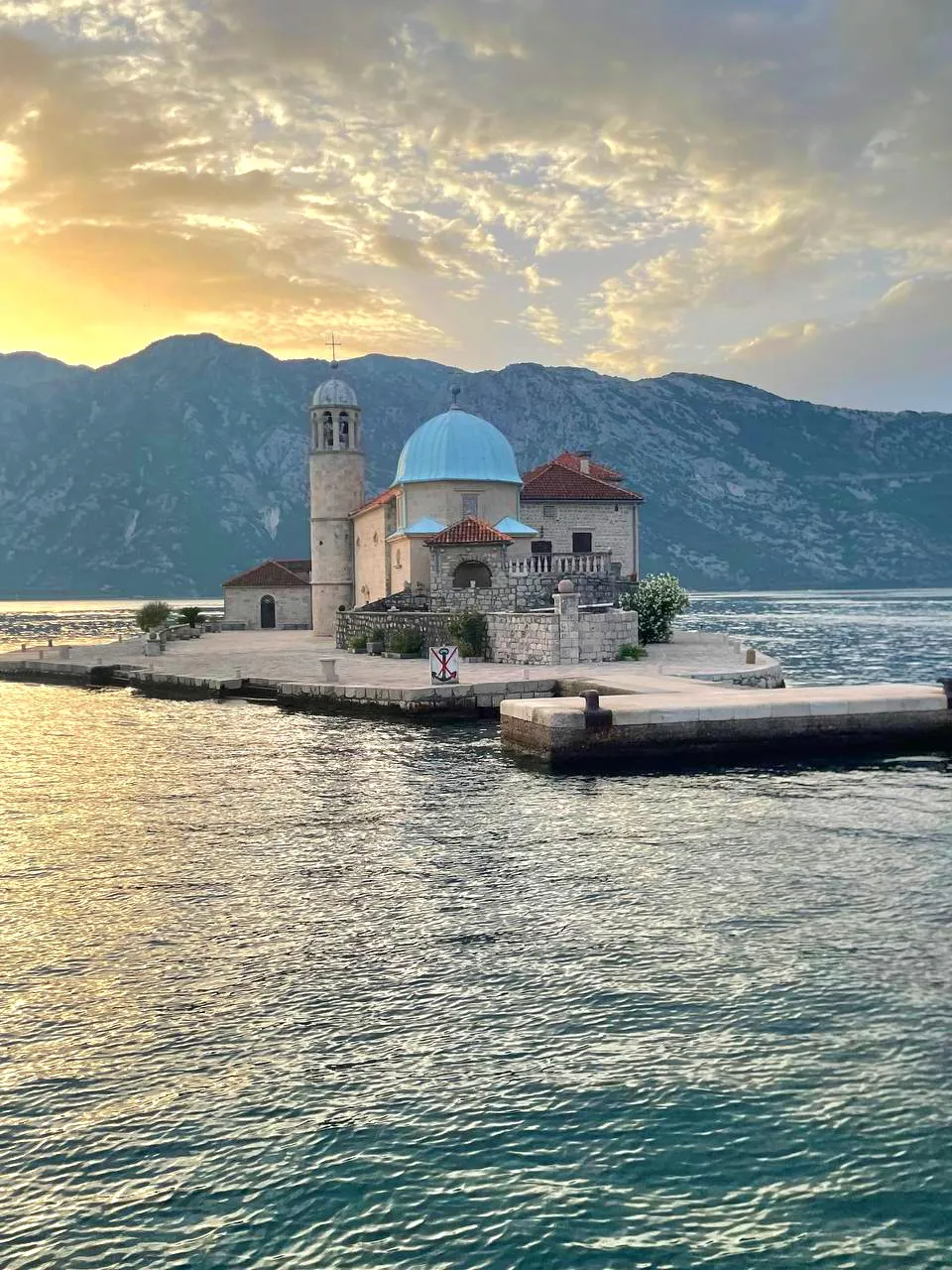
- Make Perast the boat stop of the loopSmall boats cross from Perast to the island church of Our Lady of the Rocks, which makes it the natural stop between Kotor and Risan. The Perast guide covers the crossing.Perast guide
Neighborhoods
Where to stay in Bay of Kotor, the full guide
Kotor
- Best for: First visits, history
- To airport: Taxi or bus from Tivat airport
- Price band: $$–$$$
- Old town and fortress path
- Cable car and bus links
- Crowded at midday
Skip if you want empty lanes in daytime.
We may earn a commission. It never decides our picks.
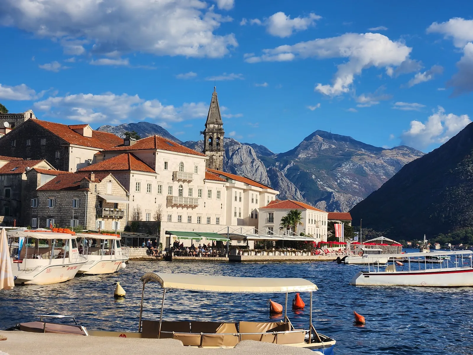
Perast
- Best for: Couples, slow stays
- To airport: Taxi from Tivat airport
- Price band: $$
- Waterfront stone houses
- Boats to the island church
- Few shops and restaurants
Skip if you want a choice of dinners.
We may earn a commission. It never decides our picks.
Things to do in Bay of Kotor
See all attractions in Bay of Kotor





Need to know
- Airport
- Tivat (TIV) sits on the bay; Podgorica (TGD) is the second airport
- Getting there
- Road from the coast or Podgorica; catamaran from Dubrovnik to Kotor
- Getting around
- Car or bus on the shore roads; boats for islands and caves
- Best base
- Kotor for the old town; Tivat or Herceg Novi for the bay ends
- Time needed
- Two to three days for a loop with stops
Weather by month
- Rainy days
- Best
- Good
- Mixed
- Poor
- JanuaryRain14 rainy daysHigh10°Low6°Quiet, wetJanuaryRain
Poor
- High
- 10°
- Low
- 6°
- Precipitation
- 280 mm
- Rainy days
- 14
- Snowy days
- 0
- Days with storms
- 0
Quiet, wet
- FebruaryRain12 rainy daysHigh12°Low7°Quiet, wetFebruaryRain
Poor
- High
- 12°
- Low
- 7°
- Precipitation
- 240 mm
- Rainy days
- 12
- Snowy days
- 0
- Days with storms
- 0
Quiet, wet
- MarchRain13 rainy daysHigh13°Low8°Spring lightMarchRain
Poor
- High
- 13°
- Low
- 8°
- Precipitation
- 301 mm
- Rainy days
- 13
- Snowy days
- 0
- Days with storms
- 0
Spring light
- AprilPartly cloudy10 rainy daysHigh17°Low11°Warm, greenAprilPartly cloudy
Good
- High
- 17°
- Low
- 11°
- Precipitation
- 149 mm
- Rainy days
- 10
- Snowy days
- 0
- Days with storms
- 0
Warm, green
- MayRain13 rainy daysHigh20°Low15°Warm, calmMayRain
Good
- High
- 20°
- Low
- 15°
- Precipitation
- 182 mm
- Rainy days
- 13
- Snowy days
- 0
- Days with storms
- 0
Warm, calm
- JuneClear7 rainy daysHigh25°Low20°Hot, brightJuneClear
Best
- High
- 25°
- Low
- 20°
- Precipitation
- 78 mm
- Rainy days
- 7
- Snowy days
- 0
- Days with storms
- 0
Hot, bright
- JulyClear3 rainy daysHigh28°Low22°Hot, shipsJulyClear
Best
- High
- 28°
- Low
- 22°
- Precipitation
- 44 mm
- Rainy days
- 3
- Snowy days
- 0
- Days with storms
- 0
Hot, ships
- AugustClear6 rainy daysHigh28°Low22°Hot, shipsAugustClear
Best
- High
- 28°
- Low
- 22°
- Precipitation
- 57 mm
- Rainy days
- 6
- Snowy days
- 0
- Days with storms
- 0
Hot, ships
- SeptemberRain10 rainy daysHigh24°Low18°Warm seaSeptemberRain
Best
- High
- 24°
- Low
- 18°
- Precipitation
- 191 mm
- Rainy days
- 10
- Snowy days
- 0
- Days with storms
- 0
Warm sea
- OctoberRain10 rainy daysHigh20°Low14°Mild, calmOctoberRain
Mixed
- High
- 20°
- Low
- 14°
- Precipitation
- 268 mm
- Rainy days
- 10
- Snowy days
- 0
- Days with storms
- 0
Mild, calm
- NovemberRain15 rainy daysHigh16°Low11°RainyNovemberRain
Poor
- High
- 16°
- Low
- 11°
- Precipitation
- 516 mm
- Rainy days
- 15
- Snowy days
- 0
- Days with storms
- 0
Rainy
- DecemberRain13 rainy daysHigh12°Low7°Mild, wetDecemberRain
Poor
- High
- 12°
- Low
- 7°
- Precipitation
- 331 mm
- Rainy days
- 13
- Snowy days
- 0
- Days with storms
- 0
Mild, wet
Average daily high and low in Kotor, 2016–2025. Rainy day: 1 mm of rain or more.
Right now in Bay of Kotor
Local time, today's weather and the exchange rate, refreshed through the day.

12
- Feels like
- 9°
- Humidity
- 73%
- Wind
- 16 km/h
- Chance of rain
- 80%
Tivat
01:03 AM
Tuesday, November 3
- Today19°16°80%Tuesday: Rain. High 19°, Low 16°. Chance of rain 80%.
- Wed19°15°0%Wednesday: Cloudy. High 19°, Low 15°. Chance of rain 0%.
- Thu19°15°0%Thursday: Partly cloudy. High 19°, Low 15°. Chance of rain 0%.
- Fri18°14°4%Friday: Clear. High 18°, Low 14°. Chance of rain 4%.
- Sat18°14°17%Saturday: Rain. High 18°, Low 14°. Chance of rain 17%.
- Sun16°14°28%Sunday: Rain. High 16°, Low 14°. Chance of rain 28%.
Updated 10:50 PM local time · Powered by WeatherAPI.com · Weather data by Open-Meteo.com
Day trips by train
Before you go to Bay of Kotor
We may earn a commission. It never decides our picks.
Rules for Bay of Kotor, checked
- Montenegro is outside the EU, so check whether your nationality needs a visa or can enter on a passport alone with the Montenegrin Ministry of Foreign Affairs before you book.
- Declare cash and goods above the legal limits on arrival. Check the current limits with Montenegrin customs before you travel.
- Dial 112 for police, fire or an ambulance anywhere in Montenegro.
- Cover shoulders and knees before entering the Orthodox and Catholic churches and monasteries around the bay.

Plan around Bay of Kotor
Bay of Kotor FAQ
Is the Bay of Kotor a fjord?
Montenegro's tourism board calls it the southernmost fjord in the world, while many geographers call it a drowned river valley. Either way it is a long inlet ringed by steep mountains.
How big is the Bay of Kotor?
The tourism board gives the bay area as 87.3 km², with a 105.7 km coast and a maximum depth of 68 m.
How many days do you need for the Bay of Kotor?
Two days cover Kotor and Perast. Three days add Tivat or Herceg Novi, a boat trip and the cable car. A fourth day suits Lovćen or a coastal beach day.
What is the best way to see the Bay of Kotor?
A car gives the most freedom on the shore roads, a boat tour adds caves and islands, and buses link the main towns. Mix a driving day with a boat day.
Where should you stay on the Bay of Kotor?
Kotor for the old town, Perast for quiet evenings, Tivat for the airport and marina, Herceg Novi for the western end and Croatia. Pick one base and visit the rest.