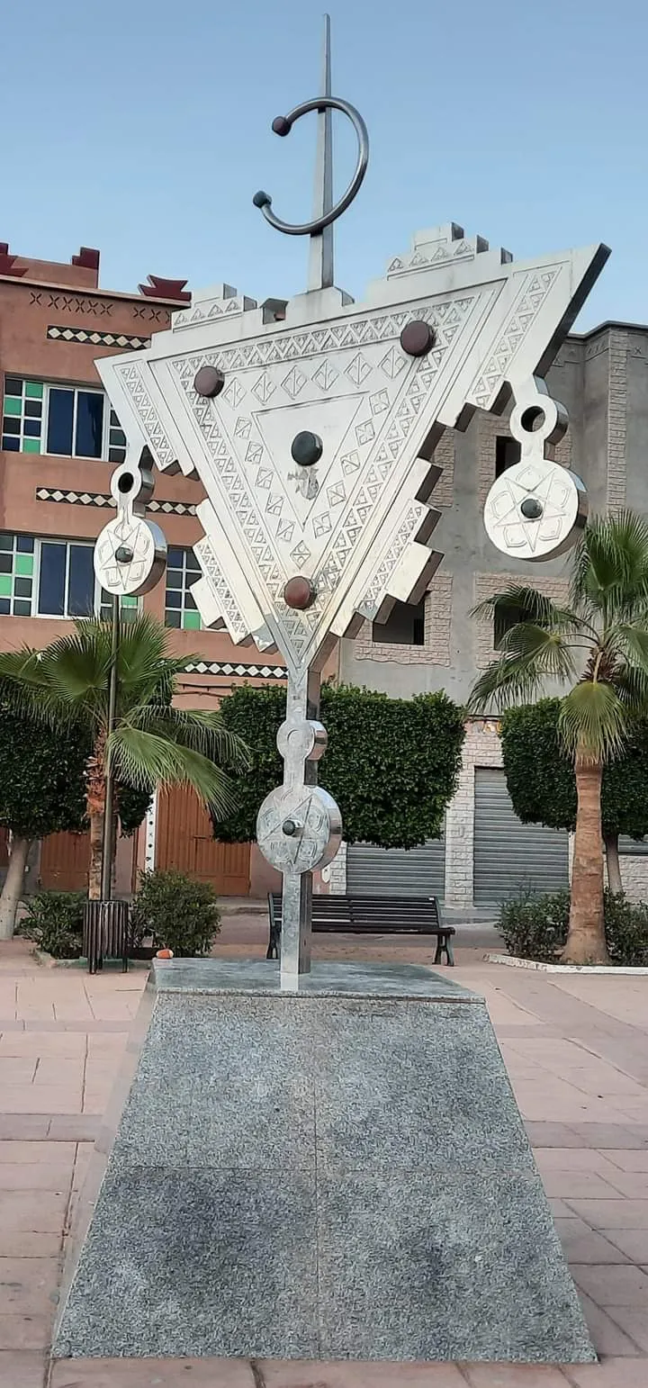
Tafraoute
Tafraoute is a town in Morocco’s Anti-Atlas, set in a valley beneath Djebel Lekest, a pink granite mountain.
We may earn a commission. It never decides our picks.
Tafraoute, also spelled Tafraout, is a town in Tiznit Province in Morocco’s Souss-Massa region. It sits in a small valley in the central Anti-Atlas, at the foot of Djebel Lekest, a pink granite mountain shaped by erosion. The surrounding area has mountain scenery, olive and almond groves, and argan and fig trees. Tafraoute is a base for seeing the valleys and mountains of southern Morocco.
Tachelhit, the local Berber language, is spoken in Tafraoute. The town’s name comes from a Tachelhit word for a basin or cistern used to pour water drawn from a well; the word also means valley. The Arabic spelling is تافراوت. The Anti-Atlas forms part of the wider Atlas Mountains system in northwest Africa. Tafraoute is a fit for a trip focused on mountain and valley scenery. The facts here do not establish specific activities, travel times, or seasonal conditions, so check current local information when planning those details.
Tafraoute in five
- Drive the steep road from Tiznit in daylightThe tourist board gives Tiznit to Tafraoute as 110 km of steep road, with lunar landscapes that change as it enters the valley. The UK government warns that night driving is dangerous.Taroudant
- Time the trip for the almond blossomThe tourist board calls Tafraoute the land of almonds and says it celebrates the almond trees in February with a festival lasting until dawn. Book a room early and confirm the dates locally.
- See the painted rocks in the Ameln valleyThe tourist board says Tafraoute's painted rocks in the Ameln valley form a spectacular setting. Go early or late for light, and walk or drive depending on the heat.
- Plan a night, not a rushed day trip from AgadirThe tourist board gives Tiznit as 78 km from Agadir, then 110 km on to Tafraoute. A night here makes the drive reasonable and lets you walk among the granite at either end of the day.Agadir
- Hire a guide for walks beyond the roadThe UK government advises researching trails and hiring a professional guide for hiking in the Atlas. The Anti-Atlas is arid, so carry water and sun protection.Insurance

Need to know
- Getting there
- Steep road from Tiznit, 110 km; Tiznit is 78 km from Agadir
- Getting around
- On foot in town; a car or driver for the Ameln valley
- Best base
- A guesthouse in Tafraoute or the Ameln valley
- Time needed
- One night; two with walks
- Festival
- Almond blossom festival in February
Weather by month
- Rainy days
- Best
- Good
- JanuaryClear2 rainy daysHigh20°Low11°Cool, clearJanuaryClear
Best
- High
- 20°
- Low
- 11°
- Precipitation
- 12 mm
- Rainy days
- 2
- Snowy days
- 0
- Days with storms
- 0
Cool, clear
- FebruaryClear4 rainy daysHigh21°Low12°Almond blossomFebruaryClear
Best
- High
- 21°
- Low
- 12°
- Precipitation
- 30 mm
- Rainy days
- 4
- Snowy days
- 0
- Days with storms
- 0
Almond blossom
- MarchClear6 rainy daysHigh21°Low13°Mild, clearMarchClear
Best
- High
- 21°
- Low
- 13°
- Precipitation
- 25 mm
- Rainy days
- 6
- Snowy days
- 0
- Days with storms
- 0
Mild, clear
- AprilClear3 rainy daysHigh23°Low15°Warm, easyAprilClear
Best
- High
- 23°
- Low
- 15°
- Precipitation
- 12 mm
- Rainy days
- 3
- Snowy days
- 0
- Days with storms
- 0
Warm, easy
- MayClear3 rainy daysHigh24°Low16°HotMayClear
Best
- High
- 24°
- Low
- 16°
- Precipitation
- 10 mm
- Rainy days
- 3
- Snowy days
- 0
- Days with storms
- 0
Hot
- JuneClear1 rainy dayHigh26°Low18°Very hotJuneClear
Best
- High
- 26°
- Low
- 18°
- Precipitation
- 3 mm
- Rainy days
- 1
- Snowy days
- 0
- Days with storms
- 0
Very hot
- JulyClear0 rainy daysHigh30°Low20°Very hotJulyClear
Best
- High
- 30°
- Low
- 20°
- Precipitation
- 0 mm
- Rainy days
- 0
- Snowy days
- 0
- Days with storms
- 0
Very hot
- AugustClear0 rainy daysHigh31°Low22°Very hotAugustClear
Good
- High
- 31°
- Low
- 22°
- Precipitation
- 0 mm
- Rainy days
- 0
- Snowy days
- 0
- Days with storms
- 0
Very hot
- SeptemberClear1 rainy dayHigh28°Low20°Hot, easingSeptemberClear
Best
- High
- 28°
- Low
- 20°
- Precipitation
- 8 mm
- Rainy days
- 1
- Snowy days
- 0
- Days with storms
- 0
Hot, easing
- OctoberClear2 rainy daysHigh27°Low19°Warm, easyOctoberClear
Best
- High
- 27°
- Low
- 19°
- Precipitation
- 12 mm
- Rainy days
- 2
- Snowy days
- 0
- Days with storms
- 0
Warm, easy
- NovemberClear3 rainy daysHigh24°Low15°Mild, clearNovemberClear
Best
- High
- 24°
- Low
- 15°
- Precipitation
- 20 mm
- Rainy days
- 3
- Snowy days
- 0
- Days with storms
- 0
Mild, clear
- DecemberClear3 rainy daysHigh21°Low13°Cool, clearDecemberClear
Best
- High
- 21°
- Low
- 13°
- Precipitation
- 23 mm
- Rainy days
- 3
- Snowy days
- 0
- Days with storms
- 0
Cool, clear
Average daily high and low in Tafraoute, 2016–2025. Rainy day: 1 mm of rain or more.
Right now in Tafraoute
Local time, today's weather and the exchange rate, refreshed through the day.

17
- Feels like
- 16°
- Humidity
- 60%
- Wind
- 4 km/h
- Chance of rain
- 65%
Tafraoute
10:38 PM
Monday, November 2
- Today20°16°65%Monday: Rain. High 20°, Low 16°. Chance of rain 65%.
- Tue19°14°65%Tuesday: Thunderstorms. High 19°, Low 14°. Chance of rain 65%.
- Wed20°12°3%Wednesday: Cloudy. High 20°, Low 12°. Chance of rain 3%.
- Thu23°13°0%Thursday: Cloudy. High 23°, Low 13°. Chance of rain 0%.
- Fri24°16°0%Friday: Cloudy. High 24°, Low 16°. Chance of rain 0%.
- Sat25°15°3%Saturday: Cloudy. High 25°, Low 15°. Chance of rain 3%.
- Sun25°18°59%Sunday: Rain. High 25°, Low 18°. Chance of rain 59%.
Updated 10:34 PM local time · Powered by WeatherAPI.com · Weather data by Open-Meteo.com
Money
Mid-market rate1 USD = 9.842 MAD
Rates from Nov 2, 2026 · Rates By Exchange Rate API
Every year
- JulFestival TimitarAgadir, a day trip
Day trips by train
- Anti Atlas Mountainsthe range around TafraouteArid peaks and Amazigh villages, crossed on a modern touring circuit.Read the guide
- Taroudanta long drive northA walled market town and trekking base between the Atlas ranges.Read the guide
- Agadir78 km to Tiznit, then 110 kmThe resort city and airport where most trips start.Read the guide
Before you go to Tafraoute
We may earn a commission. It never decides our picks.
Rules for Tafraoute, checked
- Tafraoute: the tourist board gives 110 km by a steep road from Tiznit, with an almond blossom festival in February.Checked Oct 2, 2026 · Source
- Anti-Atlas bends: the FCDO cautions that poor lighting makes night driving dangerous and mountain routes are hazardous in poor weather.Checked Oct 2, 2026 · Source
Plan around Tafraoute
The arid range around the town
Read the guideTaroudantRamparts and souks to the north
Read the guideSouss-Massa National ParkBirds and cliffs on the coast
Read the guideSouthern MoroccoThe wider Anti-Atlas and Atlantic south
Read the guideAgadir travel guideThe airport and starting point
Read the guideAll of MoroccoCities, desert, coast and entry basics
Read the guideMirleftAtlantic beach stop west of the range
Read the guideSidi IfniOld Spanish-era port on the coast
Read the guideTafraoute FAQ
What is Tafraoute known for?
Pink granite, almond trees and painted rocks. The tourist board describes lunar landscapes in a valley overhung by huge blocks of pink granite, and an almond festival in February that lasts until dawn.
How far is Tafraoute from Agadir?
The tourist board gives 78 km from Agadir to Tiznit and 110 km from Tiznit to Tafraoute, on a steep road. This guide has no verified total time, so ask a driver and plan a night.
When is the almond blossom in Tafraoute?
The tourist board says the town celebrates the almond trees in February with a festival. Exact dates and blossom timing vary, so confirm locally before you book.
Are the painted rocks worth seeing?
Yes if you like landscape art in a granite setting. The tourist board says the painted rocks in the Ameln valley form a spectacular setting, and early or late light is better than midday.
What is the Anti-Atlas?
A dry mountain chain south of the High Atlas. The tourist board names Jbel Siroua, at 3,300 m, as its highest peak, and says crossing the range is now a touring circuit with Amazigh villages.