Travel advisory · MoroccoSome governments advise against travel to parts of Morocco.The warnings cover only these areas: Mauritania border, Western Sahara: south and east of the Berm, Western Sahara: within 30 km of the Berm, Algeria border region, Western Sahara.Advice depends on your passport. Read your own government's advice before you book.Official advice
- Mauritania border · avoid all travel · France, Italy
- Western Sahara: south and east of the Berm · avoid all travel · Canada, New Zealand
- Western Sahara: within 30 km of the Berm · avoid all travel · Canada, New Zealand
- Algeria border region · avoid non-essential travel · Canada, Germany, Italy
- Western Sahara · avoid non-essential travel · Canada, Germany
Also named by one government: Al Houz (Spain), Taroudant (Spain), Casablanca peripheral and deprived neighbourhoods (Italy), East of the Moroccan defence wall (Italy)
| Government | Advice | Updated | Read the advice |
|---|---|---|---|
| United Kingdom (FCDO) | No advice against travel; general precautions only | – | Read the advice |
| United States (State Dept) | Exercise increased caution | Sep 4, 2026 | Read the advice |
| Canada (Global Affairs) | Exercise a high degree of caution due to terrorism (regional advisories) | – | Read the advice |
| Germany (Auswärtiges Amt) | Kein Warnhinweis für das übrige Land; Abraten nur für bestimmte Gebiete (regional advisories) | Nov 2, 2026 | Read the advice |
| New Zealand (SafeTravel) | Exercise increased caution (regional advisories) | – | Read the advice |
| Ireland (Department of Foreign Affairs) | High Degree of Caution | – | Read the advice |
| France (Ministry for Europe and Foreign Affairs) | Pays sûr, vigilance accrue dans certaines zones seulement (regional advisories) | – | Read the advice |
Checked daily from the governments' published advice; last checked Nov 2, 2026. RoamLedger summarises official advice; it is not advice from any government.

High Atlas Mountains
Walk among Morocco’s High Atlas peaks and mule-track villages, or cross mountain passes between Marrakech and the southern valleys.
We may earn a commission. It never decides our picks.
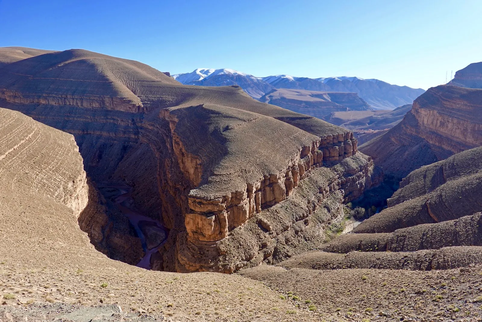
The High Atlas Mountains run across central Morocco, south of Marrakech. Mount Toubkal draws hikers, and valleys and mountain passes connect routes through the range toward the Draa and Dades valleys. Imlil is a common base for hikes toward Toubkal. Drivers can cross the mountains on roads that link Marrakech with destinations farther south.
Plan several days if you want to spend time near a trailhead and cross the range; with less time, choose one area to explore. A hiking trip works best when you plan around a mountain base such as Imlil. For a road trip, allow time for the mountain roads and passes between stops. The High Atlas suits travelers who want to walk or drive through mountain scenery, but it is a poor fit if you have only a short stop and expect to cover several areas.
High Atlas Mountains in five
- Choose a valley, not the whole rangeThe High Atlas is huge. The tourist board points to Imlil for Toubkal and the Ait Bouguemez valley, called the happy valley, for walking, so pick one base per trip.Imlil
- Hire a professional guide for real hikesThe UK government advises researching trails and hiring a professional guide before Atlas hikes, with insurance that covers what you plan to do.Insurance
- Treat the mountain roads with respectIn poor weather, secondary and mountain roads can be especially hazardous, and driving at night is risky because of poor lighting. Budget time and avoid dusk drives.Car hire
- Use the pass to reach the south, not to sightseeThe tourist board lists the Tizi n Tichka pass among the highlights on the way to the Ouarzazate area, and the trip from Marrakech takes about 3 hr 45 min to Ouarzazate. Stop for views and plan lunch before the climb.Ait Ben Haddou
- Do not expect to ski without checking the seasonThe tourist board mentions skiing at Oukaimeden in the Toubkal national park. Snow depends on the year, so confirm conditions and gear before you build a trip around it.
Things to do in High Atlas Mountains
See all attractions in High Atlas Mountains


Need to know
- Gateway
- Marrakech, by mountain road
- Getting there
- Hired car, shared taxi or tour; limited public transport
- Getting around
- Driver, 4x4 or on foot; mountain roads can be hazardous
- Best base
- Imlil for Toubkal; valley guesthouses for walking
- Time needed
- 2 days for Imlil; 5 or more for valley treks
Weather by month
- Best
- Good
- Mixed
- Poor
- JanuarySnow possible
- FebruarySnow possible
- MarchCool, variable
- AprilSpring walking
- MayGood trekking
- JuneGood trekking
- JulyHot valleys
- AugustHot valleys
- SeptemberGood trekking
- OctoberAutumn walking
- NovemberCold, snow
- DecemberSnow likely
Right now in High Atlas Mountains
Local time, today's weather and the exchange rate, refreshed through the day.

7
- Feels like
- 5°
- Humidity
- 82%
- Wind
- 4 km/h
- Chance of rain
- 65%
High Atlas Mountains
09:18 PM
Monday, November 2
- Today15°10°65%Monday: Rain. High 15°, Low 10°. Chance of rain 65%.
- Tue14°8°93%Tuesday: Thunderstorms. High 14°, Low 8°. Chance of rain 93%.
- Wed13°7°23%Wednesday: Fog. High 13°, Low 7°. Chance of rain 23%.
- Thu15°7°4%Thursday: Rain. High 15°, Low 7°. Chance of rain 4%.
- Fri16°8°6%Friday: Cloudy. High 16°, Low 8°. Chance of rain 6%.
- Sat19°10°1%Saturday: Cloudy. High 19°, Low 10°. Chance of rain 1%.
- Sun16°13°41%Sunday: Rain. High 16°, Low 13°. Chance of rain 41%.
Updated 08:03 PM local time · Powered by WeatherAPI.com · Weather data by Open-Meteo.com
Money
Mid-market rate1 USD = 9.842 MAD
Rates from Nov 2, 2026 · Rates By Exchange Rate API
Day trips by train
- Imlila mountain road from MarrakechThe trailhead village for Toubkal and nearby valley walks.Read the guide
- Ait Ben Haddoua long drive over the passA UNESCO ksar on the south side, better as part of a two-day route.Read the guide
- Agafay Desertabout 30 min from MarrakechA rocky plateau at the foot of the mountains.Read the guide
Before you go to High Atlas Mountains
We may earn a commission. It never decides our picks.
Rules for High Atlas Mountains, checked
- High Atlas treks: FCDO advice is to research the route, know the experience needed, hire a professional guide and insure the activity.Checked Oct 2, 2026 · Source
Plan around High Atlas Mountains
Trailhead village below Toubkal
Read the guideMarrakech travel guideThe city most trips start from
Read the guideAit Ben HaddouUNESCO ksar on the road south
Read the guideAgafay DesertRocky desert camps on the plain
Read the guideAll of MoroccoCities, desert, coast and entry basics
Read the guideBest time to visit MoroccoWhich months suit the mountains
Read the guideToubkal National ParkSummit climb, season and gear
Read the guideOurika ValleyThe nearest river valley south of Marrakech
Read the guideHigh Atlas Mountains FAQ
What is the best base in the High Atlas?
Imlil for Toubkal and short walks, or a valley village such as those in the Ait Bouguemez area for a quieter, longer stay. Choose by how much hiking you plan, not by distance from Marrakech.
Which High Atlas valley should you pick?
Imlil for Toubkal and short walks, the Ourika valley for the nearest river and waterfall outing from Marrakech, or a high valley such as Ait Bouguemez for a quieter, longer stay. Pick one base per trip.
Can you drive across the High Atlas yourself?
Yes on the main passes, but the UK government warns that mountain roads can be hazardous in poor weather and night driving is risky because of poor lighting. Avoid dusk and bad-weather drives.
Is the High Atlas good in winter?
For snow and skiing yes, though conditions vary. Roads and trails can be difficult, and the upper slopes can be cold, so choose winter only if you have the gear and a guide.
Can you see the High Atlas on a day trip from Marrakech?
Yes, with a tour or a driver. A day trip to Imlil is possible but long, and a night in the mountains gives you more walking time.