Tepoztlán
A Morelos hill town under red cliffs, known for the climb to the Tepozteco pyramid and a weekend market within reach of Mexico City.
We may earn a commission. It never decides our picks.
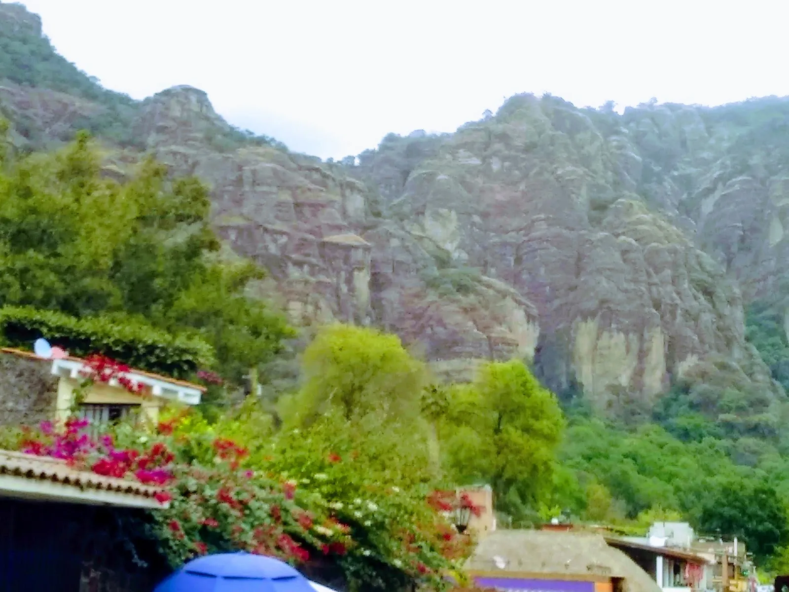
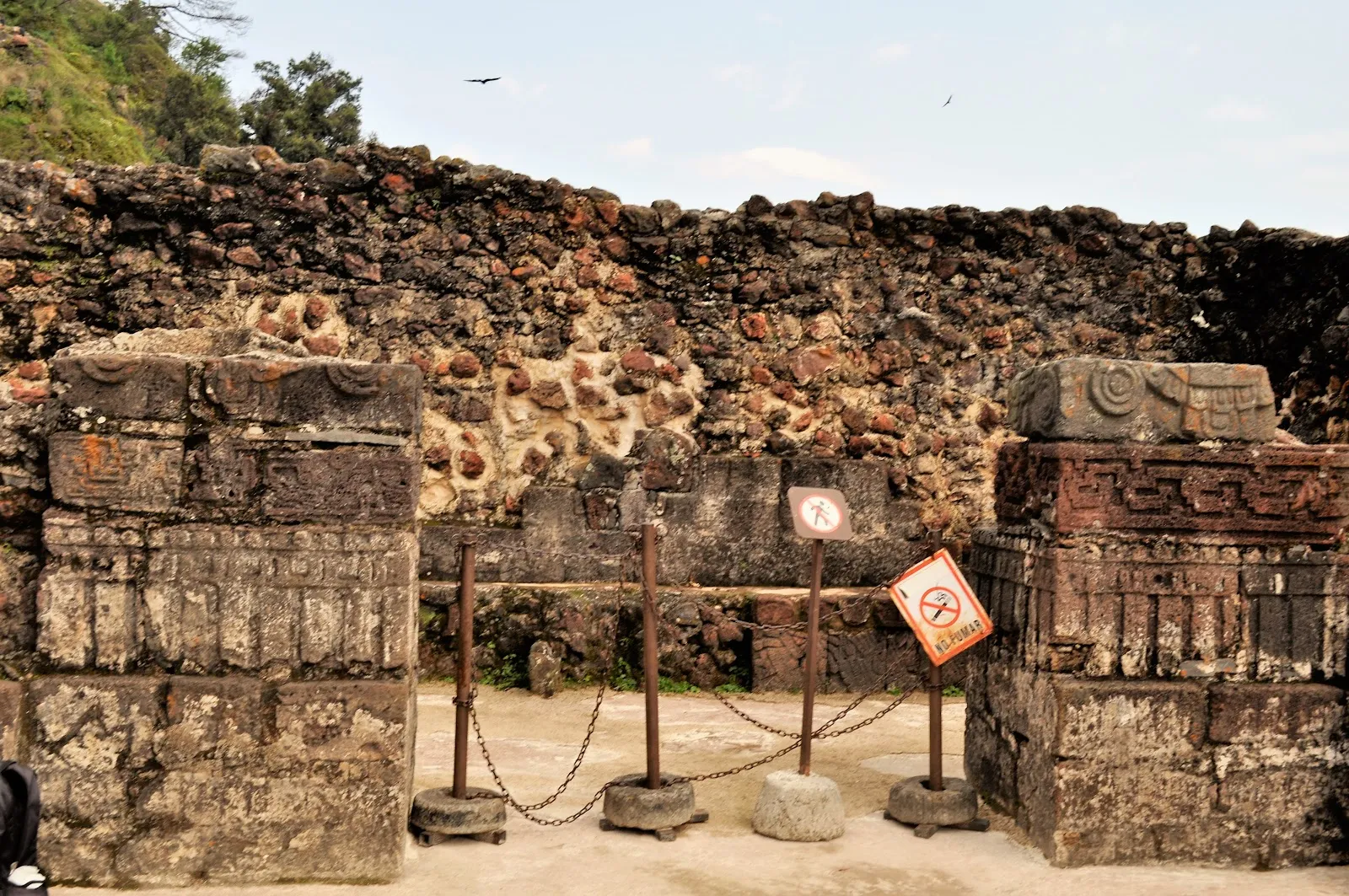
Tepoztlán is a hill town in Morelos, a state in central Mexico, a short drive south of Mexico City. Steep reddish cliffs rise behind the town, and on a ridge above it sits the Tepozteco, a stone pyramid built before the Spanish arrived. Reaching it means a steep climb on foot, which is the main reason visitors come. Around the central plaza you will find a weekend market with food and crafts, and restaurants serving local dishes.
A day trip from Mexico City works, and so does one or two nights. Weekends bring the most people to both the trail and the market, so a weekday or an early start makes for an easier visit. The rainy season runs roughly June through September, while the drier, cooler months from November through February make the climb more comfortable. Set aside a few hours for the hike and a few more for the town.
Tepoztlán in five
- Start the Tepozteco hike at openingThe stepped trail to the hilltop pyramid is steep, often an hour up for a moderately fit hiker, and it gets hot and crowded by late morning. Take water and shoes with grip.
- Go on a weekday if you canWeekends bring crowds from Mexico City, queues on the trail and full restaurants. A weekday keeps both the market and the climb calm.
- Take the bus from the southern terminalBuses from Mexico City's southern terminal take about 1.5 hours, longer in traffic on the road to Cuernavaca.Mexico City
- Eat at the market and try a local neveríaTepoztlán is known for ice cream in unusual flavors, and the market stalls serve quick lunches. Eat after the hike, not before.
- Add Cuernavaca or Taxco on the same loopTepoztlán sits between the capital and the colonial cities of the south, so it works as a night on a longer route.Cuernavaca


Need to know
- Airport
- Mexico City (MEX), about 1.5–2 hours by road
- Getting there
- Bus from Mexico City's southern terminal, about 1.5 hours
- Getting around
- On foot in the center; taxis to farther spots
- Best base
- In town for the market and trail, or Mexico City for a day trip
- Time needed
- A long day, or 1 night
Weather by month
- Rainy days
- Days with storms
- Best
- Mixed
- Poor
- JanuaryClear1 rainy dayHigh24°Low11°Dry, pleasantJanuaryClear
Best
- High
- 24°
- Low
- 11°
- Precipitation
- 9 mm
- Rainy days
- 1
- Snowy days
- 0
- Days with storms
- 0
Dry, pleasant
- FebruaryClear1 rainy dayHigh27°Low12°DryFebruaryClear
Best
- High
- 27°
- Low
- 12°
- Precipitation
- 4 mm
- Rainy days
- 1
- Snowy days
- 0
- Days with storms
- 0
Dry
- MarchClear1 rainy dayHigh29°Low14°Dry, warmMarchClear
Best
- High
- 29°
- Low
- 14°
- Precipitation
- 10 mm
- Rainy days
- 1
- Snowy days
- 0
- Days with storms
- 0
Dry, warm
- AprilClear3 rainy daysHigh30°Low15°Hot, dryAprilClear
Best
- High
- 30°
- Low
- 15°
- Precipitation
- 10 mm
- Rainy days
- 3
- Snowy days
- 0
- Days with storms
- 0
Hot, dry
- MayRain13 rainy daysHigh30°Low16°Hot, rains startMayRain
Mixed
- High
- 30°
- Low
- 16°
- Precipitation
- 98 mm
- Rainy days
- 13
- Snowy days
- 0
- Days with storms
- 0
Hot, rains start
- JuneRain23 rainy days1 day with stormsHigh26°Low16°Rainy seasonJuneRain
Poor
- High
- 26°
- Low
- 16°
- Precipitation
- 292 mm
- Rainy days
- 23
- Snowy days
- 0
- Days with storms
- 1
Rainy season
- JulyRain21 rainy days1 day with stormsHigh25°Low15°Rainy, greenJulyRain
Mixed
- High
- 25°
- Low
- 15°
- Precipitation
- 197 mm
- Rainy days
- 21
- Snowy days
- 0
- Days with storms
- 1
Rainy, green
- AugustRain26 rainy days1 day with stormsHigh25°Low15°Rainy, greenAugustRain
Poor
- High
- 25°
- Low
- 15°
- Precipitation
- 308 mm
- Rainy days
- 26
- Snowy days
- 0
- Days with storms
- 1
Rainy, green
- SeptemberRain25 rainy days2 days with stormsHigh24°Low15°Rain, greenSeptemberRain
Poor
- High
- 24°
- Low
- 15°
- Precipitation
- 364 mm
- Rainy days
- 25
- Snowy days
- 0
- Days with storms
- 2
Rain, green
- OctoberRain17 rainy daysHigh24°Low14°Rains endingOctoberRain
Mixed
- High
- 24°
- Low
- 14°
- Precipitation
- 139 mm
- Rainy days
- 17
- Snowy days
- 0
- Days with storms
- 0
Rains ending
- NovemberClear4 rainy daysHigh25°Low13°Dry, pleasantNovemberClear
Best
- High
- 25°
- Low
- 13°
- Precipitation
- 23 mm
- Rainy days
- 4
- Snowy days
- 0
- Days with storms
- 0
Dry, pleasant
- DecemberClear1 rainy dayHigh24°Low12°Dry, holidaysDecemberClear
Best
- High
- 24°
- Low
- 12°
- Precipitation
- 2 mm
- Rainy days
- 1
- Snowy days
- 0
- Days with storms
- 0
Dry, holidays
Average daily high and low in Tepoztlán, 2016–2025. Rainy day: 1 mm of rain or more.
Right now in Tepoztlán
Local time, today's weather and the exchange rate, refreshed through the day.

25
- Feels like
- 25°
- Humidity
- 53%
- Wind
- 10 km/h
- Chance of rain
- 8%
Tepoztlán
02:37 PM
Monday, November 2
- Today21°11°8%Monday: Clear. High 21°, Low 11°. Chance of rain 8%.
- Tue23°12°22%Tuesday: Cloudy. High 23°, Low 12°. Chance of rain 22%.
- Wed22°12°18%Wednesday: Cloudy. High 22°, Low 12°. Chance of rain 18%.
- Thu22°12°88%Thursday: Drizzle. High 22°, Low 12°. Chance of rain 88%.
- Fri22°12°59%Friday: Drizzle. High 22°, Low 12°. Chance of rain 59%.
- Sat20°12°61%Saturday: Drizzle. High 20°, Low 12°. Chance of rain 61%.
- Sun20°10°73%Sunday: Drizzle. High 20°, Low 10°. Chance of rain 73%.
Updated 12:10 PM local time · Powered by WeatherAPI.com · Weather data by Open-Meteo.com
Money
Mid-market rate1 USD = 18.81 MXN
Rates from Nov 2, 2026 · Rates By Exchange Rate API
Before you go to Tepoztlán
We may earn a commission. It never decides our picks.
Rules for Tepoztlán, checked
- Many nationalities need no visa for Mexico. Immigration issues a tourist permit (FMM) on arrival; check entry rules at gob.mx/sre before you book.
- Declare cash above the legal limit on the customs form at arrival or departure. Check the current amount with Mexican customs (SAT) before you travel.
- Dial 911 for police, fire or an ambulance anywhere in Mexico.
- Tipping waiters and taxi drivers is customary. Check the bill first, since some restaurants add a service charge.
Plan around Tepoztlán
Regions, entry rules, transport and money for a Mexico trip
Read the guideMexico CityThe usual starting point for the trip
Read the guideSouth of Mexico CityMorelos and Guerrero below the capital
Read the guideCuernavacaThe city on the way south
Read the guideTaxcoA silver town two hours farther south
Read the guideAround Mexico CityMore day trips from the capital
Read the guideTepoztlán FAQ
How hard is the Tepozteco hike?
It is steep with stone steps, often about an hour up for a moderately fit hiker and shorter down. It is slippery after rain. Start early and check opening hours and any entry fee at the trailhead.
Is Tepoztlán worth it as a day trip from Mexico City?
Yes if you like hiking and a market town. It is about 1.5 hours each way, so start early to have time for the climb and lunch. Stay a night if you want the town without the crowds.
How do you get from Mexico City to Tepoztlán?
By bus from the southern terminal in about 1.5 hours, or by car on the road toward Cuernavaca. A car helps if you plan to combine it with Taxco, but traffic on weekends can add an hour.
How many days do you need in Tepoztlán?
One long day covers the hike and the market. One night lets you see the town after the day trippers leave and start the trail at opening without a bus from the city.
When is the best time to visit Tepoztlán?
November to March for dry, mild days. The rainy season from June to September greens the hills but makes the trail slippery, and weekends are crowded all year.