Travel advisory · PanamaSome governments advise against travel to parts of Panama.The warnings cover only these areas: Mosquito Gulf, Colón, Curundú, El Chorrillo, San Miguelito.Advice depends on your passport. Read your own government's advice before you book.Official advice
- Mosquito Gulf · avoid all travel · Canada, France, New Zealand, US
- Colón · avoid non-essential travel · France, Italy
- Curundú · avoid non-essential travel · Spain, France
- El Chorrillo · avoid non-essential travel · Spain, France
- San Miguelito · avoid non-essential travel · Spain, France
Also named by one government: Darién border zone with Colombia (France), Darién Gap south of Yaviza (New Zealand), Darién south of Metetí to Colombian border (Canada), Parts of Darién Region (US), Arena (Canada), Arraiján (France), Calidonia (France), Colombian border zones (Spain), Cristobal (France), Darién Province (France), Eastern Darién Province (Italy), Eastern part of Guna Yala (San Blas) (France), El Cacao (Canada), Isla de Cusapín (Spain), Juan Díaz (France), La Chorrera (France), Pedregal (France), Quebro (Canada), San Felipe (France), Santa Ana (France), Tocumen (France)
| Government | Advice | Updated | Read the advice |
|---|---|---|---|
| United Kingdom (FCDO) | Remain vigilant, follow local authorities' advice after earthquake | – | Read the advice |
| United States (State Dept) | Exercise increased caution due to crime (regional advisories) | Aug 19, 2026 | Read the advice |
| Canada (Global Affairs) | Take normal security precautions (regional advisories) | – | Read the advice |
| Germany (Auswärtiges Amt) | No advice against the whole country | Oct 13, 2026 | Read the advice |
| New Zealand (SafeTravel) | Exercise increased caution (regional advisories) | – | Read the advice |
| Ireland (Department of Foreign Affairs) | High Degree of Caution | – | Read the advice |
| France (Ministry for Europe and Foreign Affairs) | Niveau de sécurité globalement satisfaisant, vigilance renforcée dans certaines zones (regional advisories) | – | Read the advice |
Checked daily from the governments' published advice; last checked Nov 2, 2026. RoamLedger summarises official advice; it is not advice from any government.
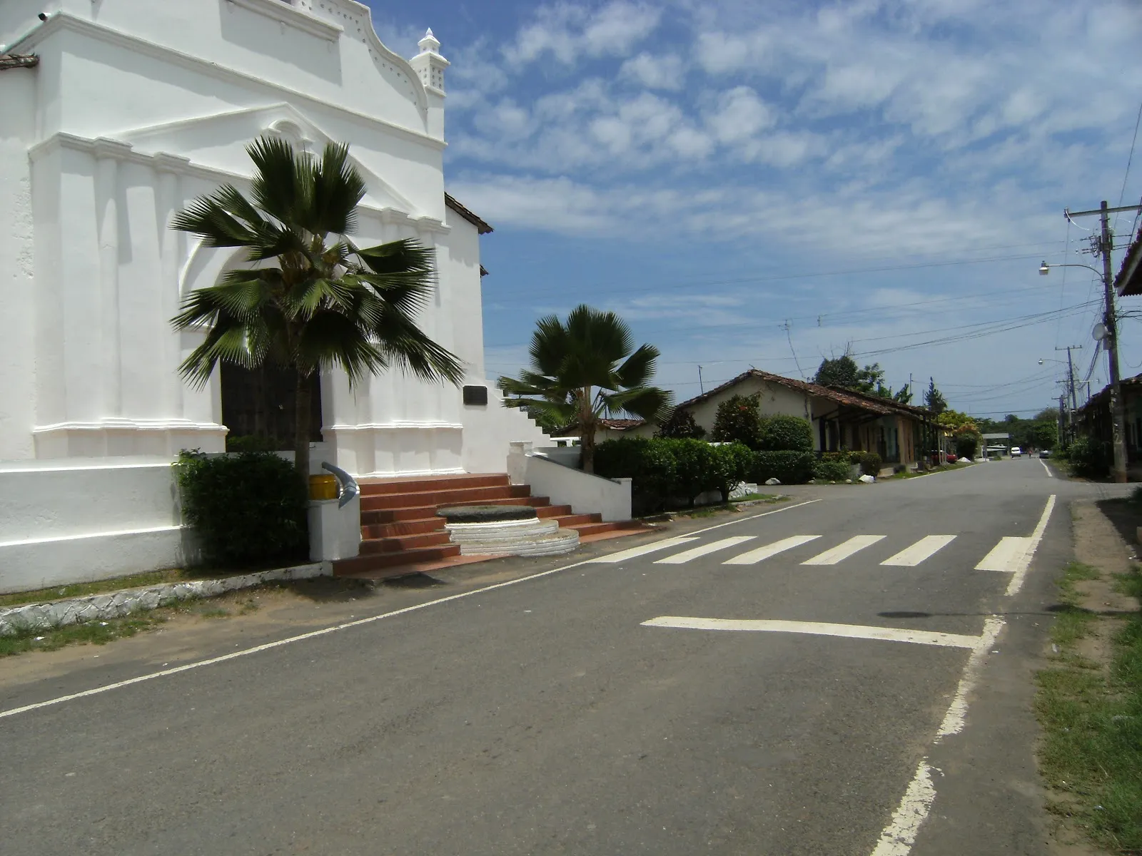
Península de Azuero
Go to the Azuero Peninsula for the towns of Chitré and Las Tablas, sport fishing at Pedasí, and a dry Pacific coast.
We may earn a commission. It never decides our picks.
Azuero is a broad peninsula in southern Panama. Its south side faces the Pacific, with the Gulf of Montijo on the west and the Gulf of Panama on the east. Herrera and Los Santos provinces lie entirely on it, along with a southeastern slice of Veraguas. Most people live on the east coast, in Chitré, Herrera's capital, and in Las Tablas, which hosts the annual carnival. People have lived here for more than 10,000 years, and the name Azuero is tied to the grandiablos and diablicos traditions.
Eastern Azuero is known for baseball, and its coast is the driest in Panama, where long droughts can occur. The west is known for cattle ranching, farming, fishing, sunsets and beaches, and Pedasí, a small fishing town, is known for sport fishing. Apart from the Pan-American Highway, no usable road links east and west, so plan each side as a separate stop. The dry season runs from late November to early May. The rainy season, from May to November, is less intense than in the rest of Panama.
Península de Azuero in five
- Fly to Pedasí or Chitré, or budget a long driveThe tourism authority says direct flights to Pedasí usually run three times a week and take about 1 hour 50 minutes. Otherwise fly to Chitré and taxi about an hour. Driving takes 4.5 to 6.5 hours.
- Go whale watching from July to OctoberHumpback whales migrate past the Pacific coast between July and October, with September named as the best month for sightings. Arrange boats through operators on the coast.
- Snorkel Isla IguanaIsla Iguana's reserve protects the oldest and largest coral reef in the Gulf of Panama, along with birds and iguanas. Reach it by boat from the Pedasí coast.
- Choose Venao for lessons, Cambutal for bigger wavesVenao Beach has constant waves, a surf community, rentals and classes. Cambutal, in Tonosí district, has world-class waves in a rustic setting, better for experienced surfers.
- Time turtle nesting for July to NovemberOlive ridley, green and hawksbill turtles nest between July and November. The tourism authority names Isla Cañas, La Marinera and Pablo Barrios refuges as places to witness it.
Things to do in Península de Azuero
See all attractions in Península de Azuero
Need to know
- Province
- Los Santos in southern Azuero, with Tonosí district
- Getting there
- Flights to Pedasí or Chitré, or 4.5–6.5 h by road
- Whales
- July to October, best in September
- Turtle nesting
- July to November at named refuges
- Heritage
- Pollera and sombrero pintao: Intangible Cultural Heritage
Weather by month
- Rainy days
- Best
- Good
- Mixed
- Poor
- JanuaryPartly cloudy8 rainy daysHigh31°Low22°Dry, hotJanuaryPartly cloudy
Best
- High
- 31°
- Low
- 22°
- Precipitation
- 52 mm
- Rainy days
- 8
- Snowy days
- 0
- Days with storms
- 0
Dry, hot
- FebruaryClear4 rainy daysHigh33°Low22°Dry, hotFebruaryClear
Best
- High
- 33°
- Low
- 22°
- Precipitation
- 20 mm
- Rainy days
- 4
- Snowy days
- 0
- Days with storms
- 0
Dry, hot
- MarchPartly cloudy6 rainy daysHigh35°Low23°Dry, hottestMarchPartly cloudy
Good
- High
- 35°
- Low
- 23°
- Precipitation
- 27 mm
- Rainy days
- 6
- Snowy days
- 0
- Days with storms
- 0
Dry, hottest
- AprilRain18 rainy daysHigh33°Low24°Dry, hotAprilRain
Mixed
- High
- 33°
- Low
- 24°
- Precipitation
- 185 mm
- Rainy days
- 18
- Snowy days
- 0
- Days with storms
- 0
Dry, hot
- MayRain29 rainy daysHigh30°Low24°Rains beginMayRain
Poor
- High
- 30°
- Low
- 24°
- Precipitation
- 418 mm
- Rainy days
- 29
- Snowy days
- 0
- Days with storms
- 0
Rains begin
- JuneRain30 rainy daysHigh29°Low23°Green seasonJuneRain
Poor
- High
- 29°
- Low
- 23°
- Precipitation
- 406 mm
- Rainy days
- 30
- Snowy days
- 0
- Days with storms
- 0
Green season
- JulyRain30 rainy daysHigh29°Low23°Green, humpbacksJulyRain
Poor
- High
- 29°
- Low
- 23°
- Precipitation
- 385 mm
- Rainy days
- 30
- Snowy days
- 0
- Days with storms
- 0
Green, humpbacks
- AugustRain31 rainy daysHigh29°Low23°Green, humpbacksAugustRain
Poor
- High
- 29°
- Low
- 23°
- Precipitation
- 417 mm
- Rainy days
- 31
- Snowy days
- 0
- Days with storms
- 0
Green, humpbacks
- SeptemberRain30 rainy daysHigh29°Low23°Whale peakSeptemberRain
Poor
- High
- 29°
- Low
- 23°
- Precipitation
- 426 mm
- Rainy days
- 30
- Snowy days
- 0
- Days with storms
- 0
Whale peak
- OctoberRain30 rainy daysHigh28°Low23°Wet, whalesOctoberRain
Poor
- High
- 28°
- Low
- 23°
- Precipitation
- 473 mm
- Rainy days
- 30
- Snowy days
- 0
- Days with storms
- 0
Wet, whales
- NovemberRain28 rainy daysHigh28°Low22°Wet, turtlesNovemberRain
Poor
- High
- 28°
- Low
- 22°
- Precipitation
- 509 mm
- Rainy days
- 28
- Snowy days
- 0
- Days with storms
- 0
Wet, turtles
- DecemberRain18 rainy daysHigh30°Low22°Drier, hotDecemberRain
Good
- High
- 30°
- Low
- 22°
- Precipitation
- 142 mm
- Rainy days
- 18
- Snowy days
- 0
- Days with storms
- 0
Drier, hot
Average daily high and low in Chitré, 2016–2025. Rainy day: 1 mm of rain or more.
Right now in Península de Azuero
Local time, today's weather and the exchange rate, refreshed through the day.

24
- Feels like
- 28°
- Humidity
- 87%
- Wind
- 5 km/h
- Chance of rain
- 98%
Península de Azuero
07:19 PM
Monday, November 2
- Today29°23°98%Monday: Thunderstorms. High 29°, Low 23°. Chance of rain 98%.
- Tue29°23°100%Tuesday: Rain. High 29°, Low 23°. Chance of rain 100%.
- Wed30°22°98%Wednesday: Thunderstorms. High 30°, Low 22°. Chance of rain 98%.
- Thu28°23°86%Thursday: Rain. High 28°, Low 23°. Chance of rain 86%.
- Fri29°22°94%Friday: Thunderstorms. High 29°, Low 22°. Chance of rain 94%.
- Sat29°23°99%Saturday: Drizzle. High 29°, Low 23°. Chance of rain 99%.
- Sun30°22°91%Sunday: Drizzle. High 30°, Low 22°. Chance of rain 91%.
Updated 03:42 PM local time · Powered by WeatherAPI.com · Weather data by Open-Meteo.com
Money
Mid-market rate1 EUR = 1.116 USD
Rates from Nov 2, 2026 · Rates By Exchange Rate API
Day trips by train
- Isla Iguanaa boat trip from the Pedasí coastSnorkel the oldest and largest coral reef in the Gulf of Panama.
- Venao Beachon the Pacific side of Los SantosA surf beach with classes, rentals and constant waves.
- Cerro Hoya National Parka day hike or camping tripClimb to 1,559 m and look for the Azuero spider monkey; go with a guide.
Before you go to Península de Azuero
We may earn a commission. It never decides our picks.
Rules for Península de Azuero, checked
- UK advice: a UK photocard licence is valid for driving up to 3 months; carry a copy of your passport with the dated entry stamp.Checked Oct 2, 2026 · Source
Plan around Península de Azuero
Flights and the long drive start here
Read the guideSanta CatalinaThe next surf coast west, on the Veraguas side
Read the guideEl ValleA cool crater stop on the way down the highway
Read the guideRenting a car abroadInsurance checks before a long drive
Read the guideInternational driving permitWho needs one to rent in Panama
Read the guideTravel insuranceCover for boat trips and surf days
Read the guideAll of PanamaRegions, entry basics and money
Read the guidePenínsula de Azuero FAQ
How do you get to Pedasí from Panama City?
By air, direct flights to Pedasí from Tocumen or Albrook usually run three times a week and take about 1 hour 50 minutes. Otherwise fly to Chitré, about an hour by taxi. By road allow 4.5 to 6.5 hours by car, or 5 to 6 hours by bus to Chitré or Las Tablas, then an hour onward.
When is whale season on the Azuero coast?
Humpback whales migrate between July and October, and the tourism authority names September as the best month for sightings along the Pacific coast.
Is Venao good for beginner surfers?
It is a popular choice because waves are constant and there are rentals and classes. Cambutal, further along the coast, has world-class waves and suits experienced surfers.
What is the Azuero Peninsula known for?
Folklore, surf, a coral reef at Isla Iguana and whale watching. The tourism authority calls Los Santos the cradle of Panamanian folklore, and the pollera and sombrero pintao are recognized as Intangible Cultural Heritage.
Do you need a car on the Azuero Peninsula?
It helps. Beaches, refuges and towns are spread along the coast, and bus routes run mainly to Chitré and Las Tablas before a taxi or local bus. Flying to Pedasí and arranging transfers is the alternative.