Plan a trip
Language: English
Trip plannerPlan your trip on a map

Top destinations

EnglishDeutschFrançaisEspañolPortuguêsPortuguês (BR)Italiano
Travel advisory · MexicoSome governments advise against travel to parts of Mexico.The warnings cover only these areas: Colima, Culiacán and surroundings, Guerrero, Sinaloa, Southern Michoacán, Acapulco, Chiapas, Chihuahua, Federal Highway 199 (San Cristóbal de las Casas–Palenque), Guatemala border region (Chiapas), Lagunas de Zempoala National Park, Mexico–US border region, Michoacán, Monterrey–Nuevo Laredo highway, Nayarit border strip (20 km from Sinaloa and Durango), Nuevo León, Piedras Negras, Sonora, South of Highway 45D (Guanajuato), Tamaulipas, Tecate, Tijuana, Zacatecas.Advice depends on your passport. Read your own government's advice before you book.Official advice
Areas with warnings
  • Colima · avoid all travel · Canada, Germany, France, New Zealand, UK
  • Culiacán and surroundings · avoid all travel · Spain, France
  • Guerrero · avoid all travel · Canada, Germany, France, New Zealand, UK
  • Sinaloa · avoid all travel · Canada, Germany, Spain, France, New Zealand, UK
  • Southern Michoacán · avoid all travel · Spain, France
  • Acapulco · avoid non-essential travel · Spain, France
  • Chiapas · avoid non-essential travel · Canada, France
  • Chihuahua · avoid non-essential travel · Canada, France, UK
  • Federal Highway 199 (San Cristóbal de las Casas–Palenque) · avoid non-essential travel · France, UK
  • Guatemala border region (Chiapas) · avoid non-essential travel · Germany, France, New Zealand, UK
  • Lagunas de Zempoala National Park · avoid non-essential travel · Canada, New Zealand
  • Mexico–US border region · avoid non-essential travel · Germany, France
  • Michoacán · avoid non-essential travel · Canada, Germany, New Zealand, UK
  • Monterrey–Nuevo Laredo highway · avoid non-essential travel · Spain, France
  • Nayarit border strip (20 km from Sinaloa and Durango) · avoid non-essential travel · Canada, New Zealand
  • Nuevo León · avoid non-essential travel · Canada, New Zealand
  • Piedras Negras · avoid non-essential travel · Spain, France
  • Sonora · avoid non-essential travel · Canada, New Zealand
  • South of Highway 45D (Guanajuato) · avoid non-essential travel · Canada, New Zealand, UK
  • Tamaulipas · avoid non-essential travel · Canada, France, UK
  • Tecate · avoid non-essential travel · France, UK
  • Tijuana · avoid non-essential travel · France, UK
  • Zacatecas · avoid non-essential travel · Canada, Germany, Spain, France, UK

Also named by one government: Northern Tamaulipas (north of Ciudad Victoria) (Germany), Route 129 Martinez de la Torre–Teziutlán (France), Route 131 Tlapacoyan–Perote (France), Route 40 Monterrey–Reynosa (France), Secondary roads Martinez de la Torre–Papantla (France), Triangle Celaya–Irapuato–Salamanca (France), Baja California (France), Chiapas tourist zones (Spain), Ciudad Acuña (Spain), Ciudad Juárez and surrounding area (Spain), Ciudad Obregón (France), Coahuila (New Zealand), Coatzacoalcos (France), Colonias north and north-east of the Zócalo (France), Durango (France), Eastern Nuevo León (France), Ecatepec (Spain), Highway 45 between León and Irapuato (New Zealand), Jalisco, 50 km strip along Michoacán border (Canada), Monclova (Spain), Morelos (France), Naucalpan (Spain), Nayarit (France), Nezahualcóyotl (Spain), Nogales (France), Northern Jalisco municipalities (UK), Northern Tamaulipas (San Fernando to US border) (Spain), Northern Veracruz (from Martinez de la Torre) (France), Route 150D Puebla–Orizaba (France), Route 190 Oaxaca–Santo Domingo Tehuantepec (France), Route 85 and 83 Monterrey–Ciudad Victoria–Tampico (France), Route 95 Mexico City–Cuernavaca (France), Selva Lacandona (France), South and south-west of Lake Chapala (UK), Southern Guanajuato state (France), Southwest Jalisco and Los Altos (France), Southwestern Michoacán (France), Southwestern Tamaulipas (France), Tepic (New Zealand), Toluca (France), Veracruz (city) (France)

GovernmentAdviceUpdatedRead the advice
United Kingdom (FCDO)No advice against the whole country (regional advisories)–Read the advice
United States (State Dept)Exercise increased cautionMay 29, 2026Read the advice
Canada (Global Affairs)Exercise a high degree of caution (regional advisories)–Read the advice
Germany (Auswärtiges Amt)Besondere Vorsicht walten lassen (Sicherheitslage) (regional advisories)Oct 19, 2026Read the advice
New Zealand (SafeTravel)Exercise increased caution (regional advisories)–Read the advice
France (Ministry for Europe and Foreign Affairs)Vigilance renforcée pour le reste du pays (regional advisories)–Read the advice

Checked daily from the governments' published advice; last checked Nov 3, 2026. RoamLedger summarises official advice; it is not advice from any government.

Pirámide del Sol
Landmark

Pyramid of the Sun

Visit the Pyramid of the Sun in Teotihuacán: how to get around the site, what is known about its history, entry in pesos, and when to arrive.

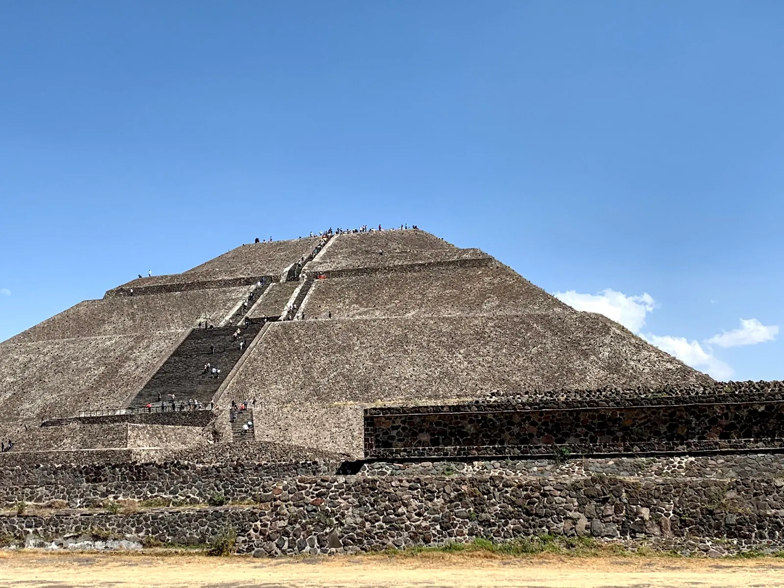
The Pyramid of the Sun is the largest structure at Teotihuacán, the ancient city about 30 km from central Mexico City. It stands on the east side of the Avenue of the Dead, with the Pyramid of the Moon at the avenue's far end. Built around 200 CE in one construction effort, it ranks among the biggest pyramids anywhere. Its alignment follows the sunrise and sunset on certain days of the year. Walk the avenue, add the site museum beside the pyramid, and plan for a long day on foot with little shade.

Where it stands on the Avenue of the Dead
Pyramid of the Sun
Pyramid of the Sun

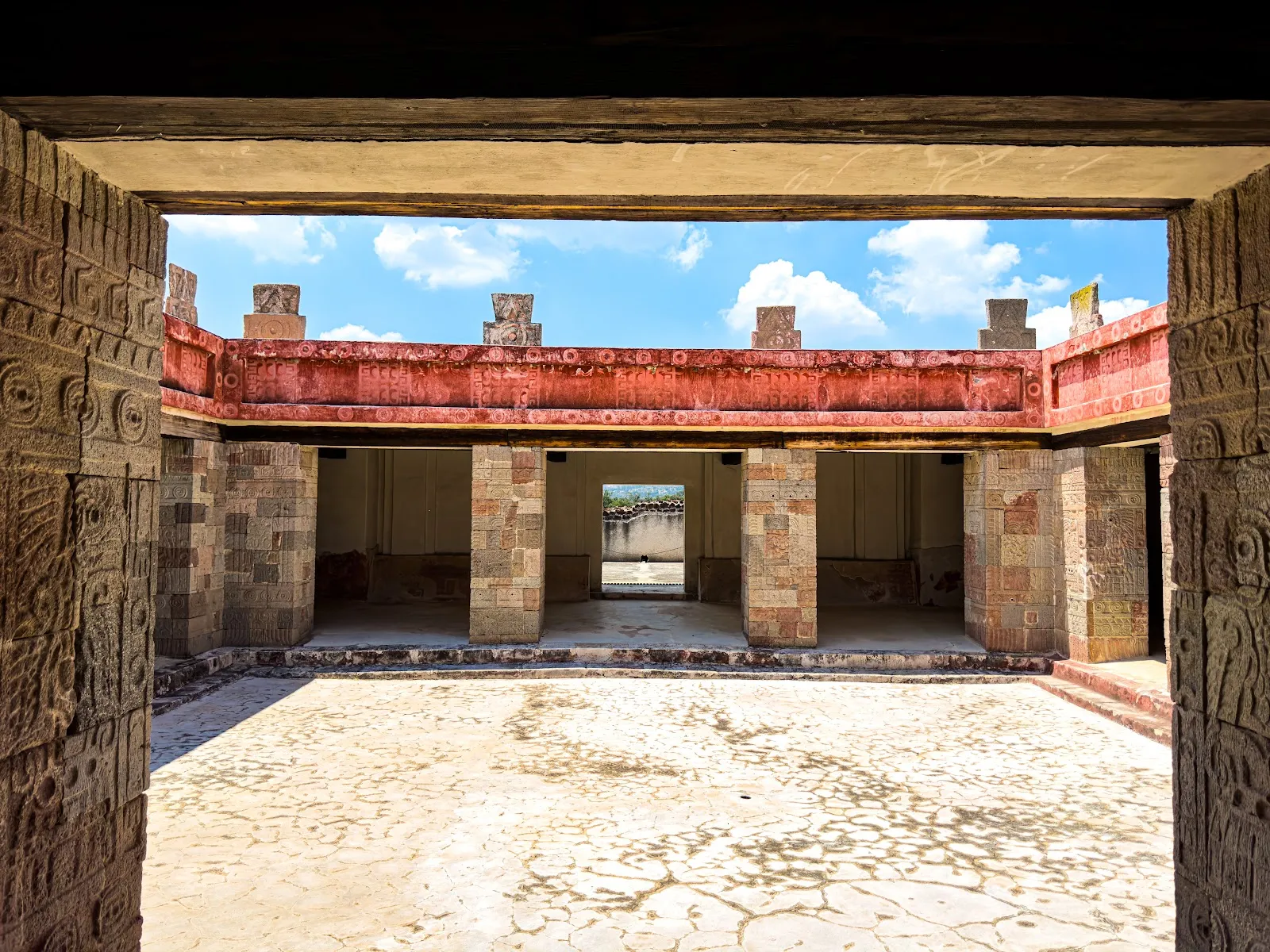
The pyramid rises on the east side of the Avenue of the Dead, the long processional road that organises the ancient city. The avenue begins at the Plaza of the Moon, where the Pyramid of the Moon closes the view to the north. At its southern end are the Ciudadela and the Temple of the Feathered Serpent, also known as the Temple of Quetzalcoatl. Between the two ends, temples, palaces and plazas line the way.

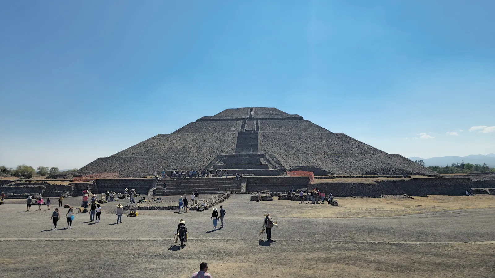
The site has five gates, and the choice matters. Gate 1, by the Temple of Quetzalcoatl, is about 2.5 km from the Sun and Moon pyramids. Gate 2 puts you right beside the Pyramid of the Sun, which suits anyone arriving by taxi, Uber or private tour. The site museum is next to the pyramid, so the two fit into one stop.

What is known about the pyramid
Pyramid of the Sun
Pyramid of the Sun

Teotihuacán was founded around 200 BC and is regarded as the first planned urban settlement in Mesoamerica. Work on the Pyramid of the Sun began around 200 CE, and it was raised in a single, massive construction effort. It is the largest building in the city. Sources give different figures for its height, so treat any single number with care.

At the city's height the pyramid's plaster was painted bright red. Recent excavations have uncovered offerings of greenstone objects and traces of exterior sculpture with motifs of fire and jaguars. The pyramid's alignment follows the sunrise and sunset on certain days of the year.

Much remains uncertain. The interior has never been fully explored, and a subterranean tunnel found in 2014 is still being excavated. Its purpose is not known, though one theory ties it to the veneration of a particular Teotihuacano deity. Researchers also do not agree on who lived in the city. Some propose Nahuas, Otomis or Totonacs, and others a multi-ethnic society. The name Teotihuacán is Nahuatl and means the place where the gods were created.

Planning the day on site

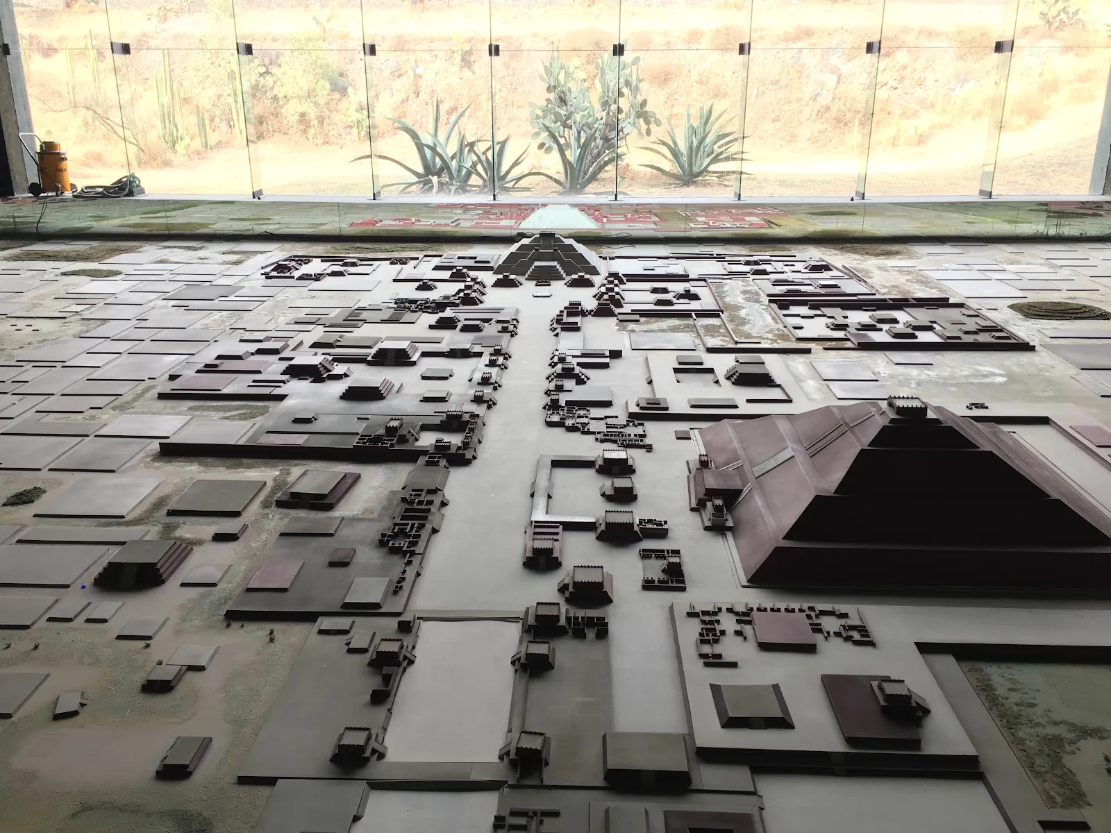
Expect a lot of walking. One visitor logged over 20,000 steps in a day, and a tour that covered the Temple of Quetzalcoatl and both major pyramids took about four hours. Without a guide you can go slower and add the museum, which holds artifacts and a model of the city at its peak.

For a quiet pause, there is a shaded stretch of wall facing the Pyramid of the Sun where you can sit in the afternoon with a clear view of it. Early in the morning, balloons float over the pyramid, and arriving before the tour groups gives you the plaza almost to yourself. Attendance rises around the spring equinox.

For food, a restaurant stands by the Pyramid of the Sun and the museum, and another is in the park near the main entrance. Restrooms are well kept. The entrance and parking lot are wheelchair accessible, and parking is paid. Vendors along the paths sell souvenirs, so keep some extra cash.

FAQ

How much is entry to the Pyramid of the Sun?

Entry to the Teotihuacán site is 210 Mexican pesos per person, paid in cash at the ticket booth. Residents with valid proof of residence can get half off.

How long do you need at Teotihuacán?

Plan on 3 to 4 hours for the main temples and pyramids. Adding the museum and the long walks between sights can turn it into a full day.

Which gate is closest to the Pyramid of the Sun?

Gate 2 puts you next to the pyramid. Gate 1, at the Temple of Quetzalcoatl, is about 2.5 km from the Sun and Moon pyramids.

How far is it from Mexico City?

The site is about 30 km from the center of Mexico City, roughly an hour by road.

Is there shade at the site?

Very little. Bring a hat, sunscreen and water, and go early in the morning to avoid the hottest hours.

More must-sees in Teotihuacán

Explore all