Travel advisory · MexicoChiapas is in or near an area where governments advise against all but essential travel: Chiapas, Guatemala border region, Chiapas.Advice depends on your passport. Read your own government's advice before you book.Official advice
- Colima · avoid all travel · Canada, Germany, France, UK
- Guerrero · avoid all travel · Canada, Germany, Spain, France, New Zealand, UK
- Sinaloa · avoid all travel · Canada, Germany, Spain, France, New Zealand, UK
- Chiapas · avoid non-essential travel · Canada, Spain, France
- Chihuahua · avoid non-essential travel · Canada, France, UK
- Federal Highway 199 San Cristóbal de las Casas–Palenque · avoid non-essential travel · France, UK
- Guanajuato, south of Highways 43D and 45D · avoid non-essential travel · Canada, New Zealand
- Guatemala border region, Chiapas · avoid non-essential travel · Germany, France, New Zealand
- Lagunas de Zempoala National Park · avoid non-essential travel · Canada, New Zealand
- Michoacán · avoid non-essential travel · Canada, Germany, New Zealand, UK
- Nayarit, within 20 km of Sinaloa and Durango border · avoid non-essential travel · Canada, New Zealand
- Nuevo León, except Monterrey · avoid non-essential travel · Canada, New Zealand
- Piedras Negras · avoid non-essential travel · Spain, France
- Route 85 Monterrey–Nuevo Laredo · avoid non-essential travel · Spain, France
- Sonora · avoid non-essential travel · Canada, New Zealand
- Tamaulipas · avoid non-essential travel · Canada, France, UK
- Tecate · avoid non-essential travel · France, UK
- Tijuana · avoid non-essential travel · France, UK
- US border region · avoid non-essential travel · Germany, Spain, France
- Zacatecas · avoid non-essential travel · Canada, Germany, Spain, France, UK
Also named by one government: Celaya–Irapuato–Salamanca triangle, Guanajuato (France), Culiacán and surrounding area (France), North of Ciudad Victoria, Tamaulipas (Germany), Route 129 Martinez de la Torre–Teziutlán (France), Route 131 Tapacoyan–Perote (France), Route 180 Martinez de la Torre–Papantla secondary roads (France), Route 40 Monterrey–Reynosa (France), Southern Michoacán from Uruapán to the coast (France), Acapulco (France), Baja California, except Tijuana and Tecate (France), Ciudad Acuña (Spain), Ciudad Juárez and surrounding area (Spain), Ciudad Obregón (France), Coahuila, except southern part (New Zealand), Coatzacoalcos (France), Colonias north and north-east of the Zócalo, Mexico City (France), Durango (France), East Nuevo León, bordering Tamaulipas (France), Guanajuato (Spain), Guanajuato, Highway 45 between León and Irapuato (New Zealand), Guanajuato, south-west of Highway 45D (UK), Jalisco, within 50 km of Michoacán border (Canada), Monclova (Spain), Morelos (France), Nayarit (France), Nogales (France), Non-tourist rural areas of Baja California (Spain), Non-tourist rural areas of Chihuahua (Spain), Non-tourist rural areas of Coahuila (Spain), Non-tourist rural areas of Durango (Spain), Non-tourist rural areas of Sonora (Spain), Northern municipalities of Jalisco (UK), Northern Tamaulipas from San Fernando to US border (Spain), Northern Veracruz bordering Tamaulipas (Spain), Northern Veracruz from Martinez de la Torre (France), Route 150D Puebla–Orizaba (France), Route 190 Oaxaca–Santo Domingo Tehuantepec (France), Route 85 and 83 Monterrey–Ciudad Victoria–Tampico (France), Route 95 Mexico City–Cuernavaca (France), Selva Lacandona (France), South and south-west of Lake Chapala, Jalisco (UK), South-west Jalisco and Los Altos, except Puerto Vallarta (France), South-west Michoacán (France), South-west Tamaulipas (France), Southern Guanajuato state (France), Southern Michoacán south of Morelia (Spain), Strip within 40 km of Guatemalan border, Chiapas (UK), Tepic (New Zealand), Toluca (France), Veracruz city (France)
| Government | Advice | Updated | Read the advice |
|---|---|---|---|
| United Kingdom (FCDO) | No advice against the whole country (regional advisories) | – | Read the advice |
| United States (State Dept) | Exercise increased caution | May 29, 2026 | Read the advice |
| Canada (Global Affairs) | Exercise a high degree of caution (regional advisories) | – | Read the advice |
| Germany (Auswärtiges Amt) | Besondere Vorsicht walten lassen (Sicherheitslage) (regional advisories) | Oct 19, 2026 | Read the advice |
| New Zealand (SafeTravel) | Exercise increased caution (regional advisories) | – | Read the advice |
| France (Ministry for Europe and Foreign Affairs) | Vigilance renforcée pour le reste du pays (regional advisories) | – | Read the advice |
Checked daily from the governments' published advice; last checked Nov 2, 2026. RoamLedger summarises official advice; it is not advice from any government.
Chiapas
Visitors come for highland towns, Maya ruins at Palenque, the cliffs of Sumidero Canyon and waterfalls. Mountain roads make travel slow, so plan fewer bases.
We may earn a commission. It never decides our picks.
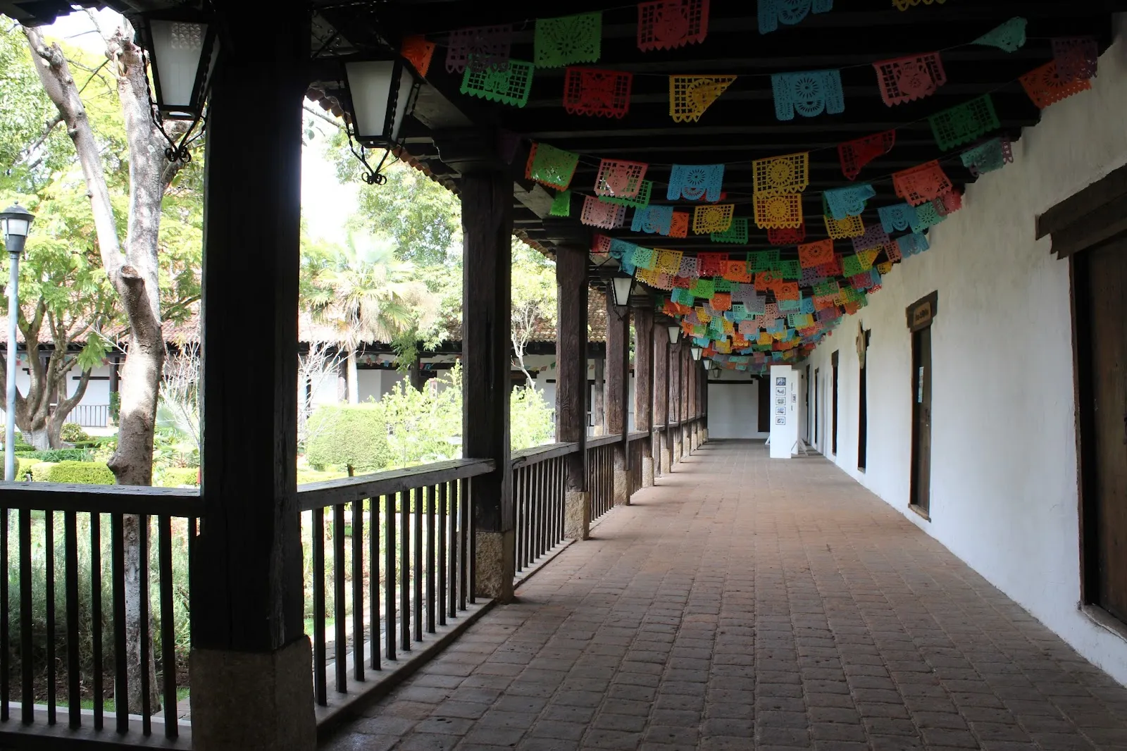
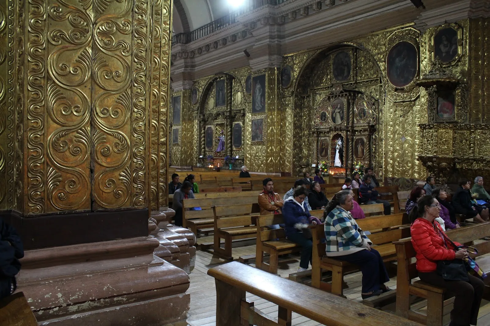
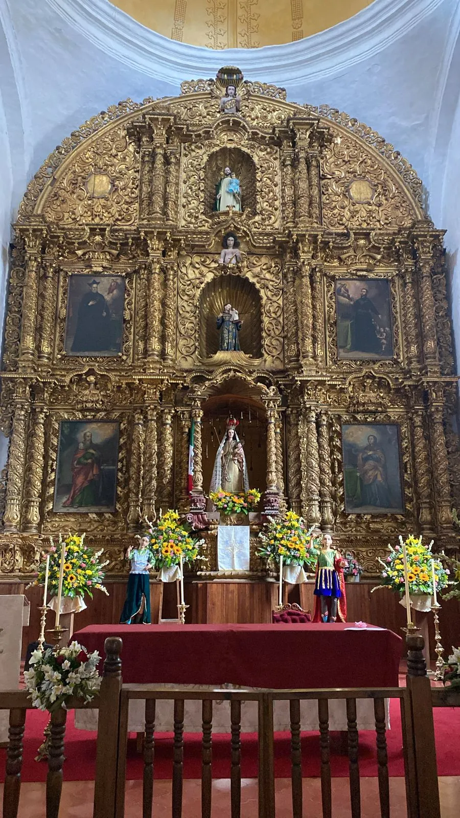
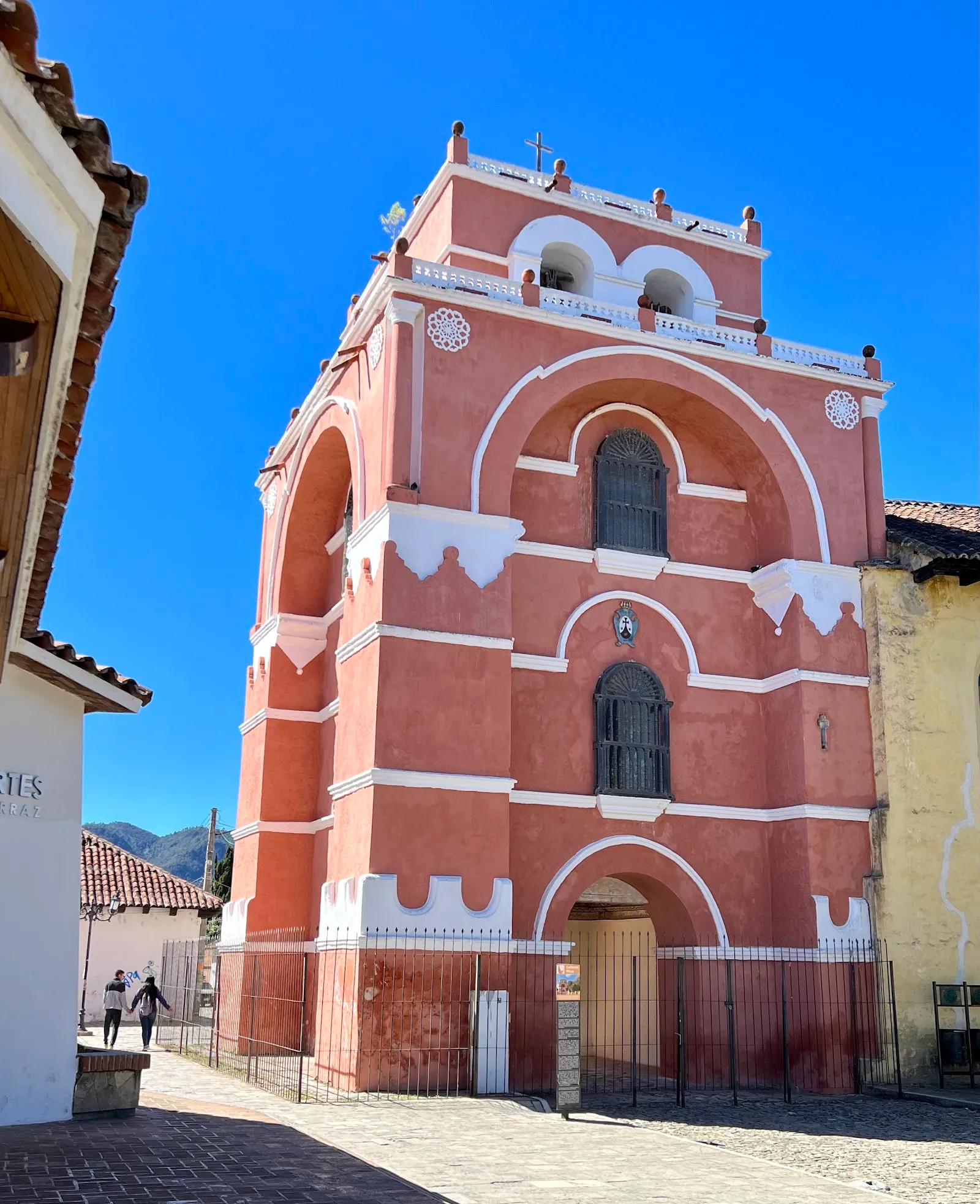
Chiapas is Mexico's southernmost state, bordering Guatemala to the east and southeast and the Pacific Ocean to the southwest. Its terrain changes with altitude, from hot lowlands to cool, foggy highlands with cloud forests. San Cristóbal de las Casas, one of the state's main visitor destinations, is a highland city the Spanish founded in 1528, and it still has a strong Indigenous identity. On market day, families from rural areas come into town to sell and buy fruit, cloth, tools and everyday goods. Nearby San Juan Chamula is considered a centre of Indigenous culture.
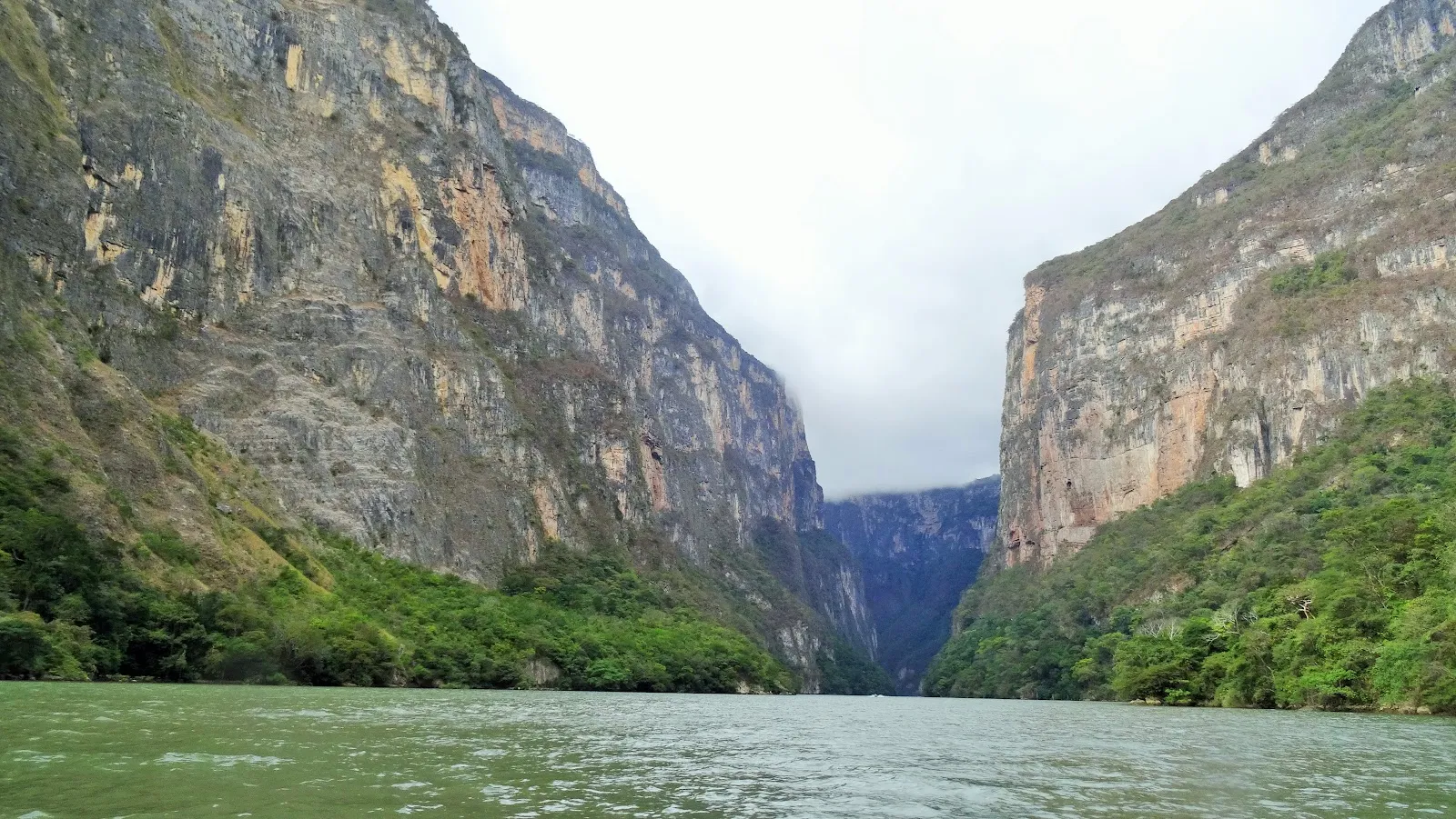
Palenque has major Maya ruins, and Sumidero Canyon's cliffs rise up to 1,000 meters above the Grijalva River, where boat trips run. The Agua Azul waterfalls, in Tumbalá, have large pools below the falls. Plan for the dry season from November to April, and bring warm clothing for winter, since the Central Highlands can have frost from December to March. Mountain roads are slow, so limit yourself to two or three bases.
Chiapas in five
- Base in San Cristóbal de las CasasThe highland town at about 2,200 m has colonial streets, markets and cool nights. It is the best base for day trips to nearby villages and the canyon.San Cristóbal de las Casas
- Ride the Sumidero Canyon boat earlyBoats leave from Chiapa de Corzo or Cahuaré, and the ride takes about two hours past cliffs and wildlife. Morning departures are cooler and less crowded.
- Plan Palenque and its waterfalls togetherThe jungle ruins sit near Agua Azul and Misol-Ha waterfalls. The road from San Cristóbal is winding, so allow most of a day or take a shared van.Palenque
- Ask about road blockades before long drivesLocal groups sometimes block highways, which can delay buses and shuttles by hours. Check with your hotel and read current government advice for the state before long overland days.
- Pack warm layers and ask before photographing peopleHighland nights are cold, even in the tropics. In Indigenous villages, ask permission before taking photos, and do not photograph inside the church at San Juan Chamula.
Neighborhoods

San Cristóbal de las Casas
- Price band: $$

Palenque
- Price band: $$
Things to do in Chiapas
See all attractions in Chiapas













Need to know
- Airport
- Tuxtla Gutiérrez (TGZ) is the main airport; Palenque has a small one
- Getting there
- Fly to Tuxtla or Oaxaca, or take long-distance buses
- Getting around
- Shared vans, ADO buses and tours between towns
- Best base
- San Cristóbal for the highlands; Palenque for ruins
- Time needed
- 5–7 days for the highlands and Palenque
Weather by month
- Best
- Good
- Mixed
- Poor
- JanuaryDry, cold nights
- FebruaryDry, sunny
- MarchDry, warm
- AprilWarm, dry
- MayRains start
- JuneRainy season
- JulyRainy season
- AugustRainy season
- SeptemberRain, storms
- OctoberRainy, cooler
- NovemberDrier, cold nights
- DecemberDry, holidays
Right now in Chiapas
Local time, today's weather and the exchange rate, refreshed through the day.

23
- Feels like
- 25°
- Humidity
- 75%
- Wind
- 4 km/h
- Chance of rain
- 100%
Chiapas
06:04 PM
Monday, November 2
- Today22°15°100%Monday: Thunderstorms. High 22°, Low 15°. Chance of rain 100%.
- Tue24°14°75%Tuesday: Drizzle. High 24°, Low 14°. Chance of rain 75%.
- Wed23°14°90%Wednesday: Drizzle. High 23°, Low 14°. Chance of rain 90%.
- Thu24°13°73%Thursday: Drizzle. High 24°, Low 13°. Chance of rain 73%.
- Fri23°14°98%Friday: Drizzle. High 23°, Low 14°. Chance of rain 98%.
- Sat24°14°69%Saturday: Drizzle. High 24°, Low 14°. Chance of rain 69%.
- Sun23°15°88%Sunday: Thunderstorms. High 23°, Low 15°. Chance of rain 88%.
Updated 03:49 PM local time · Weather data by Open-Meteo.com
Money
Mid-market rate1 USD = 18.81 MXN
Rates from Nov 2, 2026 · Rates By Exchange Rate API
Day trips by train
- Cañón del Sumideroabout 30–45 min from Tuxtla GutiérrezA 2-hour boat ride beneath tall cliffs.
- San Cristóbal de las Casasabout 1–1.5 hours from TuxtlaColonial highland streets and markets.Read the guide
- Palenqueabout 5–6 hours from San CristóbalRuins in the jungle, with waterfalls nearby.Read the guide
Before you go to Chiapas
We may earn a commission. It never decides our picks.
Rules for Chiapas, checked
- Many nationalities need no visa for Mexico, but check entry forms and passport rules on the foreign ministry site.Source
- Since the November 2023 treaty, Zapatista community centres (caracoles) admit locals but not outside visitors. Check current conditions before traveling to Zapatista areas.
- Dial 911 for police, fire or an ambulance anywhere in Chiapas.
- Leave about 10 to 15 percent in restaurants, the usual custom, and check the bill for a service charge first.
Plan around Chiapas
Highland base with markets and villages
Read the guidePalenqueJungle ruins and waterfalls
Read the guideTabascoThe lowland state north of Palenque
Read the guideOaxacaA cultural stop west of Chiapas
Read the guideCampecheA walled city on the Gulf, a long road north
Read the guideAll of MexicoCities, ruins, beaches and entry basics
Read the guideChiapas FAQ
Is Chiapas safe to visit?
Many travelers visit San Cristóbal and Palenque without trouble, but government advice for Chiapas is stricter than for much of Mexico. Read the current wording, travel in daylight and check for road blockades.
How many days do you need in Chiapas?
Five to seven days covers San Cristóbal, Sumidero Canyon and Palenque with its waterfalls. Add days if you want the Lacandon jungle or Lagos de Montebello.
How do you get from San Cristóbal to Palenque?
By shared van or ADO bus on a winding road, roughly 5 to 6 hours with waterfall stops possible. Many travelers book a van with a stop at Agua Azul.
When is the best time to visit Chiapas?
November to March for dry weather, with cold nights in the highlands. The rainy season runs roughly May to October and can close some roads.
Is San Cristóbal de las Casas cold?
Days are mild but nights can be near freezing in winter, and most hotels have little heating. Bring layers and ask about heating or extra blankets.