Plan a trip
Language: English
Trip plannerPlan your trip on a map

Top destinations

EnglishDeutschFrançaisEspañolPortuguêsPortuguês (BR)Italiano
Travel advisory · MalaysiaSome governments advise against travel to parts of Malaysia.The warnings cover only these areas: Malaysia-Thailand land border, Offshore islands and dive sites of eastern Sabah.Advice depends on your passport. Read your own government's advice before you book.Official advice
Areas with warnings
  • Malaysia-Thailand land border · avoid non-essential travel · Germany, France, New Zealand
  • Offshore islands and dive sites of eastern Sabah · avoid non-essential travel · Germany, New Zealand, UK

Also named by one government: Islands and maritime areas of north and east Sabah (France), Sandakan (France), Semporna (France), Sulu Archipelago and intervening sea (Germany), Tawau (France), East coast of Sabah (Terusan to Tawau) (Germany), North and east coasts of Sabah (France)

GovernmentAdviceUpdatedRead the advice
United Kingdom (FCDO)No advice against the whole country (regional advisories)–Read the advice
United States (State Dept)Level 1: Exercise Normal PrecautionsFeb 22, 2026Read the advice
Canada (Global Affairs)Take normal security precautions–Read the advice
Germany (Auswärtiges Amt)No advice against the whole country (regional advisories)Oct 16, 2026Read the advice
New Zealand (SafeTravel)Exercise normal safety and security precautions overall (regional advisories)–Read the advice
France (Ministry for Europe and Foreign Affairs)No advice against the whole country (regional advisories)–Read the advice

Checked daily from the governments' published advice; last checked Nov 2, 2026. RoamLedger summarises official advice; it is not advice from any government.

A small boat floating on top of a large body of water
Sight

Gunung Raya

Visit Gunung Raya, Langkawi’s highest point, for a rainforest climb, cooler air and views across the island’s coastline on a clear day.

Gunung Raya is Langkawi Island’s highest point, reached by a winding road through dense rainforest. The climb brings cooler air and chances to spot monkeys and hornbills, while the summit looks out over the island’s forests and coastline. You can drive up or hike, then take in the view from the top. Clear weather gives the best chance of seeing the coast; fog can cover the panorama and make the summit feel cold.

The climb through the rainforest
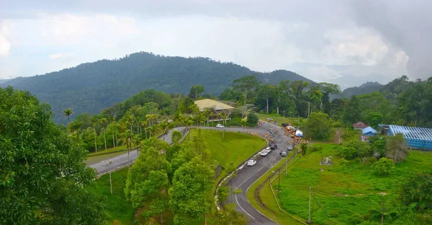
Gunung Raya
Gunung Raya

A winding road leads through dense forest toward Gunung Raya’s summit. You can make the ascent by car or scooter, or hike if you prefer to travel on foot. The route is part of the visit, with cooler air as you gain height and the chance to see monkeys and hornbills.

Take care on the road. Dogs have been seen along the route, and monkeys near the summit can behave aggressively. Give them space, particularly if you are travelling by scooter.

Views and conditions at the summit
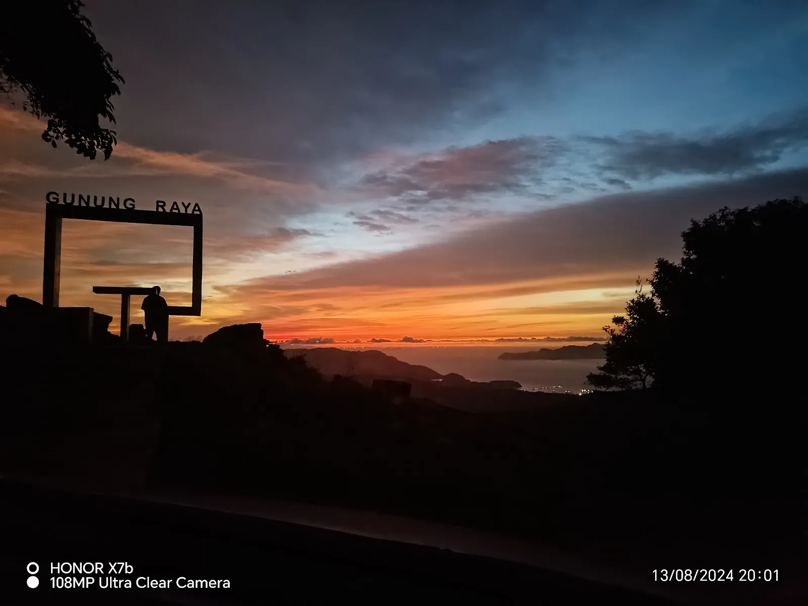
Gunung Raya
Gunung Raya

From the top, the view takes in Langkawi’s forest and coastline. Visibility depends on the weather: fog can obscure the scenery, so a clear day is the better choice if you are coming for the panorama. The summit can feel cold when fog rolls in.

There is little to do at the top beyond taking in the view. An observation tower and a resort have been reported as abandoned, so plan the visit around the drive, the landscape and the chance of seeing wildlife.

FAQ

How do you get to the top of Gunung Raya?

You can drive or ride a scooter up the winding road, or hike to the summit.

When is the best time to visit Gunung Raya?

Go on a clear day for the best views. Sunset, around 7pm, is one suggested time, and mornings or evenings bring cooler conditions.

How long does it take to reach the summit?

The ascent has been reported to take about one to two hours.

Is there an entry fee for Gunung Raya?

The available information reports no charge to go up.

More must-sees in Langkawi

Explore all