Travel advisory · KenyaMalindi is in or near an area where governments advise against all but essential travel: Coast between Tana River and Galana River.Advice depends on your passport. Read your own government's advice before you book.Official advice
- Border with Ethiopia · avoid all travel · Spain, France, New Zealand
- Border with South Sudan · avoid all travel · Spain, France, New Zealand
- Coastal areas north of Malindi · avoid all travel · Canada, France, New Zealand, US
- Garissa county · avoid all travel · Canada, Germany, Spain, Italy, New Zealand, US
- Lamu county · avoid all travel · Spain, New Zealand, US
- Lamu county excluding Lamu Island and Manda Island · avoid all travel · Canada, Germany, France, UK
- Mandera county · avoid all travel · Canada, Germany, Spain, Italy, New Zealand, UK, US
- Tana River county (except Tsavo National Park) · avoid all travel · Italy, US
- Wajir county · avoid all travel · Canada, Germany, Spain, Italy, New Zealand, US
- Baringo county · avoid non-essential travel · Germany, Italy
- Coast between Tana River and Galana River · avoid non-essential travel · Spain, UK
- Coastal areas of Tana River county · avoid non-essential travel · Canada, New Zealand
- Eastleigh (Nairobi) · avoid non-essential travel · Spain, France, Italy, New Zealand, US
- Kibera (Nairobi) · avoid non-essential travel · Canada, Spain, France, New Zealand, US
- Mathare (Nairobi) · avoid non-essential travel · Spain, France
- Northern Tana River county · avoid non-essential travel · Germany, UK
- Pangani (Nairobi) · avoid non-essential travel · France, Italy
- Turkana county · avoid non-essential travel · Germany, Spain
- West Pokot county · avoid non-essential travel · Germany, Italy, US
Also named by one government: Areas bordering Somalia (New Zealand), Garissa county excluding Garissa Town, Lagdera and parts of Balambala (UK), Kilifi county north of highway C103 (US), Maritime zone up to 72E and 15S (France), Marsabit county within 110 km of South Sudan and Ethiopia borders (Canada), Marsabit county within 50 km of Ethiopia border (US), Somalia border strip up to 100 km inside Kenya (France), Tarbaj and Wajir East constituencies (UK), Turkana county within 110 km of South Sudan and Ethiopia borders (Canada), Turkana county within 50 km of Ethiopia border (US), Wajir county within 60 km of Somalia border (UK), Western Turkana county (US), Arid and remote regions of northern Kenya (Italy), Baringo sub-counties Mukutani, Muchongoi, Bartabwa, Tiaty East and Tiaty West (Spain), Elgeyo Marakwet county (Italy), Elgeyo Marakwet sub-counties Marakwet East and Marakwet West (Spain), Garissa Town (UK), Laikipia county (Italy), Laikipia sub-counties Olmoran, Ng'arua and Mukogodo (Spain), Lamu Island (Germany), Manda Island (Germany), Marsabit county (Spain), Mombasa (Italy), Outlying areas of Isiolo county (France), Outlying areas of Turkana county (France), Outlying areas of West Pokot county (France), Outlying regions of Marsabit county (France), Overland routes between Lamu and Malindi (Italy), Samburu county areas of Loroki and Kirisia (Spain), Turkana sub-counties Turkana South, Turkana East and Loima (Spain), West of Garissa county (France), West of Mandera county (France), West of Wajir county (France), West Pokot sub-counties Pokot North and Sigor (Spain), Within 75 km of Kenya-Somalia border (Ireland)
| Government | Advice | Updated | Read the advice |
|---|---|---|---|
| United Kingdom (FCDO) | No advice against the whole country (regional advisories) | – | Read the advice |
| United States (State Dept) | Reconsider travel | Oct 19, 2026 | Read the advice |
| Canada (Global Affairs) | Exercise a high degree of caution (regional advisories) | – | Read the advice |
| Germany (Auswärtiges Amt) | Increased caution nationwide; partial travel warnings for specific areas (regional advisories) | Oct 19, 2026 | Read the advice |
| New Zealand (SafeTravel) | Exercise increased caution (regional advisories) | – | Read the advice |
| Ireland (Department of Foreign Affairs) | High Degree of Caution (regional advisories) | – | Read the advice |
| France (Ministry for Europe and Foreign Affairs) | Vigilance renforcée (reste du territoire) (regional advisories) | – | Read the advice |
Checked daily from the governments' published advice; last checked Nov 2, 2026. RoamLedger summarises official advice; it is not advice from any government.
Malindi
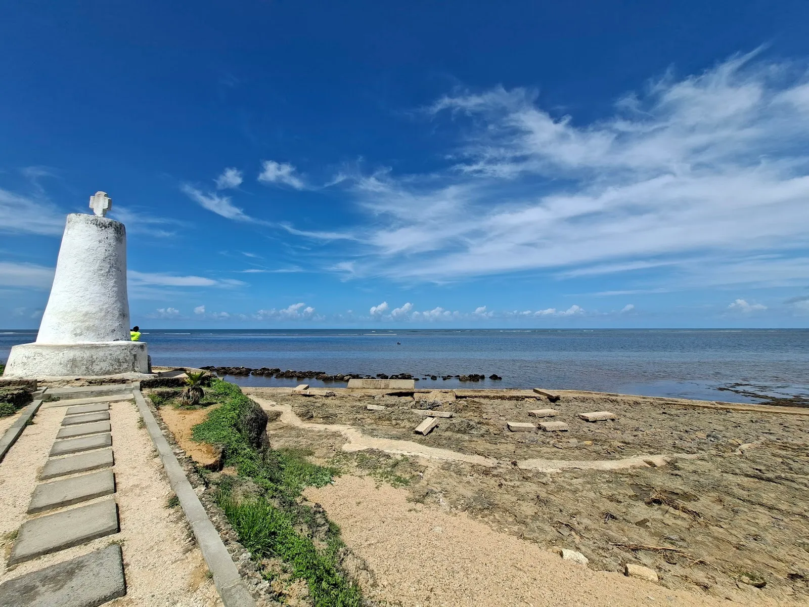
Malindi is a beach town on Kenya's Indian Ocean coast, known for Swahili buildings, a 1498 Portuguese pillar and marine parks.
We may earn a commission. It never decides our picks.
Malindi is a coastal town on Malindi Bay, at the mouth of the Galana River, in Kilifi County. It is the largest town in the county and a main tourism center on the Kenyan coast, about 100 km north of Mombasa by road. Tourism is the main industry, and most visitors come for the beaches, heritage sites and marine parks.
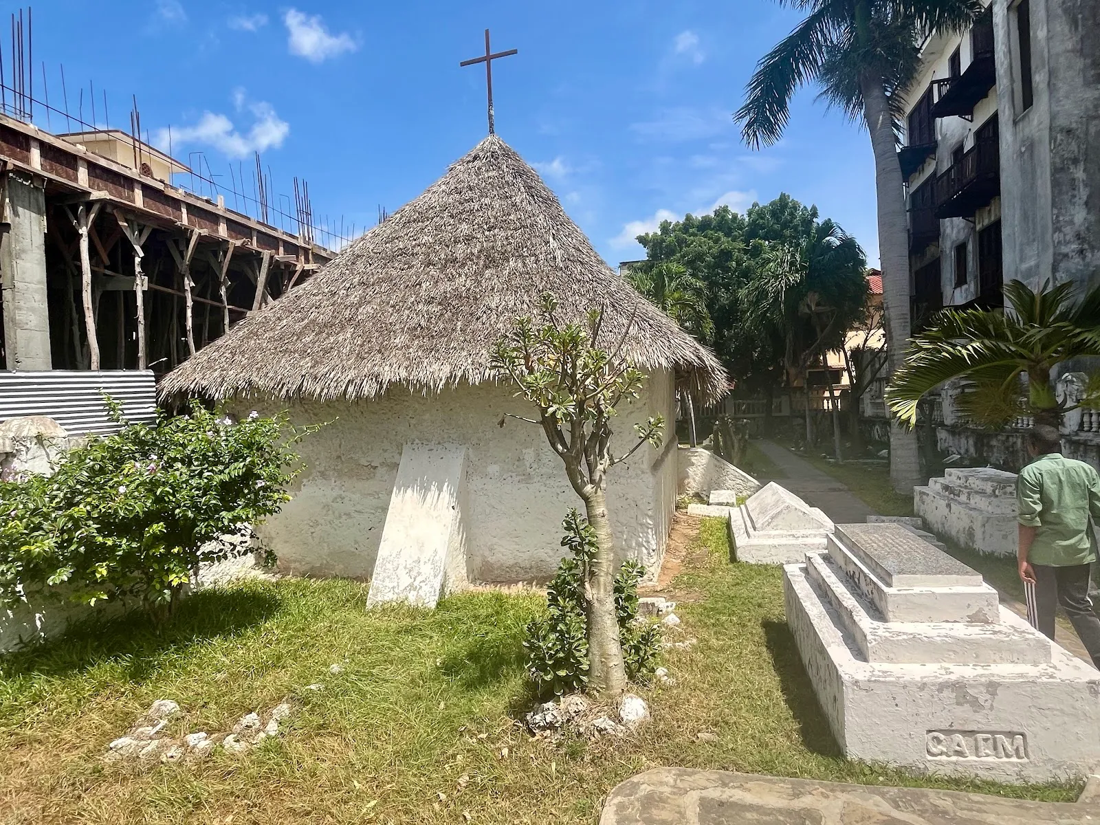
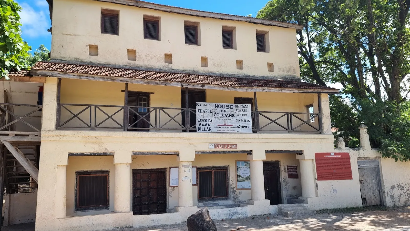
Malindi grew as a trading port in the Swahili world. Vasco da Gama signed a trade agreement with local authorities in 1498, and a stone marker from that year still stands near the fishing harbor, though erosion could eventually topple it into the sea. The Portuguese Chapel, built before 1542, and the Juma Mosque are other old sites in town. For a day trip, the Gedi Ruins lie south of town, and the Watamu and Malindi marine parks form a protected coastal area in the same direction. Malindi suits travelers who want beaches combined with history.
Malindi in five
- Check the FCDO map before any trip up the coastFCDO advises against all but essential travel within 15 km of the east coast between the Tana and Galana rivers, and all travel to Lamu County except Lamu and Manda islands. Its map starts that strip just north of Malindi.UK travel advice
- Visit Malindi Marine Park, 5 km from townKWS lists coral gardens, snorkeling, scuba, reef walks and water sports, and gives the access road as Casuarina Road. It dates from 1968 and was Kenya's first marine protected area.
- Add Watamu and Gede on a day southKWS puts Watamu 28 km south of Malindi, with Mida Creek and the Gede ruins on its list. National Museums of Kenya lists Gede Ruins at USD 8 for adults from outside Africa, paid via eCitizen.
- Fly to Malindi or drive north from MombasaKWS lists flights from Nairobi to Malindi Airport. By rail, the SGR ends at Mombasa Terminus and the rest is a road transfer north through Gede, about 120 km to Watamu.Nairobi to Mombasa options




Need to know
- Airport
- Malindi Airport, with flights from Nairobi (KWS)
- Getting there
- Fly, or SGR to Mombasa then road north through Gede
- Getting around
- Taxis and hotel transfers; check the FCDO map before going north
- Best base
- The town or the beaches nearest the marine park
- Time needed
- 3–4 days; add Watamu and Gede
Weather by month
- Rainy days
- Best
- Good
- Mixed
- JanuaryPartly cloudy5 rainy daysHigh30°Low25°Hot, dryJanuaryPartly cloudy
Best
- High
- 30°
- Low
- 25°
- Precipitation
- 19 mm
- Rainy days
- 5
- Snowy days
- 0
- Days with storms
- 0
Hot, dry
- FebruaryClear4 rainy daysHigh31°Low25°Hot, dryFebruaryClear
Best
- High
- 31°
- Low
- 25°
- Precipitation
- 13 mm
- Rainy days
- 4
- Snowy days
- 0
- Days with storms
- 0
Hot, dry
- MarchPartly cloudy12 rainy daysHigh31°Low26°Hot, humidMarchPartly cloudy
Best
- High
- 31°
- Low
- 26°
- Precipitation
- 55 mm
- Rainy days
- 12
- Snowy days
- 0
- Days with storms
- 0
Hot, humid
- AprilRain24 rainy daysHigh30°Low26°Long rainsAprilRain
Mixed
- High
- 30°
- Low
- 26°
- Precipitation
- 171 mm
- Rainy days
- 24
- Snowy days
- 0
- Days with storms
- 0
Long rains
- MayRain23 rainy daysHigh29°Low25°Heaviest rainMayRain
Mixed
- High
- 29°
- Low
- 25°
- Precipitation
- 245 mm
- Rainy days
- 23
- Snowy days
- 0
- Days with storms
- 0
Heaviest rain
- JuneRain21 rainy daysHigh28°Low24°Cooler, dryingJuneRain
Good
- High
- 28°
- Low
- 24°
- Precipitation
- 106 mm
- Rainy days
- 21
- Snowy days
- 0
- Days with storms
- 0
Cooler, drying
- JulyRain21 rainy daysHigh27°Low24°Cool, breezyJulyRain
Best
- High
- 27°
- Low
- 24°
- Precipitation
- 75 mm
- Rainy days
- 21
- Snowy days
- 0
- Days with storms
- 0
Cool, breezy
- AugustRain19 rainy daysHigh28°Low23°Cool, breezyAugustRain
Best
- High
- 28°
- Low
- 23°
- Precipitation
- 55 mm
- Rainy days
- 19
- Snowy days
- 0
- Days with storms
- 0
Cool, breezy
- SeptemberRain17 rainy daysHigh28°Low24°Dry, breezySeptemberRain
Best
- High
- 28°
- Low
- 24°
- Precipitation
- 55 mm
- Rainy days
- 17
- Snowy days
- 0
- Days with storms
- 0
Dry, breezy
- OctoberRain17 rainy daysHigh29°Low24°Warm, dryOctoberRain
Best
- High
- 29°
- Low
- 24°
- Precipitation
- 92 mm
- Rainy days
- 17
- Snowy days
- 0
- Days with storms
- 0
Warm, dry
- NovemberRain18 rainy daysHigh30°Low25°Short rainsNovemberRain
Good
- High
- 30°
- Low
- 25°
- Precipitation
- 118 mm
- Rainy days
- 18
- Snowy days
- 0
- Days with storms
- 0
Short rains
- DecemberRain15 rainy daysHigh30°Low25°Hot, busyDecemberRain
Good
- High
- 30°
- Low
- 25°
- Precipitation
- 79 mm
- Rainy days
- 15
- Snowy days
- 0
- Days with storms
- 0
Hot, busy
Average daily high and low in Malindi, 2016–2025. Rainy day: 1 mm of rain or more.
Right now in Malindi
Local time, today's weather and the exchange rate, refreshed through the day.

26
- Feels like
- 29°
- Humidity
- 82%
- Wind
- 12 km/h
- Chance of rain
- 90%
Malindi
11:36 PM
Monday, November 2
- Today30°25°90%Monday: Drizzle. High 30°, Low 25°. Chance of rain 90%.
- Tue30°25°79%Tuesday: Drizzle. High 30°, Low 25°. Chance of rain 79%.
- Wed30°24°69%Wednesday: Drizzle. High 30°, Low 24°. Chance of rain 69%.
- Thu31°25°35%Thursday: Drizzle. High 31°, Low 25°. Chance of rain 35%.
- Fri31°23°47%Friday: Drizzle. High 31°, Low 23°. Chance of rain 47%.
- Sat31°24°68%Saturday: Drizzle. High 31°, Low 24°. Chance of rain 68%.
- Sun31°23°94%Sunday: Drizzle. High 31°, Low 23°. Chance of rain 94%.
Updated 08:49 PM local time · Powered by WeatherAPI.com · Weather data by Open-Meteo.com
Money
Mid-market rate1 USD = 129.9 KES
Rates from Nov 2, 2026 · Rates By Exchange Rate API
Day trips by train
- Malindi Marine National Park5 km from town via Casuarina RoadCoral gardens and snorkeling in a park established in 1968.
- Watamu and Gede ruins28 km south by road (KWS)A marine park, Mida Creek and a historic Swahili settlement near the Mombasa road.
- Mombasaabout 150 km south by roadFort Jesus and the SGR terminus; better as the next stop than a day trip.Read the guide
Before you go to Malindi
We may earn a commission. It never decides our picks.
Rules for Malindi, checked
- FCDO advises against all but essential travel within 15km of the east coast between the Tana River and the Galana (Athi-Galana-Sabaki) River.Checked Oct 6, 2026 · Source
- KWS lists USD 25 per adult and USD 15 per child for non-residents at marine protected areas, a group that includes Malindi and Watamu.Checked Oct 6, 2026 · Source
- National Museums of Kenya sites, including Gede Ruins, are open 8:30 to 17:30 daily and take payment through eCitizen, not cash.Checked Oct 6, 2026 · Source
Plan around Malindi
The port city and SGR terminus to the south
Read the guideNairobi to MombasaThe first leg of most routes to Malindi
Read the guideDiani BeachThe south-coast alternative for a beach week
Read the guideLamuIsland old town reached by air, not road
Read the guideNairobiWhere flights to Malindi connect
Read the guideKenya eTA guideApply online before you fly
Read the guideAll of KenyaSafari parks, the coast and entry rules
Read the guideMalindi FAQ
Is Malindi safe for tourists?
The UK advice reports a heightened terrorism threat and a high threat of terrorist kidnap across Kenya, and advises against all but essential travel within 15 km of the east coast between the Tana and Galana rivers. Its map starts that strip just north of Malindi. Ask your hotel before any trip north.
How do I get to Malindi from Nairobi?
KWS lists flights from Nairobi to Malindi Airport. The alternative is the SGR train to Mombasa, then a road transfer north through Gede, about 120 km to Watamu with Malindi 28 km further.
What is there to do in Malindi?
Malindi Marine Park, 5 km from town, has coral gardens and snorkeling. Reef walks, kite and wind sports and beach days fill the rest, and Watamu and the Gede ruins make a day south.
Is Malindi better than Diani Beach?
Malindi suits a town with a marine park and Watamu close by. Diani is a longer, more resort-style beach in the south, outside the areas the UK advises against, while the UK map's coastal strip begins just north of Malindi.
Do I need cash for the Gede ruins?
Not for tickets. The National Museums of Kenya rates page marks payment as eCitizen only, with no cash, and lists Gede Ruins at USD 8 for adults from outside Africa. Check the page before you go.