Puntarenas
Pacific beaches, seafood and sunsets on a narrow sand spit, where ferries cross the Gulf of Nicoya to the Nicoya Peninsula.
We may earn a commission. It never decides our picks.
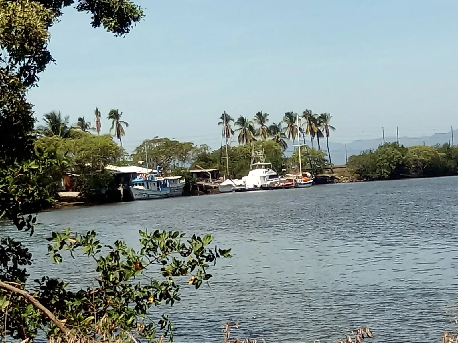
Puntarenas is a city on Costa Rica's Pacific coast and the capital of Puntarenas Province, the largest province in the country. It sits at sea level on a narrow sand spit on the east side of the Gulf of Nicoya, facing the Nicoya Peninsula. The name means "sand point," after the needle-shaped spit. Scheduled ferries run from the end of the Paseo de los Turistas to the peninsula, and the city is about 99 km by road from San José.
The city is a sun-and-sand spot for surfers and for Costa Ricans from the Central Valley. The Paseo de los Turistas is the main strip, a beachfront boulevard lined with palms and beach almond trees, with kiosks, bars, hotels and restaurants. At its end, the La Punta lighthouse is a popular sunset spot. The Parque Marino del Pacífico has an aquarium and a rescue center with turtles, crocodiles and pelicans. Ceviche is the signature dish, and the churchill, a shaved-ice dessert topped with ice cream, is the best-known sweet. The climate is tropical dry, about 28 to 34 °C, eased by the sea breeze. Plan a day or two for the promenade, the marine park and a ferry crossing.
Puntarenas in five
- Choose the ferry route before the hotelICT lists two routes: Paquera for Montezuma, Santa Teresa and Mal País, and Playa Naranjo for Sámara and Nicoya. Coonatramar's current sheet covers Playa Naranjo; confirm Paquera times with the operator.Mal País and Santa Teresa
- Plan around the Playa Naranjo sailingsCoonatramar's sheet for 21 July to 30 November 2026 lists Puntarenas departures at 5:15am, 10:00am, 2:30pm, 6:45pm and 8:30pm, plus 11:30am on Fridays and Sundays. Adults pay ¢1,000 and a car ¢10,170.Playa Sámara
- Use a long wait for the seafrontICT lists a tourist promenade to the lighthouse, a marine history museum and a Pacific marine park with an aquarium. They suit a gap before a sailing better than a full day.
- Take a boat tour of the Gulf islandsICT says boats for touring the Gulf of Nicoya islands leave from Puntarenas, Playa Naranjo and Cóbano. Chira is the largest island, inhabited and only lightly touristed.
- Respect the river banks on the road southICT praises the coastal highway from Caldera to Quepos and Manuel Antonio. Stay off river banks and mouths along the surf beaches; the Central Pacific Coast guide has the crocodile warning.Central Pacific Coast


Need to know
- Airport
- San José (SJO); ICT gives about two hours by car, 74 miles
- Getting there
- By road from San José; the port has a cruise dock and ferry terminal
- Getting around
- Walking on the sandbar; taxis for the ferry and the highway
- Best base
- An overnight only before an early sailing
- Time needed
- A few hours to one night
Weather by month
- Rainy days
- Best
- Mixed
- Poor
- JanuaryPartly cloudy6 rainy daysHigh30°Low23°Dry, breezyJanuaryPartly cloudy
Best
- High
- 30°
- Low
- 23°
- Precipitation
- 25 mm
- Rainy days
- 6
- Snowy days
- 0
- Days with storms
- 0
Dry, breezy
- FebruaryClear3 rainy daysHigh32°Low24°Dry, sunnyFebruaryClear
Best
- High
- 32°
- Low
- 24°
- Precipitation
- 12 mm
- Rainy days
- 3
- Snowy days
- 0
- Days with storms
- 0
Dry, sunny
- MarchClear7 rainy daysHigh32°Low25°Driest, hotMarchClear
Best
- High
- 32°
- Low
- 25°
- Precipitation
- 26 mm
- Rainy days
- 7
- Snowy days
- 0
- Days with storms
- 0
Driest, hot
- AprilRain17 rainy daysHigh32°Low25°Hot, transitionAprilRain
Mixed
- High
- 32°
- Low
- 25°
- Precipitation
- 95 mm
- Rainy days
- 17
- Snowy days
- 0
- Days with storms
- 0
Hot, transition
- MayRain26 rainy daysHigh30°Low25°Rains beginMayRain
Poor
- High
- 30°
- Low
- 25°
- Precipitation
- 381 mm
- Rainy days
- 26
- Snowy days
- 0
- Days with storms
- 0
Rains begin
- JuneRain29 rainy daysHigh29°Low25°Green seasonJuneRain
Poor
- High
- 29°
- Low
- 25°
- Precipitation
- 475 mm
- Rainy days
- 29
- Snowy days
- 0
- Days with storms
- 0
Green season
- JulyRain26 rainy daysHigh29°Low24°Veranillo lullJulyRain
Poor
- High
- 29°
- Low
- 24°
- Precipitation
- 330 mm
- Rainy days
- 26
- Snowy days
- 0
- Days with storms
- 0
Veranillo lull
- AugustRain28 rainy daysHigh29°Low25°Veranillo lullAugustRain
Poor
- High
- 29°
- Low
- 25°
- Precipitation
- 395 mm
- Rainy days
- 28
- Snowy days
- 0
- Days with storms
- 0
Veranillo lull
- SeptemberRain28 rainy daysHigh29°Low24°Very wetSeptemberRain
Poor
- High
- 29°
- Low
- 24°
- Precipitation
- 440 mm
- Rainy days
- 28
- Snowy days
- 0
- Days with storms
- 0
Very wet
- OctoberRain30 rainy daysHigh28°Low24°Very wetOctoberRain
Poor
- High
- 28°
- Low
- 24°
- Precipitation
- 675 mm
- Rainy days
- 30
- Snowy days
- 0
- Days with storms
- 0
Very wet
- NovemberRain21 rainy daysHigh28°Low24°Rains easeNovemberRain
Mixed
- High
- 28°
- Low
- 24°
- Precipitation
- 313 mm
- Rainy days
- 21
- Snowy days
- 0
- Days with storms
- 0
Rains ease
- DecemberPartly cloudy11 rainy daysHigh29°Low23°Dry beginsDecemberPartly cloudy
Best
- High
- 29°
- Low
- 23°
- Precipitation
- 80 mm
- Rainy days
- 11
- Snowy days
- 0
- Days with storms
- 0
Dry begins
Average daily high and low in Puntarenas, 2016–2025. Rainy day: 1 mm of rain or more.
Right now in Puntarenas
Local time, today's weather and the exchange rate, refreshed through the day.

27
- Feels like
- 32°
- Humidity
- 95%
- Wind
- 10 km/h
- Chance of rain
- 100%
Puntarenas
02:38 PM
Monday, November 2
- Today29°24°100%Monday: Thunderstorms. High 29°, Low 24°. Chance of rain 100%.
- Tue29°23°95%Tuesday: Rain. High 29°, Low 23°. Chance of rain 95%.
- Wed25°24°98%Wednesday: Rain. High 25°, Low 24°. Chance of rain 98%.
- Thu26°23°94%Thursday: Rain. High 26°, Low 23°. Chance of rain 94%.
- Fri25°23°94%Friday: Rain. High 25°, Low 23°. Chance of rain 94%.
- Sat29°23°96%Saturday: Drizzle. High 29°, Low 23°. Chance of rain 96%.
- Sun31°23°76%Sunday: Drizzle. High 31°, Low 23°. Chance of rain 76%.
Updated 11:58 AM local time · Weather data by Open-Meteo.com
Money
Mid-market rate1 USD = 455.4 CRC
Rates from Nov 2, 2026 · Rates By Exchange Rate API
Day trips by train
- Quepos and Manuel Antoniosouth on the coastal highwayICT praises the Caldera to Quepos highway; stay off river banks and beaches with crocodile warnings.Read the guide
- Montezuma and Mal Paísferry to Paquera, then by roadThe southern tip of the Nicoya Peninsula, on ICT's Paquera route.Read the guide
- Gulf of Nicoya islandsboat tour from the portChira, Tortuga and other islands, by boat tours that ICT says leave from Puntarenas.
Before you go to Puntarenas
We may earn a commission. It never decides our picks.
Rules for Puntarenas, checked
- Coonatramar fares: adults ¢1,000, children 3 to 12 ¢600, cars ¢10,170. Its sailing sheet runs 21 July to 30 November 2026 (Puntarenas to Playa Naranjo).Checked Oct 3, 2026 · Source
- ICT's undated ferry page lists two Puntarenas routes: Paquera, with tickets from Naviera Tambor, and Playa Naranjo, sold by Coonatramar.Checked Oct 3, 2026 · Source
Plan around Puntarenas
The coastal highway's gateway to Manuel Antonio.
Read the guideMal País and Santa TeresaSurf beaches at the end of the Paquera ferry.
Read the guidePlaya SámaraA calm bay reached via the Playa Naranjo ferry.
Read the guideMonteverdeCloud forest reserves, north of Puntarenas by road.
Read the guideSan JoséAbout 74 miles by road, per ICT, from the port.
Read the guideTransport in Costa RicaFerries, buses and the planning pages that cover them.
Read the guideAll of Costa RicaA port stop within a longer Costa Rica route.
Read the guidePuntarenas FAQ
How do you get from Puntarenas to the Nicoya Peninsula?
By ferry, and the route depends on where you are going. ICT lists Paquera for Montezuma, Santa Teresa and Mal País, and Playa Naranjo for Sámara and Nicoya. Coonatramar's current sheet lists Playa Naranjo sailings from 5:15am to 8:30pm; check the Paquera operator for its own times.
Is Puntarenas worth a stop?
As a gap in a ferry day, yes: ICT lists a promenade to the lighthouse, a marine park with an aquarium and a marine history museum. It is not a beach base for most visitors, and the sandbar is best for a few hours.
How far is Puntarenas from San José?
ICT puts it at around two hours by car and 74 miles from the capital. Traffic, rain and holiday weekends can stretch that, so leave margin before any ferry sailing.
Can you take a rental car on the Puntarenas ferry?
Coonatramar's fare sheet lists a price for cars, but rental contracts may restrict ferry use. Ask your rental company before you board, and keep the paperwork handy.
Where do cruise ships dock?
ICT says the Port of Puntarenas receives cruises on its remodeled dock. Ask your cruise line for the all-aboard time and any shuttle to the town before you plan a day on shore.