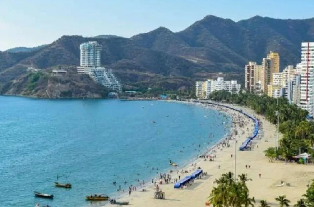
Santa Marta
Santa Marta is a Caribbean port city where travelers come for the beaches, Tayrona National Natural Park, and treks into the Sierra Nevada mountains.
We may earn a commission. It never decides our picks.
Santa Marta is a port city on Colombia's Caribbean coast, founded by the Spanish in 1525. Many travelers use it as a base for Tayrona National Natural Park, with its forested headlands and coves, and for the Sierra Nevada de Santa Marta, a mountain range that rises close to the coast. The city itself is busy and practical, with a historic center and a long waterfront.
It suits travelers who want beaches, hiking and day trips more than a city break built around museums. The best-known trek is to the Ciudad Perdida, the Lost City, a multi-day hike through the mountains. Taganga, a fishing village nearby, is a common stop for diving and a quieter beach. The drier months from December to April are the usual time to visit, though the coast is hot all year. Plan three or four days, and four to six more if you want to make the trek.
Santa Marta in five
- Set up data before you leave the airportTaxi, tour and hotel bookings in Santa Marta often run through WhatsApp, so get a local SIM or eSIM before you land.Phones and eSIM
- Carry small peso notes for beaches and boatsBeach kiosks, Taganga boat operators and Centro market stalls often want cash for drinks, snacks and short trips, so keep small notes on hand.Money and costs
- Ask for the license before you book a trekThe Ciudad Perdida trek runs for several days in the Sierra Nevada. Ask the operator to show its license and confirm whether meals, camps and the guide are included in the price.Tours and tickets
- Have your hotel call a registered taxiAsk your hotel or restaurant to call a registered taxi, and check that the registration plate matches before you get in.Getting around
- Read the trekking and swimming clauses in your policySome policies exclude multi-day hiking or water sports. Check the Lost City trek and Tayrona swimming are covered before you buy.Travel insurance


Need to know
- Currency
- Colombian peso (COP)
- Entry
- Visa-free short stays for many passports; check Migración Colombia before you fly Read more
- Emergency
- 123 for police, ambulance and fire
- Tipping
- 10% service often added to the bill; check before tipping more
- Time
- UTC-5, no daylight saving
Weather by month
- Rainy days
- Days with storms
- Best
- Good
- Mixed
- Poor
- JanuaryClear3 rainy daysHigh29°Low25°Dry, busyJanuaryClear
Good
- High
- 29°
- Low
- 25°
- Precipitation
- 10 mm
- Rainy days
- 3
- Snowy days
- 0
- Days with storms
- 0
Dry, busy
- FebruaryClear1 rainy dayHigh29°Low25°Dry, breezyFebruaryClear
Best
- High
- 29°
- Low
- 25°
- Precipitation
- 5 mm
- Rainy days
- 1
- Snowy days
- 0
- Days with storms
- 0
Dry, breezy
- MarchClear2 rainy daysHigh30°Low25°Dry, breezyMarchClear
Best
- High
- 30°
- Low
- 25°
- Precipitation
- 8 mm
- Rainy days
- 2
- Snowy days
- 0
- Days with storms
- 0
Dry, breezy
- AprilPartly cloudy8 rainy daysHigh30°Low26°Hot, dryAprilPartly cloudy
Good
- High
- 30°
- Low
- 26°
- Precipitation
- 55 mm
- Rainy days
- 8
- Snowy days
- 0
- Days with storms
- 0
Hot, dry
- MayRain17 rainy daysHigh30°Low26°Heat, first showersMayRain
Mixed
- High
- 30°
- Low
- 26°
- Precipitation
- 120 mm
- Rainy days
- 17
- Snowy days
- 0
- Days with storms
- 0
Heat, first showers
- JuneRain21 rainy days1 day with stormsHigh29°Low26°Rain returnsJuneRain
Mixed
- High
- 29°
- Low
- 26°
- Precipitation
- 167 mm
- Rainy days
- 21
- Snowy days
- 0
- Days with storms
- 1
Rain returns
- JulyRain18 rainy daysHigh30°Low26°Mid-year lullJulyRain
Mixed
- High
- 30°
- Low
- 26°
- Precipitation
- 116 mm
- Rainy days
- 18
- Snowy days
- 0
- Days with storms
- 0
Mid-year lull
- AugustRain21 rainy days1 day with stormsHigh30°Low26°School holidaysAugustRain
Good
- High
- 30°
- Low
- 26°
- Precipitation
- 170 mm
- Rainy days
- 21
- Snowy days
- 0
- Days with storms
- 1
School holidays
- SeptemberRain22 rainy days1 day with stormsHigh30°Low26°Hot, humidSeptemberRain
Mixed
- High
- 30°
- Low
- 26°
- Precipitation
- 157 mm
- Rainy days
- 22
- Snowy days
- 0
- Days with storms
- 1
Hot, humid
- OctoberRain25 rainy daysHigh29°Low25°Wettest monthsOctoberRain
Poor
- High
- 29°
- Low
- 25°
- Precipitation
- 219 mm
- Rainy days
- 25
- Snowy days
- 0
- Days with storms
- 0
Wettest months
- NovemberRain21 rainy daysHigh29°Low25°Rain, quieterNovemberRain
Poor
- High
- 29°
- Low
- 25°
- Precipitation
- 157 mm
- Rainy days
- 21
- Snowy days
- 0
- Days with storms
- 0
Rain, quieter
- DecemberPartly cloudy6 rainy daysHigh29°Low25°Festive, busyDecemberPartly cloudy
Good
- High
- 29°
- Low
- 25°
- Precipitation
- 28 mm
- Rainy days
- 6
- Snowy days
- 0
- Days with storms
- 0
Festive, busy
Average daily high and low in Santa Marta, 2016–2025. Rainy day: 1 mm of rain or more.
Right now in Santa Marta
Local time, today's weather and the exchange rate, refreshed through the day.

28
- Feels like
- 31°
- Humidity
- 77%
- Wind
- 6 km/h
- Chance of rain
- 35%
Santa Marta
03:38 PM
Monday, November 2
- Today30°26°35%Monday: Thunderstorms. High 30°, Low 26°. Chance of rain 35%.
- Tue30°25°42%Tuesday: Thunderstorms. High 30°, Low 25°. Chance of rain 42%.
- Wed30°25°65%Wednesday: Thunderstorms. High 30°, Low 25°. Chance of rain 65%.
- Thu29°24°75%Thursday: Drizzle. High 29°, Low 24°. Chance of rain 75%.
- Fri28°25°67%Friday: Thunderstorms. High 28°, Low 25°. Chance of rain 67%.
- Sat29°24°39%Saturday: Thunderstorms. High 29°, Low 24°. Chance of rain 39%.
- Sun30°25°18%Sunday: Drizzle. High 30°, Low 25°. Chance of rain 18%.
Updated 03:30 PM local time · Powered by WeatherAPI.com · Weather data by Open-Meteo.com
Money
Mid-market rate1 USD = 3,192 COP
Rates from Nov 2, 2026 · Rates By Exchange Rate API
Every year
- Feb–MarBarranquilla's CarnivalBarranquilla, a day trip
Day trips by train
- Tayrona National Natural Parkabout 1 hour by car to El ZainoBeaches and jungle trails in a national park. Go early for the quietest sand.
- Mincaabout 1 hour by 4x4 taxiA hill village with coffee farms and river pools, reached up a steep road.
- Cartagenaabout 4 to 5 hours by roadA walled colonial city for a long day, with an early start.
Before you go to Santa Marta
Rules for Santa Marta, checked
- Tayrona is a national natural park. Entry tickets, visiting rules and swimming warnings are set by Parques Nacionales Naturales de Colombia.Source
- Follow the flags and signs on Tayrona beaches, where currents are strong and some stretches are closed to swimming.
- Carry your passport for hotel check-ins and police checks. Check Colombian entry rules on Migración Colombia before you fly.Source
Plan around Santa Marta
Centro, El Rodadero and Taganga compared
Read the guideGetting aroundTaxis, buses and transfers to the beaches and hills
Read the guideMoney and costsCash, cards and typical daily prices
Read the guideVisas and entryEntry rules and the official checks to make
Read the guideColombia guideCities, regions and wider travel in the country
Read the guideTours and ticketsTayrona, Minca and multi-day trek bookings
Read the guideSanta Marta FAQ
Is Santa Marta worth visiting?
Yes, for Caribbean beaches, the Tayrona park and a base for hikes into the Sierra Nevada. It is a weaker choice for a city with many museums or a long nightlife scene.
How do you get from Santa Marta to Tayrona?
Take a taxi or car to the park entrance at El Zaino, or book a tour that includes transport. Start early, since the midday heat makes the trail tiring.
Is Santa Marta safe for tourists?
Most visits pass without trouble, but petty theft happens in crowded areas. Keep phones out of sight, use registered taxis and stick to well-lit streets at night.
How many days do you need in Santa Marta?
Three or four days covers the beaches, Taganga and a day at Tayrona. Add four to six days for the Lost City trek, which runs for several days in the mountains.
Is Taganga worth a visit?
Yes, for seafood, diving and boat trips from a working fishing village. Go for a day or two, since the beach is less polished than El Rodadero.