Travel advisory · ColombiaSome governments advise against travel to parts of Colombia.The warnings cover only these areas: Arauca department, Buenaventura city, Caquetá department, Catatumbo region, Cauca department, Chocó department, Colombia–Venezuela border, immediate areas (no distance given), Ecuador border areas (no distance given), Norte de Santander department, Tumaco, Valle del Cauca department, Casanare department, Guainía department, Guaviare department, Meta department, Nariño department, Northern Antioquia, Putumayo department, Southern Bolívar, Southern Córdoba, Vaupés department, Vichada department.Advice depends on your passport. Read your own government's advice before you book.Official advice
- Arauca department · avoid all travel · Canada, Spain, New Zealand, UK, US
- Buenaventura city · avoid all travel · Canada, New Zealand
- Caquetá department · avoid all travel · Canada, Spain, France, New Zealand
- Catatumbo region · avoid all travel · Spain, New Zealand
- Cauca department · avoid all travel · Canada, Germany, Spain, Italy, New Zealand, UK, US
- Chocó department · avoid all travel · Canada, Germany, Spain, New Zealand, UK
- Colombia–Venezuela border, immediate areas (no distance given) · avoid all travel · Germany, France, New Zealand
- Ecuador border areas (no distance given) · avoid all travel · France, New Zealand
- Norte de Santander department · avoid all travel · Canada, Germany, New Zealand, UK, US
- Tumaco · avoid all travel · Canada, New Zealand
- Valle del Cauca department · avoid all travel · Canada, Germany, Italy, New Zealand, US
- Casanare department · avoid non-essential travel · Spain, New Zealand
- Guainía department · avoid non-essential travel · Canada, France, New Zealand
- Guaviare department · avoid non-essential travel · Canada, Germany, Spain, France, New Zealand, UK
- Meta department · avoid non-essential travel · Canada, Germany, Spain, New Zealand
- Nariño department · avoid non-essential travel · Canada, Germany, Spain, France, New Zealand
- Northern Antioquia · avoid non-essential travel · Germany, France
- Putumayo department · avoid non-essential travel · Canada, Germany, Spain, France, New Zealand
- Southern Bolívar · avoid non-essential travel · Germany, France, New Zealand, UK
- Southern Córdoba · avoid non-essential travel · Germany, France, New Zealand, UK
- Vaupés department · avoid non-essential travel · Canada, France
- Vichada department · avoid non-essential travel · Canada, France, New Zealand
Also named by one government: Brazil border areas (no distance given) (France), Cali–Popayán–Pasto–Ipiales highway (France), Cauca River banks (Sucre, Córdoba, Bolívar and northern Antioquia) (France), Colombia–Venezuela border within 10 km (US), Colombia–Venezuela border within 50 km, excluding Cúcuta (Canada), Communes immediately south of Cali (France), Darien Gap within Chocó (New Zealand), Ecuador border within 50 km, excluding Ipiales crossing (Canada), González and Río de Oro municipalities (Cesar) (Canada), Montes de María (Spain), Northwest zone around Panama border and Gulf of Urabá (Spain), Pacific coast (Chocó, Cauca, Valle del Cauca), excluding Nuquí and Bahía Solano (France), Panama border areas (no distance given) (France), Panama border within 100 km (Canada), Peru border areas (no distance given) (France), Amazonas department (France), Amazonas, within 20 km of Peru border west of Puerto Nariño (Canada), Antioquia department (New Zealand), Ariari region of southern Meta (UK), Bahía Solano, Capurganá and Nuquí (Canada), Bajo Cauca region (Antioquia) (UK), Cartagena del Chairá (UK), Colombia–Venezuela border within 5 km (rest of border) (UK), Cúcuta city (Canada), Earthquake-affected zone (Eje Cafetero and Suroriente) (Spain), Eastern Valle del Cauca (France), Ecuador border within 5 km (UK), Florencia city (Canada), Hillside communes of Medellín (France), Ipiales city and border crossing (Canada), Jamundí municipality (Valle del Cauca) (UK), La Montañita (UK), Northwest Antioquia, north of Buriticá and west of highway 62 (Canada), Orito (UK), Paramillo National Natural Park (Córdoba) (Canada), Paujil (UK), Popayán city (Canada), Popular districts of south Bogotá (Kennedy, Ciudad Bolívar, Altos, Cazucá, Soacha) (France), Puerto Asís (UK), Puerto Caicedo (UK), Puerto Carreño municipality (Vichada) (UK), Puerto Guzmán (UK), Puerto Leguízamo (UK), Puerto Rico (Caquetá) (UK), Quibdó city (France), San Jorge and La Mojana subregions of Sucre (New Zealand), San Miguel (Putumayo) (UK), San Vicente del Caguán (UK), Sanquianga region (Nariño) (UK), Santander department (France), South Pacific region (Nariño) (UK), Southern Sucre (France), Southern Tolima (Germany), Sur sub-region of Cesar (New Zealand), Telembí region (Nariño) (UK), Urabá region (Antioquia) (UK), Valle del Guamuez (UK), Western Valle del Cauca, including Buenaventura (UK)
| Government | Advice | Updated | Read the advice |
|---|---|---|---|
| United Kingdom (FCDO) | No advice against the whole country (regional advisories) | – | Read the advice |
| United States (State Dept) | Reconsider travel | Mar 31, 2026 | Read the advice |
| Canada (Global Affairs) | Exercise a high degree of caution (regional advisories) | – | Read the advice |
| Germany (Auswärtiges Amt) | Keine Reisewarnung für das ganze Land (regional advisories) | Oct 13, 2026 | Read the advice |
| New Zealand (SafeTravel) | Exercise increased caution due to violent crime and the threat of terrorism (regional advisories) | – | Read the advice |
| France (Ministry for Europe and Foreign Affairs) | Increased vigilance, with specific areas to avoid (regional advisories) | – | Read the advice |
Checked daily from the governments' published advice; last checked Nov 2, 2026. RoamLedger summarises official advice; it is not advice from any government.
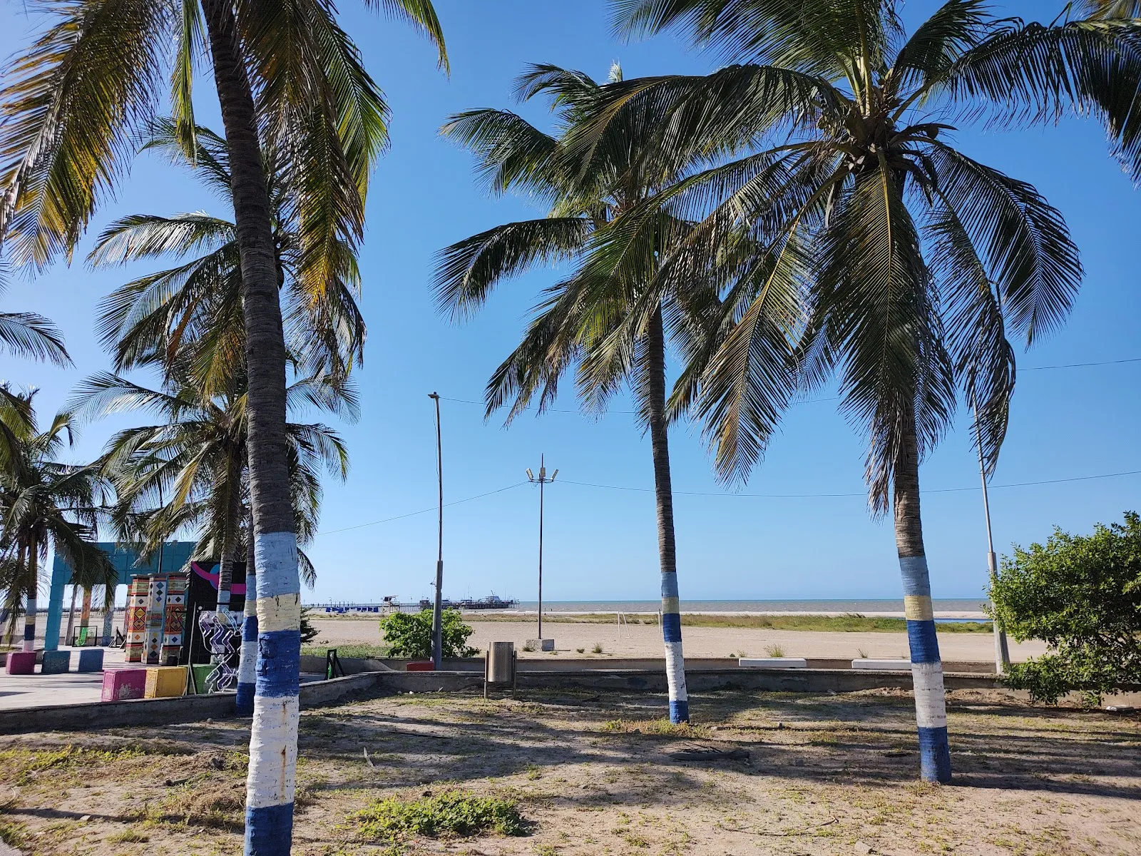
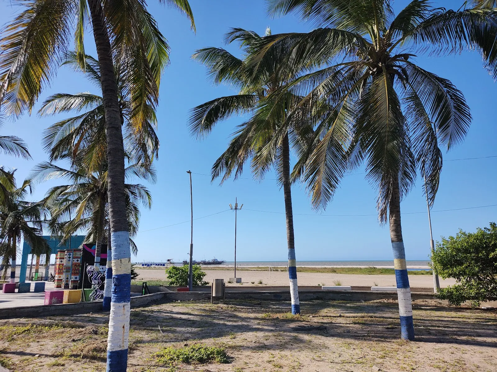
Riohacha
Riohacha is the main base for exploring La Guajira, a dry peninsula of desert scrub and Wayuu villages on Colombia's Caribbean coast.
We may earn a commission. It never decides our picks.
Riohacha is the capital of La Guajira, Colombia's northernmost department, on the Caribbean coast near the Venezuelan border. The Ranchería River reaches the sea here. The city is low, hot and laid out on a grid, with a waterfront road. The Wayuu, one of Colombia's largest Indigenous peoples, shape much of life in the region, from the markets to the handicrafts sold along the coast.
Most travelers use Riohacha as a base for trips out of the city. Day trips and longer drives reach the dry peninsula, the flamingo lagoons at Los Flamencos and the coast farther north. The dry season, roughly December to April, is the most comfortable time to visit, with strong trade winds, though it stays hot most of the year. Two or three nights in the city give a first look. A trip into the peninsula takes longer, and the sand roads are rough enough that many travelers book a driver with a 4x4.
Riohacha in five
- Carry pesos in cash for the GuajiraCard payments drop off quickly once you leave the city, and many small shops, fuel stops and village tours take only cash. Withdraw Colombian pesos in Riohacha before you drive out.
- Hire a 4x4 and driver for the sand tracksThe roads beyond Uribia turn to sand and rough tracks, and a rented sedan can get stuck. Ask your hotel for a driver who knows the route to Cabo de la Vela.Getting around
- Ask before photographing Wayuu peopleSome Wayuu families ask for payment for a photo, so agree on the fee before you raise the camera. Ask first, and take no pictures inside homes without a clear yes.
- Check the Check-Mig form before you flyComplete the Check-Mig form on Migración Colombia's site before you arrive. Check the official site before you buy a ticket, since entry rules change.Visas and entry
- Set up an eSIM before you leave the cityMobile coverage thins out along the Guajira coast and on desert tracks. Load data and download offline maps before the drive, and tell someone your route.Phones and eSIM


Need to know
- Currency
- Colombian peso (COP)
- Entry
- Entry rules vary by passport; check the Check-Mig form before you fly Read more
- Emergency
- 123 national emergency line, 112 from mobiles
- Tipping
- A 10% service charge is often added; if not, leave about 10%
- Time
- UTC-5, no daylight saving
Weather by month
- Rainy days
- Days with storms
- Best
- Good
- Mixed
- Poor
- JanuaryClear3 rainy daysHigh30°Low24°Dry, windyJanuaryClear
Good
- High
- 30°
- Low
- 24°
- Precipitation
- 11 mm
- Rainy days
- 3
- Snowy days
- 0
- Days with storms
- 0
Dry, windy
- FebruaryClear2 rainy daysHigh30°Low24°Dry, breezyFebruaryClear
Best
- High
- 30°
- Low
- 24°
- Precipitation
- 8 mm
- Rainy days
- 2
- Snowy days
- 0
- Days with storms
- 0
Dry, breezy
- MarchClear4 rainy daysHigh30°Low24°Dry, hotMarchClear
Best
- High
- 30°
- Low
- 24°
- Precipitation
- 12 mm
- Rainy days
- 4
- Snowy days
- 0
- Days with storms
- 0
Dry, hot
- AprilPartly cloudy8 rainy daysHigh30°Low25°Dry, hotAprilPartly cloudy
Good
- High
- 30°
- Low
- 25°
- Precipitation
- 40 mm
- Rainy days
- 8
- Snowy days
- 0
- Days with storms
- 0
Dry, hot
- MayRain13 rainy daysHigh31°Low26°Hot, dryMayRain
Mixed
- High
- 31°
- Low
- 26°
- Precipitation
- 106 mm
- Rainy days
- 13
- Snowy days
- 0
- Days with storms
- 0
Hot, dry
- JunePartly cloudy11 rainy daysHigh32°Low26°Hot, windyJunePartly cloudy
Mixed
- High
- 32°
- Low
- 26°
- Precipitation
- 83 mm
- Rainy days
- 11
- Snowy days
- 0
- Days with storms
- 0
Hot, windy
- JulyPartly cloudy6 rainy days1 day with stormsHigh32°Low26°Hot, windyJulyPartly cloudy
Mixed
- High
- 32°
- Low
- 26°
- Precipitation
- 28 mm
- Rainy days
- 6
- Snowy days
- 0
- Days with storms
- 1
Hot, windy
- AugustRain13 rainy days1 day with stormsHigh32°Low26°Hot, windyAugustRain
Mixed
- High
- 32°
- Low
- 26°
- Precipitation
- 78 mm
- Rainy days
- 13
- Snowy days
- 0
- Days with storms
- 1
Hot, windy
- SeptemberRain21 rainy days1 day with stormsHigh31°Low26°Hot, rainy spellsSeptemberRain
Mixed
- High
- 31°
- Low
- 26°
- Precipitation
- 140 mm
- Rainy days
- 21
- Snowy days
- 0
- Days with storms
- 1
Hot, rainy spells
- OctoberRain24 rainy days1 day with stormsHigh30°Low25°Hot, rainy spellsOctoberRain
Mixed
- High
- 30°
- Low
- 25°
- Precipitation
- 201 mm
- Rainy days
- 24
- Snowy days
- 0
- Days with storms
- 1
Hot, rainy spells
- NovemberRain19 rainy daysHigh30°Low25°Humid, rainyNovemberRain
Poor
- High
- 30°
- Low
- 25°
- Precipitation
- 126 mm
- Rainy days
- 19
- Snowy days
- 0
- Days with storms
- 0
Humid, rainy
- DecemberPartly cloudy6 rainy daysHigh30°Low24°Dry, windyDecemberPartly cloudy
Good
- High
- 30°
- Low
- 24°
- Precipitation
- 22 mm
- Rainy days
- 6
- Snowy days
- 0
- Days with storms
- 0
Dry, windy
Average daily high and low in Riohacha, 2016–2025. Rainy day: 1 mm of rain or more.
Right now in Riohacha
Local time, today's weather and the exchange rate, refreshed through the day.

28
- Feels like
- 34°
- Humidity
- 83%
- Wind
- 10 km/h
- Chance of rain
- 67%
Riohacha
05:39 PM
Monday, November 2
- Today33°25°67%Monday: Rain. High 33°, Low 25°. Chance of rain 67%.
- Tue32°24°67%Tuesday: Thunderstorms. High 32°, Low 24°. Chance of rain 67%.
- Wed28°24°69%Wednesday: Thunderstorms. High 28°, Low 24°. Chance of rain 69%.
- Thu29°23°59%Thursday: Rain. High 29°, Low 23°. Chance of rain 59%.
- Fri28°24°65%Friday: Rain. High 28°, Low 24°. Chance of rain 65%.
- Sat29°24°80%Saturday: Drizzle. High 29°, Low 24°. Chance of rain 80%.
- Sun31°23°58%Sunday: Drizzle. High 31°, Low 23°. Chance of rain 58%.
Updated 03:05 PM local time · Powered by WeatherAPI.com · Weather data by Open-Meteo.com
Money
Mid-market rate1 USD = 3,192 COP
Rates from Nov 2, 2026 · Rates By Exchange Rate API
Day trips by train
- Los Flamencos and Camaronesby car along the coast roadA coastal sanctuary where flamingos feed in the shallow lagoons.Read the guide
- Uribia and the Taroa dunesby car or 4x4, a half-day driveThe Wayuu town that is the gateway to the desert and its sand dunes.Read the guide
- Cabo de la Velaa long day by 4x4 on sand tracksA remote headland on the northern coast, with sand tracks and a lighthouse.Read the guide
Before you go to Riohacha
Rules for Riohacha, checked
- Check the Check-Mig pre-arrival form and entry requirements on Migración Colombia before you fly.Source
- Wayuu communities are on their own land and set their own rules; ask before entering a village or photographing anyone.
Plan around Riohacha
Taxis, buses and hired 4x4s for desert routes
Read the guideMoney and costsCash in pesos, card acceptance and tipping
Read the guideVisas and entryEntry rules and the pre-arrival form
Read the guideWhere to stay in RiohachaHotels and guesthouses in and around the city
Read the guideAll of ColombiaCities, regions and entry rules for the whole country
Read the guideSouth AmericaTrip ideas and regional planning across the continent
Read the guideRiohacha FAQ
Is Riohacha worth visiting?
Yes, if you want a dry, windy coastal town as a base for the Guajira peninsula, its desert and its Wayuu communities. It is a poor choice if you want a lively beach resort with a busy nightlife scene.
How do you get to Riohacha?
Fly into Riohacha's airport, or travel by road along the coast. Once you are in Riohacha, roads beyond Uribia need a 4x4 and a driver who knows the tracks.
Do you need a 4x4 to visit Cabo de la Vela?
Yes. The route to Cabo de la Vela runs over sand and rough tracks, and rented sedans can get stuck. Hire a 4x4 with a driver from Riohacha.
What is the best time to visit Riohacha?
December to April are the driest and most reliable months for travel and desert drives. Expect heat and wind through the middle of the year.
Can you pay by card in Riohacha?
Cards work in larger hotels and restaurants in the city, but cash is needed for fuel, small shops and village visits. Carry Colombian pesos before you leave Riohacha.
Can you visit Wayuu communities on your own?
You can, but ask a local guide or driver to introduce you and agree on any fee before you take a photo. Respect any request to keep out of homes or ceremonies.