Travel advisory · ColombiaSome governments advise against travel to parts of Colombia.The warnings cover only these areas: Arauca department, Buenaventura city, Caquetá department, Catatumbo region, Cauca department, Chocó department, Colombia–Venezuela border, immediate areas (no distance given), Ecuador border areas (no distance given), Norte de Santander department, Tumaco, Valle del Cauca department, Casanare department, Guainía department, Guaviare department, Meta department, Nariño department, Northern Antioquia, Putumayo department, Southern Bolívar, Southern Córdoba, Vaupés department, Vichada department.Advice depends on your passport. Read your own government's advice before you book.Official advice
- Arauca department · avoid all travel · Canada, Spain, New Zealand, UK, US
- Buenaventura city · avoid all travel · Canada, New Zealand
- Caquetá department · avoid all travel · Canada, Spain, France, New Zealand
- Catatumbo region · avoid all travel · Spain, New Zealand
- Cauca department · avoid all travel · Canada, Germany, Spain, Italy, New Zealand, UK, US
- Chocó department · avoid all travel · Canada, Germany, Spain, New Zealand, UK
- Colombia–Venezuela border, immediate areas (no distance given) · avoid all travel · Germany, France, New Zealand
- Ecuador border areas (no distance given) · avoid all travel · France, New Zealand
- Norte de Santander department · avoid all travel · Canada, Germany, New Zealand, UK, US
- Tumaco · avoid all travel · Canada, New Zealand
- Valle del Cauca department · avoid all travel · Canada, Germany, Italy, New Zealand, US
- Casanare department · avoid non-essential travel · Spain, New Zealand
- Guainía department · avoid non-essential travel · Canada, France, New Zealand
- Guaviare department · avoid non-essential travel · Canada, Germany, Spain, France, New Zealand, UK
- Meta department · avoid non-essential travel · Canada, Germany, Spain, New Zealand
- Nariño department · avoid non-essential travel · Canada, Germany, Spain, France, New Zealand
- Northern Antioquia · avoid non-essential travel · Germany, France
- Putumayo department · avoid non-essential travel · Canada, Germany, Spain, France, New Zealand
- Southern Bolívar · avoid non-essential travel · Germany, France, New Zealand, UK
- Southern Córdoba · avoid non-essential travel · Germany, France, New Zealand, UK
- Vaupés department · avoid non-essential travel · Canada, France
- Vichada department · avoid non-essential travel · Canada, France, New Zealand
Also named by one government: Brazil border areas (no distance given) (France), Cali–Popayán–Pasto–Ipiales highway (France), Cauca River banks (Sucre, Córdoba, Bolívar and northern Antioquia) (France), Colombia–Venezuela border within 10 km (US), Colombia–Venezuela border within 50 km, excluding Cúcuta (Canada), Communes immediately south of Cali (France), Darien Gap within Chocó (New Zealand), Ecuador border within 50 km, excluding Ipiales crossing (Canada), González and Río de Oro municipalities (Cesar) (Canada), Montes de María (Spain), Northwest zone around Panama border and Gulf of Urabá (Spain), Pacific coast (Chocó, Cauca, Valle del Cauca), excluding Nuquí and Bahía Solano (France), Panama border areas (no distance given) (France), Panama border within 100 km (Canada), Peru border areas (no distance given) (France), Amazonas department (France), Amazonas, within 20 km of Peru border west of Puerto Nariño (Canada), Antioquia department (New Zealand), Ariari region of southern Meta (UK), Bahía Solano, Capurganá and Nuquí (Canada), Bajo Cauca region (Antioquia) (UK), Cartagena del Chairá (UK), Colombia–Venezuela border within 5 km (rest of border) (UK), Cúcuta city (Canada), Earthquake-affected zone (Eje Cafetero and Suroriente) (Spain), Eastern Valle del Cauca (France), Ecuador border within 5 km (UK), Florencia city (Canada), Hillside communes of Medellín (France), Ipiales city and border crossing (Canada), Jamundí municipality (Valle del Cauca) (UK), La Montañita (UK), Northwest Antioquia, north of Buriticá and west of highway 62 (Canada), Orito (UK), Paramillo National Natural Park (Córdoba) (Canada), Paujil (UK), Popayán city (Canada), Popular districts of south Bogotá (Kennedy, Ciudad Bolívar, Altos, Cazucá, Soacha) (France), Puerto Asís (UK), Puerto Caicedo (UK), Puerto Carreño municipality (Vichada) (UK), Puerto Guzmán (UK), Puerto Leguízamo (UK), Puerto Rico (Caquetá) (UK), Quibdó city (France), San Jorge and La Mojana subregions of Sucre (New Zealand), San Miguel (Putumayo) (UK), San Vicente del Caguán (UK), Sanquianga region (Nariño) (UK), Santander department (France), South Pacific region (Nariño) (UK), Southern Sucre (France), Southern Tolima (Germany), Sur sub-region of Cesar (New Zealand), Telembí region (Nariño) (UK), Urabá region (Antioquia) (UK), Valle del Guamuez (UK), Western Valle del Cauca, including Buenaventura (UK)
| Government | Advice | Updated | Read the advice |
|---|---|---|---|
| United Kingdom (FCDO) | No advice against the whole country (regional advisories) | – | Read the advice |
| United States (State Dept) | Reconsider travel | Mar 31, 2026 | Read the advice |
| Canada (Global Affairs) | Exercise a high degree of caution due to high levels of crime (regional advisories) | – | Read the advice |
| Germany (Auswärtiges Amt) | Keine Reisewarnung für das ganze Land (regional advisories) | Oct 13, 2026 | Read the advice |
| New Zealand (SafeTravel) | Exercise increased caution due to violent crime and the threat of terrorism (regional advisories) | – | Read the advice |
| France (Ministry for Europe and Foreign Affairs) | Increased vigilance, with specific areas to avoid (regional advisories) | – | Read the advice |
Checked daily from the governments' published advice; last checked Nov 2, 2026. RoamLedger summarises official advice; it is not advice from any government.
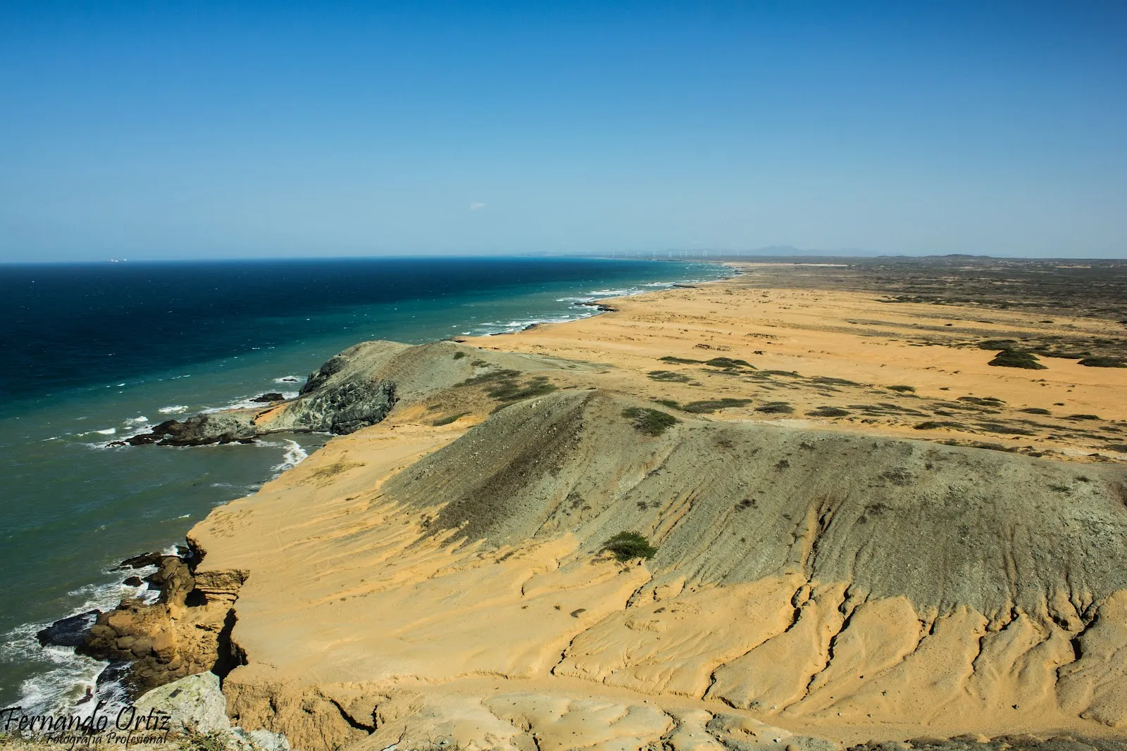
La Guajira Peninsula
Visitors come to La Guajira for desert dunes and salt flats, Wayuu villages and a dry, sparsely populated Caribbean coast, far from Colombia's resort beaches.
We may earn a commission. It never decides our picks.
La Guajira is the desert peninsula at the northern tip of Colombia, where the Caribbean Sea meets the Venezuelan border. The department of La Guajira covers this land, and Riohacha is its capital. Most of the land is arid, with scrubland, sand dunes and salt flats, and the coast has long stretches with no towns. The Wayuu, an Indigenous people with their own language, live across the peninsula, and their villages and weaving are a large part of what visitors come to see.
The trip suits travelers who want open country and remote places more than resort beaches. Roads outside the main towns are often unpaved, so distances take longer than the map suggests, and many travelers use a driver or a 4x4. The dry season, roughly December to April, has the driest weather and steady winds. Allow several days to reach the main points on the peninsula, and more if you want to slow down.
La Guajira Peninsula in five
- Get a 4x4 with a local driver for the tracksPast Uribia the roads turn to sand and gravel, and the trip to Cabo de la Vela and Punta Gallinas is usually made by 4x4 with a local driver. Agree the fare, fuel stops and return day in Riohacha first.Getting around
- Carry Colombian pesos in cash for the desertCard terminals and ATMs are rare away from Riohacha, so withdraw pesos (COP) in town and keep small notes for drivers, meals and handicrafts.Money and costs
- Set up an eSIM and offline maps before the tracksSignal drops out across much of the peninsula, so download offline maps for the whole route before you leave Riohacha.Phones and eSIM
- Ask before you photograph Wayuu people and weavingWayuu families live and work across the peninsula. Ask before you photograph people, homes or weavings, and accept a no.
- Carry extra water and a head torch on every driveStops on the desert roads are few and far apart, so carry extra water and a head torch on every drive.
Things to do in La Guajira Peninsula
See all attractions in La Guajira PeninsulaNeed to know
- Currency
- Colombian peso (COP)
- Entry
- Entry rules depend on your passport; check Migración Colombia Read more
- Emergency
- 123 police; 112 general emergency
- Tipping
- 10% usual in restaurants if no service charge is added
- Time
- UTC-5, no daylight saving
Weather by month
- Best
- Good
- Mixed
- Poor
- JanuaryDry, windy
- FebruaryDry, windy
- MarchDry, hot
- AprilDry, hot
- MayHeat builds
- JuneHeat, first rains
- JulyHot, humid
- AugustHot, humid
- SeptemberRain season
- OctoberRain season
- NovemberRains easing
- DecemberDry, windy
Right now in La Guajira Peninsula
Local time, today's weather and the exchange rate, refreshed through the day.

32
- Feels like
- 35°
- Humidity
- 55%
- Wind
- 29 km/h
- Chance of rain
- 24%
La Guajira Peninsula
03:38 PM
Monday, November 2
- Today33°27°24%Monday: Cloudy. High 33°, Low 27°. Chance of rain 24%.
- Tue33°27°53%Tuesday: Thunderstorms. High 33°, Low 27°. Chance of rain 53%.
- Wed32°25°67%Wednesday: Rain. High 32°, Low 25°. Chance of rain 67%.
- Thu31°24°86%Thursday: Rain. High 31°, Low 24°. Chance of rain 86%.
- Fri29°24°96%Friday: Rain. High 29°, Low 24°. Chance of rain 96%.
- Sat30°24°98%Saturday: Rain. High 30°, Low 24°. Chance of rain 98%.
- Sun29°22°61%Sunday: Rain. High 29°, Low 22°. Chance of rain 61%.
Updated 11:28 AM local time · Weather data by Open-Meteo.com
Money
Mid-market rate1 USD = 3,192 COP
Rates from Nov 2, 2026 · Rates By Exchange Rate API
Day trips by train
- Uribiaby car from RiohachaA Wayuu town on the road north from Riohacha, on the way to the desert tracks.
- Cabo de la Velaby 4x4 from RiohachaA fishing village on the north-west coast, reached by a long sand and gravel track.
- Punta Gallinasovernight by 4x4 from RiohachaThe northernmost point of mainland South America, reached over a long desert track.
Before you go to La Guajira Peninsula
Rules for La Guajira Peninsula, checked
- Check entry rules for your passport on Migración Colombia before you fly, as requirements and forms can change.Source
- Ask before photographing Wayuu people, homes or weavings, and respect a no if one is given.
- Use a driver recommended by your lodge or a local operator, and tell someone your route and return time before you leave Riohacha.
Plan around La Guajira Peninsula
Riohacha access and the desert tracks north
Read the guideMoney and costsCash, cards and typical prices on the ground
Read the guideVisas and entryEntry rules and what to check before you fly
Read the guideWhere to stayPlaces to sleep in Riohacha and beyond
Read the guideColombia travel guideCities, routes and entry for the wider country
Read the guidePhones and eSIMSignal, eSIM and offline maps for the desert
Read the guideLa Guajira Peninsula FAQ
Is La Guajira worth visiting?
Yes, if you want desert scenery, a dry coast and time with Wayuu communities, and you accept long drives on rough tracks. It is a poor choice for a beach week with easy transport and nightlife.
Do you need a 4x4 to reach Cabo de la Vela?
In practice, yes. The final stretch is sand and gravel track that local drivers take in 4x4s. Agree the price and return time before you leave Riohacha.
When is the best time to visit La Guajira?
The dry months from January to March suit most trips best, though the wind is strong and the heat is high. Tracks can be hard going after rain in September and October.
Is it safe to travel in La Guajira?
Drive in daylight, use a driver recommended by your lodge, and check your government's current travel advice before you fly.
Is there phone signal in La Guajira?
Signal is patchy outside Riohacha and drops out on the tracks, so set up an eSIM and download offline maps before you leave.
Can you visit Punta Gallinas as a day trip?
No. The drive is long and rough, so most trips include overnight stops in desert villages.