Travel advisory · BoliviaSome governments advise against travel to parts of Bolivia.The warnings cover only these areas: Chapare Region.Advice depends on your passport. Read your own government's advice before you book.Official advice
- Chapare Region · avoid all travel · Canada, Germany, New Zealand, UK, US
Also named by one government: Brazil border region, Santa Cruz Department (Germany), Brazil border zone (France), Highway routes 4 and 24 (UK), Villa Tunari (UK)
| Government | Advice | Updated | Read the advice |
|---|---|---|---|
| United Kingdom (FCDO) | No advice against the whole country (regional advisories) | – | Read the advice |
| United States (State Dept) | Exercise Increased Caution (regional advisories) | Aug 18, 2026 | Read the advice |
| Canada (Global Affairs) | Exercise a high degree of caution (regional advisories) | – | Read the advice |
| Germany (Auswärtiges Amt) | Besondere Vorsicht walten lassen (exercise special caution) (regional advisories) | Oct 13, 2026 | Read the advice |
| New Zealand (SafeTravel) | Exercise increased caution in the rest of Bolivia (regional advisories) | – | Read the advice |
| France (Ministry for Europe and Foreign Affairs) | vigilance renforcée (reste du pays) (regional advisories) | – | Read the advice |
Checked daily from the governments' published advice; last checked Nov 2, 2026. RoamLedger summarises official advice; it is not advice from any government.
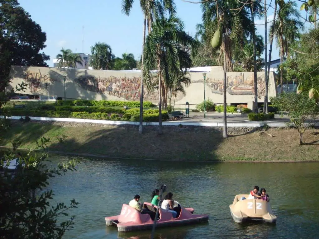
Santa Cruz
Santa Cruz is Bolivia's largest city, in the warm eastern lowlands. Go for the heat, a break from the Andes, and day trips to forests and Jesuit mission towns.
We may earn a commission. It never decides our picks.
Santa Cruz de la Sierra is Bolivia's largest city and the main city of the eastern lowlands. It sits about 400 meters above sea level, far below La Paz and Sucre, so the air is warm and humid for most of the year. Viru Viru International Airport (VVI) serves the city, and it is the base for trips into the lowlands and nearby forests.
Go for the change of pace from the Andes, the plazas and markets of the center, and access to the outdoors. The Jesuit Missions of Chiquitos, a UNESCO World Heritage site, lie to the east, and Amboró National Park can be reached by road. Samaipata, a small town below a large pre-Columbian rock carving, is a day trip from the city by road. For hiking, the drier months from May to July suit the trails best.
Santa Cruz in five
- Check entry rules before you book flightsEntry rules depend on your passport, so check them before you pay for flights.Visas and entry
- Carry bolivianos for markets and taxisMany market stalls, bakeries and taxis in Santa Cruz deal in cash. Withdraw bolivianos from bank ATMs in the center and keep small notes for change.Money and costs
- Pack repellent for daytime mosquitoesDengue is present in the lowlands, and the mosquitoes that carry it bite during the day. Bring repellent with DEET or picaridin and use it at breakfast and in the afternoon.
- Set up an eSIM before you leave the cityMobile data helps with maps and ride apps in the city, but signal can drop on rural roads. Download offline maps before you head out of town.Phones and eSIM
- Hire a driver for roads out of townTrips to Samaipata and the national parks are long days by road. A driver lets you set your own return time.
Things to do in Santa Cruz
See all attractions in Santa Cruz

Need to know
- Currency
- Boliviano (BOB)
- Entry
- Depends on passport; check Bolivia's foreign ministry before you book
- Emergency
- 110 police, 118 ambulance, 119 fire
- Tipping
- Not expected; a small tip in restaurants is appreciated
- Time
- UTC-4, no daylight saving
Weather by month
- Best
- Good
- Mixed
- Poor
- JanuaryRainy season
- FebruaryHot, rainy
- MarchRains easing
- AprilHot, humid
- MayDry, pleasant
- JuneDry, cooler
- JulyDry, cool nights
- AugustDry, hot
- SeptemberHot, dry
- OctoberHot, rains start
- NovemberRains start
- DecemberRainy season
Right now in Santa Cruz
Local time, today's weather and the exchange rate, refreshed through the day.

31
- Feels like
- 33°
- Humidity
- 63%
- Wind
- 29 km/h
- Chance of rain
- 38%
Santa Cruz
06:43 PM
Monday, November 2
- Today32°25°38%Monday: Drizzle. High 32°, Low 25°. Chance of rain 38%.
- Tue32°25°10%Tuesday: Cloudy. High 32°, Low 25°. Chance of rain 10%.
- Wed33°26°14%Wednesday: Cloudy. High 33°, Low 26°. Chance of rain 14%.
- Thu28°23°92%Thursday: Rain. High 28°, Low 23°. Chance of rain 92%.
- Fri31°23°27%Friday: Drizzle. High 31°, Low 23°. Chance of rain 27%.
- Sat27°19°75%Saturday: Thunderstorms. High 27°, Low 19°. Chance of rain 75%.
- Sun26°18°22%Sunday: Cloudy. High 26°, Low 18°. Chance of rain 22%.
Updated 04:01 PM local time · Weather data by Open-Meteo.com
Money
Mid-market rate1 USD = 12.1 BOB
Rates from Nov 2, 2026 · Rates By Exchange Rate API
Day trips by train
- Samaipataabout 2 to 3 hours by roadA small town below a large pre-Columbian rock carving, a good first day trip from the city.
- Amboró National Parkby road from the cityForest and cloud-forest trails, best done with a local guide and an early start.
- Jesuit missions of Chiquitaniaa long drive by roadColonial mission churches in the Chiquitania, a longer trip for travelers with more days.
Before you go to Santa Cruz
Rules for Santa Cruz, checked
- Entry rules depend on nationality. Check Bolivia's foreign ministry before you book flights or leave home.
- Check Bolivian customs rules before you carry cash, coca leaves or other plant products out of the country.
- Check vaccine advice with a travel clinic before a lowland trip, since yellow fever is endemic in parts of Bolivia.
Plan around Santa Cruz
Highlands, lowlands and entry rules for a full Bolivia trip
Read the guideGetting around BoliviaFlights, buses and car hire for the trip from Santa Cruz
Read the guideMoney and costsCash, cards and typical prices for food, rides and sights
Read the guideVisas and entryEntry rules by passport and what to check before you fly
Read the guideWhere to stayCentral hotels and quieter areas for a Santa Cruz base
Read the guidePhones and eSIMData plans and offline maps for the city and the roads out
Read the guideSanta Cruz FAQ
Is Santa Cruz worth visiting?
Yes, for a warm lowland city with markets and a day trip to Samaipata. It has fewer headline sights than La Paz, so pair it with the highlands for a fuller trip.
How do you get to Santa Cruz?
Fly into Viru Viru International Airport (VVI), then take a taxi or a pre-booked transfer to the center. Buses also run from La Paz and Cochabamba, which is a long overland trip.
How many days do you need in Santa Cruz?
Allow at least one full day for the center and the markets, and a separate day for Samaipata if you want it. Add more days for Amboró or the Jesuit missions.
What is the weather like in Santa Cruz?
Hot and humid for most of the year. The drier months, May to July, have the best weather for hiking and sightseeing.
How high is Santa Cruz?
The city sits about 400 meters above sea level, so altitude sickness is rarely a concern here, unlike in La Paz.
Is Santa Cruz or La Paz better?
Santa Cruz is warm and low, while La Paz is high and steep. Pick by the climate you want and the kind of trip you are planning.