Plan a trip
Language: English
Trip plannerPlan your trip on a map

Top destinations

EnglishDeutschFrançaisEspañolPortuguêsPortuguês (BR)Italiano
Travel advisory · MexicoMonterrey is in or near an area where governments advise against all but essential travel: Route 85 Monterrey–Nuevo Laredo.Advice depends on your passport. Read your own government's advice before you book.Official advice
Areas with warnings
  • Colima · avoid all travel · Canada, Germany, France, UK
  • Guerrero · avoid all travel · Canada, Germany, Spain, France, New Zealand, UK
  • Sinaloa · avoid all travel · Canada, Germany, Spain, France, New Zealand, UK
  • Chiapas · avoid non-essential travel · Canada, Spain, France
  • Chihuahua · avoid non-essential travel · Canada, France, UK
  • Federal Highway 199 San Cristóbal de las Casas–Palenque · avoid non-essential travel · France, UK
  • Guanajuato, south of Highways 43D and 45D · avoid non-essential travel · Canada, New Zealand
  • Guatemala border region, Chiapas · avoid non-essential travel · Germany, France, New Zealand
  • Lagunas de Zempoala National Park · avoid non-essential travel · Canada, New Zealand
  • Michoacán · avoid non-essential travel · Canada, Germany, New Zealand, UK
  • Nayarit, within 20 km of Sinaloa and Durango border · avoid non-essential travel · Canada, New Zealand
  • Nuevo León, except Monterrey · avoid non-essential travel · Canada, New Zealand
  • Piedras Negras · avoid non-essential travel · Spain, France
  • Route 85 Monterrey–Nuevo Laredo · avoid non-essential travel · Spain, France
  • Sonora · avoid non-essential travel · Canada, New Zealand
  • Tamaulipas · avoid non-essential travel · Canada, France, UK
  • Tecate · avoid non-essential travel · France, UK
  • Tijuana · avoid non-essential travel · France, UK
  • US border region · avoid non-essential travel · Germany, Spain, France
  • Zacatecas · avoid non-essential travel · Canada, Germany, Spain, France, UK

Also named by one government: Celaya–Irapuato–Salamanca triangle, Guanajuato (France), Culiacán and surrounding area (France), North of Ciudad Victoria, Tamaulipas (Germany), Route 129 Martinez de la Torre–Teziutlán (France), Route 131 Tapacoyan–Perote (France), Route 180 Martinez de la Torre–Papantla secondary roads (France), Route 40 Monterrey–Reynosa (France), Southern Michoacán from Uruapán to the coast (France), Acapulco (France), Baja California, except Tijuana and Tecate (France), Ciudad Acuña (Spain), Ciudad Juárez and surrounding area (Spain), Ciudad Obregón (France), Coahuila, except southern part (New Zealand), Coatzacoalcos (France), Colonias north and north-east of the Zócalo, Mexico City (France), Durango (France), East Nuevo León, bordering Tamaulipas (France), Guanajuato (Spain), Guanajuato, Highway 45 between León and Irapuato (New Zealand), Guanajuato, south-west of Highway 45D (UK), Jalisco, within 50 km of Michoacán border (Canada), Monclova (Spain), Morelos (France), Nayarit (France), Nogales (France), Non-tourist rural areas of Baja California (Spain), Non-tourist rural areas of Chihuahua (Spain), Non-tourist rural areas of Coahuila (Spain), Non-tourist rural areas of Durango (Spain), Non-tourist rural areas of Sonora (Spain), Northern municipalities of Jalisco (UK), Northern Tamaulipas from San Fernando to US border (Spain), Northern Veracruz bordering Tamaulipas (Spain), Northern Veracruz from Martinez de la Torre (France), Route 150D Puebla–Orizaba (France), Route 190 Oaxaca–Santo Domingo Tehuantepec (France), Route 85 and 83 Monterrey–Ciudad Victoria–Tampico (France), Route 95 Mexico City–Cuernavaca (France), Selva Lacandona (France), South and south-west of Lake Chapala, Jalisco (UK), South-west Jalisco and Los Altos, except Puerto Vallarta (France), South-west Michoacán (France), South-west Tamaulipas (France), Southern Guanajuato state (France), Southern Michoacán south of Morelia (Spain), Strip within 40 km of Guatemalan border, Chiapas (UK), Tepic (New Zealand), Toluca (France), Veracruz city (France)

GovernmentAdviceUpdatedRead the advice
United Kingdom (FCDO)No advice against the whole country (regional advisories)–Read the advice
United States (State Dept)Exercise increased cautionMay 29, 2026Read the advice
Canada (Global Affairs)Exercise a high degree of caution (regional advisories)–Read the advice
Germany (Auswärtiges Amt)Besondere Vorsicht walten lassen (Sicherheitslage) (regional advisories)Oct 19, 2026Read the advice
New Zealand (SafeTravel)Exercise increased caution (regional advisories)–Read the advice
France (Ministry for Europe and Foreign Affairs)Vigilance renforcée pour le reste du pays (regional advisories)–Read the advice

Checked daily from the governments' published advice; last checked Nov 2, 2026. RoamLedger summarises official advice; it is not advice from any government.

a body of water with a mountain in the background
Forest

Chipinque A.B.P. Ecological Park

Chipinque Ecological Park in Monterrey: forest trails, the rocky M peak and city views from the top. Plan water, sun cover and advance tickets.

Chipinque Ecological Park is a protected green area on the southern edge of Monterrey, about 12 km from downtown. Its pine and oak forest is laced with trails for hiking and mountain biking, and the park is run much like a national park, with rangers and a visitor center that provides maps and trail advice. The rocky three-peaked formation known as the M rises above the park and can be seen from many points in the city. Walk up for the high views, or stay near the picnic tables for a slower morning.

A forest turned into a park
Chipinque A.B.P. Ecological Park

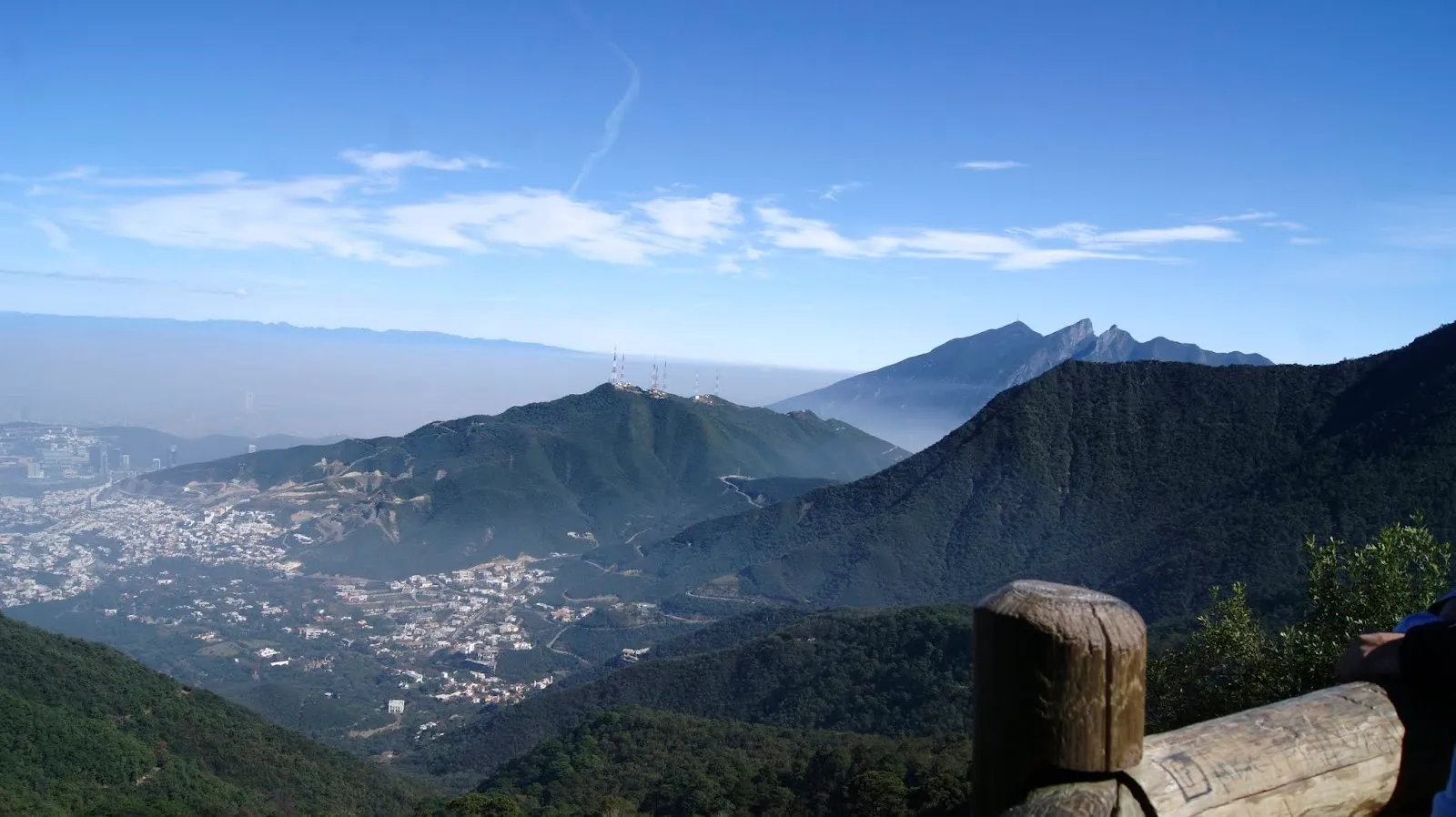
Private companies developed this pine and oak forest into a recreational area. It forms part of the Cumbres de Monterrey National Park and is set up much like the national parks in the United States, complete with rangers.

The park sits in the Sierra Madre foothills, about 12 km from downtown, so it is an easy trip for a half day outdoors without leaving the city behind for long.

The M and the summit
Chipinque A.B.P. Ecological Park

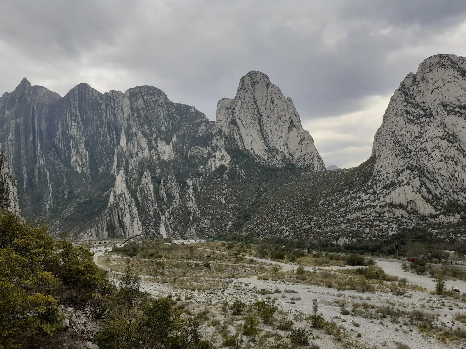
The rocky formation known as the M has three undulations and forms the focal point of the mountain range south of Monterrey. Its silhouette is visible from several points in the city.

The highest point is Copete de Águilas, at about 2,200 meters. The summit hike takes about three hours, so plan water and food for the full route.

Trails and what to see

More than 60 kilometers of trails cross the forest and climb the rocky peaks, and both hiking and mountain biking are allowed on them. The La M trail is a hiking route with ridge views, and local hiking groups use it.

Inside the park, the museum has interactive exhibits, and a butterfly atrium and an insect house add to the visit. The visitor center has maps, snacks, trail advice and permits for those heading to the summits.

Facilities for a day out

Picnic tables and a barbecue grill sit within the park, along with a playground, slides, swings and a skateboarding area. There are also cycling lanes, a basketball court, a volleyball court, a tennis court and a baseball field.

Dogs are allowed. Public restrooms are on site, and the entrance and parking lot are wheelchair accessible.

FAQ

Do I need tickets in advance?

Getting tickets in advance is recommended. Buying them online before your visit helps you avoid queues.

How long does the hike take?

The hike to the summit takes about three hours. A shorter visit works well for a picnic and a walk on the trails.

Is the park suitable for children and dogs?

Yes. The park has a playground, slides and swings, kid-friendly hikes, and a museum with a butterfly atrium and an insect house. Dogs are allowed.

Can I buy food inside the park?

There are no shops inside the park, so bring lunch and snacks. The visitor center has snacks, maps and trail advice.
More must-sees in Monterrey

Explore all