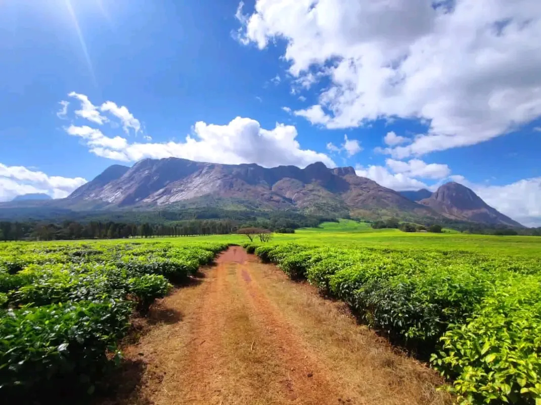
Mount Mulanje
Hikers come to Mount Mulanje for multi-day trails on a granite massif, with cedar forest, waterfalls and mountain huts in southern Malawi.
We may earn a commission. It never decides our picks.
Mount Mulanje is a granite massif in southern Malawi, near the town of Mulanje. Its highest point, Sapitwa, rises to about 3,000 meters, and the upper plateau is split by deep valleys, rock faces and streams. The mountain has montane forest and grassland, including the Mulanje cedar, a tree that grows in few places. Tea estates and villages sit on the lower slopes.
People go mainly to hike. Routes run from day walks to waterfalls and viewpoints near the base, up to multi-day climbs that stay in mountain huts on the plateau. The trails are steep and rough in places, and the weather can change quickly at altitude, so sturdy footwear and warm layers matter. Nights on the plateau are cold, so pack warm layers even if the base is hot. The drier months, roughly May to October, are the usual time to walk. Plan multi-day routes in advance, and check permit and guide rules with the Forestry Department before you travel.
Need to know
- Currency
- Malawian kwacha (MWK)
- Entry
- Visa needed by many passports; check with Malawi immigration before you book
- Emergency
- 997 police, 998 ambulance, 999 fire
- Tipping
- Customary for guides and porters; rounding up in restaurants
- Time
- UTC+2, no daylight saving
Weather by month
- Best
- Good
- Mixed
- Poor
- JanuaryPeak rains
- FebruaryHeavy rain
- MarchMuddy trails
- AprilRains easing
- MayDry season starts
- JuneCool, clear
- JulyCool, dry
- AugustClear skies
- SeptemberDry, warm days
- OctoberHot, dry
- NovemberRains begin
- DecemberRainy season
Right now in Mount Mulanje
Local time, today's weather and the exchange rate, refreshed through the day.

23
- Feels like
- 20°
- Humidity
- 46%
- Wind
- 13 km/h
- Chance of rain
- 65%
Mount Mulanje
02:52 AM
Tuesday, November 3
- Today20°11°65%Tuesday: Drizzle. High 20°, Low 11°. Chance of rain 65%.
- Wed21°12°43%Wednesday: Drizzle. High 21°, Low 12°. Chance of rain 43%.
- Thu20°11°59%Thursday: Drizzle. High 20°, Low 11°. Chance of rain 59%.
- Fri20°13°57%Friday: Drizzle. High 20°, Low 13°. Chance of rain 57%.
- Sat21°14°10%Saturday: Drizzle. High 21°, Low 14°. Chance of rain 10%.
- Sun22°13°10%Sunday: Drizzle. High 22°, Low 13°. Chance of rain 10%.
Updated 10:41 PM local time · Powered by WeatherAPI.com · Weather data by Open-Meteo.com
Money
Mid-market rate1 USD = 1,734 MWK
Rates from Nov 2, 2026 · Rates By Exchange Rate API
Before you go to Mount Mulanje
Rules for Mount Mulanje, checked
- Register with the Forestry Department at the mountain base before you climb. It manages access to the massif.
- Do not light fires or cut trees in the forest reserve; the Forestry Department enforces this.
- Take all rubbish back down the mountain and do not leave litter on the trails or at huts.
- Check whether your passport needs a visa with Malawi immigration before you book flights.
Plan around Mount Mulanje
Country basics, entry notes and regional planning
Read the guideGetting around MalawiBuses, driver hire and the road from Blantyre
Read the guideMoney and costsCash, cards and kwacha for the trail and the base towns
Read the guideVisas and entryWhich passports need a visa, and how to apply
Read the guideWhere to stayBase-town lodges and nights near the massif
Read the guideTravel insuranceEvacuation cover for remote mountain hiking
Read the guideMount Mulanje FAQ
How hard is the climb up Mount Mulanje?
The routes to the plateau are steep and rough in places. Some trips take several days with at least one night on the plateau. Fitness and altitude both matter, so a shorter walk to the base waterfalls is a fair start if you are unsure.
Do I need a guide for Mulanje?
Check with the Forestry Department at the base whether your route requires a guide.
How high is Sapitwa?
Sapitwa is about 3,000 meters high and is the highest peak in Malawi. It sits on the plateau of the Mulanje Massif.
When is the best time to visit Mount Mulanje?
June to September are the best months, with clear skies and cool days. The rains usually run from November to April, when the trails are muddy and the upper routes are harder to walk.
Is it cold on the plateau?
Yes. Nights on the plateau are cold, especially in the dry season. Pack warm layers even if the base town is hot.
How do I get to Mulanje from Blantyre?
Fly into Kamuzu International Airport (BLZ) in Blantyre, then take a driver or bus to Mulanje town. Confirm your transfer before you land.