Planifier un voyage
Langue: Français
Planificateur de voyagePlanifiez votre voyage sur une carte

Destinations incontournables

EnglishDeutschFrançaisEspañolPortuguêsPortuguês (BR)Italiano
Avis aux voyageurs · PakistanCertains gouvernements déconseillent tout voyage à Pakistan sauf s'il est indispensable.Les conseils dépendent de votre passeport. Consultez ceux de votre propre gouvernement avant de réserver.Conseils officiels
Zones signalées
  • province du Baloutchistan · éviter tout voyage · Canada, Allemagne, France, Nouvelle-Zélande, Royaume-Uni, États-Unis
  • Frontière indienne, distance non précisée (y compris LoC) · éviter tout voyage · France, Nouvelle-Zélande
  • Karakoram Highway, de Mansehra à Chilas · éviter tout voyage · Canada, Nouvelle-Zélande, Royaume-Uni
  • province de Khyber Pakhtunkhwa · éviter tout voyage · Canada, France, Nouvelle-Zélande, États-Unis
  • Cachemire administré par le Pakistan (Azad Jammu-et-Cachemire) · éviter tout voyage · Canada, Allemagne, France, Italie, Nouvelle-Zélande, Royaume-Uni
  • Région frontalière avec l'Afghanistan, distance non précisée · éviter les voyages non essentiels · Italie, Nouvelle-Zélande
  • Anciennes zones tribales de la FATA · éviter les voyages non essentiels · France, Italie

Également signalé par un seul gouvernement : Bande de 10 km le long de la frontière chinoise (Canada), Bande de 10 km le long de la frontière indienne (Canada), Bande de 10 km le long de la frontière iranienne (Canada), Bande de 10 km le long de la ligne de contrôle (Canada), Bande de 10 miles le long de la frontière afghane (Royaume-Uni), Bande de 10 miles le long de la ligne de contrôle (Royaume-Uni), Bande de 50 km le long de la frontière afghane (Canada), Bande de 50 km le long de la frontière afghane au Gilgit-Baltistan (Nouvelle-Zélande), Bajaour (Royaume-Uni), Bannu (Royaume-Uni), Buner (Royaume-Uni), Charsadda (Royaume-Uni), Dera Ismaïl Khan (Royaume-Uni), Hangu (Royaume-Uni), Abords immédiats de la ligne de contrôle (États-Unis), Karak (Royaume-Uni), district de Khyber (Royaume-Uni), Kohat (Royaume-Uni), Kurram (Royaume-Uni), Lakki Marwat (Royaume-Uni), Basse-Dir (Royaume-Uni), Bas-Waziristan-Sud (Royaume-Uni), Mohmand (Royaume-Uni), Route N45, du nord de la rocade de Mardan jusqu'à la périphérie de Chitral, y compris la vallée des Kalash (Royaume-Uni), Waziristan-Nord (Royaume-Uni), Orakzai (Royaume-Uni), Peshawar (Royaume-Uni), Province du Pendjab, à l'exclusion de la zone Faisalabad–Lahore–Islamabad (France), Swat (Royaume-Uni), Tank (Royaume-Uni), Haut-Dir (Royaume-Uni), Haut-Waziristan-Sud (Royaume-Uni), Bande de 20 km le long de la frontière indienne, y compris la LoC (Allemagne), Bande de 5 miles le long de la frontière indienne (Royaume-Uni), District de Chitral (Canada), Dera Ghazi Khan (Royaume-Uni), Zone Faisalabad–Lahore–Islamabad (France), Karachi (Canada), Route terrestre vers et depuis l'Iran et l'Afghanistan (Allemagne), Malakand (Royaume-Uni), Mardan (Royaume-Uni), Nowshera (Royaume-Uni), Shangla (Royaume-Uni), Province du Sind au nord de Nawabshah, Nawabshah incluse (Royaume-Uni), Swabi (Royaume-Uni), Zones tribales du Baloutchistan (Italie)

GouvernementConseilsMis à jourLire les conseils
Royaume-Uni (FCDO)No advice against the whole country (regional advisories)–Lire les conseils
États-Unis (State Dept)Reconsider Travel16 juin 2026Lire les conseils
Canada (Affaires mondiales)Exercise a high degree of caution (regional advisories)–Lire les conseils
Allemagne (Auswärtiges Amt)No advice against the whole country; partial warnings for named regions (regional advisories)13 oct. 2026Lire les conseils
Nouvelle-Zélande (SafeTravel)Avoid non-essential travel–Lire les conseils
France (ministère de l'Europe et des Affaires étrangères)Le reste du territoire est déconseillé sauf raison impérative–Lire les conseils

Vérifié quotidiennement d'après les conseils publiés par les gouvernements ; dernière vérification le 3 nov. 2026.RoamLedger résume les conseils officiels ; il ne s'agit pas de conseils émanant d'un gouvernement.

a view of a street with mountains in the background
Parc

Daman-e-Koh Park

Daman-e-Koh Park is a hilltop park in the Margalla Hills, north of Islamabad.

Daman-e-Koh Park is a hilltop park in the Margalla Hills, north of Islamabad. From the top you see the city below, with Faisal Mosque and Rawal Lake among the landmarks in view. The park has a large telescope, long walking trails and a hike up toward Pir Sohawa. Rhesus monkeys live on the slopes, and there are picnic areas, a small zoo and a children's play area. Go in the late afternoon to see the city by daylight and again once the lights come on.

Name and setting
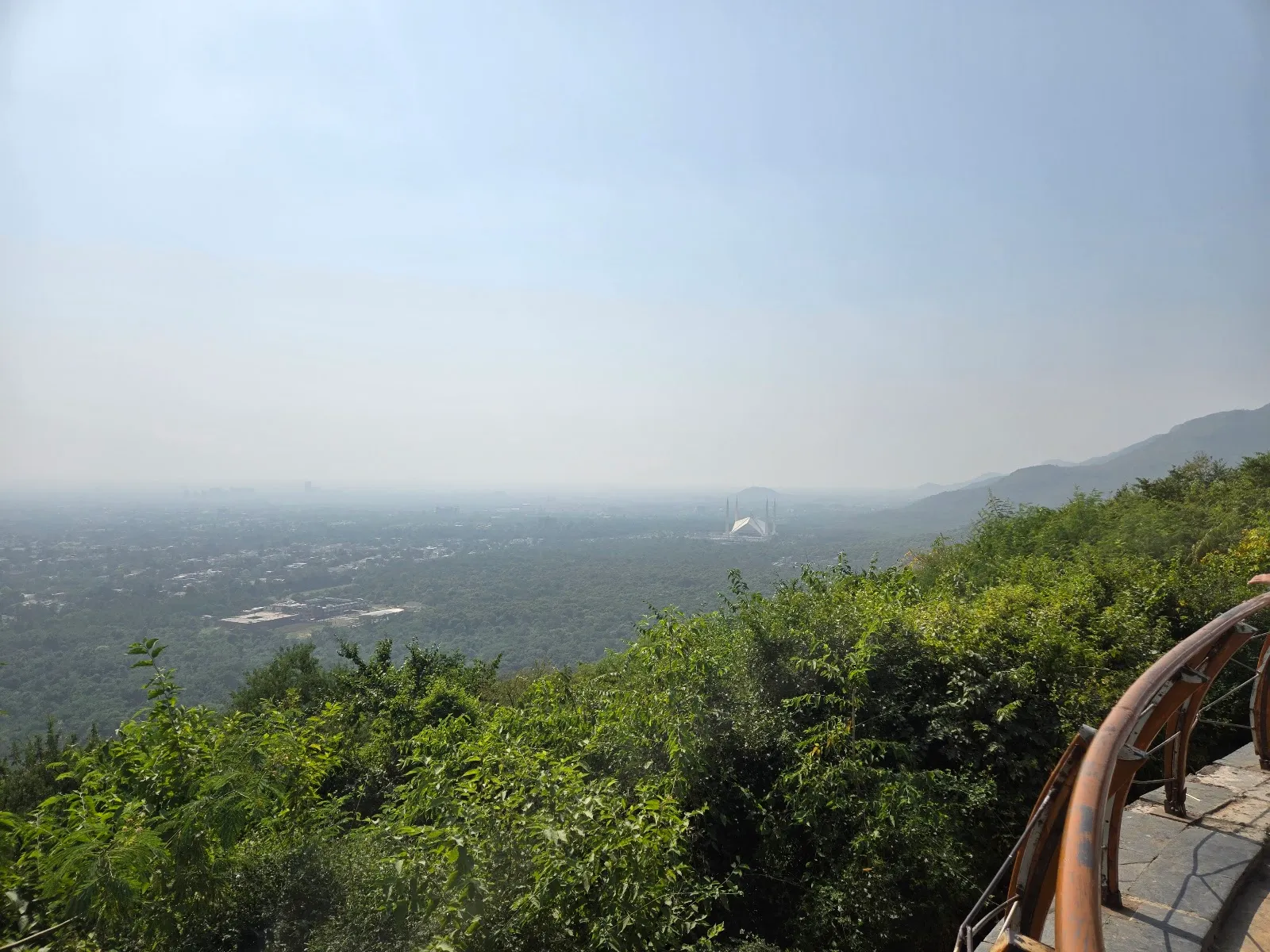
Daman-e-Koh Park
Daman-e-Koh Park

The name joins two Persian words that together mean foothills, which fits the site. The park lies in the Margalla Hills, part of the Margalla Hills National Park, just north of Islamabad.

The summit area sits at about 2400 feet above sea level. A path continues toward Pir Sohawa, which stands at about 3600 feet. Locals visit often, and the park is a regular stop for people who come to the hills for a walk or a picnic.

What is on the hill
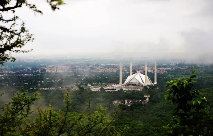
Daman-e-Koh Park
Daman-e-Koh Park

The park has a large telescope for looking over the city. Long walking trails run through lawns with trees, plants and flowers. A small zoo and a children's play area sit within the grounds, and there are benches for resting and enjoying the view.

The spot suits photography, especially of the cityscape and the surrounding hills.

Trails and the climb

Trail 2 and Trail 5 are the routes most often named for a walk on the hill. The Margalla Hills have several trails in all, and the park is a starting point for hikes that suit children as well as more experienced walkers. A skateboarding area and cycling lanes are also part of the grounds.

For a shorter outing, stay on the lower paths and return to the lawns. For a longer day, the climb toward Pir Sohawa gives a wider view of the hills.

Getting there and facilities

Most visitors arrive by car or taxi. The drive up offers views of the Margalla Hills and of Islamabad below.

There is a free parking lot and a paid one, and both free and paid street parking are listed nearby. The entrance and the parking lot are wheelchair accessible. There is a public restroom, and picnic tables and a barbecue grill are available for groups.

Eating on the hill

Visitors can buy traditional snacks at local eateries in the park. Dome Restaurant offers a meal with a view over the city. Those who prefer to bring their own food can use the picnic tables, though loose food packets draw monkeys.

FAQ

Are there monkeys at Daman-e-Koh Park?

Yes. Rhesus monkeys live on the slopes. Keep bags closed and avoid carrying loose food packets.

Is the park wheelchair accessible?

The entrance and the parking lot are listed as wheelchair accessible.

Is parking available?

There is a free parking lot and a paid one, along with free and paid street parking. Weekend parking is limited, so a weekday visit is easier.

When is the best time to visit?

Spring, from March to May, and autumn, from September to November, have pleasant weather. Late afternoon, around 5 PM, lets you see the city by day and after dark.
Autres incontournables à Islamabad

Tout explorer