Pianifica un viaggio
Lingua: Italiano
Pianificatore di viaggiPianifica il tuo viaggio su una mappa

Le migliori destinazioni

EnglishDeutschFrançaisEspañolPortuguêsPortuguês (BR)Italiano
Avviso di viaggio · PakistanAlcuni governi sconsigliano di recarsi in Pakistan se non per motivi essenziali.Le indicazioni dipendono dal tuo passaporto. Leggi quelle del tuo governo prima di prenotare.Indicazioni ufficiali
Aree con avvisi
  • Azad Jammu e Kashmir · evitare ogni viaggio · Canada, Germania, Spagna, Francia, Italia, Nuova Zelanda, Regno Unito
  • Bajaur · evitare ogni viaggio · Spagna, Regno Unito
  • provincia del Belucistan · evitare ogni viaggio · Canada, Germania, Spagna, Francia, Nuova Zelanda, Regno Unito, Stati Uniti
  • Confine con l'India (intero confine) · evitare ogni viaggio · Francia, Nuova Zelanda
  • ex aree tribali FATA · evitare ogni viaggio · Francia, Italia, Stati Uniti
  • Karakoram Highway, da Mansehra a Chilas · evitare ogni viaggio · Canada, Nuova Zelanda, Regno Unito
  • Khyber · evitare ogni viaggio · Spagna, Regno Unito
  • provincia di Khyber Pakhtunkhwa · evitare ogni viaggio · Canada, Spagna, Francia, Nuova Zelanda, Stati Uniti
  • Kurram · evitare ogni viaggio · Spagna, Regno Unito
  • Linea di controllo (Line of Control) · evitare ogni viaggio · Canada, Nuova Zelanda, Regno Unito, Stati Uniti
  • Waziristan Meridionale Inferiore · evitare ogni viaggio · Spagna, Regno Unito
  • Mohmand · evitare ogni viaggio · Spagna, Regno Unito
  • Waziristan Settentrionale · evitare ogni viaggio · Spagna, Regno Unito
  • Orakzai · evitare ogni viaggio · Spagna, Regno Unito
  • Waziristan Meridionale Superiore · evitare ogni viaggio · Spagna, Regno Unito
  • Regione di confine con l'Afghanistan · evitare i viaggi non essenziali · Italia, Nuova Zelanda

Segnalata anche da un solo governo: Striscia di 10 km lungo il confine cinese (Canada), Striscia di 10 km lungo il confine indiano (Canada), Striscia di 10 km lungo il confine iraniano (Canada), 10 miglia del confine afghano (Regno Unito), Striscia di 50 km lungo il confine afghano (Canada), Striscia di 50 km lungo il confine afghano nel Gilgit-Baltistan (Nuova Zelanda), Bannu (Regno Unito), Buner (Regno Unito), Charsadda (Regno Unito), Dera Ismail Khan (Regno Unito), Hangu (Regno Unito), Karak (Regno Unito), Kohat (Regno Unito), Lakki Marwat (Regno Unito), Dir Inferiore (Regno Unito), Strada N45, da Mardan a Chitral (Regno Unito), Peshawar (Regno Unito), Punjab, esclusa la zona Faisalabad-Lahore-Islamabad (Francia), Swat (Regno Unito), Tank (Regno Unito), Dir Superiore (Regno Unito), Fascia di 20 km lungo il confine indiano, inclusa la LoC (Germania), Fascia di 5 miglia lungo il confine indiano (Regno Unito), Distretto di Chitral (Canada), Dera Ghazi Khan (Regno Unito), Zona Faisalabad-Lahore-Islamabad (Francia), Karachi (Canada), Via terrestre da e per l'Afghanistan (Germania), Via terrestre da e per l'Iran (Germania), Malakand (Regno Unito), Mardan (Regno Unito), Nowshera (Regno Unito), Shangla (Regno Unito), Sindh a nord di Nawabshah, incluso Nawabshah (Regno Unito), Swabi (Regno Unito), Aree tribali del Belucistan (Italia)

GovernoConsigliAggiornatoLeggi le indicazioni
Regno Unito (FCDO)No advice against the whole country (regional advisories)–Leggi le indicazioni
Stati Uniti (Dipartimento di Stato)Reconsider Travel16 giu 2026Leggi le indicazioni
Canada (Affari globali)Exercise a high degree of caution (regional advisories)–Leggi le indicazioni
Germania (Auswärtiges Amt)No advice against the whole country; partial warnings for named regions (regional advisories)13 ott 2026Leggi le indicazioni
Nuova Zelanda (SafeTravel)Avoid non-essential travel–Leggi le indicazioni
Francia (Ministero per l'Europa e gli Affari esteri)Le reste du territoire est déconseillé sauf raison impérative–Leggi le indicazioni

Verificato ogni giorno dalle indicazioni pubblicate dai governi; ultima verifica 2 nov 2026.RoamLedger riassume le indicazioni ufficiali; non è un consiglio di alcun governo.

a view of a street with mountains in the background
Parco

Daman-e-Koh Park

Daman-e-Koh Park is a hilltop park in the Margalla Hills, north of Islamabad.

Daman-e-Koh Park is a hilltop park in the Margalla Hills, north of Islamabad. From the top you see the city below, with Faisal Mosque and Rawal Lake among the landmarks in view. The park has a large telescope, long walking trails and a hike up toward Pir Sohawa. Rhesus monkeys live on the slopes, and there are picnic areas, a small zoo and a children's play area. Go in the late afternoon to see the city by daylight and again once the lights come on.

Name and setting
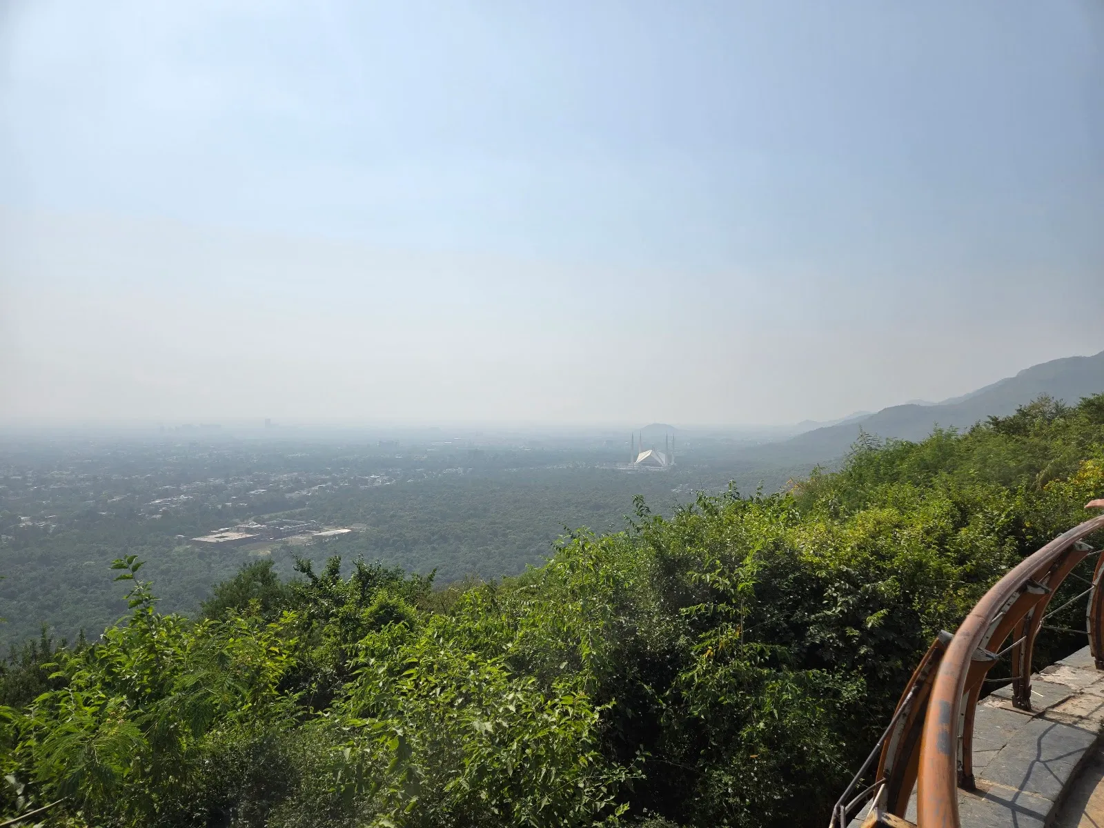
Daman-e-Koh Park
Daman-e-Koh Park

The name joins two Persian words that together mean foothills, which fits the site. The park lies in the Margalla Hills, part of the Margalla Hills National Park, just north of Islamabad.

The summit area sits at about 2400 feet above sea level. A path continues toward Pir Sohawa, which stands at about 3600 feet. Locals visit often, and the park is a regular stop for people who come to the hills for a walk or a picnic.

What is on the hill
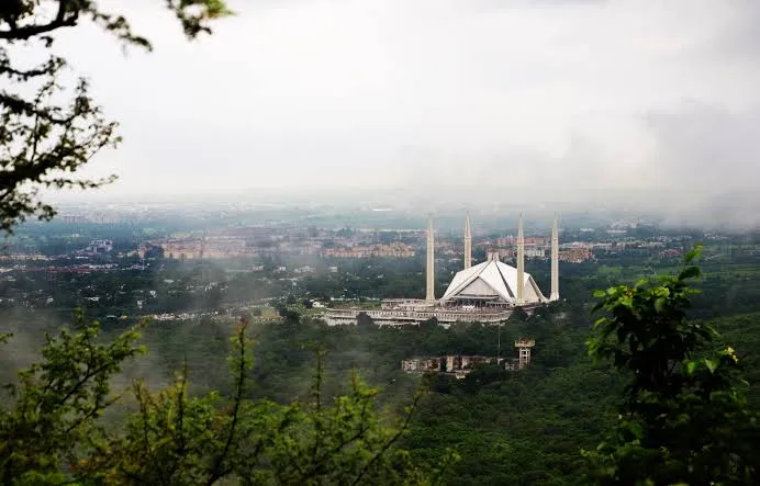
Daman-e-Koh Park
Daman-e-Koh Park

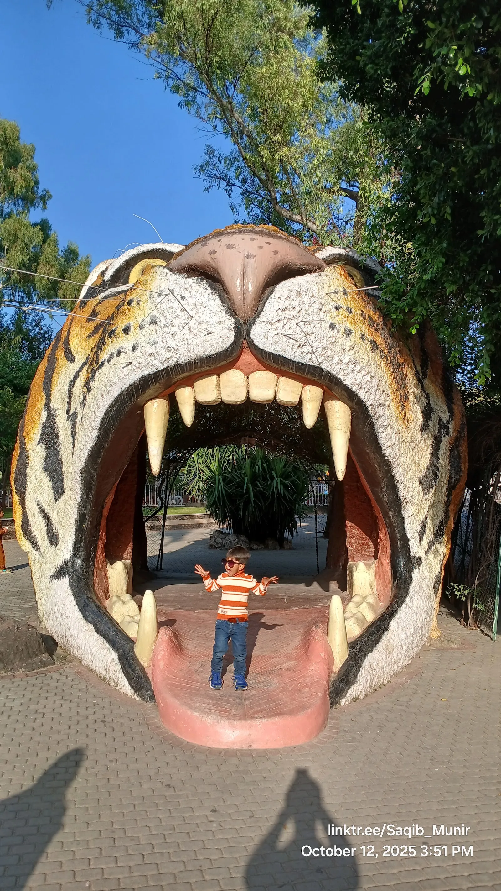
The park has a large telescope for looking over the city. Long walking trails run through lawns with trees, plants and flowers. A small zoo and a children's play area sit within the grounds, and there are benches for resting and enjoying the view.

The spot suits photography, especially of the cityscape and the surrounding hills.

Trails and the climb

Trail 2 and Trail 5 are the routes most often named for a walk on the hill. The Margalla Hills have several trails in all, and the park is a starting point for hikes that suit children as well as more experienced walkers. A skateboarding area and cycling lanes are also part of the grounds.

For a shorter outing, stay on the lower paths and return to the lawns. For a longer day, the climb toward Pir Sohawa gives a wider view of the hills.

Getting there and facilities

Most visitors arrive by car or taxi. The drive up offers views of the Margalla Hills and of Islamabad below.

There is a free parking lot and a paid one, and both free and paid street parking are listed nearby. The entrance and the parking lot are wheelchair accessible. There is a public restroom, and picnic tables and a barbecue grill are available for groups.

Eating on the hill

Visitors can buy traditional snacks at local eateries in the park. Dome Restaurant offers a meal with a view over the city. Those who prefer to bring their own food can use the picnic tables, though loose food packets draw monkeys.

FAQ

Are there monkeys at Daman-e-Koh Park?

Yes. Rhesus monkeys live on the slopes. Keep bags closed and avoid carrying loose food packets.

Is the park wheelchair accessible?

The entrance and the parking lot are listed as wheelchair accessible.

Is parking available?

There is a free parking lot and a paid one, along with free and paid street parking. Weekend parking is limited, so a weekday visit is easier.

When is the best time to visit?

Spring, from March to May, and autumn, from September to November, have pleasant weather. Late afternoon, around 5 PM, lets you see the city by day and after dark.
Altre attrazioni imperdibili a Islamabad

Esplora tutto