Planifier un voyage
Langue: Français
Planificateur de voyagePlanifiez votre voyage sur une carte

Destinations incontournables

EnglishDeutschFrançaisEspañolPortuguêsPortuguês (BR)Italiano
Avis aux voyageurs · BrésilSalvador se trouve dans ou près d'une zone où les gouvernements déconseillent tout voyage sauf essentiel : Favelas.Les conseils dépendent de votre passeport. Consultez ceux de votre propre gouvernement avant de réserver.Conseils officiels
Zones signalées
  • Ceilândia · éviter les voyages non essentiels · Italie, États-Unis
  • Favelas · éviter les voyages non essentiels · Allemagne, Espagne, Nouvelle-Zélande, États-Unis
  • Paranoá · éviter les voyages non essentiels · Italie, États-Unis
  • Santa Maria · éviter les voyages non essentiels · Italie, États-Unis
  • São Sebastião · éviter les voyages non essentiels · Italie, États-Unis
  • Zone frontalière avec le Venezuela · éviter les voyages non essentiels · Allemagne, France

Également signalé par un seul gouvernement : Bande de 160 km le long des frontières terrestres du Brésil (États-Unis), Complexo da Maré (Canada), Complexo da Penha (Canada), Bande de 20 km le long de la frontière bolivienne (hors parc national du Pantanal) (Canada), Bande de 20 km le long de la frontière colombienne (Canada), Bande de 20 km le long de la frontière avec la Guyane française (Canada), Bande de 20 km le long de la frontière avec le Guyana (Canada), Bande de 20 km le long de la frontière paraguayenne (Canada), Bande de 20 km le long de la frontière péruvienne (Canada), Bande de 20 km le long de la frontière avec le Suriname (Canada), Bande de 50 km le long de la frontière vénézuélienne (Canada), Rio Amazonas et affluents, État d'Amazonas (entre Codajás et Belém do Solimões) (Royaume-Uni), Zones frontalières (non précisées) (France), Parc national de Chapada Diamantina (Trilha do 21) (Espagne), Planaltina (Italie), Samambaia (Italie)

GouvernementConseilsMis à jourLire les conseils
Royaume-Uni (FCDO)No advice against the whole country (regional advisories)–Lire les conseils
États-Unis (State Dept)Exercise increased caution (regional advisories)31 août 2026Lire les conseils
Canada (Affaires mondiales)Exercise a high degree of caution (regional advisories)–Lire les conseils
Allemagne (Auswärtiges Amt)No advice against the whole country (regional advisories)27 oct. 2026Lire les conseils
Nouvelle-Zélande (SafeTravel)Exercise increased caution due to high crime rates (regional advisories)–Lire les conseils
France (ministère de l'Europe et des Affaires étrangères)Vigilance renforcée (pays à risque) (regional advisories)–Lire les conseils

Vérifié quotidiennement d'après les conseils publiés par les gouvernements ; dernière vérification le 3 nov. 2026.RoamLedger résume les conseils officiels ; il ne s'agit pas de conseils émanant d'un gouvernement.

Forte de Santo Antônio da Barra
Musée

Forte de Santo Antônio da Barra

Forte de Santo Antônio da Barra stands at the entrance to Todos os Santos Bay in Salvador, with the Barra Lighthouse rising above its stone walls.

Forte de Santo Antônio da Barra stands at the entrance to Todos os Santos Bay in Salvador, with the Barra Lighthouse rising above its stone walls. The fort is recognized as Brazil’s oldest military structure, and its compact Bahia Nautical Museum brings the coast’s maritime history into view through old maps, navigation instruments, model ships, artillery and shipwreck finds. Climb the lighthouse for views across the bay and coastline, then take in the sunset from the grassy area outside.

A fort at the bay entrance
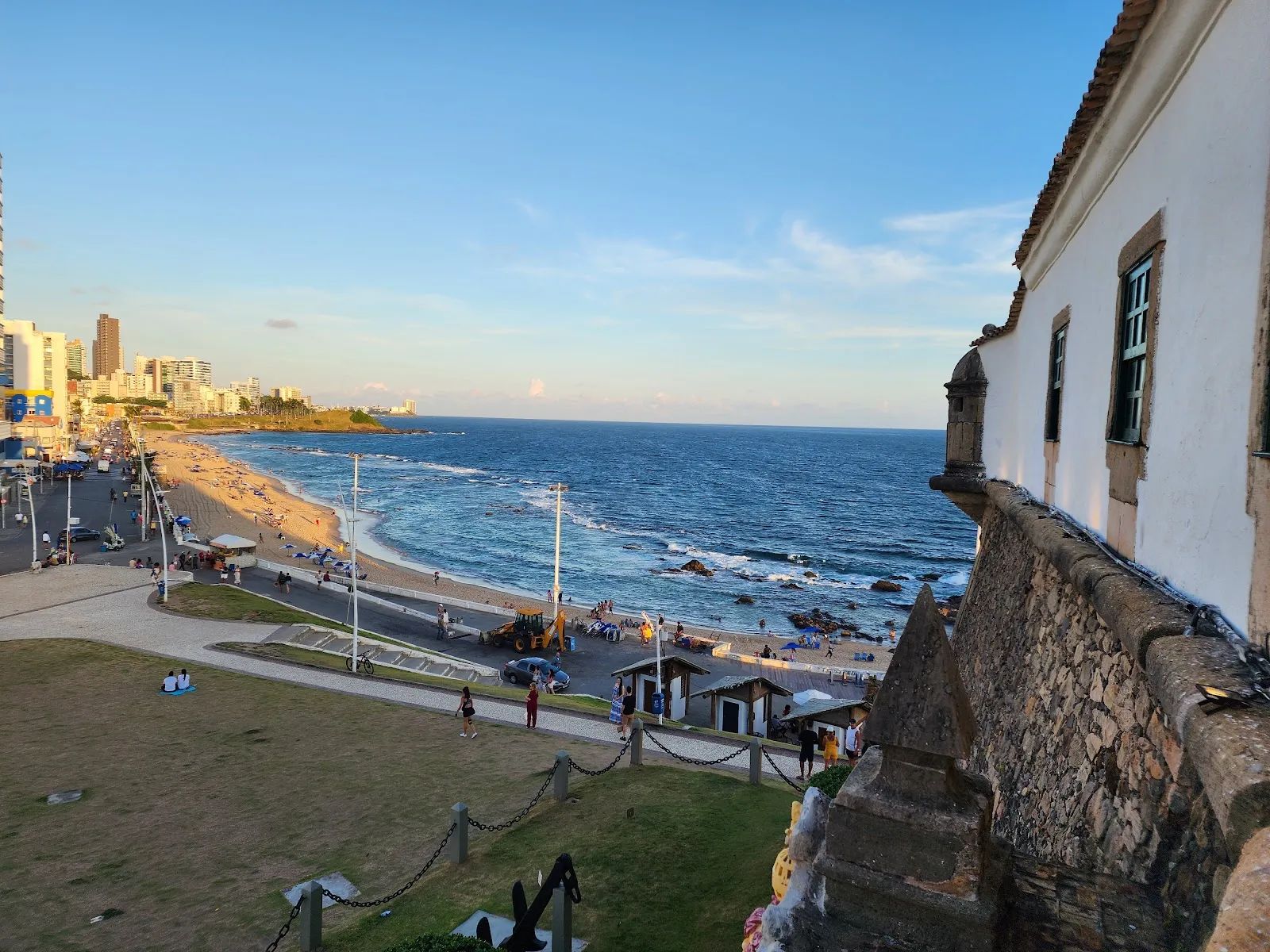
Forte de Santo Antônio da Barra

Forte de Santo Antônio da Barra occupies the northern entrance to Todos os Santos Bay, at the tip of Salvador’s peninsula. Recognized as Brazil’s oldest military structure, it was built to guard the city and the bay. The fort began as a tower with ten sides, then underwent enlargement and repairs in the late sixteenth century, followed by further alterations between 1602 and 1702.

The lighthouse now associated with the fort came later. Shipwrecks on the coral reefs near the bay entrance prompted its construction. Its light helped guide vessels approaching the harbor. Whale oil fueled the lamps until electricity was installed in 1937.

Inside the Bahia Nautical Museum
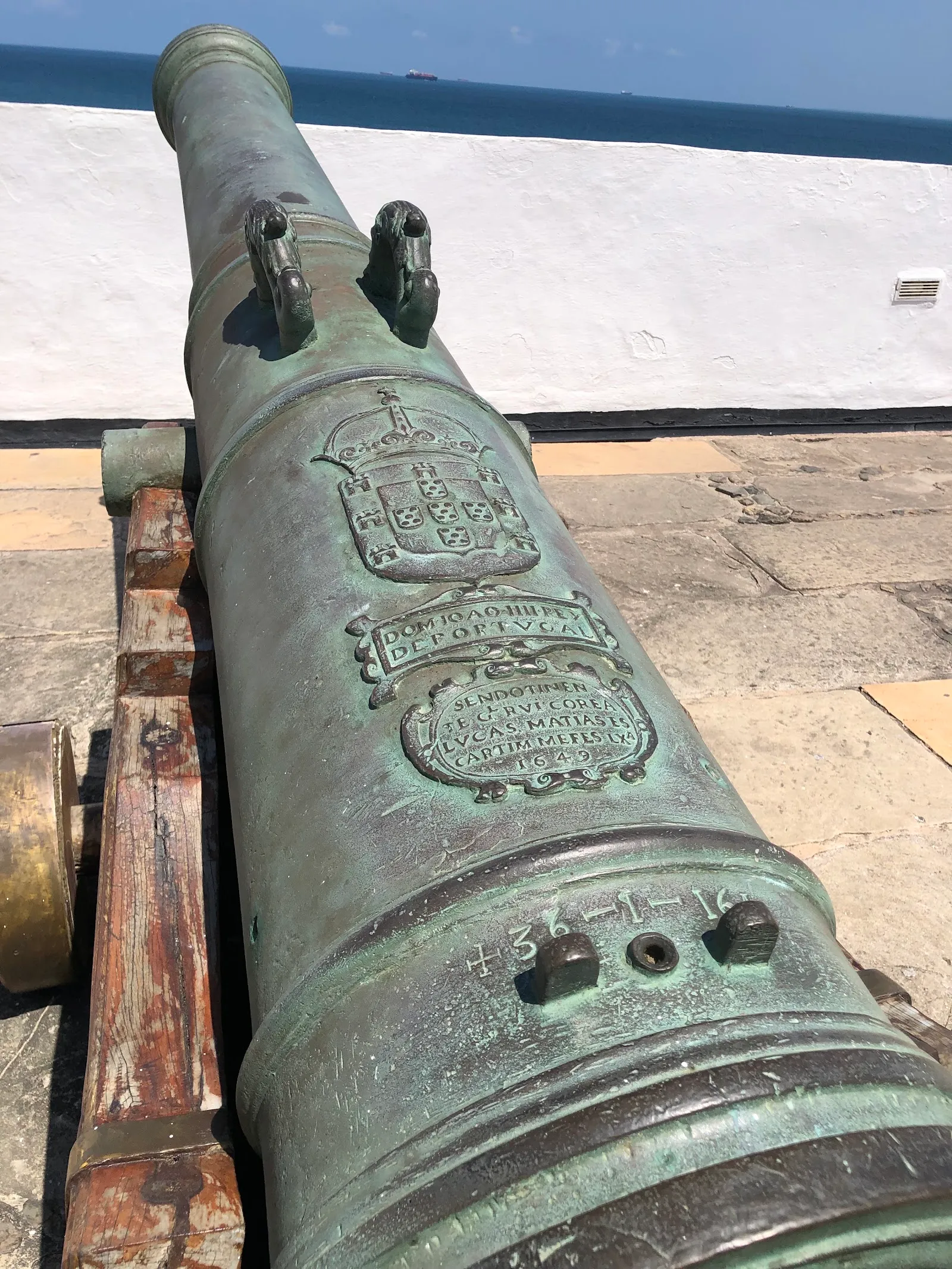
Forte de Santo Antônio da Barra

The Bahia Nautical Museum is housed within the fort. Its permanent displays trace Portuguese navigation and maritime activity along the Bahian coast. Look for old maps, navigation equipment, artillery and model vessels, as well as remains from shipwrecks recovered by archaeologists offshore.

The museum also covers the history of the slave trade. The exhibits give context to the fort’s position on a strategic sea route and to the ships that entered the bay.

Views from the lighthouse and fort

The lighthouse and fort look out over the ocean and the coastline around Salvador. From the lighthouse’s upper level, the view takes in the city and Todos os Santos Bay. Around the fort, changing angles bring the coast into view, including the stretch toward Porto da Barra Beach and Morro do Cristo.

The grassy area outside the fort is a place to pause as the sun sets over the bay. Weekends can be busier, with people gathering outside for photos and time on the grass. Street vendors may approach visitors, so keep valuables secure.

FAQ

What can you see inside Forte de Santo Antônio da Barra?

The Bahia Nautical Museum has old maps, navigation equipment, artillery, model vessels and shipwreck remains. Its displays also cover Portuguese maritime history and the slave trade.

Can you climb the Barra Lighthouse?

Yes. Climb to the top for views of Salvador and Todos os Santos Bay.

When is a good time to visit?

Go at sunset for views over the bay. Weekdays tend to be quieter than weekends.

How long should you allow for a visit?

Allow about 1 to 2 hours to see the museum, explore the fort and climb the lighthouse.

Autres incontournables à Salvador

Tout explorer