Reise planen
Sprache: Deutsch
ReiseplanerPlane deine Reise auf einer Karte

Top-Reiseziele

EnglishDeutschFrançaisEspañolPortuguêsPortuguês (BR)Italiano
Reisehinweis · BrasilienSalvador liegt in oder nahe einem Gebiet, für das Regierungen von allen außer unbedingt notwendigen Reisen abraten: Favelas und informelle Wohnsiedlungen in Großstädten.Die Empfehlung hängt von Ihrem Reisepass ab. Lesen Sie vor der Buchung die Hinweise Ihrer eigenen Regierung.Offizielle Hinweise
Gebiete mit Warnungen
  • Ceilândia · nicht notwendige Reisen vermeiden · Italien, USA
  • Favelas und informelle Wohnsiedlungen in Großstädten · nicht notwendige Reisen vermeiden · Spanien, Neuseeland, USA
  • Paranoá · nicht notwendige Reisen vermeiden · Italien, USA
  • Santa Maria · nicht notwendige Reisen vermeiden · Italien, USA
  • São Sebastião · nicht notwendige Reisen vermeiden · Italien, USA
  • Grenzzone zu Venezuela · nicht notwendige Reisen vermeiden · Deutschland, Frankreich

Außerdem von einer Regierung genannt: 160-km-Streifen entlang aller Landesgrenzen (USA), Complexo da Maré (Kanada), Complexo da Penha (Kanada), 20-km-Streifen entlang der bolivianischen Grenze (ohne Nationalpark Pantanal) (Kanada), 20-km-Streifen entlang der kolumbianischen Grenze (Kanada), 20-km-Streifen entlang der Grenze zu Französisch-Guayana (Kanada), 20-km-Streifen entlang der Grenze zu Guyana (Kanada), 20-km-Streifen entlang der paraguayischen Grenze (Kanada), 20-km-Streifen entlang der peruanischen Grenze (Kanada), 20-km-Streifen entlang der Grenze zu Suriname (Kanada), 50-km-Streifen entlang der venezolanischen Grenze (Kanada), Amazonas und seine Nebenflüsse zwischen Codajás und Belém do Solimões (Bundesstaat Amazonas) (Vereinigtes Königreich), Grenzgebiete (nicht näher bezeichnet) (Frankreich), Nationalpark Chapada Diamantina (Trilha do 21) (Spanien), Planaltina (Italien), Favelas von Rio de Janeiro (Deutschland), Samambaia (Italien)

RegierungHinweiseAktualisiertHinweise lesen
Vereinigtes Königreich (FCDO)No advice against the whole country (regional advisories)–Hinweise lesen
Vereinigte Staaten (State Dept)Exercise increased caution (regional advisories)31. Aug. 2026Hinweise lesen
Kanada (Global Affairs)Exercise a high degree of caution (regional advisories)–Hinweise lesen
Deutschland (Auswärtiges Amt)No advice against the whole country (regional advisories)27. Okt. 2026Hinweise lesen
Neuseeland (SafeTravel)Exercise increased caution due to high crime rates (regional advisories)–Hinweise lesen
Frankreich (Ministerium für Europa und Auswärtige Angelegenheiten)Vigilance renforcée (pays à risque) (regional advisories)–Hinweise lesen

Täglich anhand der veröffentlichten Hinweise der Regierungen geprüft; zuletzt geprüft am 3. Nov. 2026.RoamLedger fasst offizielle Hinweise zusammen; es handelt sich nicht um Empfehlungen einer Regierung.

Forte de Santo Antônio da Barra
Museum

Forte de Santo Antônio da Barra

Forte de Santo Antônio da Barra stands at the entrance to Todos os Santos Bay in Salvador, with the Barra Lighthouse rising above its stone walls.

Forte de Santo Antônio da Barra stands at the entrance to Todos os Santos Bay in Salvador, with the Barra Lighthouse rising above its stone walls. The fort is recognized as Brazil’s oldest military structure, and its compact Bahia Nautical Museum brings the coast’s maritime history into view through old maps, navigation instruments, model ships, artillery and shipwreck finds. Climb the lighthouse for views across the bay and coastline, then take in the sunset from the grassy area outside.

A fort at the bay entrance
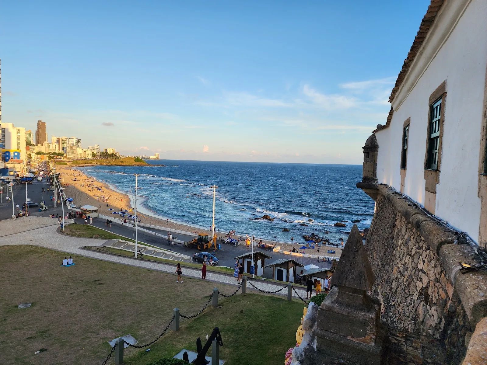
Forte de Santo Antônio da Barra

Forte de Santo Antônio da Barra occupies the northern entrance to Todos os Santos Bay, at the tip of Salvador’s peninsula. Recognized as Brazil’s oldest military structure, it was built to guard the city and the bay. The fort began as a tower with ten sides, then underwent enlargement and repairs in the late sixteenth century, followed by further alterations between 1602 and 1702.

The lighthouse now associated with the fort came later. Shipwrecks on the coral reefs near the bay entrance prompted its construction. Its light helped guide vessels approaching the harbor. Whale oil fueled the lamps until electricity was installed in 1937.

Inside the Bahia Nautical Museum
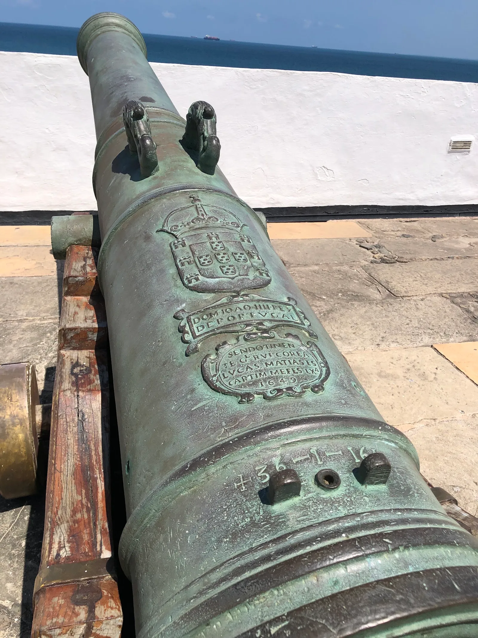
Forte de Santo Antônio da Barra

The Bahia Nautical Museum is housed within the fort. Its permanent displays trace Portuguese navigation and maritime activity along the Bahian coast. Look for old maps, navigation equipment, artillery and model vessels, as well as remains from shipwrecks recovered by archaeologists offshore.

The museum also covers the history of the slave trade. The exhibits give context to the fort’s position on a strategic sea route and to the ships that entered the bay.

Views from the lighthouse and fort

The lighthouse and fort look out over the ocean and the coastline around Salvador. From the lighthouse’s upper level, the view takes in the city and Todos os Santos Bay. Around the fort, changing angles bring the coast into view, including the stretch toward Porto da Barra Beach and Morro do Cristo.

The grassy area outside the fort is a place to pause as the sun sets over the bay. Weekends can be busier, with people gathering outside for photos and time on the grass. Street vendors may approach visitors, so keep valuables secure.

Häufige Fragen

What can you see inside Forte de Santo Antônio da Barra?

The Bahia Nautical Museum has old maps, navigation equipment, artillery, model vessels and shipwreck remains. Its displays also cover Portuguese maritime history and the slave trade.

Can you climb the Barra Lighthouse?

Yes. Climb to the top for views of Salvador and Todos os Santos Bay.

When is a good time to visit?

Go at sunset for views over the bay. Weekdays tend to be quieter than weekends.

How long should you allow for a visit?

Allow about 1 to 2 hours to see the museum, explore the fort and climb the lighthouse.

Weitere Highlights in Salvador

Alle entdecken