
The Aqueduct of Valens, also called Bozdoğan Kemeri, is a Roman waterway that crosses the streets of Fatih, Istanbul. Built in the 4th century, it carried water to Constantinople as part of a much larger supply network. Its surviving arches rise above busy Atatürk Boulevard, where ancient stonework meets modern traffic. Walk around the structure for views from both sides, then take a break in Fatih Memorial Park or Saraçhane Park nearby. It is an easy stop for architecture and history, especially if you are exploring this part of the city.
A Roman waterway above Istanbul’s streets
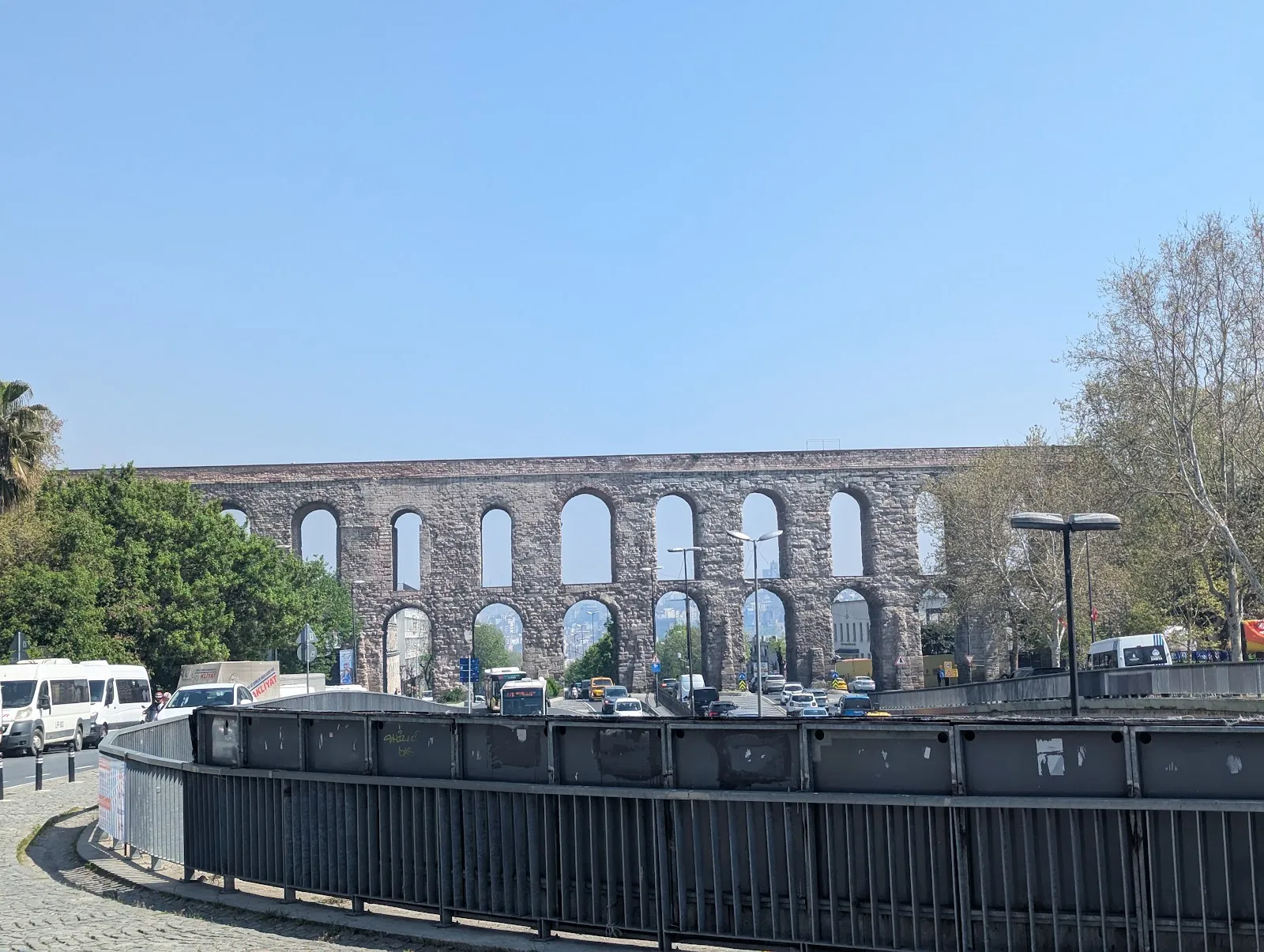
The Aqueduct of Valens, known in Turkish as Bozdoğan Kemeri, was part of the water system built to supply Constantinople. The city’s growth brought pressure on its water supply, and the aqueduct carried water from outside the city towards reservoirs, cisterns, baths and public distribution points.
Construction took place in the 4th century, during the reign of Emperor Valens. The aqueduct crossed the valley between two of Constantinople’s hills, helping water reach a city built across high ground. It was one visible part of a much larger network, not a standalone structure.
The surviving section stretches for about 920 metres. Its two tiers of arches are especially striking where Atatürk Boulevard passes beneath them. Traffic moves through the openings, giving you a close view of how the structure now sits within Istanbul’s modern street plan.
Repairs and continued use
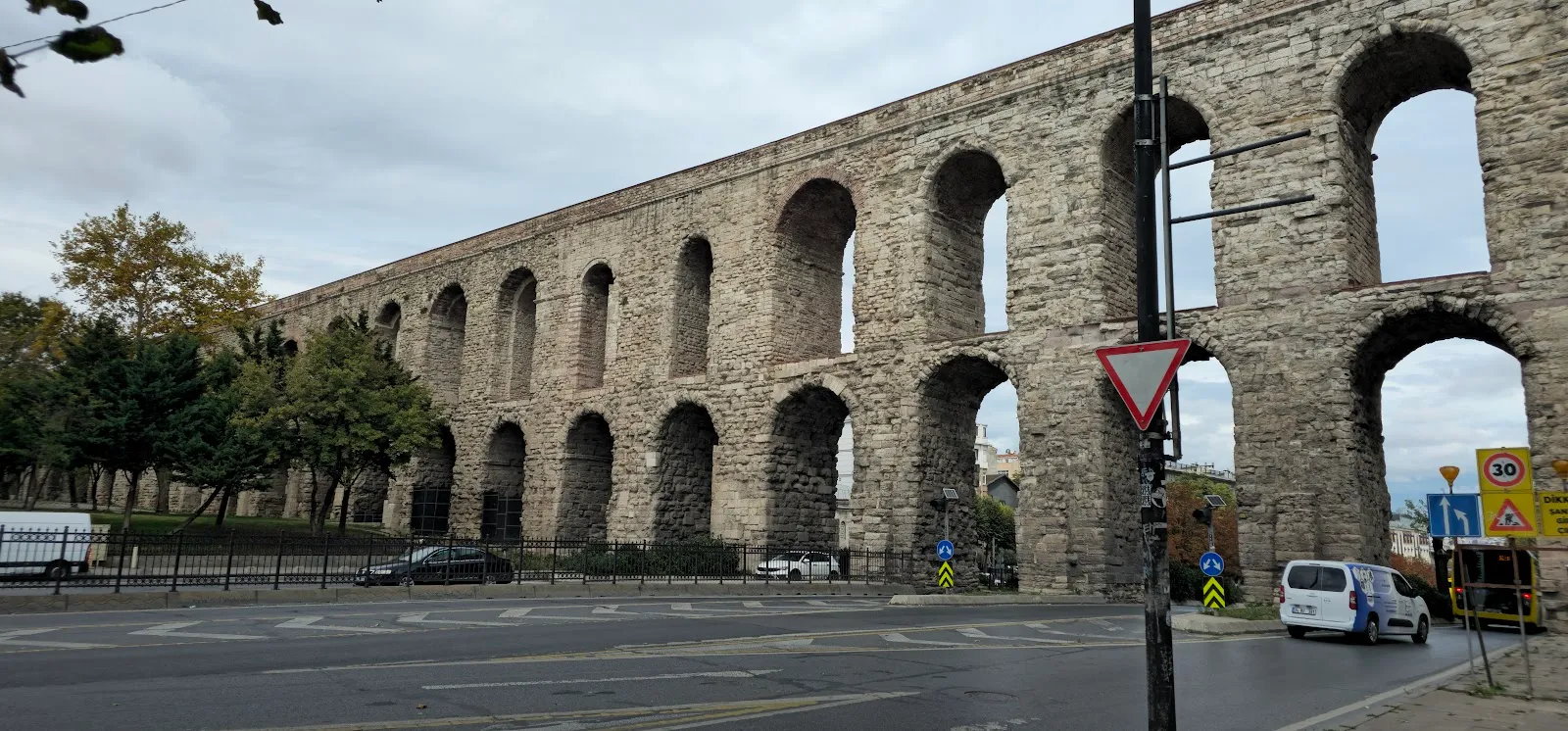
The aqueduct remained part of the city’s water infrastructure through later periods. Byzantine and Ottoman authorities maintained it, and Ottoman repairs included work by the architect Sinan in the 16th century. Its long working life makes the structure more than a remnant of Roman construction: it was infrastructure that successive rulers kept in use.
Water carried through the system supplied parts of Constantinople and was stored in cisterns before reaching places such as baths and public distribution points. The aqueduct’s arches show only one section of that route, but they make the scale of the city’s water needs visible above ground.
Viewing the aqueduct in Fatih
You can see the arches from the streets around the aqueduct and from the neighboring parks. Fatih Memorial Park and Saraçhane Park give you different angles, with space to pause after walking along the busy road. The nearby mosque adds another layer to the setting, where Roman and Ottoman-era history meet in a compact part of the city.
Vezneciler metro station is a useful approach point: the walk west from the station takes about five minutes. The aqueduct works well as a short stop during a visit to Fatih, alongside nearby mosques, cafes and restaurants. It is also a good place to photograph the contrast between old masonry and present-day traffic.
FAQ
Is the Aqueduct of Valens free to see?
The aqueduct can be viewed from the surrounding streets and parks without an admission ticket.
How long should I spend at the Aqueduct of Valens?
Allow around 20 to 30 minutes to walk around the arches and see them from a nearby park.
How do I get to the Aqueduct of Valens by metro?
Take the M2 metro to Vezneciler, then walk west for about five minutes.
When is a good time to photograph the aqueduct?
Early morning or late afternoon gives better light for photographs.


