Planear uma viagem
Idioma: Português
Planeador de viagensPlaneie a sua viagem num mapa

Principais destinos

EnglishDeutschFrançaisEspañolPortuguêsPortuguês (BR)Italiano
Aviso de viagem · MéxicoAlguns governos aconselham a não viajar para partes de México.Os avisos abrangem apenas estas áreas: Estado de Colima, Culiacán e arredores, Estado de Guerrero, Estado de Sinaloa, Acapulco, Estado de Chiapas, Estado de Chihuahua, Rodovia Federal 199, Chiapas, Guanajuato ao sul da rodovia 45D, Zona de fronteira com a Guatemala, Parque Nacional Lagunas de Zempoala, Estado de Michoacán, Rodovia Monterrey–Nuevo Laredo, Faixa de Nayarit até 20 km das fronteiras com Sinaloa e Durango, Nuevo León (exceto Monterrey), Piedras Negras, Estado de Sonora, Estado de Tamaulipas, Tecate, Tijuana, Região da fronteira com os EUA, Estado de Zacatecas.As recomendações dependem do seu passaporte. Leia as recomendações do seu próprio governo antes de reservar.Recomendações oficiais
Áreas com avisos
  • Estado de Colima · evitar todas as viagens · Canadá, Alemanha, França, Reino Unido
  • Culiacán e arredores · evitar todas as viagens · Espanha, França
  • Estado de Guerrero · evitar todas as viagens · Canadá, Alemanha, França, Nova Zelândia, Reino Unido
  • Estado de Sinaloa · evitar todas as viagens · Canadá, Alemanha, Espanha, França, Nova Zelândia, Reino Unido
  • Acapulco · evitar viagens não essenciais · Espanha, França
  • Estado de Chiapas · evitar viagens não essenciais · Canadá, França
  • Estado de Chihuahua · evitar viagens não essenciais · Canadá, França, Reino Unido
  • Rodovia Federal 199, Chiapas · evitar viagens não essenciais · França, Reino Unido
  • Guanajuato ao sul da rodovia 45D · evitar viagens não essenciais · Canadá, Nova Zelândia, Reino Unido
  • Zona de fronteira com a Guatemala · evitar viagens não essenciais · Alemanha, França, Nova Zelândia
  • Parque Nacional Lagunas de Zempoala · evitar viagens não essenciais · Canadá, Nova Zelândia
  • Estado de Michoacán · evitar viagens não essenciais · Canadá, Alemanha, Nova Zelândia, Reino Unido
  • Rodovia Monterrey–Nuevo Laredo · evitar viagens não essenciais · Espanha, França
  • Faixa de Nayarit até 20 km das fronteiras com Sinaloa e Durango · evitar viagens não essenciais · Canadá, Nova Zelândia
  • Nuevo León (exceto Monterrey) · evitar viagens não essenciais · Canadá, Nova Zelândia
  • Piedras Negras · evitar viagens não essenciais · Espanha, França
  • Estado de Sonora · evitar viagens não essenciais · Canadá, Nova Zelândia
  • Estado de Tamaulipas · evitar viagens não essenciais · Canadá, França, Reino Unido
  • Tecate · evitar viagens não essenciais · França, Reino Unido
  • Tijuana · evitar viagens não essenciais · França, Reino Unido
  • Região da fronteira com os EUA · evitar viagens não essenciais · Alemanha, França
  • Estado de Zacatecas · evitar viagens não essenciais · Canadá, Alemanha, Espanha, França, Reino Unido

Também indicado por um governo: Norte de Tamaulipas, a norte de Ciudad Victoria (Alemanha), Estrada 129, Martínez de la Torre–Teziutlán (França), Estrada 131, Tlapacoyan–Perote (França), Estrada 40, Monterrey–Reynosa (França), Estradas secundárias, estrada 180, Martínez de la Torre–Papantla (França), Sul de Michoacán, de Uruapan à costa (França), Sul de Michoacán, a sul de Morelia, incluindo a Tierra Caliente (Espanha), Triângulo Celaya, Irapuato, Salamanca (Guanajuato) (França), Baja Califórnia (exceto Tijuana e Tecate) (França), Faixa de Chiapas a menos de 40 km da fronteira com a Guatemala (Reino Unido), Zonas turísticas de Chiapas (Espanha), Ciudad Acuña (Espanha), Ciudad Juárez e arredores (Espanha), Ciudad Obregón (França), Estado de Coahuila (exceto a parte sul) (Nova Zelândia), Coatzacoalcos (França), Bairros a norte e nordeste do Zócalo, Cidade do México (França), Estado de Durango (França), Nuevo León oriental (França), Ecatepec (Espanha), Sul do estado de Guanajuato (França), Municípios do norte de Jalisco (Reino Unido), Sul e sudoeste do lago de Chapala (Jalisco) (Reino Unido), Sudoeste de Jalisco e Los Altos (exceto Puerto Vallarta) (França), Faixa de Jalisco até 50 km da fronteira com Michoacán (Canadá), Monclova (Espanha), Estado de Morelos (França), Naucalpan (Espanha), Estado de Nayarit (França), Nezahualcóyotl (Espanha), Nogales (França), Norte de Tamaulipas, de San Fernando até a fronteira com os EUA (Espanha), Norte de Veracruz a partir de Martínez de la Torre (França), Rodovia 150D, Puebla–Orizaba (França), Rodovia 190, Oaxaca–Santo Domingo Tehuantepec (França), Rodovia 95, Cidade do México–Cuernavaca (França), Rodovias 85 e 83, Monterrey–Ciudad Victoria–Tampico (França), Selva Lacandona (França), Sudoeste de Michoacán (França), Sudoeste de Tamaulipas (França), Tepic (Nova Zelândia), Toluca (França), Veracruz (França)

GovernoRecomendaçõesAtualizadoLer as recomendações
Reino Unido (FCDO)No advice against the whole country (regional advisories)–Ler as recomendações
Estados Unidos (Departamento de Estado)Exercise increased caution29/05/2026Ler as recomendações
Canadá (Assuntos Mundiais)Exercise a high degree of caution (regional advisories)–Ler as recomendações
Alemanha (Ministério dos Negócios Estrangeiros)Besondere Vorsicht walten lassen (Sicherheitslage) (regional advisories)19/10/2026Ler as recomendações
Nova Zelândia (SafeTravel)Exercise increased caution (regional advisories)–Ler as recomendações
França (Ministério para a Europa e Negócios Estrangeiros)Vigilance renforcée pour le reste du pays (regional advisories)–Ler as recomendações

Verificado diariamente a partir das recomendações publicadas pelos governos; última verificação 3/11/2026.RoamLedger resume as recomendações oficiais; não são recomendações de nenhum governo.

a large building with a dome and a clock tower
Igreja

Parroquia de San Miguel Arcángel

The Parroquia de San Miguel Arcángel is the parish church of San Miguel de Allende and the tallest building in town.

The Parroquia de San Miguel Arcángel is the parish church of San Miguel de Allende and the tallest building in town. Its pink limestone spires rise over the main square, El Jardín, and show above the rooftops from many streets. The church dates to the 17th century, but the neo-Gothic facade was added in the 1880s by the stonemason Zeferino Gutiérrez. Go inside for a calm interior, carved wooden doors and colonial paintings. Then stay for the plaza, where musicians and street vendors keep it busy from morning to night.

A 17th-century church with an 1880s facade
Parroquia de San Miguel Arcángel

The parish church was built in the late 17th century in a Baroque style, with two towers. It was a fairly simple building. About two hundred years later the structure began to show cracks, and the work of changing its face was handed to Zeferino Gutiérrez, a local stonemason and self-taught architect.

The new facade was commissioned by the first Bishop of León, and the work is dated to the 1880s. Gutiérrez had much of the older front demolished and rebuilt it in a neo-Gothic design. He is said to have worked from drawings, engravings and postcards of European cathedrals. The pink stone is cantera, quarried on the slopes of the Palo Huérfano volcano.

The result looks very different from the colonial buildings around it. The church is the tallest building in San Miguel de Allende. It is a parish church, not a cathedral, although it is often mistaken for one.

Inside the parish
Parroquia de San Miguel Arcángel

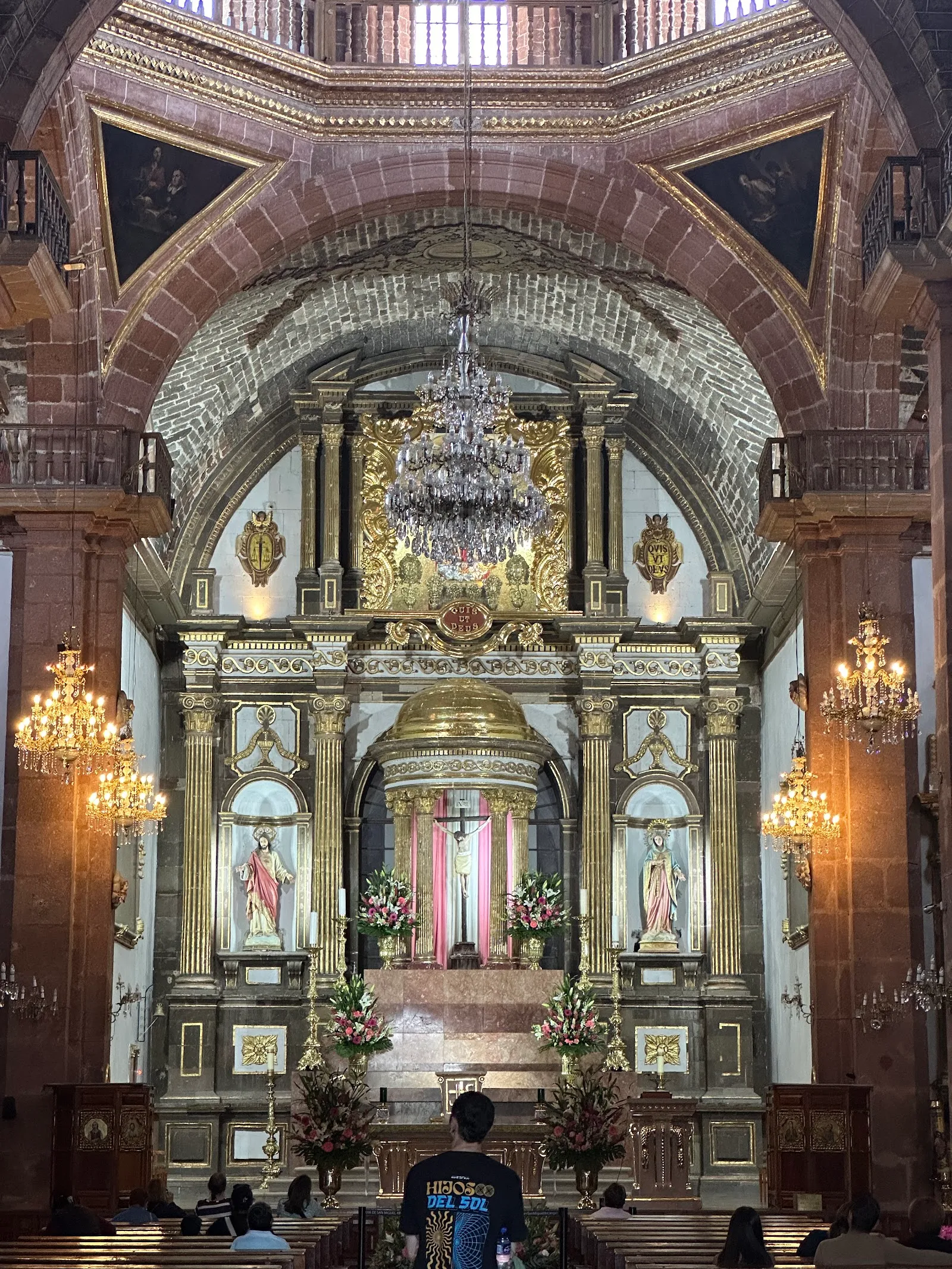
The entrance is through large wooden doors with detailed carving. Inside, the atmosphere is quiet, and the space is used for worship, so visitors are welcome to attend a service.

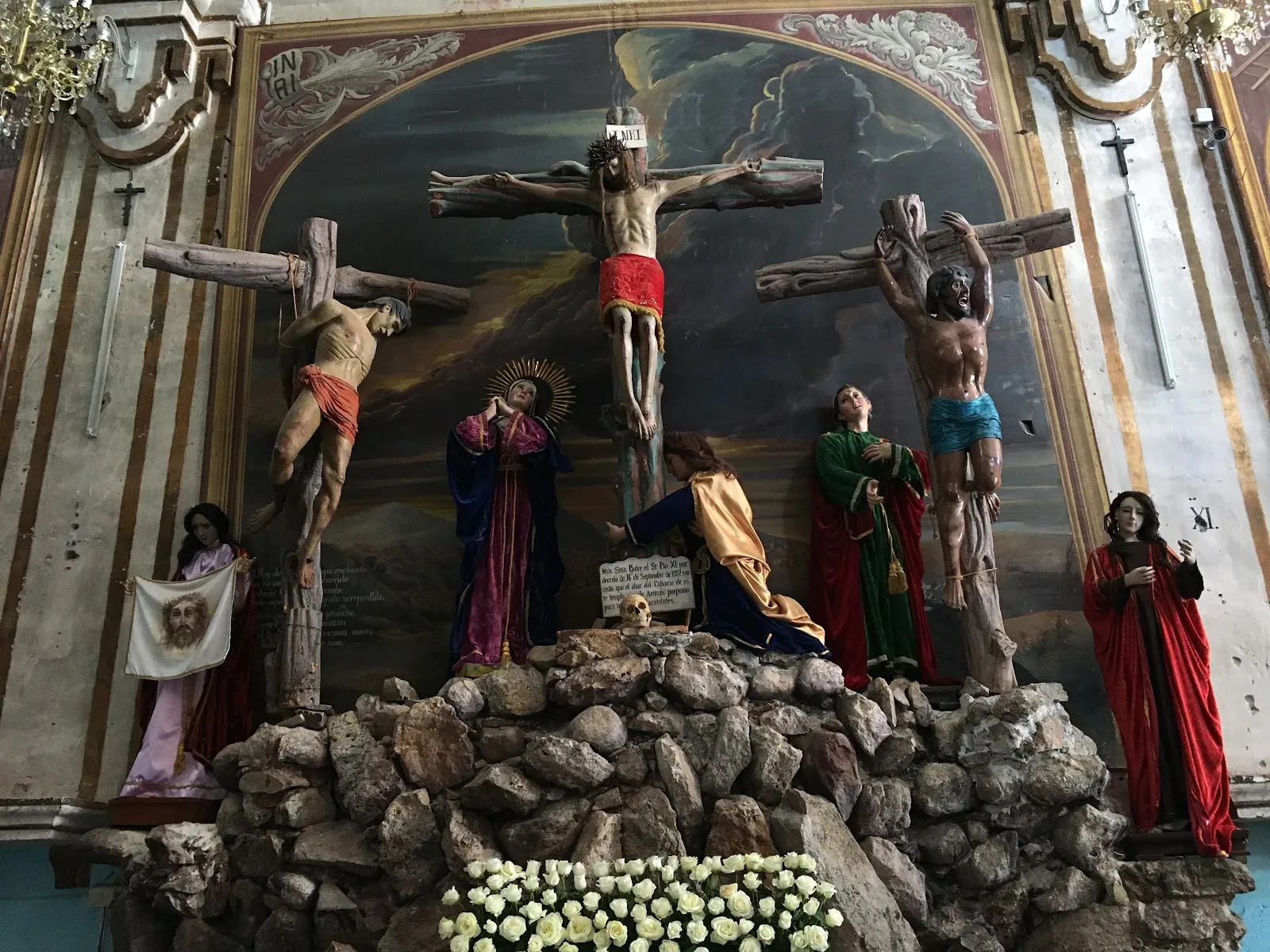
The interior holds colonial-era paintings by Juan Rodríguez Juárez. One of the chapels has a figure of Christ made of orchid paste, a technique associated with Tarascan craftsmen. The church also contains religious art and a large organ.

On Wednesdays the church provides the location for a community meal for elderly people in need, served by the charity SOME, So Others May Eat.

The plaza and the town's festivals

The church stands on the main square, El Jardín, also called Jardín Allende or Jardín Principal. Benches under the trees face the facade, and the square fills with musicians, street vendors and families through the day. Snacks sold nearby include elote, esquite and shave ice.

The church is the center of the town's main celebrations. The fiesta of San Miguel Arcángel runs for two days around September 29, the feast day of St. Michael, with processions, concerts, traditional dancing and ceremonies. In September the city also marks La Alborada, which begins in the early morning with fireworks and music. At Christmas and New Year the square has a stage in front of the church, along with lights and mariachis.

Weddings take place here as well, and the plaza is often busy with photographers. Photos of the facade with no one in front of it need some patience.

Seeing the spires from the streets

The spires show above the old center from many angles. One of the best-known views is along Calle Aldama, the street that leads from Parque Benito Juárez toward the center. From there the pointed tops of the church appear above a dome in front of it, like a crown.

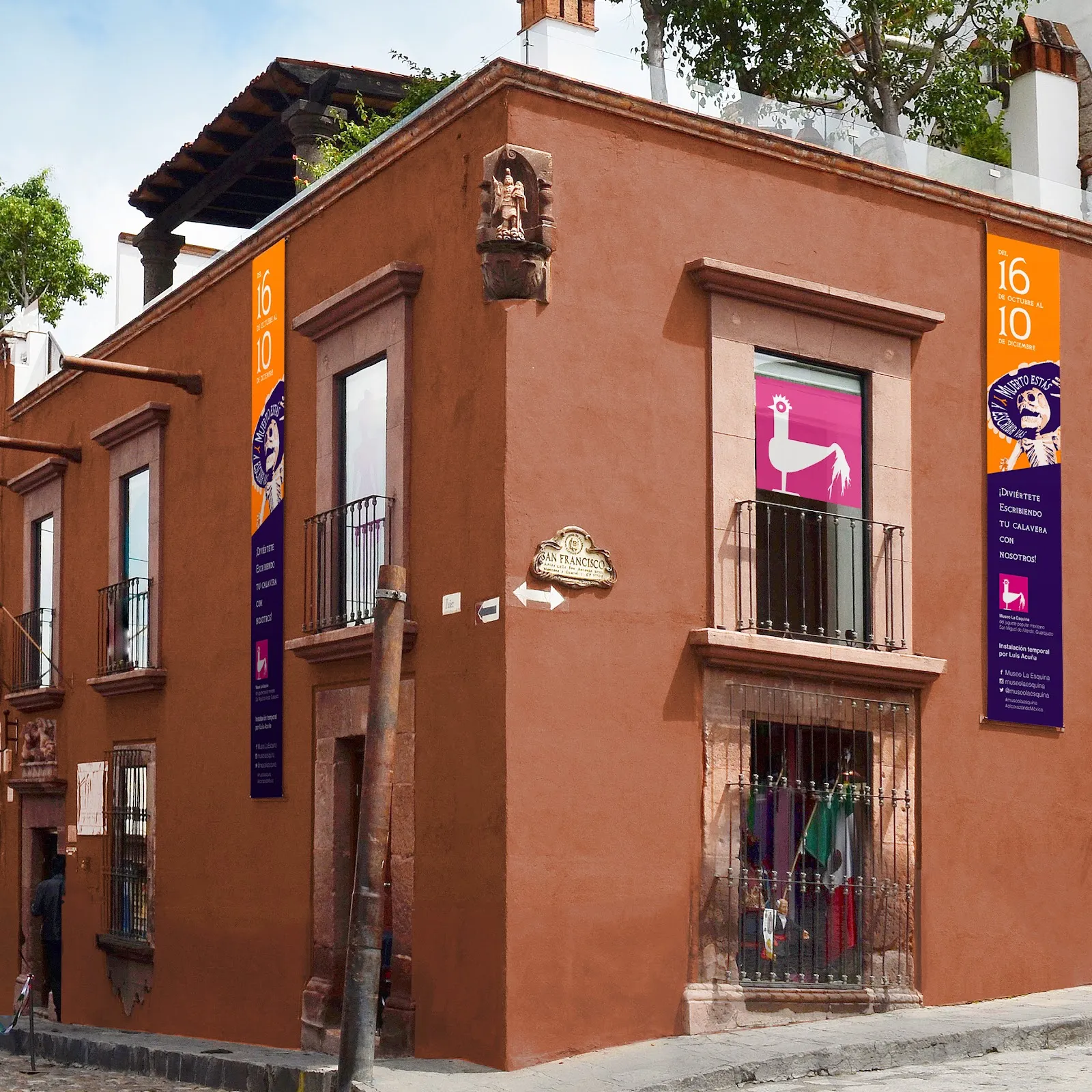
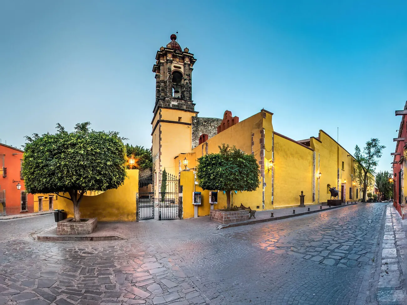
The stone changes color with the sun during the day, and the facade is lit at night. Close by you can also see the Templo de San Rafael, next to the parish, the Iglesia de San Francisco and the Oratorio de San Felipe Neri.

Perguntas frequentes

Can you go inside the Parroquia de San Miguel Arcángel?

Yes. The church is open to visitors and to people who want to attend a service. Opening hours differ by day, so check them before you go.

Can you take photos inside the church?

Do not take photos during a service. At other times, keep the space quiet and respect those who are praying.

Who designed the pink facade?

Zeferino Gutiérrez, a local stonemason and self-taught architect, rebuilt the facade in neo-Gothic style in the 1880s. He is said to have drawn on pictures and postcards of European cathedrals.

Where is the Parroquia de San Miguel Arcángel?

It is on the main square of San Miguel de Allende, El Jardín, in the historic center. Its spires are visible from many streets, so it is easy to find.

When is the best time to see the church?

Go at sunset or after dark, when the facade is lit. The pink stone also changes color through the day.

Mais locais imperdíveis em San Miguel de Allende

Explorar tudo