
Peyto Lake is a glacier-fed lake along the Icefields Parkway, about 40 km north of Lake Louise. From the Bow Summit viewpoint, its vivid turquoise water forms a shape often compared to a wolf’s head, with forested slopes and mountain peaks beyond. A short uphill walk from the parking area leads to the main lookout, so you can take in the view without a long hike. The path and viewpoint can be busy, and parking fills up, especially during popular visiting times.
The view from Bow Summit
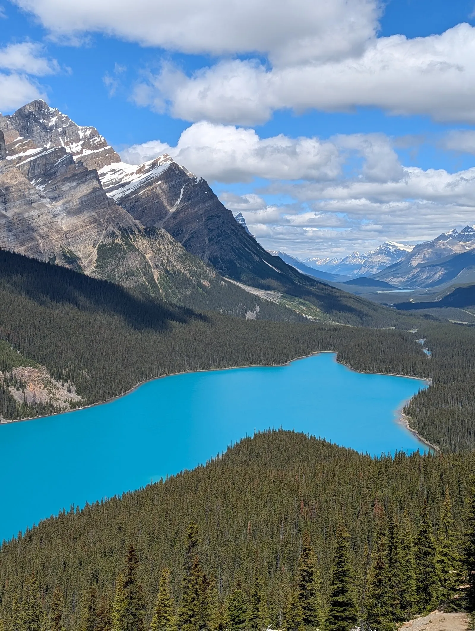
Peyto Lake is best seen from above. The short uphill walk from the parking area leads to a viewpoint overlooking the lake, the valley and the surrounding peaks. From there, the shoreline gives the lake its familiar wolf-head shape. The viewpoint sits high above the water, so the view takes in more than the lake itself: forested slopes and distant mountain ridges frame the turquoise colour.
The walk is brief, but it climbs uphill. Comfortable shoes are useful, especially if the path is wet or conditions are snowy. The area is at high elevation, and the approach can feel more demanding than the distance suggests. Stay on the trail around the lookout; erosion has made keeping to the path important.
Why the water looks turquoise
Peyto Lake is fed by water from Peyto Glacier through Peyto Creek. During the warmer months, fine glacial rock flour flows into the lake. Sunlight interacting with these suspended particles gives the water its striking blue-green appearance. The colour can shift with the light, weather and season, so the view may look different from one visit to another.
In summer, the turquoise is most pronounced once glacial melt is flowing into the lake. In colder months, snow and ice can cover the water, changing the scene from the familiar bright-blue view. The lake remains recognisable by its distinctive outline, even when its colour is less visible.
Planning a stop on the Icefields Parkway
The lake is about 40 km north of Lake Louise along the Icefields Parkway. Look for the Bow Summit turnoff when approaching by car; road signs may use that name rather than Peyto Lake. The parking area can become crowded, and spaces may be hard to find when visitor numbers are high. An early start or a later visit can help with both parking and time at the viewpoint.
Mobile reception is limited in the area, so download a map before leaving. The main lookout is a popular stop, but paths continue beyond it toward other viewpoints. The walk farther uphill can provide a different perspective and may be quieter. Allow time for the uphill approach and for the view; you do not need a long hike to reach the main panorama.
Perguntas frequentes
How long does it take to visit Peyto Lake?
Allow about 30 to 60 minutes for the uphill walk to the main viewpoint and time to enjoy the view.
When is the best time to see Peyto Lake’s turquoise colour?
Summer, after June, is a good time to see the strongest turquoise colour, when glacial rock flour is flowing into the lake.
Is there a hike to the Peyto Lake viewpoint?
Yes. A short uphill walk leads from the parking area to the main viewpoint.
Where is Peyto Lake?
Peyto Lake is along the Icefields Parkway, about 40 km north of Lake Louise. Follow signs for Bow Summit.


