
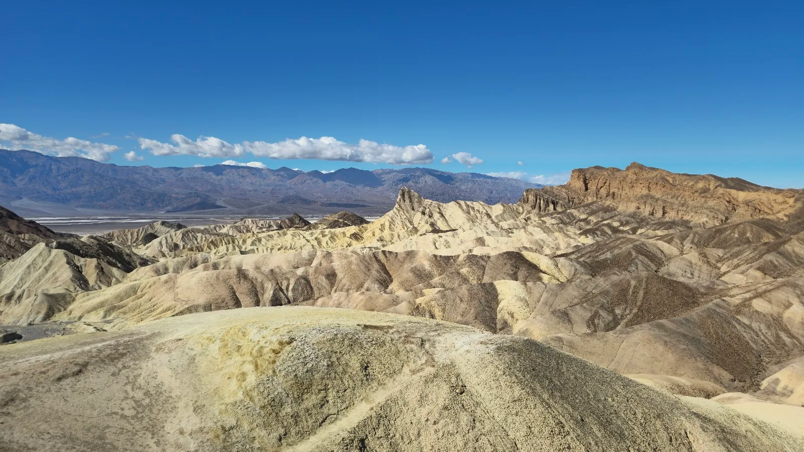
Zabriskie Point is a viewpoint in Death Valley National Park, a short drive east of Furnace Creek along Highway 190. A paved path of about a quarter mile climbs from the parking lot to a platform over eroded badlands, with the Panamint Mountains beyond. The hills turn violet, pink and gold around sunrise and sunset, which is the best time to be there. Plan for the early light, bring water, and allow time to walk down onto the trails below.
Why the point was built and who it honors
Zabriskie Point was set up by the Pacific Coast Borax Company in the years before the Furnace Creek Inn opened in 1927. The company's executives built several scenic points and roads at that time to bring visitors out to the desert scenery.
The point is named for Christian Zabriskie, a company leader who managed its mining work in the valley. Borax, the mineral mined here, was called the white gold of the desert, and prospectors had been working this ground since the California Gold Rush era. Signs at the observation platform tell this history.
What the badlands are
The hills below the point are badlands, a term for dry ground where soft rock and clay-rich soil have been cut deeply by erosion. The rock was laid down in an ancient lake that once covered much of the valley, including this area. Over time that lake bed filled with sediment: saline muds, gravel washed from nearby mountains, and ash from the Black Mountain volcanic field.
Water and wind carved those layers into the folded ridges and gullies you see today. The colors come from the different layers, so the hills shift from yellow and brown to cream and gold depending on the light.
How the visit works
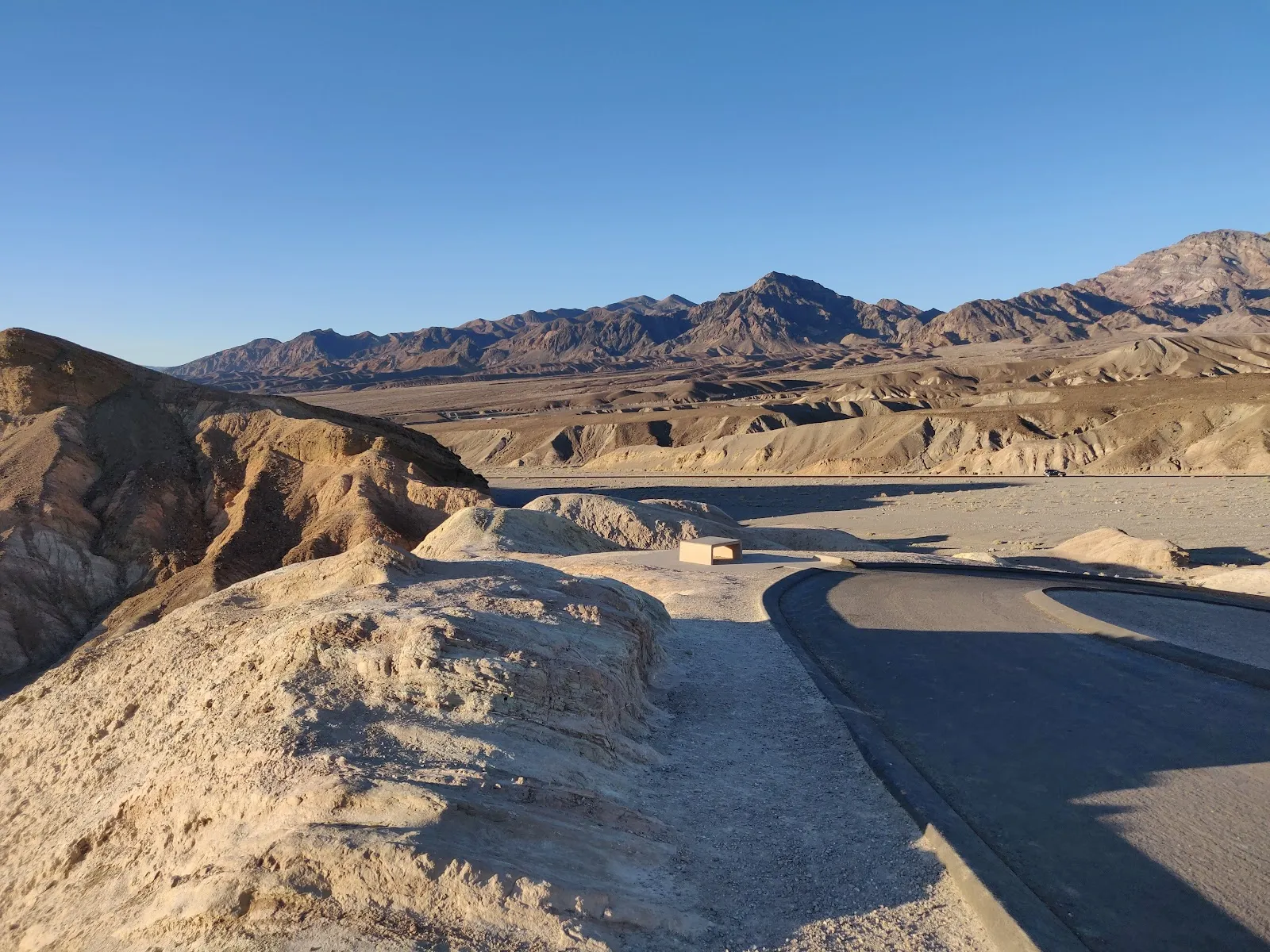
The parking lot sits at the base of the hill. A paved path of about a quarter mile climbs to the viewing platform, with a rise of roughly 50 to 60 feet. The path is steep enough in places to notice, but it is wheelchair accessible, as are the parking and the restroom at the lot.
From the top, walk around the platform to see the full view. The panorama takes in the Furnace Creek badlands, Twenty Mule Team Canyon to the south, the Panamint Mountains to the west, and Manly Beacon, a rock spire about 823 feet high. On a clear morning you can also see the salt flats far below.
Trails start from the same area. The Badlands Loop descends from the point through gullies and ridges, and its slopes have very little vegetation. A trail below the point leads to Golden Canyon and Gower Gulch. The Golden Canyon route to this lookout is about 2.5 miles one way. Once the trail opens up, it is easy to lose track of the path, so watch for signs.
Photographing the point
A wide-angle lens takes in the full sweep of ridges. A telephoto lens picks out the patterns of erosion and the light and shadow inside them. Dawn brings the strongest colors. At sunrise the light falls on the valley ahead of you, so to photograph the sun coming up over the mountains you need to turn around and face the landscape behind you.
Stay after sunset to see the blue hour change the sky and the rock. Once the sky is dark and clear, the point is also a good place for stargazing, and a tripod helps with long exposures.
Other stops close by
From the point, several of the valley's main sights are close. Twenty Mule Team Canyon is less than a five minute drive away. Badwater Basin, the lowest point in North America, lies across the valley, and Dante's View is a longer drive to the south.
If you have a single day in the park, Zabriskie Point works well as a sunrise or early morning stop before you move on to the other areas.
Preguntas frecuentes
Is there an entry fee for Zabriskie Point?
Zabriskie Point is inside Death Valley National Park. Visitors who drive in pay a per-vehicle entrance fee, which is valid for seven days.
How long do you need at Zabriskie Point?
Plan 30 to 60 minutes for the view. Allow more time if you walk the trails or take photos.
Can you bring a dog to Zabriskie Point?
No. Pets are not permitted on trails, including the paved path to the viewpoint.
Is Zabriskie Point wheelchair accessible?
Yes. The entrance, the parking lot and the restroom are wheelchair accessible.
When is the best time to visit Zabriskie Point?
Sunrise and sunset, when the hills turn violet, pink and gold. Arrive early for sunrise because the parking lot can fill quickly.


