Planifica un viaje
Idioma: Español
Planificador de viajesPlanifica tu viaje en un mapa

Destinos principales

EnglishDeutschFrançaisEspañolPortuguêsPortuguês (BR)Italiano
Aviso de viaje · MéxicoMonterrey se encuentra en una zona o cerca de ella donde los gobiernos recomiendan evitar todo viaje que no sea esencial: Carretera 85 Monterrey–Nuevo Laredo.Los consejos dependen de tu pasaporte. Lee los de tu propio gobierno antes de reservar.Recomendaciones oficiales
Zonas con advertencias
  • Colima · evitar todo viaje · Canadá, Alemania, Francia, Reino Unido
  • Guerrero · evitar todo viaje · Canadá, Alemania, España, Francia, Nueva Zelanda, Reino Unido
  • Sinaloa · evitar todo viaje · Canadá, Alemania, España, Francia, Nueva Zelanda, Reino Unido
  • Chiapas · evitar viajes no esenciales · Canadá, España, Francia
  • Chihuahua · evitar viajes no esenciales · Canadá, Francia, Reino Unido
  • Carretera federal 199 San Cristóbal de las Casas–Palenque · evitar viajes no esenciales · Francia, Reino Unido
  • Guanajuato, al sur de las carreteras 43D y 45D · evitar viajes no esenciales · Canadá, Nueva Zelanda
  • Región fronteriza con Guatemala, Chiapas · evitar viajes no esenciales · Alemania, Francia, Nueva Zelanda
  • Parque nacional Lagunas de Zempoala · evitar viajes no esenciales · Canadá, Nueva Zelanda
  • Michoacán · evitar viajes no esenciales · Canadá, Alemania, Nueva Zelanda, Reino Unido
  • Nayarit, a menos de 20 km de la frontera con Sinaloa y Durango · evitar viajes no esenciales · Canadá, Nueva Zelanda
  • Nuevo León, excepto Monterrey · evitar viajes no esenciales · Canadá, Nueva Zelanda
  • Piedras Negras · evitar viajes no esenciales · España, Francia
  • Carretera 85 Monterrey–Nuevo Laredo · evitar viajes no esenciales · España, Francia
  • Sonora · evitar viajes no esenciales · Canadá, Nueva Zelanda
  • Tamaulipas · evitar viajes no esenciales · Canadá, Francia, Reino Unido
  • Tecate · evitar viajes no esenciales · Francia, Reino Unido
  • Tijuana · evitar viajes no esenciales · Francia, Reino Unido
  • Región fronteriza con Estados Unidos · evitar viajes no esenciales · Alemania, España, Francia
  • Zacatecas · evitar viajes no esenciales · Canadá, Alemania, España, Francia, Reino Unido

También señalada por un gobierno: Triángulo Celaya–Irapuato–Salamanca, Guanajuato (Francia), Culiacán y alrededores (Francia), Norte de Ciudad Victoria, Tamaulipas (Alemania), Carretera 129 Martínez de la Torre–Teziutlán (Francia), Carretera 131 Tapacoyan–Perote (Francia), Carreteras secundarias de la 180 Martínez de la Torre–Papantla (Francia), Carretera 40 Monterrey–Reynosa (Francia), Sur de Michoacán, desde Uruapan hasta la costa (Francia), Acapulco (Francia), Baja California, excepto Tijuana y Tecate (Francia), Ciudad Acuña (España), Ciudad Juárez y alrededores (España), Ciudad Obregón (Francia), Coahuila, excepto el sur (Nueva Zelanda), Coatzacoalcos (Francia), Colonias al norte y noreste del Zócalo, Ciudad de México (Francia), Durango (Francia), Este de Nuevo León, limítrofe con Tamaulipas (Francia), Guanajuato (España), Guanajuato, carretera 45 entre León e Irapuato (Nueva Zelanda), Guanajuato, al suroeste de la carretera 45D (Reino Unido), Jalisco, a menos de 50 km de la frontera con Michoacán (Canadá), Monclova (España), Morelos (Francia), Nayarit (Francia), Nogales (Francia), Zonas rurales no turísticas de Baja California (España), Zonas rurales no turísticas de Chihuahua (España), Zonas rurales no turísticas de Coahuila (España), Zonas rurales no turísticas de Durango (España), Zonas rurales no turísticas de Sonora (España), Municipios del norte de Jalisco (Reino Unido), Norte de Tamaulipas, desde San Fernando hasta la frontera con EE. UU. (España), Norte de Veracruz, limítrofe con Tamaulipas (España), Norte de Veracruz desde Martínez de la Torre (Francia), Carretera 150D, Puebla–Orizaba (Francia), Carretera 190, Oaxaca–Santo Domingo Tehuantepec (Francia), Carreteras 85 y 83 Monterrey–Ciudad Victoria–Tampico (Francia), Carretera 95 Ciudad de México–Cuernavaca (Francia), Selva Lacandona (Francia), Sur y suroeste del lago de Chapala, Jalisco (Reino Unido), Suroeste de Jalisco y Los Altos, excepto Puerto Vallarta (Francia), Suroeste de Michoacán (Francia), Suroeste de Tamaulipas (Francia), Sur del estado de Guanajuato (Francia), Sur de Michoacán, al sur de Morelia (España), Franja de 40 km desde la frontera con Guatemala, Chiapas (Reino Unido), Tepic (Nueva Zelanda), Toluca (Francia), Ciudad de Veracruz (Francia)

GobiernoConsejosActualizadoLeer las recomendaciones
Reino Unido (FCDO)No advice against the whole country (regional advisories)–Leer las recomendaciones
Estados Unidos (Departamento de Estado)Exercise increased caution29 may 2026Leer las recomendaciones
Canadá (Asuntos Globales)Exercise a high degree of caution (regional advisories)–Leer las recomendaciones
Alemania (Auswärtiges Amt)Besondere Vorsicht walten lassen (Sicherheitslage) (regional advisories)19 oct 2026Leer las recomendaciones
Nueva Zelanda (SafeTravel)Exercise increased caution (regional advisories)–Leer las recomendaciones
Francia (Ministerio de Europa y Asuntos Exteriores)Vigilance renforcée pour le reste du pays (regional advisories)–Leer las recomendaciones

Revisado a diario según los consejos publicados por los gobiernos; última revisión 2 nov 2026.RoamLedger resume las recomendaciones oficiales; no son consejos de ningún gobierno.

Macroplaza
Plaza

Macroplaza

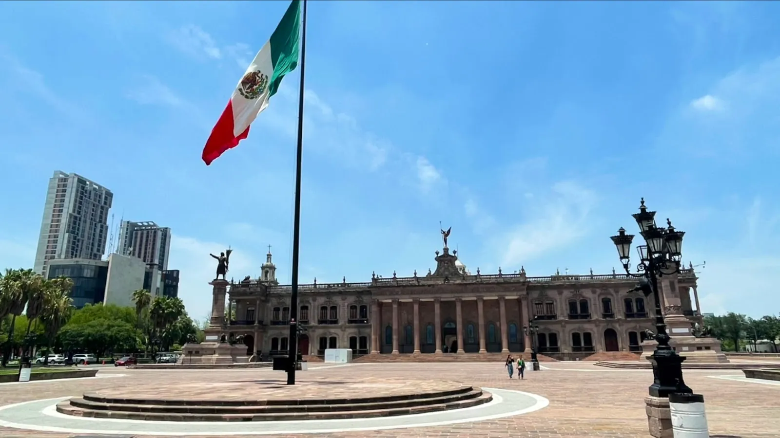
Macroplaza is the main public square of Monterrey, a 40-hectare open space in Centro that stretches about 800 meters from the Palacio de Gobierno to the Fuente de la Vida.

Macroplaza is the main public square of Monterrey, a 40-hectare open space in Centro that stretches about 800 meters from the Palacio de Gobierno to the Fuente de la Vida. Monuments, gardens and fountains line the route, among them the bronze Fuente de Neptuno and the 70-meter Faro del Comercio, which sends a green laser across the sky after dark. Street vendors, shoeshiners and musicians work the square, and the MARCO museum, the cathedral and the Museum of Mexican History are close by. The square is open around the clock.

How the square was built
Macroplaza
Macroplaza

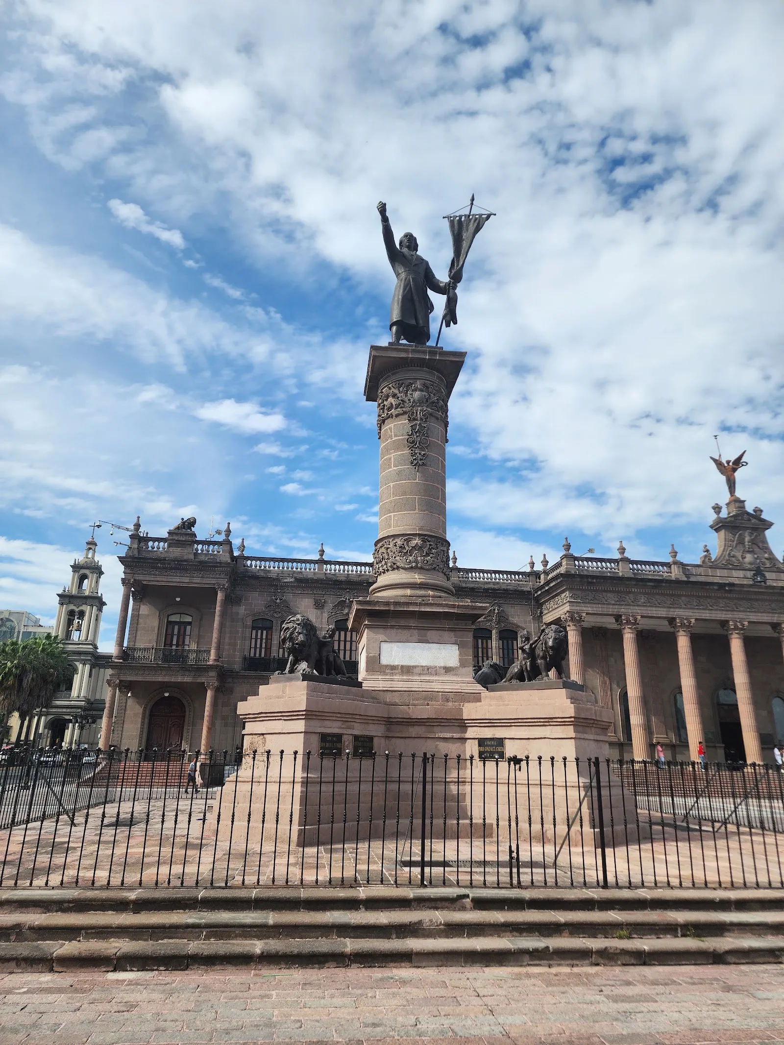
Macroplaza was built between 1984 and 1987, after a large part of the Barrio Antiguo was demolished in the early 1980s to make room for it. The square covers about 400,000 square meters, or 40 hectares, and runs roughly 800 meters from the Palacio de Gobierno to the Fuente de la Vida. It is raised above street level, with a parking garage underneath.

The modern layout explains why the square feels open and planned compared with the older streets around it. The Barrio Antiguo, with its adobe houses now used as restaurants, bars and art spaces, sits a few blocks away and is the city's oldest neighborhood.

Landmarks along the square
Macroplaza
Macroplaza

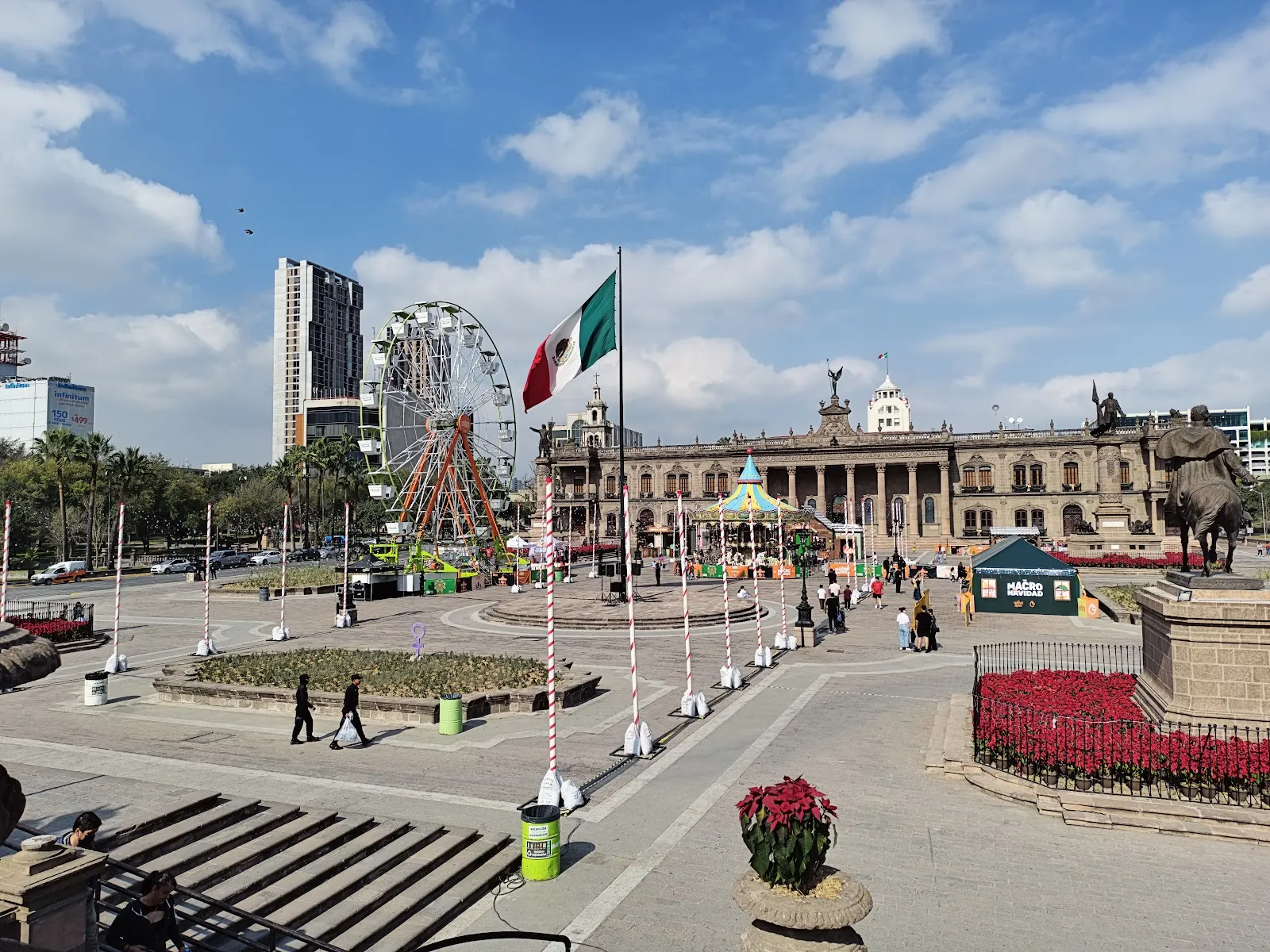
The Faro del Comercio is the easiest landmark to spot. The slim orange tower is 70 meters tall and was designed by Luis Barragán. After dark a green laser shoots from it across the city.

The Palacio de Gobierno is the seat of the governor of Nuevo León. It combines colonial and neoclassical styles, and its Spanish-style patio is one of the features to look for. The Fuente de Neptuno is a bronze fountain showing the Roman sea god. Among the statues and monuments are the Monumento al Trabajo and the Monumento a los Héroes de la Independencia. A modernist Central Library stands inside the plaza, and the Metropolitan Cathedral is on its edge.

The Explanada de los Héroes and the Neptune fountain are used as central points, which makes them practical places to begin a walk.

Museums and the Santa Lucia canal

The MARCO Contemporary Art Museum stands at one end of the square, and the Museum of Mexican History at the other. The history museum connects to the riverwalk and to Parque Fundidora, so the area can fill a good part of a day.

The Paseo Santa Lucia is a man-made canal about two and a half kilometers long. It links the Macroplaza to Parque Fundidora and is pleasant for a walk, especially in the evening.

Life on the square

The square is a place for everyday use as well as for events. Shoeshiners and street vendors set up here, selling food and handmade souvenirs, and musicians and fire dancers perform. Café terraces nearby offer coffee and cold drinks.

Open-air concerts and public celebrations are held around the plaza, and during major holidays and city festivals it becomes a large outdoor venue. Fiestas Patrias in September is the best-known of these. Athletic events are also held here.

Preguntas frecuentes

How big is Macroplaza?

It covers about 40 hectares (99 acres), or 400,000 square meters. It stretches roughly 800 meters from the Palacio de Gobierno to the Fuente de la Vida.

Is Macroplaza open at night?

Yes, it is open 24 hours every day. The Faro del Comercio projects a green laser after dark, so the evening is a good time to see it.

How long do you need at Macroplaza?

A walk through the square and its main landmarks takes a couple of hours. Add more time if you visit the museums, the cathedral or the Santa Lucia canal.

What is there to see at Macroplaza?

The main sights are the Faro del Comercio, the Palacio de Gobierno, the Fuente de Neptuno, the Monumento al Trabajo and the Explanada de los Héroes. The MARCO museum and the Museum of Mexican History are at either end.

Is there parking and wheelchair access?

There are free and paid parking lots and paid street parking. The entrance and the parking lot are wheelchair accessible.
Más lugares imprescindibles en Monterrey

Explorar todo