Reise planen
Sprache: Deutsch
ReiseplanerPlane deine Reise auf einer Karte

Top-Reiseziele

EnglishDeutschFrançaisEspañolPortuguêsPortuguês (BR)Italiano
Reisehinweis · MexikoMonterrey liegt in oder nahe einem Gebiet, für das Regierungen von allen außer unbedingt notwendigen Reisen abraten: Route 85 Monterrey–Nuevo Laredo.Die Empfehlung hängt von Ihrem Reisepass ab. Lesen Sie vor der Buchung die Hinweise Ihrer eigenen Regierung.Offizielle Hinweise
Gebiete mit Warnungen
  • Colima · alle Reisen vermeiden · Kanada, Deutschland, Frankreich, Vereinigtes Königreich
  • Guerrero · alle Reisen vermeiden · Kanada, Deutschland, Spanien, Frankreich, Neuseeland, Vereinigtes Königreich
  • Sinaloa · alle Reisen vermeiden · Kanada, Deutschland, Spanien, Frankreich, Neuseeland, Vereinigtes Königreich
  • Chiapas · nicht notwendige Reisen vermeiden · Kanada, Spanien, Frankreich
  • Chihuahua · nicht notwendige Reisen vermeiden · Kanada, Frankreich, Vereinigtes Königreich
  • Bundesstraße 199 San Cristóbal de las Casas–Palenque · nicht notwendige Reisen vermeiden · Frankreich, Vereinigtes Königreich
  • Guanajuato, südlich der Schnellstraßen 43D und 45D · nicht notwendige Reisen vermeiden · Kanada, Neuseeland
  • Grenzgebiet zu Guatemala, Chiapas · nicht notwendige Reisen vermeiden · Deutschland, Frankreich, Neuseeland
  • Nationalpark Lagunas de Zempoala · nicht notwendige Reisen vermeiden · Kanada, Neuseeland
  • Michoacán · nicht notwendige Reisen vermeiden · Kanada, Deutschland, Neuseeland, Vereinigtes Königreich
  • Nayarit, innerhalb von 20 km zur Grenze zu Sinaloa und Durango · nicht notwendige Reisen vermeiden · Kanada, Neuseeland
  • Nuevo León, außer Monterrey · nicht notwendige Reisen vermeiden · Kanada, Neuseeland
  • Piedras Negras · nicht notwendige Reisen vermeiden · Spanien, Frankreich
  • Route 85 Monterrey–Nuevo Laredo · nicht notwendige Reisen vermeiden · Spanien, Frankreich
  • Sonora · nicht notwendige Reisen vermeiden · Kanada, Neuseeland
  • Tamaulipas · nicht notwendige Reisen vermeiden · Kanada, Frankreich, Vereinigtes Königreich
  • Tecate · nicht notwendige Reisen vermeiden · Frankreich, Vereinigtes Königreich
  • Tijuana · nicht notwendige Reisen vermeiden · Frankreich, Vereinigtes Königreich
  • Grenzregion zu den USA · nicht notwendige Reisen vermeiden · Deutschland, Spanien, Frankreich
  • Zacatecas · nicht notwendige Reisen vermeiden · Kanada, Deutschland, Spanien, Frankreich, Vereinigtes Königreich

Außerdem von einer Regierung genannt: Dreieck Celaya–Irapuato–Salamanca, Guanajuato (Frankreich), Culiacán und Umgebung (Frankreich), Norden von Ciudad Victoria, Tamaulipas (Deutschland), Straße 129 Martínez de la Torre–Teziutlán (Frankreich), Straße 131 Tapacoyan–Perote (Frankreich), Nebenstraßen der 180 Martínez de la Torre–Papantla (Frankreich), Straße 40 Monterrey–Reynosa (Frankreich), Süden von Michoacán, von Uruapan bis zur Küste (Frankreich), Acapulco (Frankreich), Baja California, außer Tijuana und Tecate (Frankreich), Ciudad Acuña (Spanien), Ciudad Juárez und Umgebung (Spanien), Ciudad Obregón (Frankreich), Coahuila, außer dem Süden (Neuseeland), Coatzacoalcos (Frankreich), Viertel nördlich und nordöstlich des Zócalo, Mexiko-Stadt (Frankreich), Durango (Frankreich), Osten von Nuevo León, an Tamaulipas grenzend (Frankreich), Guanajuato (Spanien), Guanajuato, Schnellstraße 45 zwischen León und Irapuato (Neuseeland), Guanajuato, südwestlich der Schnellstraße 45D (Vereinigtes Königreich), Jalisco, innerhalb von 50 km zur Grenze zu Michoacán (Kanada), Monclova (Spanien), Morelos (Frankreich), Nayarit (Frankreich), Nogales (Frankreich), Abgelegene ländliche Gebiete von Baja California (Spanien), Abgelegene ländliche Gebiete von Chihuahua (Spanien), Abgelegene ländliche Gebiete von Coahuila (Spanien), Abgelegene ländliche Gebiete von Durango (Spanien), Abgelegene ländliche Gebiete von Sonora (Spanien), Nördliche Gemeinden von Jalisco (Vereinigtes Königreich), Nördliches Tamaulipas, von San Fernando bis zur US-Grenze (Spanien), Nördliches Veracruz an der Grenze zu Tamaulipas (Spanien), Nördliches Veracruz ab Martínez de la Torre (Frankreich), Straße 150D, Puebla–Orizaba (Frankreich), Straße 190, Oaxaca–Santo Domingo Tehuantepec (Frankreich), Route 85 und 83 Monterrey–Ciudad Victoria–Tampico (Frankreich), Route 95 Mexiko-Stadt–Cuernavaca (Frankreich), Selva Lacandona (Frankreich), Süden und Südwesten des Chapala-Sees, Jalisco (Vereinigtes Königreich), Südwesten Jaliscos und Los Altos, außer Puerto Vallarta (Frankreich), Südwesten von Michoacán (Frankreich), Südwesten von Tamaulipas (Frankreich), Süden des Bundesstaates Guanajuato (Frankreich), Süden von Michoacán, südlich von Morelia (Spanien), Streifen bis 40 km von der guatemaltekischen Grenze, Chiapas (Vereinigtes Königreich), Tepic (Neuseeland), Toluca (Frankreich), Stadt Veracruz (Frankreich)

RegierungHinweiseAktualisiertHinweise lesen
Vereinigtes Königreich (FCDO)No advice against the whole country (regional advisories)–Hinweise lesen
Vereinigte Staaten (State Dept)Exercise increased caution29. Mai 2026Hinweise lesen
Kanada (Global Affairs)Exercise a high degree of caution (regional advisories)–Hinweise lesen
Deutschland (Auswärtiges Amt)Besondere Vorsicht walten lassen (Sicherheitslage) (regional advisories)19. Okt. 2026Hinweise lesen
Neuseeland (SafeTravel)Exercise increased caution (regional advisories)–Hinweise lesen
Frankreich (Ministerium für Europa und Auswärtige Angelegenheiten)Vigilance renforcée pour le reste du pays (regional advisories)–Hinweise lesen

Täglich anhand der veröffentlichten Hinweise der Regierungen geprüft; zuletzt geprüft am 2. Nov. 2026.RoamLedger fasst offizielle Hinweise zusammen; es handelt sich nicht um Empfehlungen einer Regierung.

Macroplaza
Platz

Macroplaza

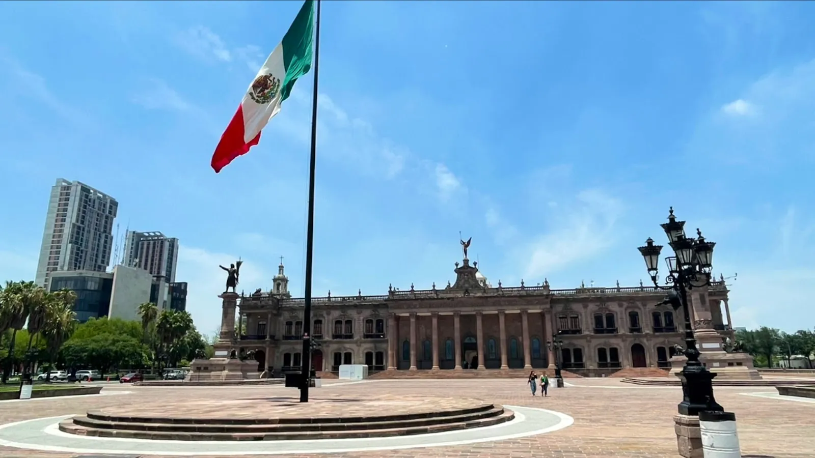
Macroplaza is the main public square of Monterrey, a 40-hectare open space in Centro that stretches about 800 meters from the Palacio de Gobierno to the Fuente de la Vida.

Macroplaza is the main public square of Monterrey, a 40-hectare open space in Centro that stretches about 800 meters from the Palacio de Gobierno to the Fuente de la Vida. Monuments, gardens and fountains line the route, among them the bronze Fuente de Neptuno and the 70-meter Faro del Comercio, which sends a green laser across the sky after dark. Street vendors, shoeshiners and musicians work the square, and the MARCO museum, the cathedral and the Museum of Mexican History are close by. The square is open around the clock.

How the square was built
Macroplaza
Macroplaza

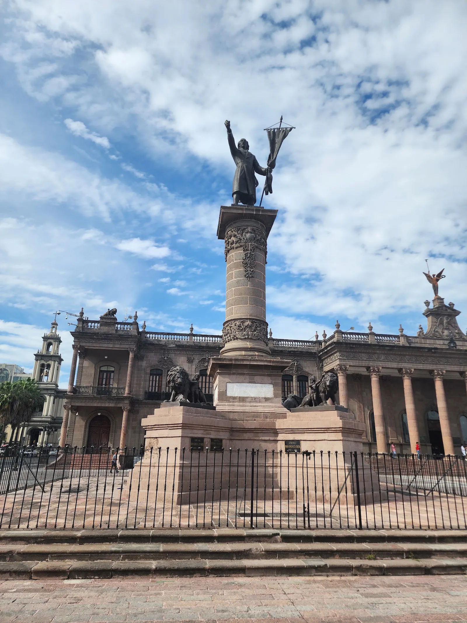
Macroplaza was built between 1984 and 1987, after a large part of the Barrio Antiguo was demolished in the early 1980s to make room for it. The square covers about 400,000 square meters, or 40 hectares, and runs roughly 800 meters from the Palacio de Gobierno to the Fuente de la Vida. It is raised above street level, with a parking garage underneath.

The modern layout explains why the square feels open and planned compared with the older streets around it. The Barrio Antiguo, with its adobe houses now used as restaurants, bars and art spaces, sits a few blocks away and is the city's oldest neighborhood.

Landmarks along the square
Macroplaza
Macroplaza

The Faro del Comercio is the easiest landmark to spot. The slim orange tower is 70 meters tall and was designed by Luis Barragán. After dark a green laser shoots from it across the city.

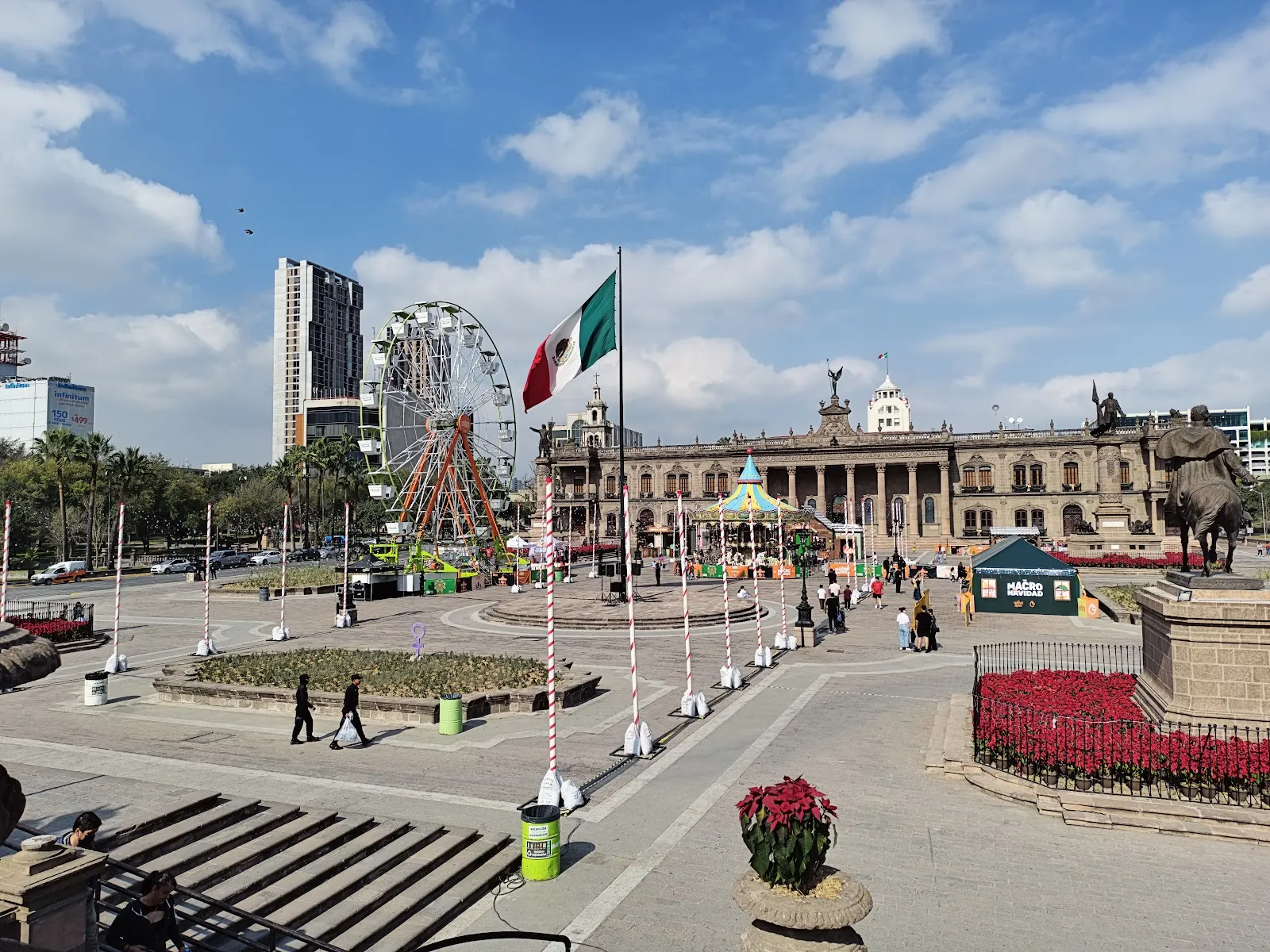
The Palacio de Gobierno is the seat of the governor of Nuevo León. It combines colonial and neoclassical styles, and its Spanish-style patio is one of the features to look for. The Fuente de Neptuno is a bronze fountain showing the Roman sea god. Among the statues and monuments are the Monumento al Trabajo and the Monumento a los Héroes de la Independencia. A modernist Central Library stands inside the plaza, and the Metropolitan Cathedral is on its edge.

The Explanada de los Héroes and the Neptune fountain are used as central points, which makes them practical places to begin a walk.

Museums and the Santa Lucia canal

The MARCO Contemporary Art Museum stands at one end of the square, and the Museum of Mexican History at the other. The history museum connects to the riverwalk and to Parque Fundidora, so the area can fill a good part of a day.

The Paseo Santa Lucia is a man-made canal about two and a half kilometers long. It links the Macroplaza to Parque Fundidora and is pleasant for a walk, especially in the evening.

Life on the square

The square is a place for everyday use as well as for events. Shoeshiners and street vendors set up here, selling food and handmade souvenirs, and musicians and fire dancers perform. Café terraces nearby offer coffee and cold drinks.

Open-air concerts and public celebrations are held around the plaza, and during major holidays and city festivals it becomes a large outdoor venue. Fiestas Patrias in September is the best-known of these. Athletic events are also held here.

Häufige Fragen

How big is Macroplaza?

It covers about 40 hectares (99 acres), or 400,000 square meters. It stretches roughly 800 meters from the Palacio de Gobierno to the Fuente de la Vida.

Is Macroplaza open at night?

Yes, it is open 24 hours every day. The Faro del Comercio projects a green laser after dark, so the evening is a good time to see it.

How long do you need at Macroplaza?

A walk through the square and its main landmarks takes a couple of hours. Add more time if you visit the museums, the cathedral or the Santa Lucia canal.

What is there to see at Macroplaza?

The main sights are the Faro del Comercio, the Palacio de Gobierno, the Fuente de Neptuno, the Monumento al Trabajo and the Explanada de los Héroes. The MARCO museum and the Museum of Mexican History are at either end.

Is there parking and wheelchair access?

There are free and paid parking lots and paid street parking. The entrance and the parking lot are wheelchair accessible.
Weitere Highlights in Monterrey

Alle entdecken