Pianifica un viaggio
Lingua: Italiano
Pianificatore di viaggiPianifica il tuo viaggio su una mappa

Le migliori destinazioni

EnglishDeutschFrançaisEspañolPortuguêsPortuguês (BR)Italiano
Avviso di viaggio · MessicoAlcuni governi sconsigliano di viaggiare in alcune zone di Messico.Gli avvisi riguardano solo queste aree: Colima, Guerrero, Sinaloa, Chiapas, Chihuahua, Strada federale 199 San Cristóbal de las Casas–Palenque, Guanajuato, a sud delle strade 43D e 45D, Regione di confine con il Guatemala, Chiapas, Parco nazionale Lagunas de Zempoala, Michoacán, Nayarit, entro 20 km dal confine con Sinaloa e Durango, Nuevo León, eccetto Monterrey, Piedras Negras, Strada 85 Monterrey–Nuevo Laredo, Sonora, Tamaulipas, Tecate, Tijuana, Regione di confine con gli Stati Uniti, Zacatecas.Le indicazioni dipendono dal tuo passaporto. Leggi quelle del tuo governo prima di prenotare.Indicazioni ufficiali
Aree con avvisi
  • Colima · evitare ogni viaggio · Canada, Germania, Francia, Regno Unito
  • Guerrero · evitare ogni viaggio · Canada, Germania, Spagna, Francia, Nuova Zelanda, Regno Unito
  • Sinaloa · evitare ogni viaggio · Canada, Germania, Spagna, Francia, Nuova Zelanda, Regno Unito
  • Chiapas · evitare i viaggi non essenziali · Canada, Spagna, Francia
  • Chihuahua · evitare i viaggi non essenziali · Canada, Francia, Regno Unito
  • Strada federale 199 San Cristóbal de las Casas–Palenque · evitare i viaggi non essenziali · Francia, Regno Unito
  • Guanajuato, a sud delle strade 43D e 45D · evitare i viaggi non essenziali · Canada, Nuova Zelanda
  • Regione di confine con il Guatemala, Chiapas · evitare i viaggi non essenziali · Germania, Francia, Nuova Zelanda
  • Parco nazionale Lagunas de Zempoala · evitare i viaggi non essenziali · Canada, Nuova Zelanda
  • Michoacán · evitare i viaggi non essenziali · Canada, Germania, Nuova Zelanda, Regno Unito
  • Nayarit, entro 20 km dal confine con Sinaloa e Durango · evitare i viaggi non essenziali · Canada, Nuova Zelanda
  • Nuevo León, eccetto Monterrey · evitare i viaggi non essenziali · Canada, Nuova Zelanda
  • Piedras Negras · evitare i viaggi non essenziali · Spagna, Francia
  • Strada 85 Monterrey–Nuevo Laredo · evitare i viaggi non essenziali · Spagna, Francia
  • Sonora · evitare i viaggi non essenziali · Canada, Nuova Zelanda
  • Tamaulipas · evitare i viaggi non essenziali · Canada, Francia, Regno Unito
  • Tecate · evitare i viaggi non essenziali · Francia, Regno Unito
  • Tijuana · evitare i viaggi non essenziali · Francia, Regno Unito
  • Regione di confine con gli Stati Uniti · evitare i viaggi non essenziali · Germania, Spagna, Francia
  • Zacatecas · evitare i viaggi non essenziali · Canada, Germania, Spagna, Francia, Regno Unito

Segnalata anche da un solo governo: Triangolo Celaya–Irapuato–Salamanca, Guanajuato (Francia), Culiacán e dintorni (Francia), A nord di Ciudad Victoria, Tamaulipas (Germania), Strada 129 Martínez de la Torre–Teziutlán (Francia), Strada 131 Tapacoyan–Perote (Francia), Strade secondarie della 180 Martínez de la Torre–Papantla (Francia), Strada 40 Monterrey–Reynosa (Francia), Sud del Michoacán, da Uruapan alla costa (Francia), Acapulco (Francia), Bassa California, eccetto Tijuana e Tecate (Francia), Ciudad Acuña (Spagna), Ciudad Juárez e dintorni (Spagna), Ciudad Obregón (Francia), Coahuila, eccetto il sud (Nuova Zelanda), Coatzacoalcos (Francia), Quartieri a nord e nord-est dello Zócalo, Città del Messico (Francia), Durango (Francia), Est del Nuevo León, al confine con Tamaulipas (Francia), Guanajuato (Spagna), Guanajuato, strada statale 45 tra León e Irapuato (Nuova Zelanda), Guanajuato, a sud-ovest della strada 45D (Regno Unito), Jalisco, entro 50 km dal confine con il Michoacán (Canada), Monclova (Spagna), Morelos (Francia), Nayarit (Francia), Nogales (Francia), Zone rurali non turistiche della Baja California (Spagna), Zone rurali non turistiche di Chihuahua (Spagna), Zone rurali non turistiche di Coahuila (Spagna), Zone rurali non turistiche di Durango (Spagna), Zone rurali non turistiche di Sonora (Spagna), Comuni del nord di Jalisco (Regno Unito), Tamaulipas settentrionale, da San Fernando al confine con gli USA (Spagna), Veracruz settentrionale, al confine con il Tamaulipas (Spagna), Veracruz settentrionale da Martínez de la Torre (Francia), Strada 150D, Puebla–Orizaba (Francia), Strada 190, Oaxaca–Santo Domingo Tehuantepec (Francia), Strade 85 e 83 Monterrey–Ciudad Victoria–Tampico (Francia), Strada 95 Città del Messico–Cuernavaca (Francia), Selva Lacandona (Francia), Sud e sud-ovest del lago di Chapala, Jalisco (Regno Unito), Sud-ovest del Jalisco e Los Altos, eccetto Puerto Vallarta (Francia), Sud-ovest del Michoacán (Francia), Sud-ovest del Tamaulipas (Francia), Sud dello stato di Guanajuato (Francia), Sud del Michoacán, a sud di Morelia (Spagna), Fascia entro 40 km dal confine con il Guatemala, Chiapas (Regno Unito), Tepic (Nuova Zelanda), Toluca (Francia), Città di Veracruz (Francia)

GovernoConsigliAggiornatoLeggi le indicazioni
Regno Unito (FCDO)No advice against the whole country (regional advisories)–Leggi le indicazioni
Stati Uniti (Dipartimento di Stato)Exercise increased caution29 mag 2026Leggi le indicazioni
Canada (Affari globali)Exercise a high degree of caution (regional advisories)–Leggi le indicazioni
Germania (Auswärtiges Amt)Besondere Vorsicht walten lassen (Sicherheitslage) (regional advisories)19 ott 2026Leggi le indicazioni
Nuova Zelanda (SafeTravel)Exercise increased caution (regional advisories)–Leggi le indicazioni
Francia (Ministero per l'Europa e gli Affari esteri)Vigilance renforcée pour le reste du pays (regional advisories)–Leggi le indicazioni

Verificato ogni giorno dalle indicazioni pubblicate dai governi; ultima verifica 2 nov 2026.RoamLedger riassume le indicazioni ufficiali; non è un consiglio di alcun governo.

Catedral
Chiesa

Guadalajara's Cathedral

Guadalajara Cathedral, formally the Catedral Basílica de la Asunción de María Santísima, stands on Avenida Alcalde in the Centro Histórico.

Guadalajara Cathedral, formally the Catedral Basílica de la Asunción de María Santísima, stands on Avenida Alcalde in the Centro Histórico. Its two yellow-tiled neo-Gothic towers rise about 65 metres and mark the city's skyline. The body of the church is Spanish Renaissance, and chapels, altars and stained glass fill the interior. Below the main altar are the crypts, where archbishops and bishops are buried. Entry is free, and the building is still an active church, so daytime services are part of the visit. Come back after dark to see the facade lit.

From an adobe church to the 1618 cathedral
Guadalajara's Cathedral

The first church on this site went up in 1541. It was made of adobe with a thatched roof, and a fire destroyed it soon after. The city had been founded in 1542, and when the Catholic see moved here in 1560, the King of Spain ordered a new cathedral.

Construction began in the 1560s and continued for roughly five decades, with the building finished in the early 17th century. The mix of styles you see today comes from that long build and from later reconstruction.

The towers and the facade
Guadalajara's Cathedral

The towers are the part everyone recognises. Earthquake damage in 1818 brought the original towers down, and the neo-Gothic pair that replaced them was built in the 19th century. They are covered in yellow tiles and are about 65 metres tall.

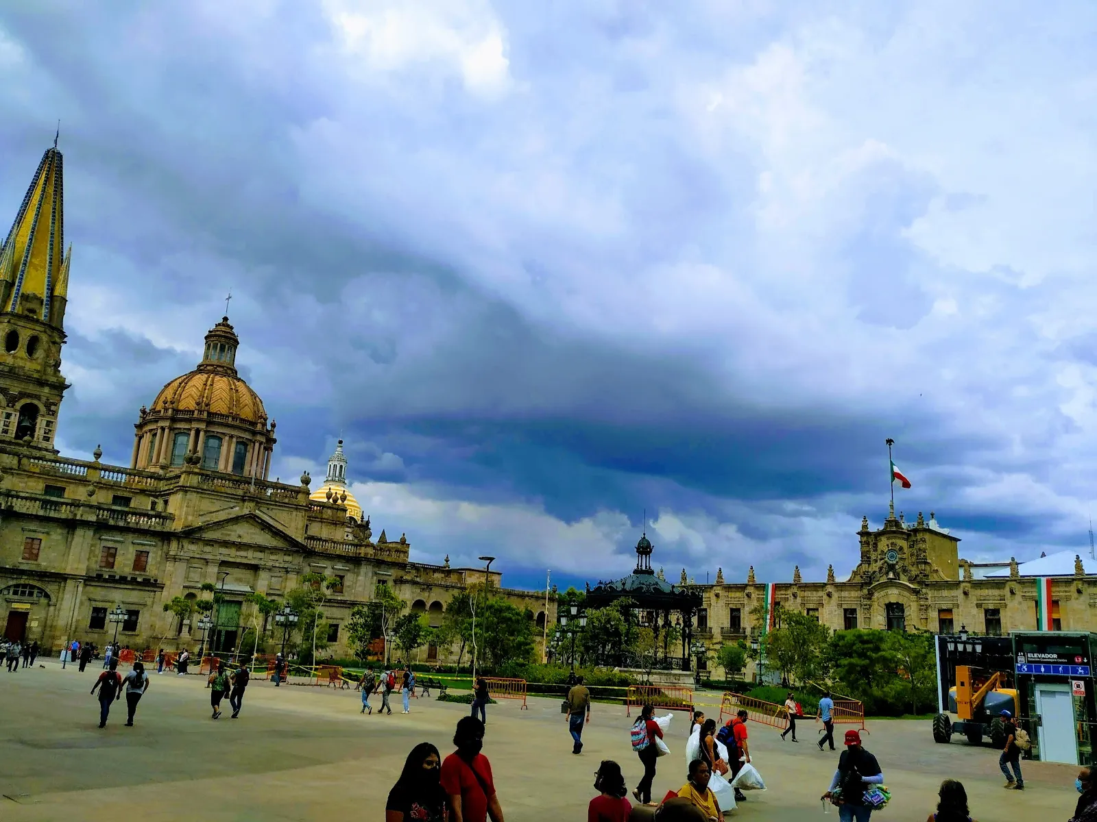
The rest of the church is Spanish Renaissance, and the facade combines elements usually described as Gothic, Baroque and Neoclassical. Because of this, the towers and the body of the building look noticeably different from each other. The cathedral faces Plaza de los Laureles, and the Plaza de Armas runs along its side.

Inside the cathedral

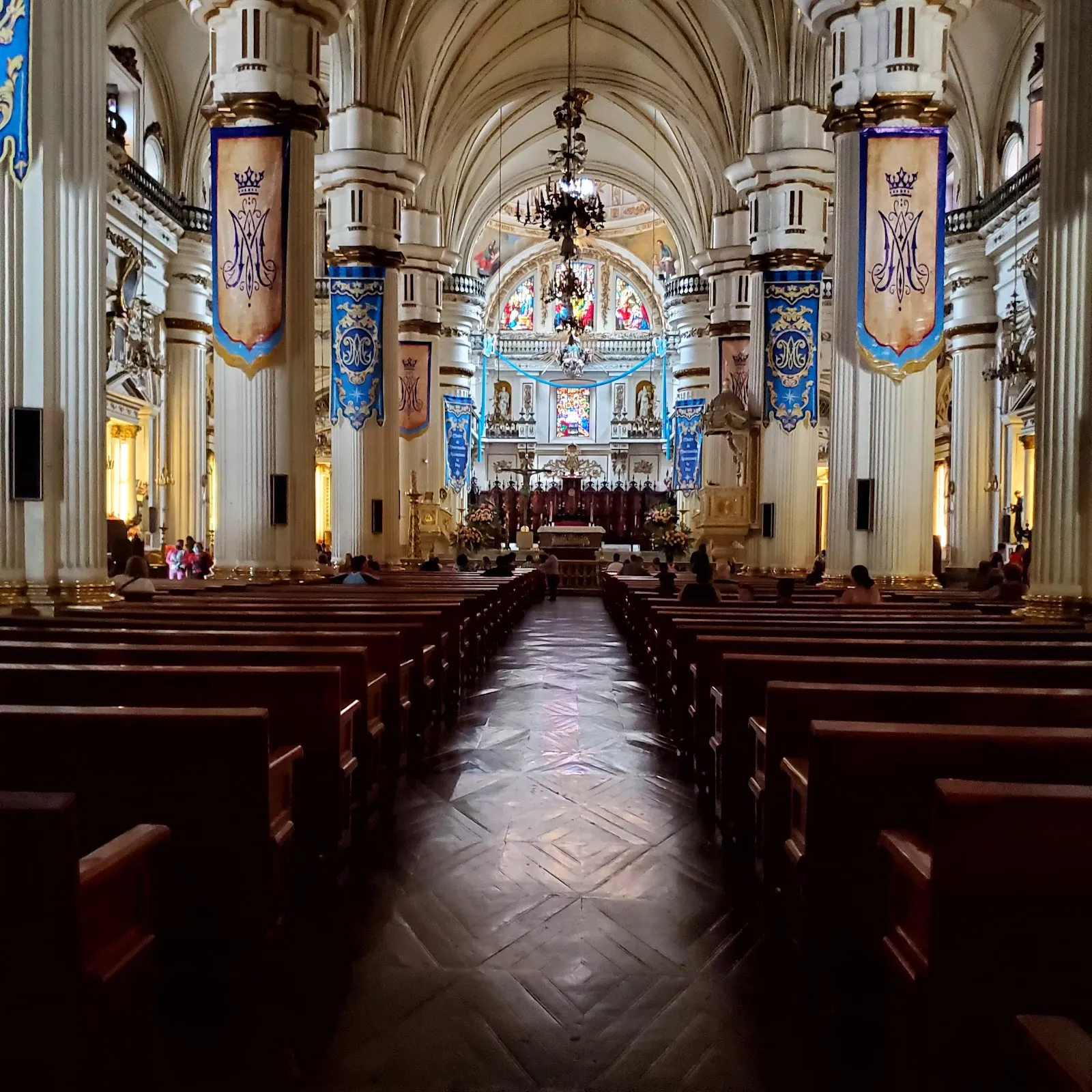
The nave is spacious and quiet, and the stained glass softens the light. Above the altar, a stained-glass Last Supper catches the daylight at the right hour. A pipe organ is still in use, and the acoustics are noticeable when a service or wedding is under way.

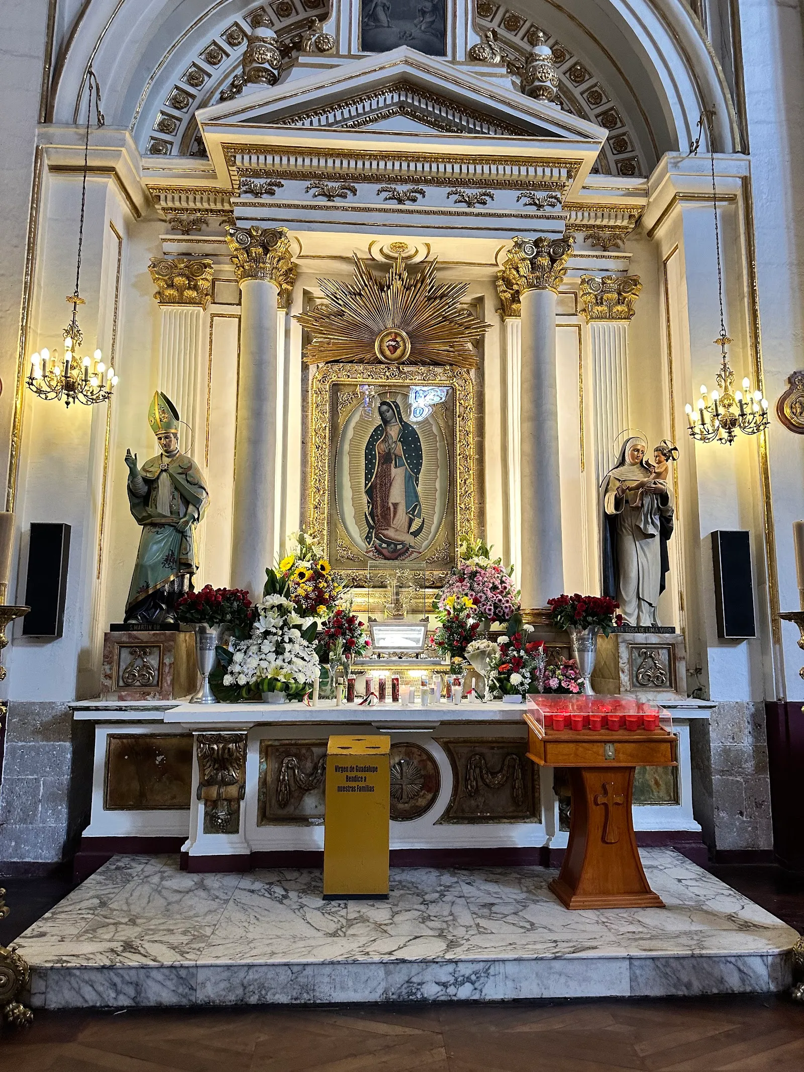
Several chapels hold paintings attributed to Cristóbal de Villalpando, Miguel Cabrera and Murillo. The cathedral also keeps a martyr's relic, a sculpture of the Virgen de la Rosa and the remains of Santa Inocencia.

Beneath the main altar are the crypts. The archbishops and other church leaders of the diocese rest there.

The plaza and the evening

The cathedral sits among plazas, and the surrounding area is a place to sit and watch the city. Mariachi music plays nearby, and street vendors work around the Plaza de Armas. Churches around the centre ring their bells, so the soundscape is lively by day.

After dark the building is lit, and the plaza is lit in colour. On some nights a history show is projected onto the cathedral walls, so an evening visit adds something even if you saw the interior earlier in the day.

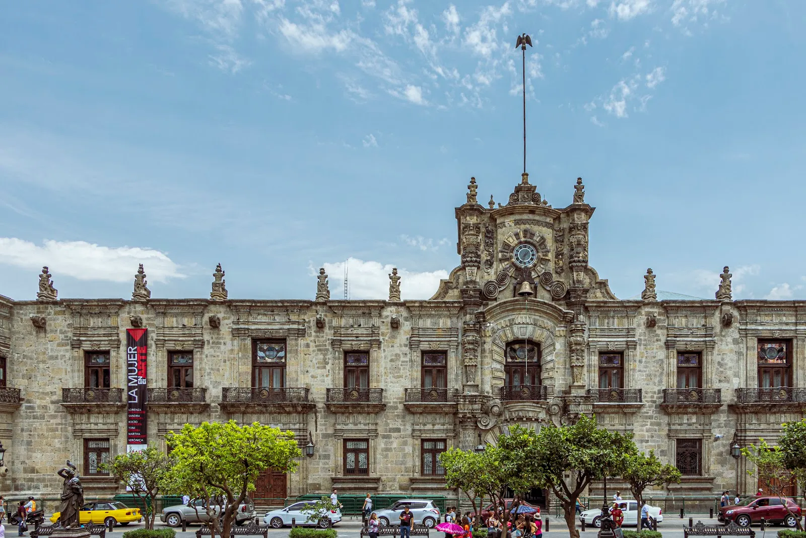
The Palacio de Gobierno, with Orozco murals inside, and the Teatro Degollado are both close by on foot.

FAQ

Is there an entry fee for Guadalajara Cathedral?

No. Visitors can go inside for free, or simply enjoy the building from the plaza.

Where is Guadalajara Cathedral?

It is at Av. Alcalde 10 in the Zona Centro, in the Centro Histórico. The Plaza de Armas is beside it and the Plaza de los Laureles is in front.

Can you see the crypts?

Yes. The crypts lie beneath the main altar and hold the remains of archbishops and bishops.

Is the cathedral lit at night?

Yes. The building is lit in the evening, and the plaza has coloured lights. On some nights a history show is projected onto the walls.

Is there wheelchair access?

The cathedral has a wheelchair accessible entrance and a wheelchair accessible parking lot.

Altre attrazioni imperdibili a Guadalajara

Esplora tutto