Pianifica un viaggio
Lingua: Italiano
Pianificatore di viaggiPianifica il tuo viaggio su una mappa

Le migliori destinazioni

EnglishDeutschFrançaisEspañolPortuguêsPortuguês (BR)Italiano
Avviso di viaggio · BrasileSalvador si trova in o vicino a un'area per cui i governi sconsigliano ogni viaggio non essenziale: Favelas.Le indicazioni dipendono dal tuo passaporto. Leggi quelle del tuo governo prima di prenotare.Indicazioni ufficiali
Aree con avvisi
  • Ceilândia · evitare i viaggi non essenziali · Italia, Stati Uniti
  • Favelas · evitare i viaggi non essenziali · Germania, Spagna, Nuova Zelanda, Stati Uniti
  • Paranoá · evitare i viaggi non essenziali · Italia, Stati Uniti
  • Santa Maria · evitare i viaggi non essenziali · Italia, Stati Uniti
  • São Sebastião · evitare i viaggi non essenziali · Italia, Stati Uniti
  • Area di confine con il Venezuela · evitare i viaggi non essenziali · Germania, Francia

Segnalata anche da un solo governo: Fascia di 160 km lungo i confini terrestri del Brasile (Stati Uniti), Complexo da Maré (Canada), Complexo da Penha (Canada), Fascia di 20 km lungo il confine con la Bolivia (escluso il Parco Nazionale del Pantanal) (Canada), Fascia di 20 km lungo il confine con la Colombia (Canada), Fascia di 20 km lungo il confine con la Guyana francese (Canada), Fascia di 20 km lungo il confine con la Guyana (Canada), Fascia di 20 km lungo il confine con il Paraguay (Canada), Fascia di 20 km lungo il confine con il Perù (Canada), Fascia di 20 km lungo il confine con il Suriname (Canada), Fascia di 50 km lungo il confine con il Venezuela (Canada), Fiume Amazonas e affluenti, Stato dell'Amazonas (tra Codajás e Belém do Solimões) (Regno Unito), Zone di confine (non specificate) (Francia), Parco Nazionale della Chapada Diamantina (Trilha do 21) (Spagna), Planaltina (Italia), Samambaia (Italia)

GovernoConsigliAggiornatoLeggi le indicazioni
Regno Unito (FCDO)No advice against the whole country (regional advisories)–Leggi le indicazioni
Stati Uniti (Dipartimento di Stato)Exercise increased caution (regional advisories)31 ago 2026Leggi le indicazioni
Canada (Affari globali)Exercise a high degree of caution (regional advisories)–Leggi le indicazioni
Germania (Auswärtiges Amt)No advice against the whole country (regional advisories)27 ott 2026Leggi le indicazioni
Nuova Zelanda (SafeTravel)Exercise increased caution due to high crime rates (regional advisories)–Leggi le indicazioni
Francia (Ministero per l'Europa e gli Affari esteri)Vigilance renforcée (pays à risque) (regional advisories)–Leggi le indicazioni

Verificato ogni giorno dalle indicazioni pubblicate dai governi; ultima verifica 2 nov 2026.RoamLedger riassume le indicazioni ufficiali; non è un consiglio di alcun governo.

a view of a harbor with boats in the water
Luogo simbolo

Elevador Lacerda

Elevador Lacerda is a public lift linking Cidade Baixa, Salvador’s lower city, with Cidade Alta and the historic centre above.

Elevador Lacerda is a public lift linking Cidade Baixa, Salvador’s lower city, with Cidade Alta and the historic centre above. Opened in 1873, it remains a useful way to travel between the two levels, with the ride taking about 30 seconds. From the upper platform at Praça Tomé de Souza, look across the lower city and Baía de Todos os Santos. Take the lift as part of a visit to Pelourinho or Mercado Modelo, and allow time to stop for the view.

A lift between Salvador’s two levels
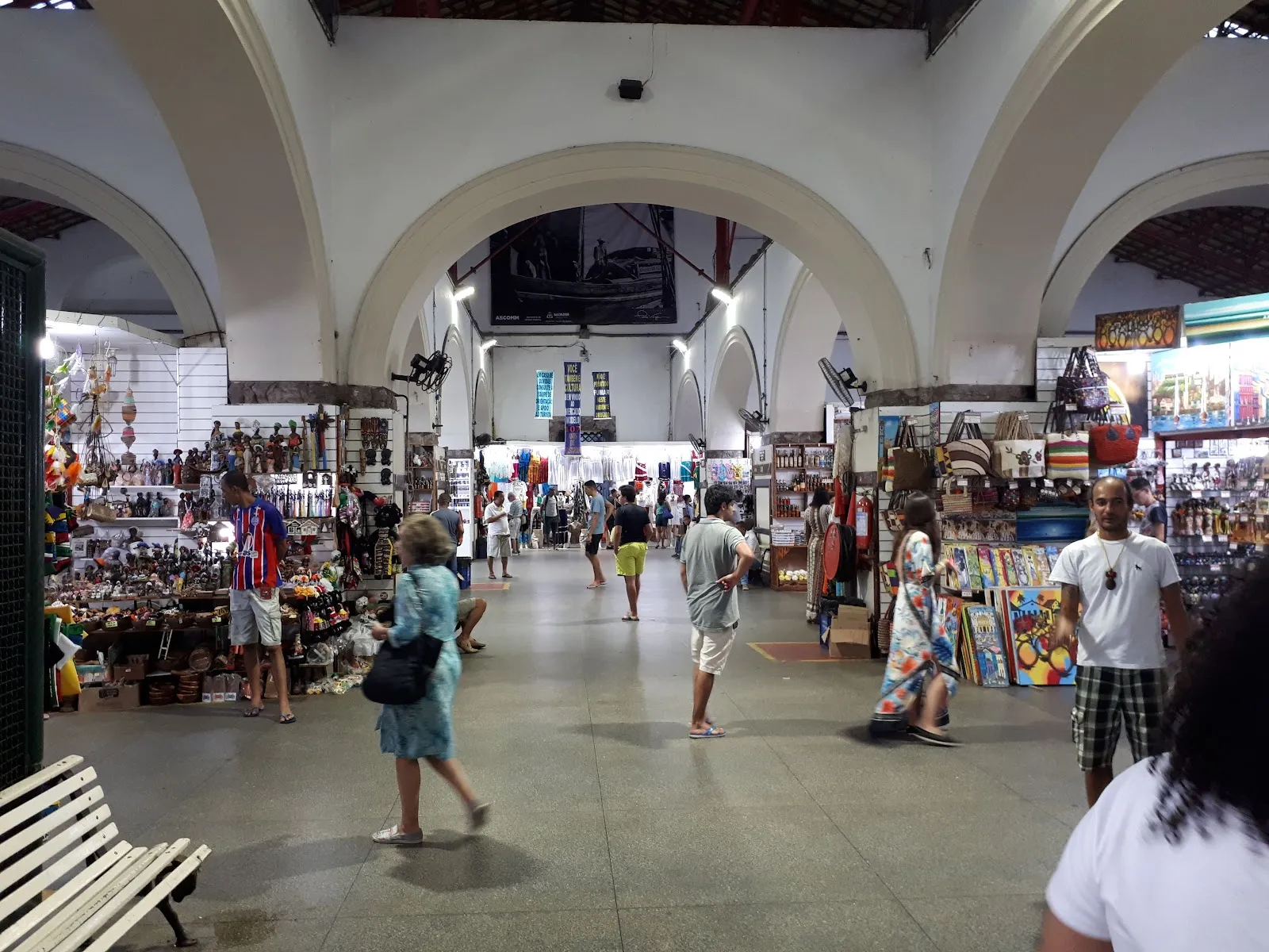
Elevador Lacerda
Elevador Lacerda

Salvador is built across an upper and a lower level. The Elevador Lacerda links Cidade Alta, where the historic centre and Pelourinho sit, with Cidade Baixa, near the harbour and Mercado Modelo. It is part of the city’s public transport system, so the ride is both a practical connection and a way to see one of Salvador’s best-known landmarks up close.

The lift opened in 1873. It was first operated hydraulically, then converted to electric operation in 1906. The structure was renovated in 1930, when it took on the Art Deco design seen today. Accounts differ on details of the lift’s earlier beginnings, so the clearest point in its documented history is its public opening in 1873.

The ride and the view
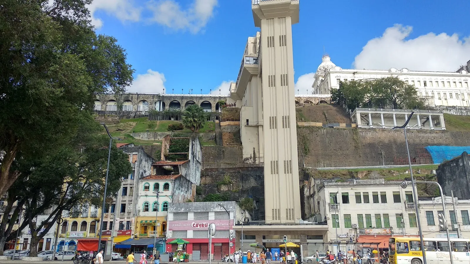
Elevador Lacerda
Elevador Lacerda

The elevator travels about 72 metres between the two levels, with the journey taking roughly 30 seconds. At the upper end, the platform at Praça Tomé de Souza gives a view over the lower town and Baía de Todos os Santos. Pause here to look out across the harbour and the surrounding city, or take photographs from above.

The lift can also help shape a walking route. From the lower city, ride up towards Pelourinho and the historic centre. From Cidade Alta, descend towards Comércio and Mercado Modelo. The lift saves the steep walk between the districts, though walking remains an option if a queue is long.

Making the stop

Treat the Elevador Lacerda as a short stop on the way between sights rather than a destination that needs a long visit. The ride itself is brief; the upper platform is where you can spend extra time with the view. Around sunset is a good time to pair the stop with a nearby ice cream.

The entrance is a busy tourist area. People may approach with ribbons, necklaces or other souvenirs, sometimes presenting them as free before asking for payment. A clear, polite refusal can prevent an unwanted purchase. Keep valuables discreet while moving through the crowds.

FAQ

What does the Elevador Lacerda connect?

It links Cidade Alta, including Salvador’s historic centre, with Cidade Baixa near the harbour and Mercado Modelo.

How long is the ride?

The journey between the upper and lower city takes about 30 seconds.

Is the Elevador Lacerda still used for transport?

Yes. It is a public elevator used to travel between Salvador’s upper and lower districts.

When is a good time to visit?

Around sunset is a good time to see the bay from the upper platform and stop for ice cream nearby.

Altre attrazioni imperdibili a Salvador

Esplora tutto