Reise planen
Sprache: Deutsch
ReiseplanerPlane deine Reise auf einer Karte

Top-Reiseziele

EnglishDeutschFrançaisEspañolPortuguêsPortuguês (BR)Italiano
Reisehinweis · MexikoEinige Regierungen raten von Reisen in Teile von Mexiko ab.Die Warnungen gelten nur für diese Gebiete: Colima, Guerrero, Sinaloa, Chiapas, Chihuahua, Bundesstraße 199 San Cristóbal de las Casas–Palenque, Guanajuato, südlich der Schnellstraßen 43D und 45D, Grenzgebiet zu Guatemala, Chiapas, Nationalpark Lagunas de Zempoala, Michoacán, Nayarit, innerhalb von 20 km zur Grenze zu Sinaloa und Durango, Nuevo León, außer Monterrey, Piedras Negras, Route 85 Monterrey–Nuevo Laredo, Sonora, Tamaulipas, Tecate, Tijuana, Grenzregion zu den USA, Zacatecas.Die Empfehlung hängt von Ihrem Reisepass ab. Lesen Sie vor der Buchung die Hinweise Ihrer eigenen Regierung.Offizielle Hinweise
Gebiete mit Warnungen
  • Colima · alle Reisen vermeiden · Kanada, Deutschland, Frankreich, Vereinigtes Königreich
  • Guerrero · alle Reisen vermeiden · Kanada, Deutschland, Spanien, Frankreich, Neuseeland, Vereinigtes Königreich
  • Sinaloa · alle Reisen vermeiden · Kanada, Deutschland, Spanien, Frankreich, Neuseeland, Vereinigtes Königreich
  • Chiapas · nicht notwendige Reisen vermeiden · Kanada, Spanien, Frankreich
  • Chihuahua · nicht notwendige Reisen vermeiden · Kanada, Frankreich, Vereinigtes Königreich
  • Bundesstraße 199 San Cristóbal de las Casas–Palenque · nicht notwendige Reisen vermeiden · Frankreich, Vereinigtes Königreich
  • Guanajuato, südlich der Schnellstraßen 43D und 45D · nicht notwendige Reisen vermeiden · Kanada, Neuseeland
  • Grenzgebiet zu Guatemala, Chiapas · nicht notwendige Reisen vermeiden · Deutschland, Frankreich, Neuseeland
  • Nationalpark Lagunas de Zempoala · nicht notwendige Reisen vermeiden · Kanada, Neuseeland
  • Michoacán · nicht notwendige Reisen vermeiden · Kanada, Deutschland, Neuseeland, Vereinigtes Königreich
  • Nayarit, innerhalb von 20 km zur Grenze zu Sinaloa und Durango · nicht notwendige Reisen vermeiden · Kanada, Neuseeland
  • Nuevo León, außer Monterrey · nicht notwendige Reisen vermeiden · Kanada, Neuseeland
  • Piedras Negras · nicht notwendige Reisen vermeiden · Spanien, Frankreich
  • Route 85 Monterrey–Nuevo Laredo · nicht notwendige Reisen vermeiden · Spanien, Frankreich
  • Sonora · nicht notwendige Reisen vermeiden · Kanada, Neuseeland
  • Tamaulipas · nicht notwendige Reisen vermeiden · Kanada, Frankreich, Vereinigtes Königreich
  • Tecate · nicht notwendige Reisen vermeiden · Frankreich, Vereinigtes Königreich
  • Tijuana · nicht notwendige Reisen vermeiden · Frankreich, Vereinigtes Königreich
  • Grenzregion zu den USA · nicht notwendige Reisen vermeiden · Deutschland, Spanien, Frankreich
  • Zacatecas · nicht notwendige Reisen vermeiden · Kanada, Deutschland, Spanien, Frankreich, Vereinigtes Königreich

Außerdem von einer Regierung genannt: Dreieck Celaya–Irapuato–Salamanca, Guanajuato (Frankreich), Culiacán und Umgebung (Frankreich), Norden von Ciudad Victoria, Tamaulipas (Deutschland), Straße 129 Martínez de la Torre–Teziutlán (Frankreich), Straße 131 Tapacoyan–Perote (Frankreich), Nebenstraßen der 180 Martínez de la Torre–Papantla (Frankreich), Straße 40 Monterrey–Reynosa (Frankreich), Süden von Michoacán, von Uruapan bis zur Küste (Frankreich), Acapulco (Frankreich), Baja California, außer Tijuana und Tecate (Frankreich), Ciudad Acuña (Spanien), Ciudad Juárez und Umgebung (Spanien), Ciudad Obregón (Frankreich), Coahuila, außer dem Süden (Neuseeland), Coatzacoalcos (Frankreich), Viertel nördlich und nordöstlich des Zócalo, Mexiko-Stadt (Frankreich), Durango (Frankreich), Osten von Nuevo León, an Tamaulipas grenzend (Frankreich), Guanajuato (Spanien), Guanajuato, Schnellstraße 45 zwischen León und Irapuato (Neuseeland), Guanajuato, südwestlich der Schnellstraße 45D (Vereinigtes Königreich), Jalisco, innerhalb von 50 km zur Grenze zu Michoacán (Kanada), Monclova (Spanien), Morelos (Frankreich), Nayarit (Frankreich), Nogales (Frankreich), Abgelegene ländliche Gebiete von Baja California (Spanien), Abgelegene ländliche Gebiete von Chihuahua (Spanien), Abgelegene ländliche Gebiete von Coahuila (Spanien), Abgelegene ländliche Gebiete von Durango (Spanien), Abgelegene ländliche Gebiete von Sonora (Spanien), Nördliche Gemeinden von Jalisco (Vereinigtes Königreich), Nördliches Tamaulipas, von San Fernando bis zur US-Grenze (Spanien), Nördliches Veracruz an der Grenze zu Tamaulipas (Spanien), Nördliches Veracruz ab Martínez de la Torre (Frankreich), Straße 150D, Puebla–Orizaba (Frankreich), Straße 190, Oaxaca–Santo Domingo Tehuantepec (Frankreich), Route 85 und 83 Monterrey–Ciudad Victoria–Tampico (Frankreich), Route 95 Mexiko-Stadt–Cuernavaca (Frankreich), Selva Lacandona (Frankreich), Süden und Südwesten des Chapala-Sees, Jalisco (Vereinigtes Königreich), Südwesten Jaliscos und Los Altos, außer Puerto Vallarta (Frankreich), Südwesten von Michoacán (Frankreich), Südwesten von Tamaulipas (Frankreich), Süden des Bundesstaates Guanajuato (Frankreich), Süden von Michoacán, südlich von Morelia (Spanien), Streifen bis 40 km von der guatemaltekischen Grenze, Chiapas (Vereinigtes Königreich), Tepic (Neuseeland), Toluca (Frankreich), Stadt Veracruz (Frankreich)

RegierungHinweiseAktualisiertHinweise lesen
Vereinigtes Königreich (FCDO)No advice against the whole country (regional advisories)–Hinweise lesen
Vereinigte Staaten (State Dept)Exercise increased caution29. Mai 2026Hinweise lesen
Kanada (Global Affairs)Exercise a high degree of caution (regional advisories)–Hinweise lesen
Deutschland (Auswärtiges Amt)Besondere Vorsicht walten lassen (Sicherheitslage) (regional advisories)19. Okt. 2026Hinweise lesen
Neuseeland (SafeTravel)Exercise increased caution (regional advisories)–Hinweise lesen
Frankreich (Ministerium für Europa und Auswärtige Angelegenheiten)Vigilance renforcée pour le reste du pays (regional advisories)–Hinweise lesen

Täglich anhand der veröffentlichten Hinweise der Regierungen geprüft; zuletzt geprüft am 3. Nov. 2026.RoamLedger fasst offizielle Hinweise zusammen; es handelt sich nicht um Empfehlungen einer Regierung.

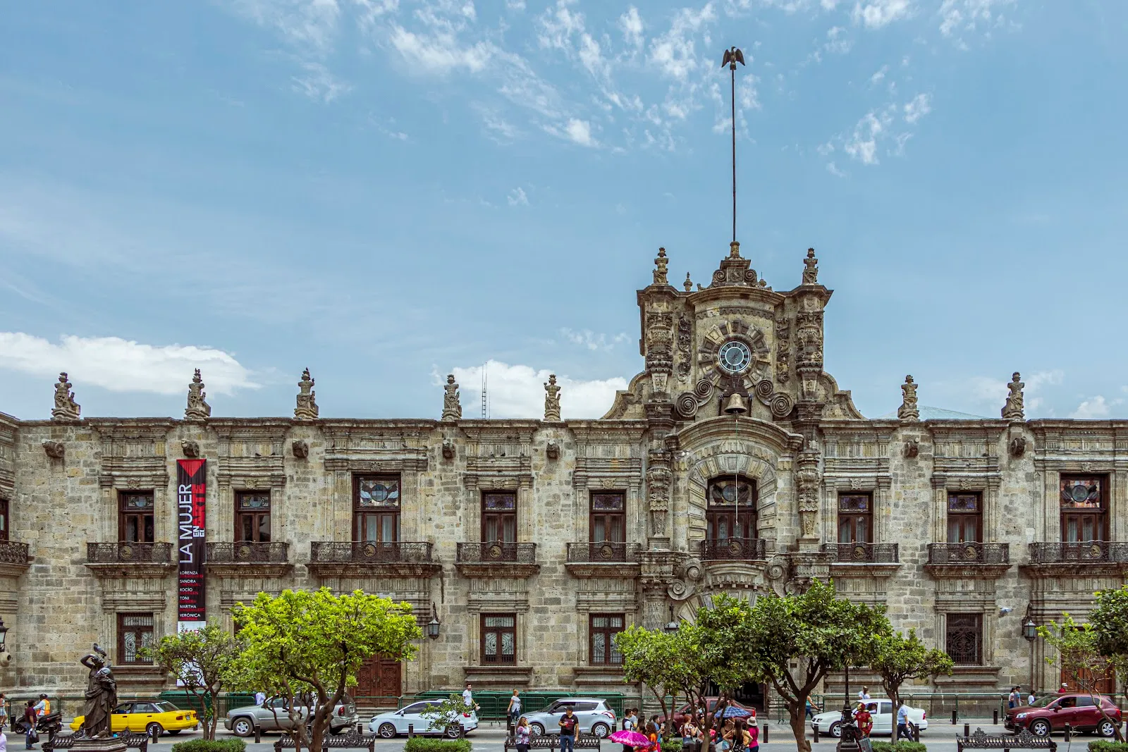
A corner of the instituto zapopan building
Museum

Cabañas Museum

The Cabañas Museum occupies the Hospicio Cabañas, a neoclassical complex at the eastern end of Plaza Tapatía in Guadalajara.

The Cabañas Museum occupies the Hospicio Cabañas, a neoclassical complex at the eastern end of Plaza Tapatía in Guadalajara. It was built to shelter orphans, the elderly and the sick, and it has been a UNESCO World Heritage Site since 1997. The main reason to go is José Clemente Orozco's murals in the Capilla Mayor, including El Hombre de Fuego in the dome. Around the chapel, low buildings open onto courtyards, and rotating exhibitions fill the rooms. The vaulted ceilings and quiet patios make for an unhurried visit.

From hospice to cultural institute

The Hospicio Cabañas was founded to care for people in need: orphans, the elderly, people with disabilities and the chronically ill. Bishop Juan Cruz Ruiz de Cabañas y Crespo founded it, and the building took his name. Until 1980 it kept working as a hospital. That year the Cabañas Cultural Institute moved in, along with affiliated schools of arts and crafts.

Today the complex is a place for exhibitions and cultural events. Each February, around the 14th, the GDLUZ festival uses it as one of its venues for about three days, together with the cathedral, Liberation Square and the Degollado Theater.

The building and its courtyards

The complex is neoclassical and monumental in scale, covering 2.34 hectares. Its plan is rectangular, and single-story buildings are arranged around open spaces. There are more than 20 patios, and arches, domes and a large courtyard give the interior an open, airy feel. The scale also explains the quiet: the visitor traffic spreads out, and some corners are often empty.

In the interior courtyards you will find works by the French conceptual artist Daniel Buren. They sit within an 18th and 19th century structure, and the contrast is part of the visit. The museum stands at the eastern end of Plaza Tapatía, one block from Mercado Libertad. Mercado San Juan de Dios, the large indoor market, is also close.

Orozco in the Capilla Mayor

The chapel is the part of the visit that most people come for. Orozco painted the ceiling and dome of the Capilla Mayor with modernist murals, and the series ranks among his best work. The paintings are political and strongly coloured, and they contrast with the calm neoclassical chapel around them. In all, he painted 57 frescoes here between 1937 and 1939.

The best-known image is El Hombre de Fuego, the Man of Fire, in the dome. Because it is overhead, the chapel provides benches, and many visitors lie back on them to take it in. The museum also holds around 340 other pieces by Orozco, including easel paintings, as well as works by other leading contemporary Mexican artists.

Exhibition rooms

The galleries change over time. Rotating photography exhibitions fill some of them, and the Sala Sampietro presents the posthumous work of Fernando Sampietro. Since the programme changes, the exhibitions are an extra on top of the building and the murals. The museum's website lists current shows.

Häufige Fragen

Is the Cabañas Museum free?

Entry is free on Tuesdays. For ticket prices on other days, check the museum's official website.

What days is the Cabañas Museum open?

It is open Tuesday to Sunday in the daytime and closed on Mondays.

What is the main thing to see at the Cabañas Museum?

The Orozco murals in the Capilla Mayor, above all El Hombre de Fuego in the dome. The 57 frescoes were painted between 1937 and 1939.

Where is the Cabañas Museum?

It is at Calle Cabañas 8, at the eastern end of Plaza Tapatía in Guadalajara's historic centre. Mercado Libertad is one block away.

How long do you need at the Cabañas Museum?

Plan on 1 to 3 hours. The complex is large and has more than 20 patios, so allow longer if you want to see the exhibition rooms as well as the chapel.

Weitere Highlights in Guadalajara

Alle entdecken