Reise planen
Sprache: Deutsch
ReiseplanerPlane deine Reise auf einer Karte

Top-Reiseziele

EnglishDeutschFrançaisEspañolPortuguêsPortuguês (BR)Italiano
Reisehinweis · MexikoEinige Regierungen raten von Reisen in Teile von Mexiko ab.Die Warnungen gelten nur für diese Gebiete: Colima, Guerrero, Sinaloa, Chiapas, Chihuahua, Bundesstraße 199 San Cristóbal de las Casas–Palenque, Guanajuato, südlich der Schnellstraßen 43D und 45D, Grenzgebiet zu Guatemala, Chiapas, Nationalpark Lagunas de Zempoala, Michoacán, Nayarit, innerhalb von 20 km zur Grenze zu Sinaloa und Durango, Nuevo León, außer Monterrey, Piedras Negras, Route 85 Monterrey–Nuevo Laredo, Sonora, Tamaulipas, Tecate, Tijuana, Grenzregion zu den USA, Zacatecas.Die Empfehlung hängt von Ihrem Reisepass ab. Lesen Sie vor der Buchung die Hinweise Ihrer eigenen Regierung.Offizielle Hinweise
Gebiete mit Warnungen
  • Colima · alle Reisen vermeiden · Kanada, Deutschland, Frankreich, Vereinigtes Königreich
  • Guerrero · alle Reisen vermeiden · Kanada, Deutschland, Spanien, Frankreich, Neuseeland, Vereinigtes Königreich
  • Sinaloa · alle Reisen vermeiden · Kanada, Deutschland, Spanien, Frankreich, Neuseeland, Vereinigtes Königreich
  • Chiapas · nicht notwendige Reisen vermeiden · Kanada, Spanien, Frankreich
  • Chihuahua · nicht notwendige Reisen vermeiden · Kanada, Frankreich, Vereinigtes Königreich
  • Bundesstraße 199 San Cristóbal de las Casas–Palenque · nicht notwendige Reisen vermeiden · Frankreich, Vereinigtes Königreich
  • Guanajuato, südlich der Schnellstraßen 43D und 45D · nicht notwendige Reisen vermeiden · Kanada, Neuseeland
  • Grenzgebiet zu Guatemala, Chiapas · nicht notwendige Reisen vermeiden · Deutschland, Frankreich, Neuseeland
  • Nationalpark Lagunas de Zempoala · nicht notwendige Reisen vermeiden · Kanada, Neuseeland
  • Michoacán · nicht notwendige Reisen vermeiden · Kanada, Deutschland, Neuseeland, Vereinigtes Königreich
  • Nayarit, innerhalb von 20 km zur Grenze zu Sinaloa und Durango · nicht notwendige Reisen vermeiden · Kanada, Neuseeland
  • Nuevo León, außer Monterrey · nicht notwendige Reisen vermeiden · Kanada, Neuseeland
  • Piedras Negras · nicht notwendige Reisen vermeiden · Spanien, Frankreich
  • Route 85 Monterrey–Nuevo Laredo · nicht notwendige Reisen vermeiden · Spanien, Frankreich
  • Sonora · nicht notwendige Reisen vermeiden · Kanada, Neuseeland
  • Tamaulipas · nicht notwendige Reisen vermeiden · Kanada, Frankreich, Vereinigtes Königreich
  • Tecate · nicht notwendige Reisen vermeiden · Frankreich, Vereinigtes Königreich
  • Tijuana · nicht notwendige Reisen vermeiden · Frankreich, Vereinigtes Königreich
  • Grenzregion zu den USA · nicht notwendige Reisen vermeiden · Deutschland, Spanien, Frankreich
  • Zacatecas · nicht notwendige Reisen vermeiden · Kanada, Deutschland, Spanien, Frankreich, Vereinigtes Königreich

Außerdem von einer Regierung genannt: Dreieck Celaya–Irapuato–Salamanca, Guanajuato (Frankreich), Culiacán und Umgebung (Frankreich), Norden von Ciudad Victoria, Tamaulipas (Deutschland), Straße 129 Martínez de la Torre–Teziutlán (Frankreich), Straße 131 Tapacoyan–Perote (Frankreich), Nebenstraßen der 180 Martínez de la Torre–Papantla (Frankreich), Straße 40 Monterrey–Reynosa (Frankreich), Süden von Michoacán, von Uruapan bis zur Küste (Frankreich), Acapulco (Frankreich), Baja California, außer Tijuana und Tecate (Frankreich), Ciudad Acuña (Spanien), Ciudad Juárez und Umgebung (Spanien), Ciudad Obregón (Frankreich), Coahuila, außer dem Süden (Neuseeland), Coatzacoalcos (Frankreich), Viertel nördlich und nordöstlich des Zócalo, Mexiko-Stadt (Frankreich), Durango (Frankreich), Osten von Nuevo León, an Tamaulipas grenzend (Frankreich), Guanajuato (Spanien), Guanajuato, Schnellstraße 45 zwischen León und Irapuato (Neuseeland), Guanajuato, südwestlich der Schnellstraße 45D (Vereinigtes Königreich), Jalisco, innerhalb von 50 km zur Grenze zu Michoacán (Kanada), Monclova (Spanien), Morelos (Frankreich), Nayarit (Frankreich), Nogales (Frankreich), Abgelegene ländliche Gebiete von Baja California (Spanien), Abgelegene ländliche Gebiete von Chihuahua (Spanien), Abgelegene ländliche Gebiete von Coahuila (Spanien), Abgelegene ländliche Gebiete von Durango (Spanien), Abgelegene ländliche Gebiete von Sonora (Spanien), Nördliche Gemeinden von Jalisco (Vereinigtes Königreich), Nördliches Tamaulipas, von San Fernando bis zur US-Grenze (Spanien), Nördliches Veracruz an der Grenze zu Tamaulipas (Spanien), Nördliches Veracruz ab Martínez de la Torre (Frankreich), Straße 150D, Puebla–Orizaba (Frankreich), Straße 190, Oaxaca–Santo Domingo Tehuantepec (Frankreich), Route 85 und 83 Monterrey–Ciudad Victoria–Tampico (Frankreich), Route 95 Mexiko-Stadt–Cuernavaca (Frankreich), Selva Lacandona (Frankreich), Süden und Südwesten des Chapala-Sees, Jalisco (Vereinigtes Königreich), Südwesten Jaliscos und Los Altos, außer Puerto Vallarta (Frankreich), Südwesten von Michoacán (Frankreich), Südwesten von Tamaulipas (Frankreich), Süden des Bundesstaates Guanajuato (Frankreich), Süden von Michoacán, südlich von Morelia (Spanien), Streifen bis 40 km von der guatemaltekischen Grenze, Chiapas (Vereinigtes Königreich), Tepic (Neuseeland), Toluca (Frankreich), Stadt Veracruz (Frankreich)

RegierungHinweiseAktualisiertHinweise lesen
Vereinigtes Königreich (FCDO)No advice against the whole country (regional advisories)–Hinweise lesen
Vereinigte Staaten (State Dept)Exercise increased caution29. Mai 2026Hinweise lesen
Kanada (Global Affairs)Exercise a high degree of caution (regional advisories)–Hinweise lesen
Deutschland (Auswärtiges Amt)Besondere Vorsicht walten lassen (Sicherheitslage) (regional advisories)19. Okt. 2026Hinweise lesen
Neuseeland (SafeTravel)Exercise increased caution (regional advisories)–Hinweise lesen
Frankreich (Ministerium für Europa und Auswärtige Angelegenheiten)Vigilance renforcée pour le reste du pays (regional advisories)–Hinweise lesen

Täglich anhand der veröffentlichten Hinweise der Regierungen geprüft; zuletzt geprüft am 2. Nov. 2026.RoamLedger fasst offizielle Hinweise zusammen; es handelt sich nicht um Empfehlungen einer Regierung.

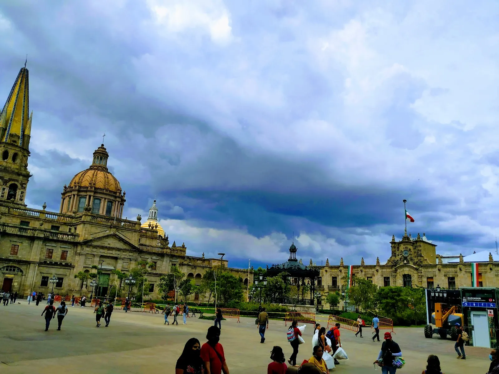
a large church with a clock tower on top of it
Wahrzeichen

Plaza de la Liberación

Plaza de la Liberación is the central square of Guadalajara, Jalisco, set between the cathedral on the west and the Teatro Degollado on the east.

Plaza de la Liberación is the central square of Guadalajara, Jalisco, set between the cathedral on the west and the Teatro Degollado on the east. Locals also call it Plaza de las Dos Copas, after its two fountains shaped like cups. The square is open at all hours, so you can see the historic center in daylight or after dark. Sunday afternoons bring magicians, mimes, musicians and street vendors. The bronze monument of Miguel Hidalgo breaking the chains of slavery marks the square's link to the abolition of slavery in Mexico.

Abolition of slavery and the Hidalgo monument
Plaza de la Liberación

The square's main monument makes its meaning clear. A bronze statue shows Miguel Hidalgo y Costilla, known as the father of Mexican independence, breaking the chains of slavery.

Hidalgo signed the decree abolishing slavery in Mexico in Guadalajara in 1810. The plaza itself was built in 1952 by Ignacio Díaz Morales to remember that abolition.

The buildings around the square
Plaza de la Liberación

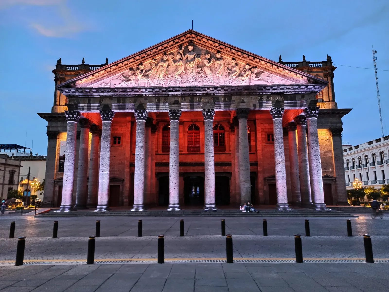
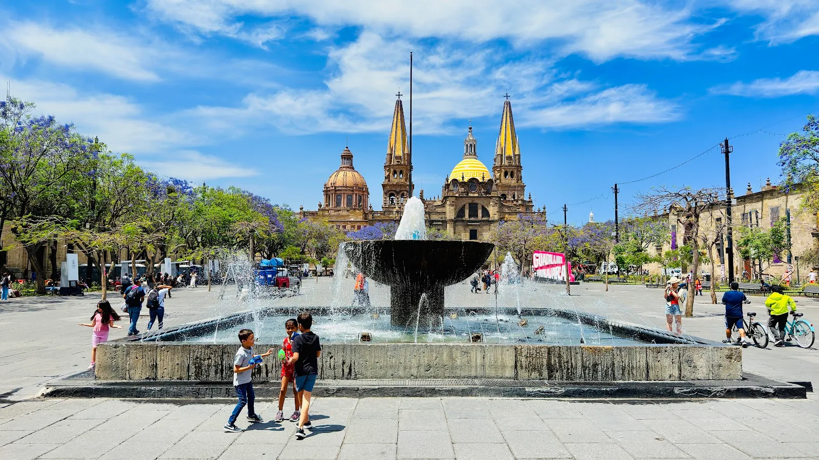
The square runs from the Guadalajara Cathedral on the west to the Teatro Degollado on the east. The cathedral's towers are Neo-Gothic, while its façade is more baroque.

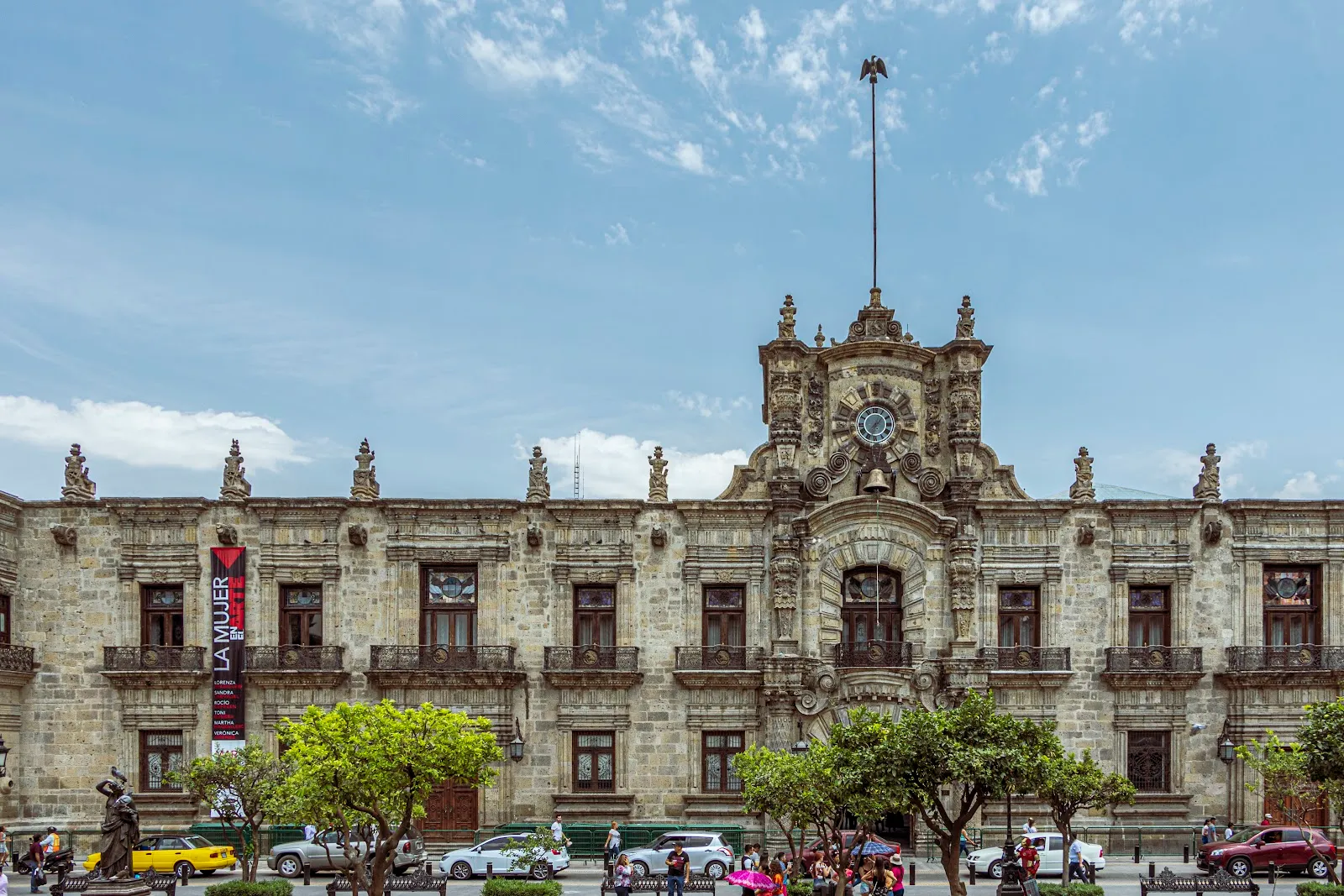
On the north side, next to the Museo Regional de Guadalajara, stands the legislative palace. Its thick stone columns make it easy to recognize. East of the square, across Calle Belén, is the Palacio de la Justicia. It was built in 1588 as the city's first nunnery, and a mural by Guillermo Chávez is inside.

Fountains, events and everyday life

The two fountains are shaped like cups, which gives the square its nickname, Plaza de las Dos Copas. Locals also call it Plaza de los Tres Poderes.

The wide open space hosts exhibitions, fairs, cultural and gastronomic events, free concerts and city festivities. Christmas displays appear here, and car shows have been held in the square. Each year the Guadalajara Pride Parade ends in the plaza.

Visiting the square

Street food stalls and small cafés line the edges of the square, and shoe polishing stations stand around the perimeter. National Guard members are present in the square and talk with people.

A hop-on, hop-off city tour stops right beside the square, so it works well as a starting point for a walk through the historic center. The Museo Regional and Plaza Tapatía are close by, which makes the square easy to combine with other stops.

Häufige Fragen

Is Plaza de la Liberación open at night?

Yes. The square is open 24 hours a day, and evenings are a pleasant time to walk around the fountains and the historic buildings.

Is the plaza wheelchair accessible?

Yes. The entrance, the restroom and the parking lot are wheelchair accessible.

Do I need cash?

Yes. The square is cash only, so bring cash for street food and other purchases.

What happens on Sunday afternoons?

Magicians, mimes, musicians and street vendors gather among the fountains, which makes it the liveliest time to visit.

Weitere Highlights in Guadalajara

Alle entdecken