Wapta Falls is a broad, powerful cascade on the Kicking Horse River in Yoho National Park, British Columbia. A mostly level forest trail leads to an upper viewpoint, with optional paths descending toward the river and the base of the falls. The waterfall is about 30 metres high and roughly 150 metres wide, so its scale comes from its width and volume. The round-trip walk is about 4.6 to 5 kilometres and usually takes around 1.5 hours. Expect spray near the base, especially if you continue down to the water.
A wide waterfall on the Kicking Horse River
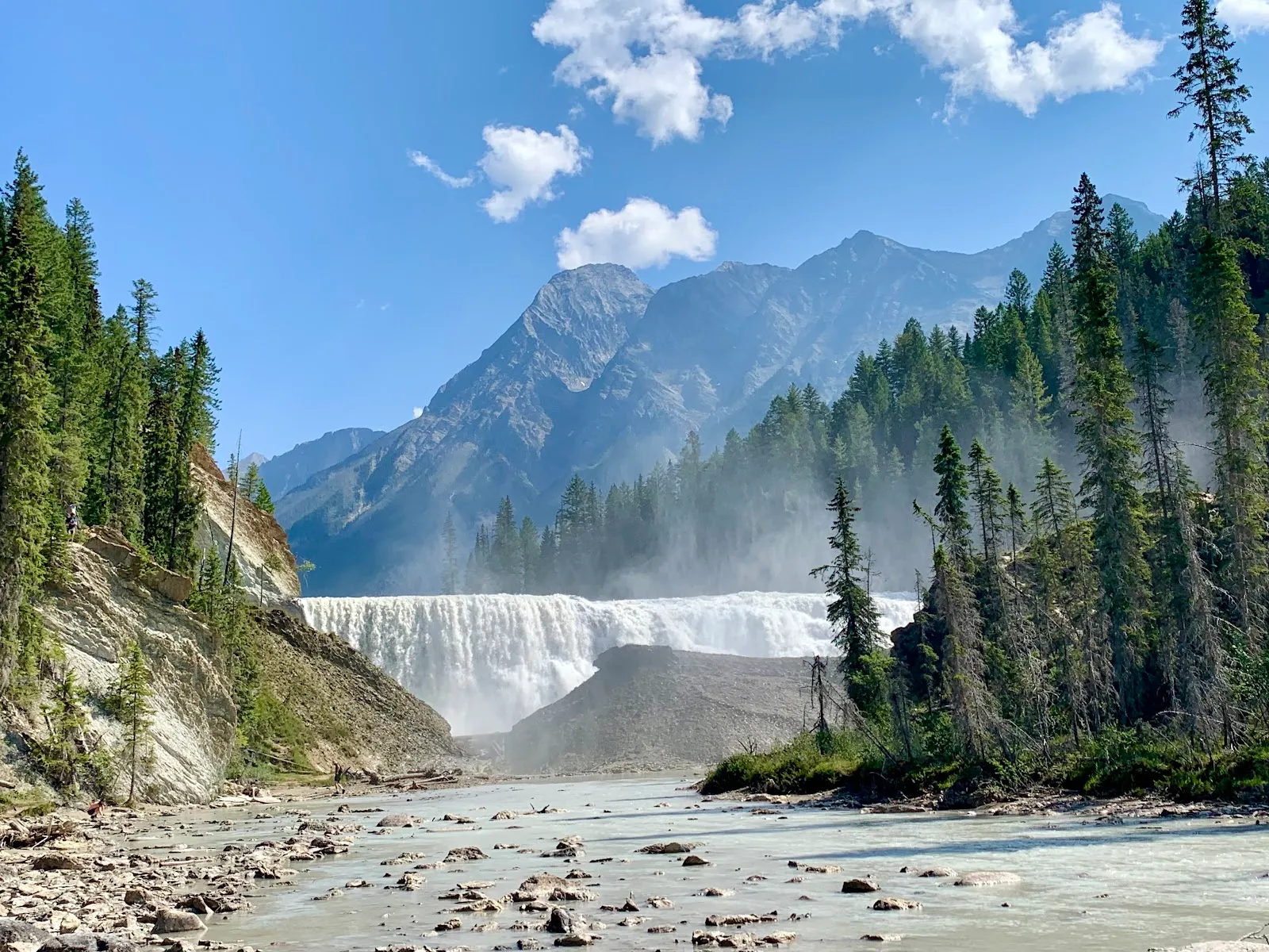
Wapta Falls lies on the Kicking Horse River in the western part of Yoho National Park. At about 30 metres high and roughly 150 metres wide, it is the river’s largest waterfall by volume. Its profile differs from a tall, narrow cascade: the water spreads across a broad section of the river, creating a forceful curtain.
The falls are reached by a forest trail from the Wapta Falls parking area. Published trail descriptions put the return distance at about 4.6 to 5 kilometres, with small differences in the stated route length. The walk is generally level, with little elevation gain, though roots and uneven ground call for care. Allow around 1.5 to 2 hours for the hike and time at the viewpoints.
Views from above and below
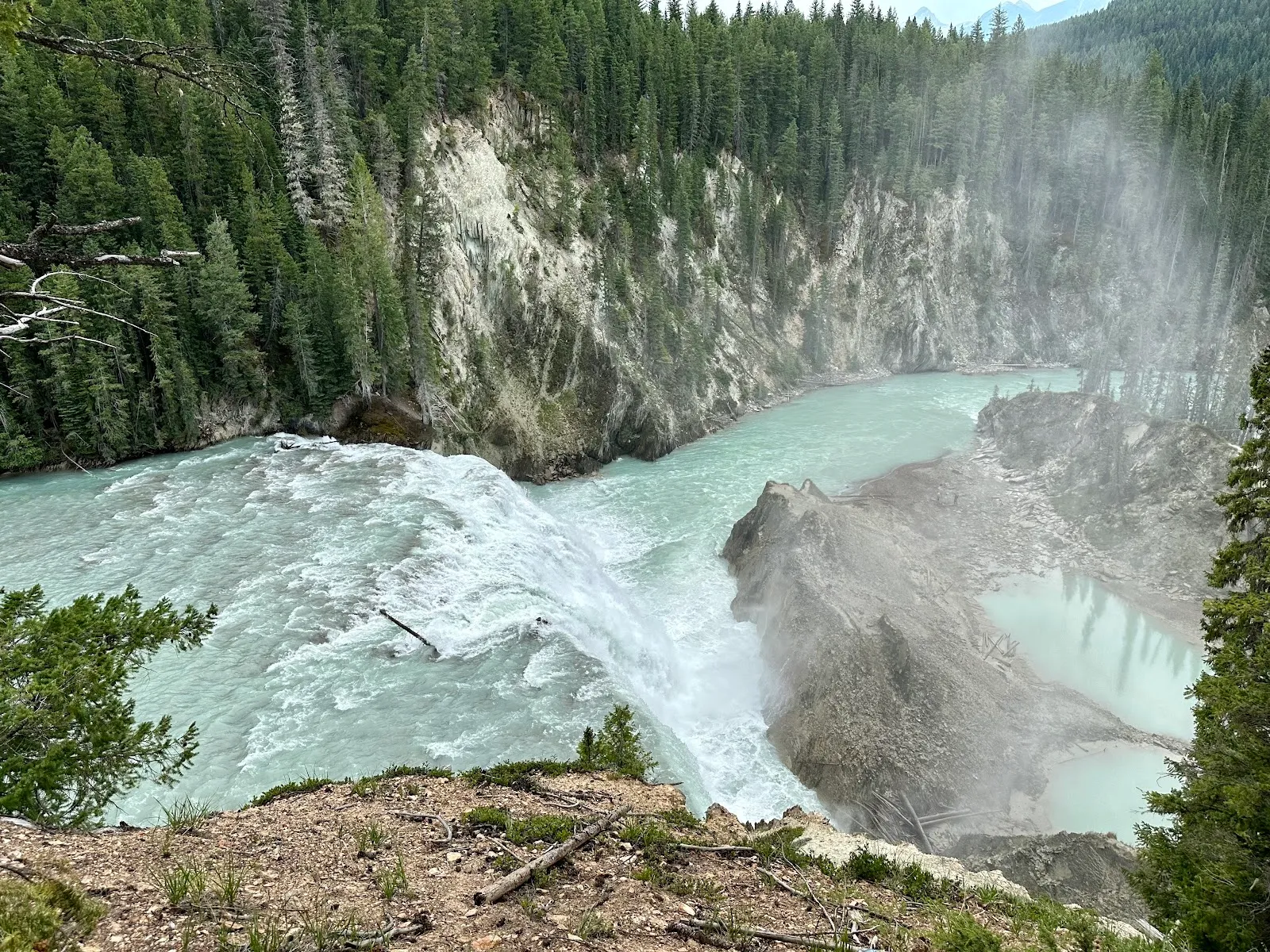
The first viewpoint looks down toward the falls from higher ground. From there, optional paths descend the slope for a more direct view of the water and river. The lower approach is steeper and can be slippery, so take care on roots and wet ground.
At the base, spray rises from the river and can leave you wet. That closeness gives a different sense of the waterfall’s width and force than the upper lookout. Bring a raincoat if you plan to continue down and would rather keep dry. You can also stay at the upper viewpoint for a view without making the descent.
Planning the trail visit
The trailhead is near the Trans-Canada Highway, between Field and Golden. The turnoff can be difficult to spot, particularly when travelling west, and reports note that access from the opposite direction may not be possible at the junction. Searching for “Wapta Falls Main Trail” can help you navigate to the proper parking area.
Conditions change with the season. After rain, mud can make closed boots useful, and mosquitoes may be present along the route. In winter, the access road may close, adding a longer approach from the highway; visitors can cover the snowy route on snowshoes or cross-country skis. Check the road and trail conditions before setting out in winter, as the extra distance depends on access.
FAQ
How long is the Wapta Falls hike?
The return walk is about 4.6 to 5 kilometres from the parking area. Allow around 1.5 to 2 hours for the hike and viewpoints.
Is the Wapta Falls trail difficult?
The forest approach is mostly level and has little elevation gain. Roots and uneven ground need care, and the descent toward the base is steeper and can be slippery.
Can you get close to Wapta Falls?
Yes. Optional paths descend from the upper viewpoint toward the base, where spray can soak your clothes and the ground may be slippery.
Can you visit Wapta Falls in winter?
Winter visits are possible, but the access road may be closed, adding a longer walk from the highway. Snowshoes or cross-country skis can be used on the snowy route.