Reise planen
Sprache: Deutsch
ReiseplanerPlane deine Reise auf einer Karte

Top-Reiseziele

EnglishDeutschFrançaisEspañolPortuguêsPortuguês (BR)Italiano
Reisehinweis · MexikoEinige Regierungen raten von Reisen in Teile von Mexiko ab.Die Warnungen gelten nur für diese Gebiete: Colima, Guerrero, Sinaloa, Chiapas, Chihuahua, Bundesstraße 199 San Cristóbal de las Casas–Palenque, Guanajuato, südlich der Schnellstraßen 43D und 45D, Grenzgebiet zu Guatemala, Chiapas, Nationalpark Lagunas de Zempoala, Michoacán, Nayarit, innerhalb von 20 km zur Grenze zu Sinaloa und Durango, Nuevo León, außer Monterrey, Piedras Negras, Route 85 Monterrey–Nuevo Laredo, Sonora, Tamaulipas, Tecate, Tijuana, Grenzregion zu den USA, Zacatecas.Die Empfehlung hängt von Ihrem Reisepass ab. Lesen Sie vor der Buchung die Hinweise Ihrer eigenen Regierung.Offizielle Hinweise
Gebiete mit Warnungen
  • Colima · alle Reisen vermeiden · Kanada, Deutschland, Frankreich, Vereinigtes Königreich
  • Guerrero · alle Reisen vermeiden · Kanada, Deutschland, Spanien, Frankreich, Neuseeland, Vereinigtes Königreich
  • Sinaloa · alle Reisen vermeiden · Kanada, Deutschland, Spanien, Frankreich, Neuseeland, Vereinigtes Königreich
  • Chiapas · nicht notwendige Reisen vermeiden · Kanada, Spanien, Frankreich
  • Chihuahua · nicht notwendige Reisen vermeiden · Kanada, Frankreich, Vereinigtes Königreich
  • Bundesstraße 199 San Cristóbal de las Casas–Palenque · nicht notwendige Reisen vermeiden · Frankreich, Vereinigtes Königreich
  • Guanajuato, südlich der Schnellstraßen 43D und 45D · nicht notwendige Reisen vermeiden · Kanada, Neuseeland
  • Grenzgebiet zu Guatemala, Chiapas · nicht notwendige Reisen vermeiden · Deutschland, Frankreich, Neuseeland
  • Nationalpark Lagunas de Zempoala · nicht notwendige Reisen vermeiden · Kanada, Neuseeland
  • Michoacán · nicht notwendige Reisen vermeiden · Kanada, Deutschland, Neuseeland, Vereinigtes Königreich
  • Nayarit, innerhalb von 20 km zur Grenze zu Sinaloa und Durango · nicht notwendige Reisen vermeiden · Kanada, Neuseeland
  • Nuevo León, außer Monterrey · nicht notwendige Reisen vermeiden · Kanada, Neuseeland
  • Piedras Negras · nicht notwendige Reisen vermeiden · Spanien, Frankreich
  • Route 85 Monterrey–Nuevo Laredo · nicht notwendige Reisen vermeiden · Spanien, Frankreich
  • Sonora · nicht notwendige Reisen vermeiden · Kanada, Neuseeland
  • Tamaulipas · nicht notwendige Reisen vermeiden · Kanada, Frankreich, Vereinigtes Königreich
  • Tecate · nicht notwendige Reisen vermeiden · Frankreich, Vereinigtes Königreich
  • Tijuana · nicht notwendige Reisen vermeiden · Frankreich, Vereinigtes Königreich
  • Grenzregion zu den USA · nicht notwendige Reisen vermeiden · Deutschland, Spanien, Frankreich
  • Zacatecas · nicht notwendige Reisen vermeiden · Kanada, Deutschland, Spanien, Frankreich, Vereinigtes Königreich

Außerdem von einer Regierung genannt: Dreieck Celaya–Irapuato–Salamanca, Guanajuato (Frankreich), Culiacán und Umgebung (Frankreich), Norden von Ciudad Victoria, Tamaulipas (Deutschland), Straße 129 Martínez de la Torre–Teziutlán (Frankreich), Straße 131 Tapacoyan–Perote (Frankreich), Nebenstraßen der 180 Martínez de la Torre–Papantla (Frankreich), Straße 40 Monterrey–Reynosa (Frankreich), Süden von Michoacán, von Uruapan bis zur Küste (Frankreich), Acapulco (Frankreich), Baja California, außer Tijuana und Tecate (Frankreich), Ciudad Acuña (Spanien), Ciudad Juárez und Umgebung (Spanien), Ciudad Obregón (Frankreich), Coahuila, außer dem Süden (Neuseeland), Coatzacoalcos (Frankreich), Viertel nördlich und nordöstlich des Zócalo, Mexiko-Stadt (Frankreich), Durango (Frankreich), Osten von Nuevo León, an Tamaulipas grenzend (Frankreich), Guanajuato (Spanien), Guanajuato, Schnellstraße 45 zwischen León und Irapuato (Neuseeland), Guanajuato, südwestlich der Schnellstraße 45D (Vereinigtes Königreich), Jalisco, innerhalb von 50 km zur Grenze zu Michoacán (Kanada), Monclova (Spanien), Morelos (Frankreich), Nayarit (Frankreich), Nogales (Frankreich), Abgelegene ländliche Gebiete von Baja California (Spanien), Abgelegene ländliche Gebiete von Chihuahua (Spanien), Abgelegene ländliche Gebiete von Coahuila (Spanien), Abgelegene ländliche Gebiete von Durango (Spanien), Abgelegene ländliche Gebiete von Sonora (Spanien), Nördliche Gemeinden von Jalisco (Vereinigtes Königreich), Nördliches Tamaulipas, von San Fernando bis zur US-Grenze (Spanien), Nördliches Veracruz an der Grenze zu Tamaulipas (Spanien), Nördliches Veracruz ab Martínez de la Torre (Frankreich), Straße 150D, Puebla–Orizaba (Frankreich), Straße 190, Oaxaca–Santo Domingo Tehuantepec (Frankreich), Route 85 und 83 Monterrey–Ciudad Victoria–Tampico (Frankreich), Route 95 Mexiko-Stadt–Cuernavaca (Frankreich), Selva Lacandona (Frankreich), Süden und Südwesten des Chapala-Sees, Jalisco (Vereinigtes Königreich), Südwesten Jaliscos und Los Altos, außer Puerto Vallarta (Frankreich), Südwesten von Michoacán (Frankreich), Südwesten von Tamaulipas (Frankreich), Süden des Bundesstaates Guanajuato (Frankreich), Süden von Michoacán, südlich von Morelia (Spanien), Streifen bis 40 km von der guatemaltekischen Grenze, Chiapas (Vereinigtes Königreich), Tepic (Neuseeland), Toluca (Frankreich), Stadt Veracruz (Frankreich)

RegierungHinweiseAktualisiertHinweise lesen
Vereinigtes Königreich (FCDO)No advice against the whole country (regional advisories)–Hinweise lesen
Vereinigte Staaten (State Dept)Exercise increased caution29. Mai 2026Hinweise lesen
Kanada (Global Affairs)Exercise a high degree of caution (regional advisories)–Hinweise lesen
Deutschland (Auswärtiges Amt)Besondere Vorsicht walten lassen (Sicherheitslage) (regional advisories)19. Okt. 2026Hinweise lesen
Neuseeland (SafeTravel)Exercise increased caution (regional advisories)–Hinweise lesen
Frankreich (Ministerium für Europa und Auswärtige Angelegenheiten)Vigilance renforcée pour le reste du pays (regional advisories)–Hinweise lesen

Täglich anhand der veröffentlichten Hinweise der Regierungen geprüft; zuletzt geprüft am 2. Nov. 2026.RoamLedger fasst offizielle Hinweise zusammen; es handelt sich nicht um Empfehlungen einer Regierung.

Basílica de Zapopan
Kirche

Basílica de Nuestra Señora de Zapopan

The Basílica de Nuestra Señora de Zapopan is a Franciscan church in the historic centre of Zapopan, Guadalajara.

The Basílica de Nuestra Señora de Zapopan is a Franciscan church in the historic centre of Zapopan, Guadalajara. It was built in the baroque style between 1689 and 1730 and holds the small wooden statue of the Virgin of Zapopan, patroness of Jalisco, whom pilgrims visit all year. Inside are the main prayer area with a section on each side, paintings and sculpture, and a statue of Pope John Paul II that draws admiration. Outside, a wide promenade leads to a plaza with shops, restaurants and local vendors.

The Virgin of Zapopan
Basílica de Nuestra Señora de Zapopan

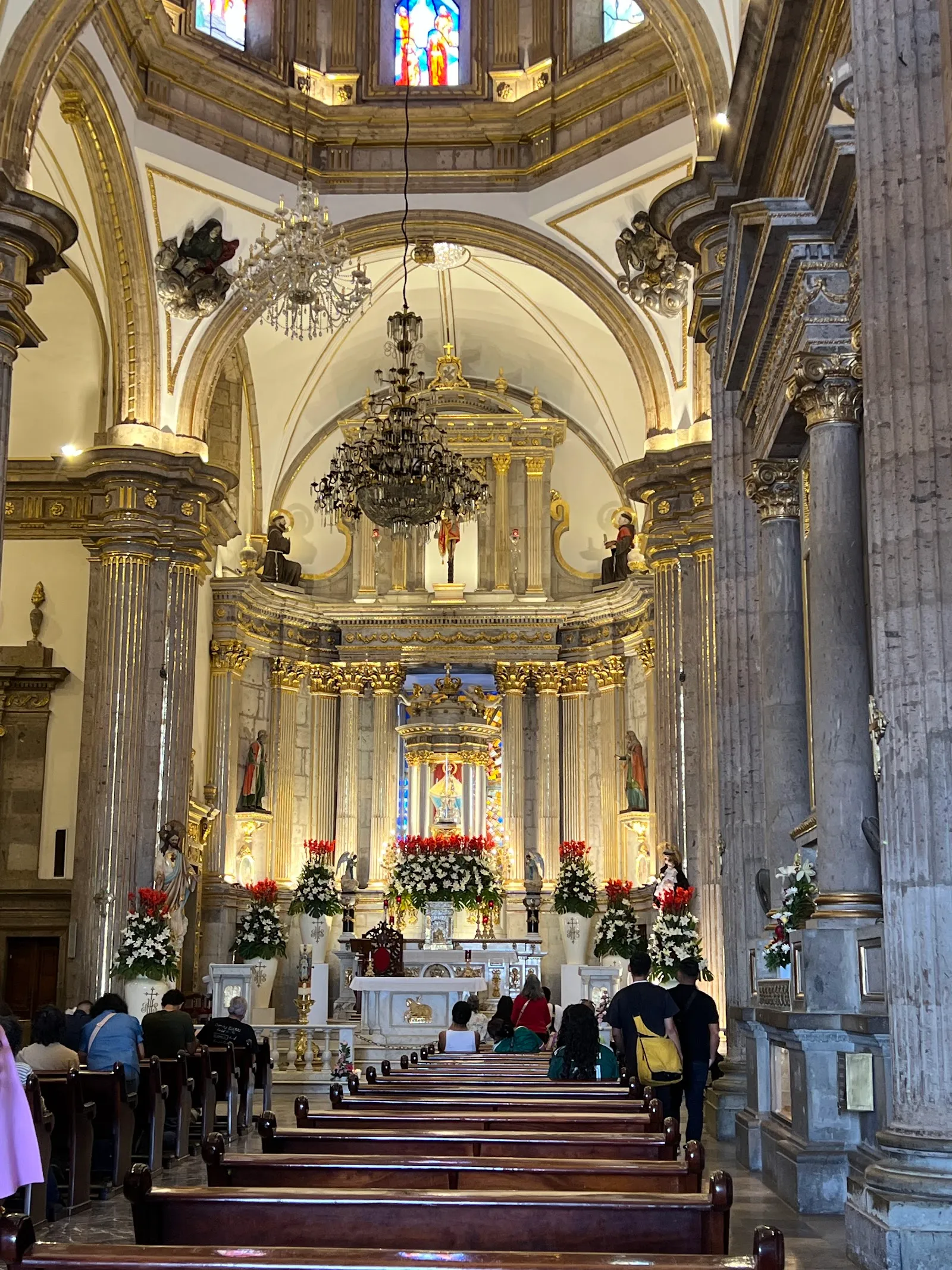
The basilica was built to house Nuestra Señora de Zapopan, a wooden figure of the Virgin Mary about 34 centimetres tall that dates from the 16th century. Pilgrims visit it year-round. The Virgin is the patroness of Jalisco and is also invoked as patroness of storms. The Catholic Church has officially recognised the statue for its miracles, and believers travel from many countries to see it.

The church holds the title of basilica, an honour given to certain buildings tied to a historical event or a major saint. It is described as the third most important pilgrimage site in Mexico.

The pilgrimage on 12 October
Basílica de Nuestra Señora de Zapopan

Every year on 12 October the statue is at the centre of one of the largest pilgrimages in Mexico. It is carried in procession between Guadalajara Cathedral and the basilica, a route of about five miles (8 km). Many of the faithful follow on their knees, and the final stretch is made up the basilica's aisle to the altar, where they pray for favours. The procession has dancing and colourful traditional dress.

The festivities continue through October, when the plaza fills with dance, food and stalls selling souvenirs. If you want quiet, choose another month.

Architecture and what is inside

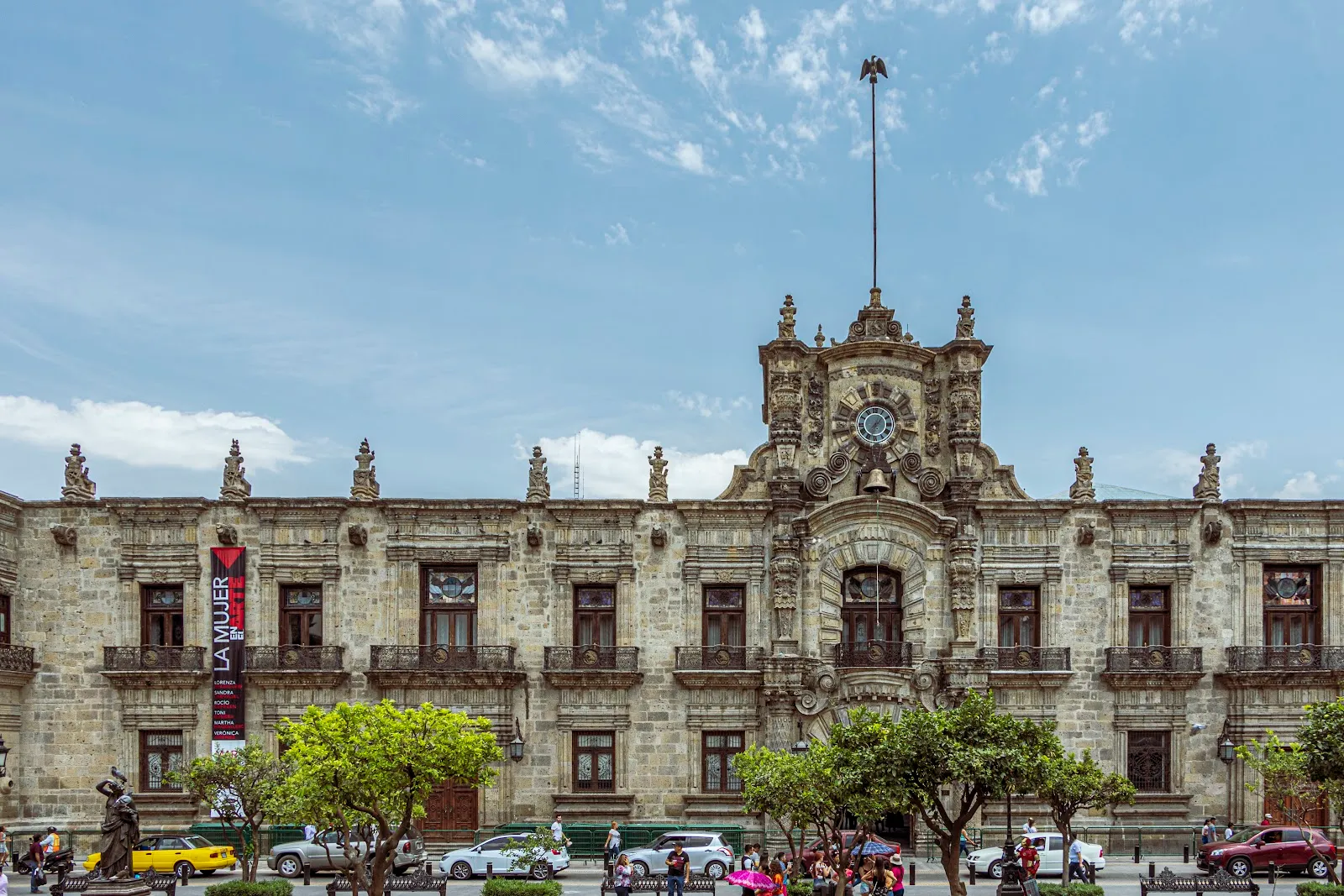
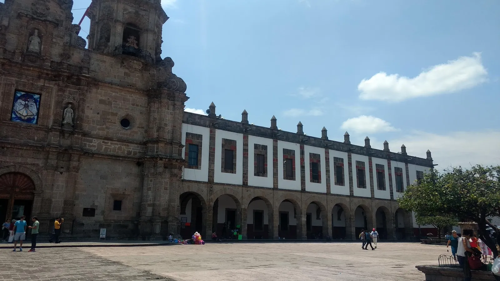
The Franciscans built the church between 1689 and 1730. The style is mainly baroque, with plateresque elements. The façade is approached along a wide promenade several blocks long that ends at a large plaza and garden square.

Inside, the main prayer area is flanked by a section on each side, and each is worth a look. The church holds paintings and sculptures, and a permanent exhibit of Huichol, Tepehuan and Cora art. The interior decoration is rich. Some visitors find the modern advertising inside out of place, so the view of the church from the plaza outside is a good counterpoint. The statue of Pope John Paul II is another point of interest.

The plaza and the evening light show

On Friday and Saturday evenings the plaza fills with food stands, vendors, friends catching up and children running about. At 9pm the plaza darkens and the crowd falls quiet. A 3D light and sound show is then projected onto the façade, telling the history of Zapopan, a colonial town that became a suburb, and of the basilica itself.

On other days the streets around the church are still busy with small shops and restaurants, and local vendors set up right in front of the building.

Getting there and what is nearby

The basilica is a short walk from the LRT. The turquoise air-conditioned TUR buses also run to Zapopan, passing just south and west of the town centre, and continue to Tlaquepaque and Tonalá.

The Art Museum of Zapopan (MAZ), the city's main contemporary art gallery, is nearby, as is the Monumento Arcos de Zapopan at the eastern edge of the centre. To combine the church with a walk, leave Bosque los Colomos by its northern Avenida Patria entrance. Historic downtown Zapopan is about 20 minutes uphill on foot.

Häufige Fragen

Is there an entry fee for the Basílica de Zapopan?

The basilica is among the free attractions of historic downtown Zapopan. It is an active church, so keep your voice low.

How long do you need at the basilica?

Allow 30 to 60 minutes for the church and plaza. Stay longer if you want to see the evening light show or explore the shops and restaurants around it.

When is the light show?

On Friday and Saturday evenings, at 9pm. It is a 3D light and sound show projected onto the façade, telling the history of Zapopan and the basilica.

What happens on 12 October?

A major pilgrimage takes place, with the statue of the Virgin of Zapopan carried in procession between Guadalajara Cathedral and the basilica. Many of the faithful follow on their knees, and the area is very busy.

How do you get to the Basílica de Zapopan?

It is a short walk from the LRT. The turquoise TUR buses also run to Zapopan.

Weitere Highlights in Guadalajara

Alle entdecken