Planeje uma viagem
Idioma: Português (BR)
Planejador de viagensPlaneje sua viagem em um mapa

Principais destinos

EnglishDeutschFrançaisEspañolPortuguêsPortuguês (BR)Italiano
Alerta de viagem · TailândiaAlguns governos recomendam evitar viagens a partes de Tailândia.Os alertas cobrem apenas estas áreas: Faixa de 50 km ao longo da fronteira com o Camboja, Narathiwat, Pattani, Sul de Songkhla (distritos de Chana, Na Thawi, Thepha e Saba Yoi), Região de fronteira Tailândia–Camboja (extensão total), Yala, Faixa de 20 km ao longo da fronteira com o Camboja.As recomendações dependem do seu passaporte. Leia a recomendação do governo do seu país antes de reservar.Recomendação oficial
Áreas com alertas
  • Faixa de 50 km ao longo da fronteira com o Camboja · evitar todas as viagens · Canadá, França, Nova Zelândia
  • Narathiwat · evitar todas as viagens · Canadá, Alemanha, Espanha, França, Irlanda, Itália, Nova Zelândia, Reino Unido
  • Pattani · evitar todas as viagens · Canadá, Alemanha, Espanha, França, Irlanda, Itália, Nova Zelândia, Reino Unido
  • Sul de Songkhla (distritos de Chana, Na Thawi, Thepha e Saba Yoi) · evitar todas as viagens · Canadá, Alemanha, França, Irlanda, Itália, Nova Zelândia, Reino Unido
  • Região de fronteira Tailândia–Camboja (extensão total) · evitar todas as viagens · Espanha, Irlanda, Itália
  • Yala · evitar todas as viagens · Canadá, Alemanha, Espanha, França, Irlanda, Itália, Nova Zelândia, Reino Unido
  • Faixa de 20 km ao longo da fronteira com o Camboja · evitar viagens não essenciais · Alemanha, Reino Unido

Também indicado por um governo: Zonas de fronteira da província de Buriram (Espanha), Zonas de fronteira da província de Sisaket (Espanha), Zonas de fronteira da província de Surin (Espanha), Zonas de fronteira da província de Ubon Ratchathani (Espanha), A leste das rodovias 408 e 4113, incluindo Sakom (Canadá), Toda a fronteira com Mianmar (exceto Mae Sot) (França), Cidade de Hat Yai (Canadá), Áreas próximas à fronteira entre Tailândia e Malásia (Irlanda), Linha ferroviária Hat Yai–Padang Besar (Reino Unido), Fronteira com Mianmar nas províncias de Mae Hong Son e Tak (Itália), Fronteira com Mianmar nas províncias de Tak e Chiang Mai (Espanha), Província de Phatthalung (França), Zona do Templo de Preah Vihear (Sisaket) (Itália), Província de Satun (França)

GovernoRecomendaçõesAtualizadoLeia a recomendação
Reino Unido (FCDO)No advice against the whole country (regional advisories)–Leia a recomendação
Estados Unidos (Departamento de Estado)Exercise Normal Precautions7 de jul. de 2026Leia a recomendação
Canadá (Global Affairs)Exercise a high degree of caution (regional advisories)–Leia a recomendação
Alemanha (Auswärtiges Amt)No advice against the whole country; partial warnings for border and southern areas (regional advisories)26 de out. de 2026Leia a recomendação
Nova Zelândia (SafeTravel)Exercise increased caution (regional advisories)–Leia a recomendação
Irlanda (Departamento de Relações Exteriores)Normal Precautions (regional advisories)–Leia a recomendação
França (Ministério da Europa e Relações Exteriores)Increased vigilance across the country (regional advisories)–Leia a recomendação

Verificado diariamente com base nas recomendações publicadas pelos governos; última verificação em 2 de nov. de 2026.RoamLedger resume recomendações oficiais; não são recomendações de nenhum governo.

Pai Canyon
Ponto turístico

Pai Canyon

Pai Canyon, also called Kong Lan, is a formation of eroded rock about 8 km from Pai town on the road towards Chiang Mai.

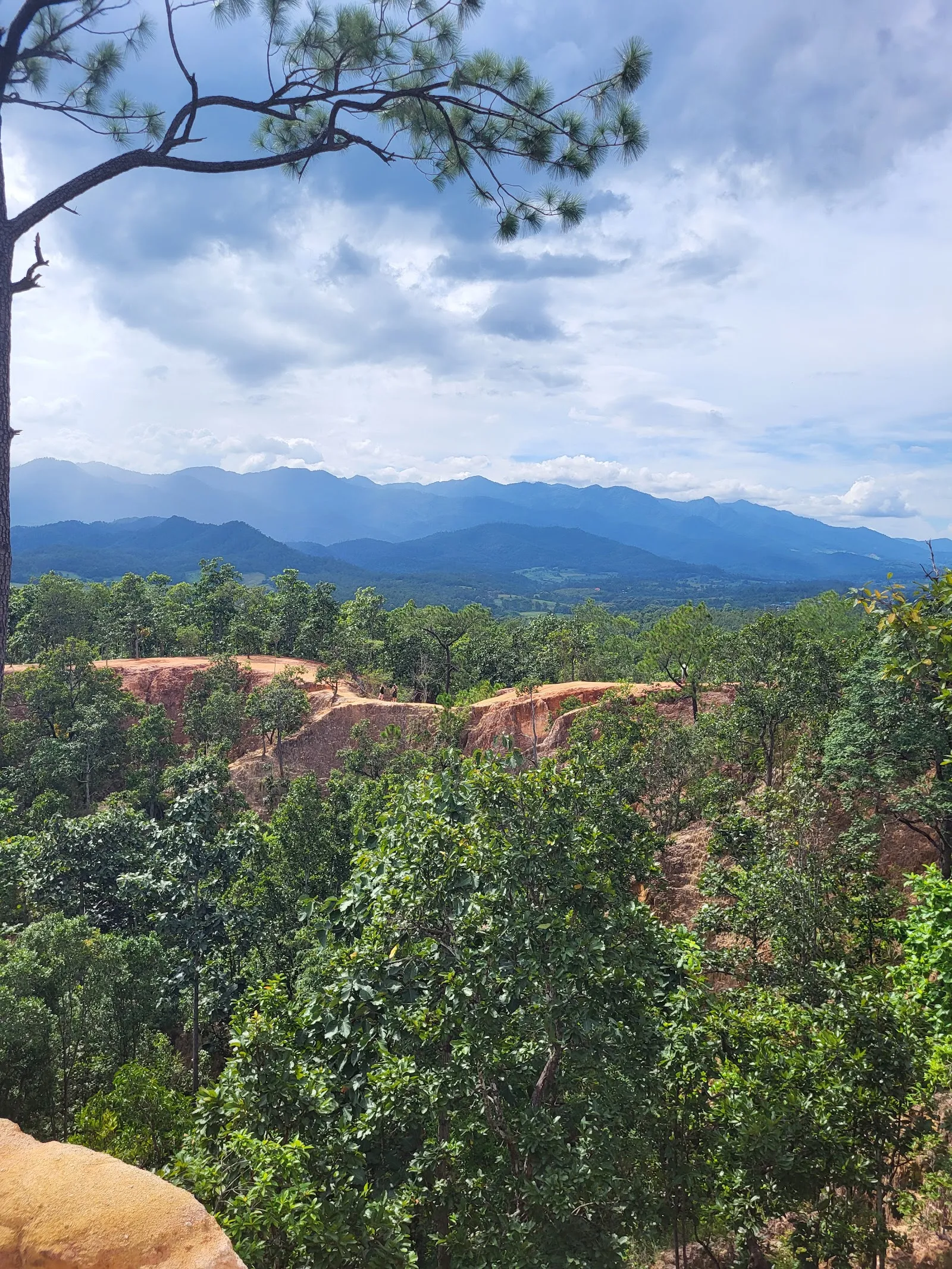
Pai Canyon, also called Kong Lan, is a formation of eroded rock about 8 km from Pai town on the road towards Chiang Mai. Wind and rain have cut narrow ledges and walkways into the rock, and a loop trail of about 3 km runs along the ridges and through open forest to two lookouts. Go for the walk, the views over the valley and mountains, and the warm light on the rock at sunset. Wear shoes with good grip and bring water.

Getting to Pai Canyon
Pai Canyon
Pai Canyon

Pai Canyon is about 8 km from Pai town, along the road towards Chiang Mai. The entrance has a parking lot, and the entrance and parking are listed as wheelchair accessible.

From the parking area, the path to the canyon is about 200 metres long and climbs steeply. The surface is concrete, so it is firm underfoot in dry weather.

The Pai Memorial Bridge, a World War II landmark, is close by. Some visitors stop there on the way back to Chiang Mai.

How the canyon formed
Pai Canyon
Pai Canyon

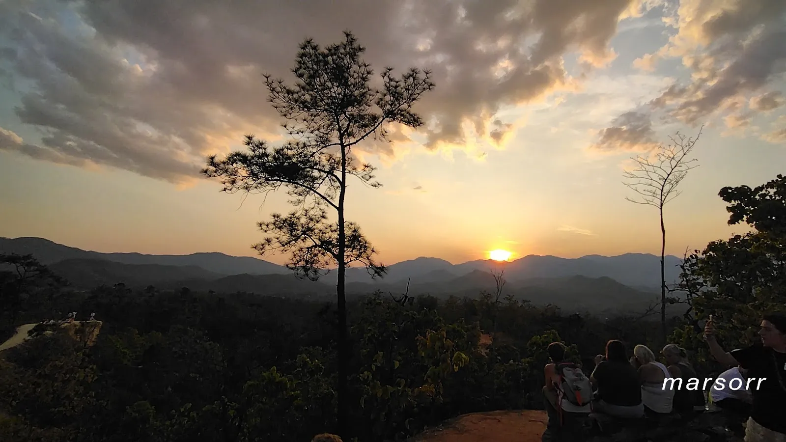
The canyon is the result of erosion that has continued for decades. Water and wind wore away the rock, and the harder slabs and ledges that survived became narrow walkways on the ridges of tall rock walls. These walls run out into the forested valley below.

The Thai name Kong Lan is the one most often used locally. The site is also known as Kong Moo.

The ground is dusty, and the colours of the rock change with the light through the day.

The loop trail

The loop runs about 3 km and goes around the canyon. Outside the most visited section, the path crosses open forest before it returns to the rock. It reaches both lookouts, and their heights differ, so each gives a different view.

The start of the trail is the narrowest part. It is single file, and some passages are only about two or three feet wide with a steep drop beside them. Some gaps are tight, so people who find narrow passages hard may prefer to turn back at the lookouts.

Bring water and sun protection. There is little shade on the exposed sections.

Visiting at sunset

Sunset is the busiest time. Many visitors arrive in the late afternoon, and young backpackers from the town often gather on the ridges. The canyon is then crowded, and the space for each viewpoint is limited.

Some visitors have been loud, pushed for photographs or ignored safety rules. Keep your voice down, wait your turn for the best spot and step back from the edge when others are passing.

On-site facilities include a restroom, a restaurant and a small cafe inside the grounds, which is a good place to rest after the walk.

Perguntas frequentes

How far is Pai Canyon from Pai?

Pai Canyon is about 8 km from Pai town, along the road towards Chiang Mai.

How long do you need at Pai Canyon?

A typical visit takes 1 to 2 hours, including the loop trail of about 3 km and time at the lookouts.

Is Pai Canyon wheelchair accessible?

The entrance and parking lot are listed as wheelchair accessible. The ridge trails are narrow and uneven, and some edges have no railings.

When is the best time to visit Pai Canyon?

Late afternoon, arriving before sunset, gives the warmest light. Morning visits are quieter.

Do I need special shoes for Pai Canyon?

Closed shoes with good grip are advised, since some ridges are narrow and uneven.
Mais atrações imperdíveis em Pai

Explorar tudo