Planeje uma viagem
Idioma: Português (BR)
Planejador de viagensPlaneje sua viagem em um mapa

Principais destinos

EnglishDeutschFrançaisEspañolPortuguêsPortuguês (BR)Italiano
Alerta de viagem · MéxicoMonterrey fica em ou perto de uma área em que os governos recomendam evitar todas as viagens, exceto as essenciais: Rodovia 85 Monterrey–Nuevo Laredo.As recomendações dependem do seu passaporte. Leia a recomendação do governo do seu país antes de reservar.Recomendação oficial
Áreas com alertas
  • Colima · evitar todas as viagens · Canadá, Alemanha, França, Reino Unido
  • Guerrero · evitar todas as viagens · Canadá, Alemanha, Espanha, França, Nova Zelândia, Reino Unido
  • Sinaloa · evitar todas as viagens · Canadá, Alemanha, Espanha, França, Nova Zelândia, Reino Unido
  • Chiapas · evitar viagens não essenciais · Canadá, Espanha, França
  • Chihuahua · evitar viagens não essenciais · Canadá, França, Reino Unido
  • Hent-bras 199 San Cristóbal de las Casas–Palenque · evitar viagens não essenciais · França, Reino Unido
  • Guanajuato, a-zeheut hentoù 43D ha 45D · evitar viagens não essenciais · Canadá, Nova Zelândia
  • Takad ar frontier gant Guatemala, Chiapas · evitar viagens não essenciais · Alemanha, França, Nova Zelândia
  • Park broadel Lagunas de Zempoala · evitar viagens não essenciais · Canadá, Nova Zelândia
  • Michoacán · evitar viagens não essenciais · Canadá, Alemanha, Nova Zelândia, Reino Unido
  • Nayarit, en ur vro 20 km a-dro da frontier Sinaloa ha Durango · evitar viagens não essenciais · Canadá, Nova Zelândia
  • Nuevo León, nemet Monterrey · evitar viagens não essenciais · Canadá, Nova Zelândia
  • Piedras Negras · evitar viagens não essenciais · Espanha, França
  • Rodovia 85 Monterrey–Nuevo Laredo · evitar viagens não essenciais · Espanha, França
  • Sonora · evitar viagens não essenciais · Canadá, Nova Zelândia
  • Tamaulipas · evitar viagens não essenciais · Canadá, França, Reino Unido
  • Tecate · evitar viagens não essenciais · França, Reino Unido
  • Tijuana · evitar viagens não essenciais · França, Reino Unido
  • Região da fronteira com os EUA · evitar viagens não essenciais · Alemanha, Espanha, França
  • Zacatecas · evitar viagens não essenciais · Canadá, Alemanha, Espanha, França, Reino Unido

Também indicado por um governo: Triangl Celaya–Irapuato–Salamanca, Guanajuato (França), Culiacán ha ar c'herioù tost (França), An norzh eus Ciudad Victoria, Tamaulipas (Alemanha), Hent 129 Martínez de la Torre–Teziutlán (França), Hent 131 Tapacoyan–Perote (França), Hentoù eilrenk 180 Martínez de la Torre–Papantla (França), Hent 40 Monterrey–Reynosa (França), Suliad Michoacán, eus Uruapan betek ar mor (França), Acapulco (França), Baja California, nemet Tijuana ha Tecate (França), Ciudad Acuña (Espanha), Ciudad Juárez ha ar c'herioù tost (Espanha), Ciudad Obregón (França), Coahuila, nemet ar su (Nova Zelândia), Coatzacoalcos (França), Kêrioù en norzh ha norzhreizh ar Zócalo, Kêr Mec'hiko (França), Durango (França), Reizh Nuevo León, o skourat Tamaulipas (França), Guanajuato (Espanha), Guanajuato, hent 45 etre León ha Irapuato (Nova Zelândia), Guanajuato, e kornôg-kreisteiz eus hent 45D (Reino Unido), Jalisco, en ur vro 50 km a-dro da frontier Michoacán (Canadá), Monclova (Espanha), Morelos (França), Nayarit (França), Nogales (França), Takadoù gwledig nann-turistek Baja California (Espanha), Takadoù gwledig nann-turistek Chihuahua (Espanha), Takadoù gwledig nann-turistek Coahuila (Espanha), Takadoù gwledig nann-turistek Durango (Espanha), Takadoù gwledig nann-turistek Sonora (Espanha), Komunioù en norzh Jalisco (Reino Unido), Norzh Tamaulipas, eus San Fernando betek frontier ar Stadoù-Unanet (Espanha), Norzh Veracruz, war frontier Tamaulipas (Espanha), Norzh Veracruz adalek Martínez de la Torre (França), Hent 150D, Puebla–Orizaba (França), Hent 190, Oaxaca–Santo Domingo Tehuantepec (França), Rodovias 85 e 83 Monterrey–Ciudad Victoria–Tampico (França), Rodovia 95 Cidade do México–Cuernavaca (França), Selva Lacandona (França), Sul e sudoeste do Lago Chapala, Jalisco (Reino Unido), Sudoeste de Jalisco e Los Altos, exceto Puerto Vallarta (França), Sudoeste de Michoacán (França), Sudoeste de Tamaulipas (França), Sul do estado de Guanajuato (França), Sul de Michoacán, ao sul de Morelia (Espanha), Faixa de 40 km da fronteira com a Guatemala, Chiapas (Reino Unido), Tepic (Nova Zelândia), Toluca (França), Cidade de Veracruz (França)

GovernoRecomendaçõesAtualizadoLeia a recomendação
Reino Unido (FCDO)No advice against the whole country (regional advisories)–Leia a recomendação
Estados Unidos (Departamento de Estado)Exercise increased caution29 de mai. de 2026Leia a recomendação
Canadá (Global Affairs)Exercise a high degree of caution (regional advisories)–Leia a recomendação
Alemanha (Auswärtiges Amt)Besondere Vorsicht walten lassen (Sicherheitslage) (regional advisories)19 de out. de 2026Leia a recomendação
Nova Zelândia (SafeTravel)Exercise increased caution (regional advisories)–Leia a recomendação
França (Ministério da Europa e Relações Exteriores)Vigilance renforcée pour le reste du pays (regional advisories)–Leia a recomendação

Verificado diariamente com base nas recomendações publicadas pelos governos; última verificação em 3 de nov. de 2026.RoamLedger resume recomendações oficiais; não são recomendações de nenhum governo.

La Huasteca
Parque

La Huasteca

La Huasteca is a park in the Cumbres de Monterrey National Park, about 20 minutes from downtown Monterrey, in the Santa Catarina area.

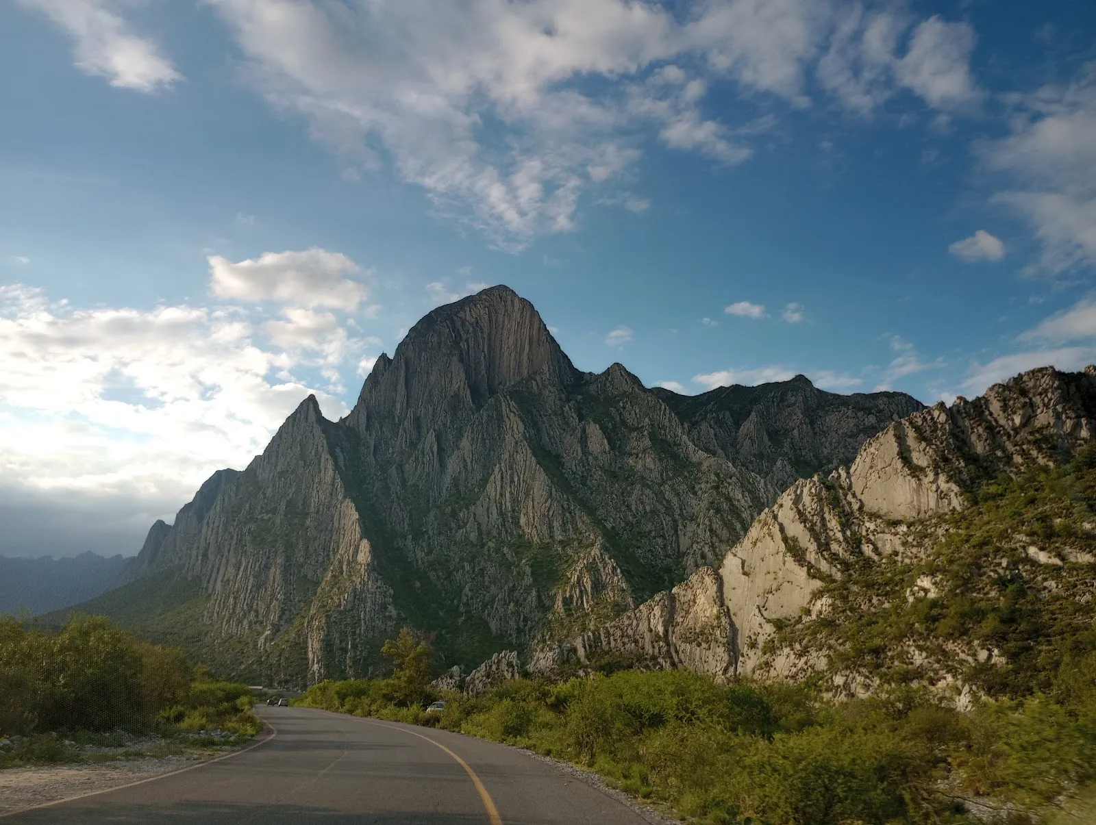
La Huasteca is a park in the Cumbres de Monterrey National Park, about 20 minutes from downtown Monterrey, in the Santa Catarina area. Pale limestone peaks rise on both sides of a canyon, and the trails and climbing routes run through the rock. Visitors come to hike, bike, run, climb and rappel, and to look over the city and the mountains from the high points. Wildlife and plants found only in this region are here too. Go early in the day, bring water, and plan your food before you arrive.

A limestone canyon above the city
La Huasteca
La Huasteca

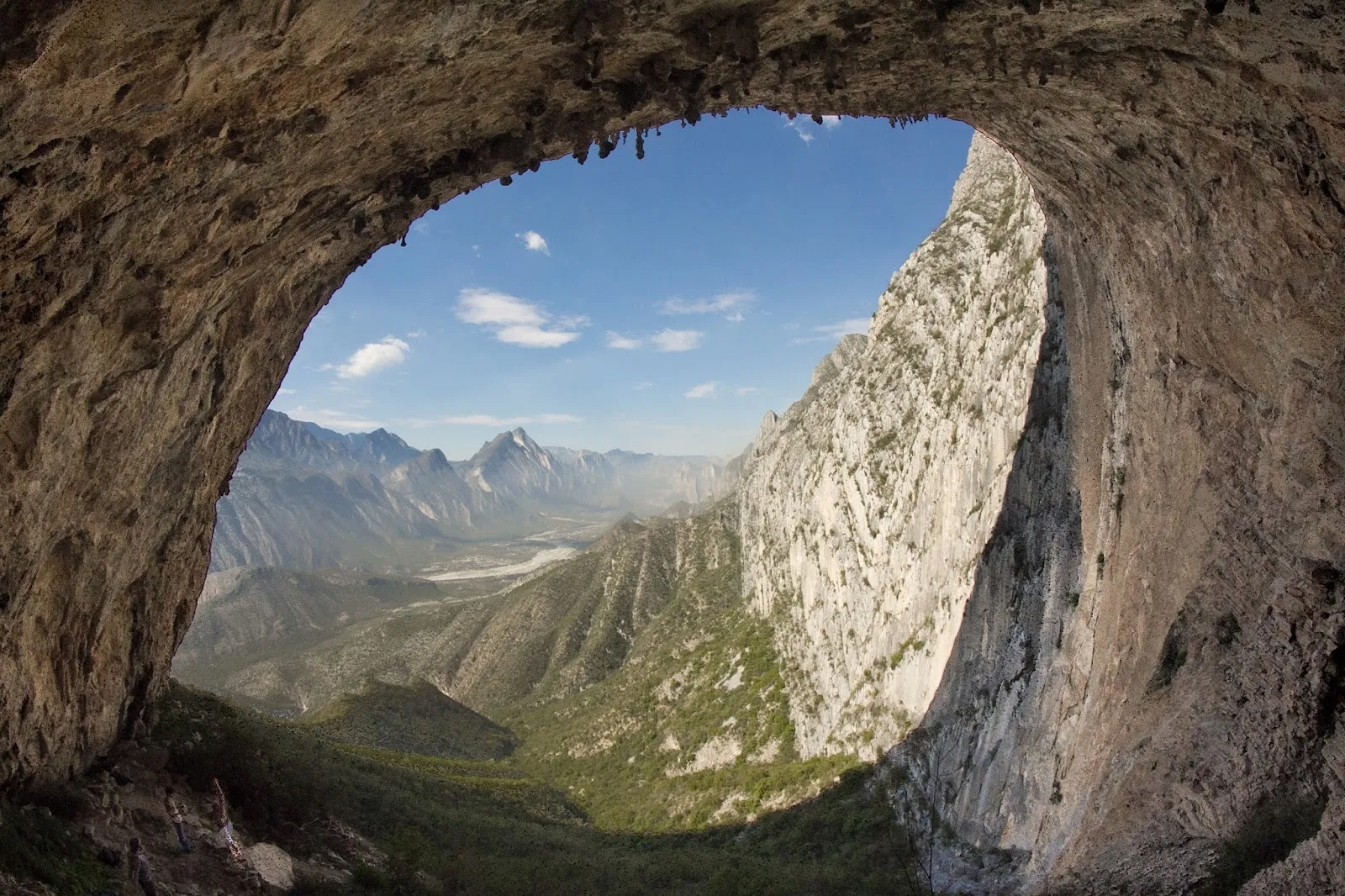
La Huasteca sits inside the Cumbres de Monterrey National Park, south of the city in the Santa Catarina area. Its limestone mountains rise on either side of the canyon in tall, thin ridges that look almost like blades. The rock is pale, and in many places there is little green on the faces, so the walls look different as the light moves across them.

The dry bed of the Santa Catarina River runs through the landscape, and the rock formations along it are among the most photographed parts of the park. In the rainy season, the water that forms between the rocks is used for kayaking.

Climbing, rappelling and the caves
La Huasteca
La Huasteca

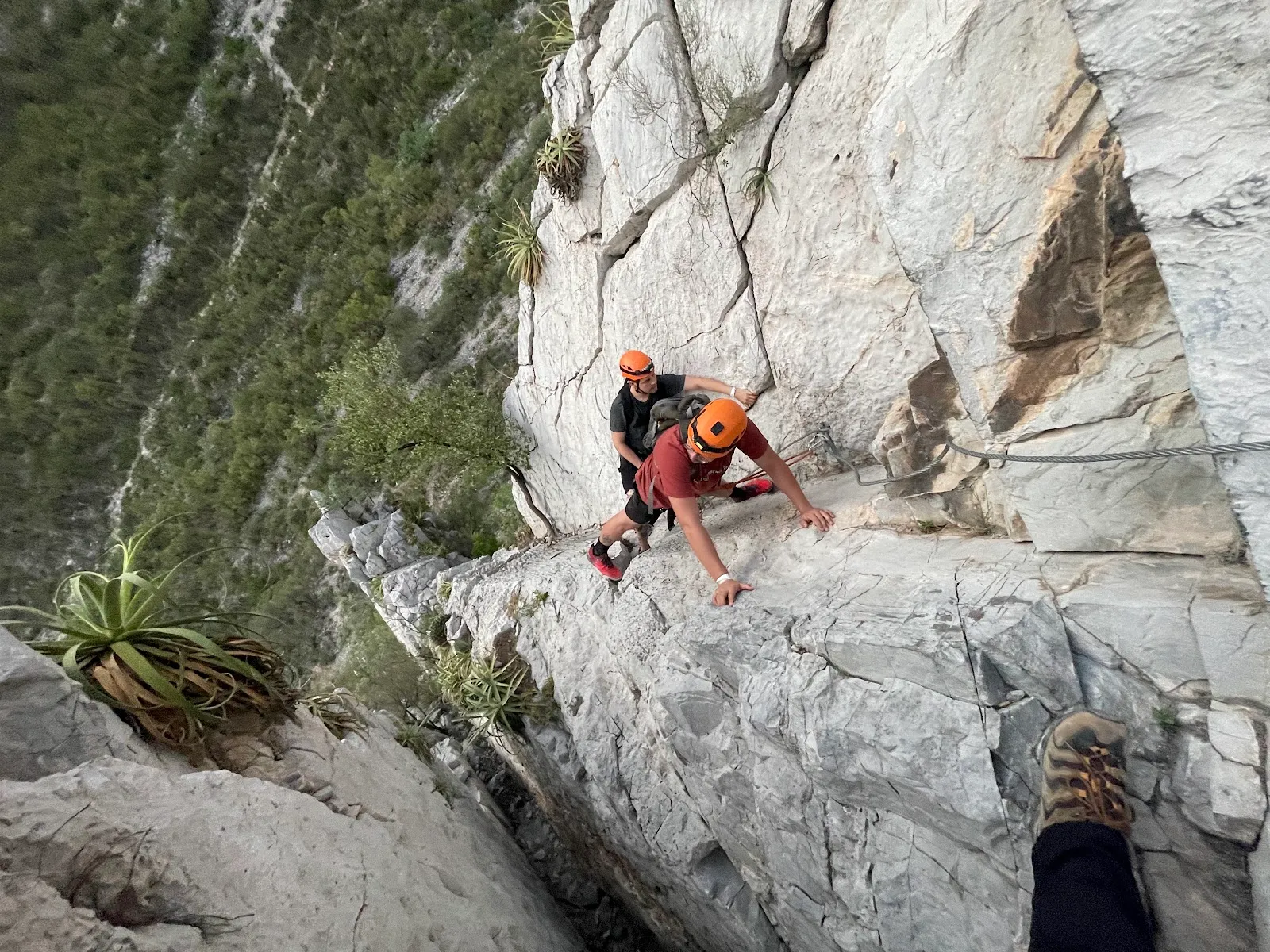
La Huasteca is one of the first climbing areas established near Monterrey. Its rock formations, some reaching about 120 meters, suit both climbing and rappelling. Permits may be required for these activities, so confirm the rules before you go.

Two caves are open to visitors: Cueva de los Murciélagos, the Cave of the Bats, and Cueva de la Virgen, the Cave of the Virgin. Both shelter wildlife and rare plant species. A professional guide is recommended for the trip inside, so follow the guide's instructions and move carefully on the rock.

Wildlife and plants

The park is home to endemic species, including the agave Agave victoria-reginae and the pine Pinus santa catarinae. Eagles and condors are the birds most often mentioned by visitors, and the park also has lizards, foxes, armadillos, bats, snakes and scorpions. Look before you put your hands on ledges or step into shaded rock gaps, and do not disturb the animals or plants you find.

Getting there and moving around

The entrance is gated, and entry to the park is free. Guided tours may cost extra. The park is about 20 minutes from downtown Monterrey by car. It is also possible to walk in from Santa Catarina town.

The main road inside the park is good for cycling and an easy drive. For longer trails, many people ride further in, where more trails leave the road. A bike rental has been available inside the park, but check whether it is running during your visit.

A few stands along the road sell drinks and snacks. Good food is available just inside the canyon, and there is little after that point. The park has picnic tables, a barbecue grill, public restrooms, a playground and a skateboarding area, so a picnic is simple to plan. Dogs are allowed, and debit and credit cards are accepted.

Perguntas frequentes

Is there an entry fee?

The entrance is free. Guided tours may cost extra, so ask the price before you start.

Do you need a guide for the caves?

A professional guide is recommended for Cueva de los Murciélagos and Cueva de la Virgen, which are the two caves open to visitors.

Can you rent a bike inside the park?

A bike rental has been available inside the park. Check whether it is open during your visit, since seasonal availability is unclear.

Is there food inside La Huasteca?

Good food is available just inside the canyon, with little after that. Pack water and snacks for longer walks.

Can you walk to La Huasteca from Santa Catarina?

Yes, it is possible to walk in from Santa Catarina town.

Mais atrações imperdíveis em Monterrey

Explorar tudo