Reise planen
Sprache: Deutsch
ReiseplanerPlane deine Reise auf einer Karte

Top-Reiseziele

EnglishDeutschFrançaisEspañolPortuguêsPortuguês (BR)Italiano
Reisehinweis · MexikoEinige Regierungen raten von Reisen in Teile von Mexiko ab.Die Warnungen gelten nur für diese Gebiete: Colima, Guerrero, Sinaloa, Chiapas, Chihuahua, Bundesstraße 199 San Cristóbal de las Casas–Palenque, Guanajuato, südlich der Schnellstraßen 43D und 45D, Grenzgebiet zu Guatemala, Chiapas, Nationalpark Lagunas de Zempoala, Michoacán, Nayarit, innerhalb von 20 km zur Grenze zu Sinaloa und Durango, Nuevo León, außer Monterrey, Piedras Negras, Route 85 Monterrey–Nuevo Laredo, Sonora, Tamaulipas, Tecate, Tijuana, Grenzregion zu den USA, Zacatecas.Die Empfehlung hängt von Ihrem Reisepass ab. Lesen Sie vor der Buchung die Hinweise Ihrer eigenen Regierung.Offizielle Hinweise
Gebiete mit Warnungen
  • Colima · alle Reisen vermeiden · Kanada, Deutschland, Frankreich, Vereinigtes Königreich
  • Guerrero · alle Reisen vermeiden · Kanada, Deutschland, Spanien, Frankreich, Neuseeland, Vereinigtes Königreich
  • Sinaloa · alle Reisen vermeiden · Kanada, Deutschland, Spanien, Frankreich, Neuseeland, Vereinigtes Königreich
  • Chiapas · nicht notwendige Reisen vermeiden · Kanada, Spanien, Frankreich
  • Chihuahua · nicht notwendige Reisen vermeiden · Kanada, Frankreich, Vereinigtes Königreich
  • Bundesstraße 199 San Cristóbal de las Casas–Palenque · nicht notwendige Reisen vermeiden · Frankreich, Vereinigtes Königreich
  • Guanajuato, südlich der Schnellstraßen 43D und 45D · nicht notwendige Reisen vermeiden · Kanada, Neuseeland
  • Grenzgebiet zu Guatemala, Chiapas · nicht notwendige Reisen vermeiden · Deutschland, Frankreich, Neuseeland
  • Nationalpark Lagunas de Zempoala · nicht notwendige Reisen vermeiden · Kanada, Neuseeland
  • Michoacán · nicht notwendige Reisen vermeiden · Kanada, Deutschland, Neuseeland, Vereinigtes Königreich
  • Nayarit, innerhalb von 20 km zur Grenze zu Sinaloa und Durango · nicht notwendige Reisen vermeiden · Kanada, Neuseeland
  • Nuevo León, außer Monterrey · nicht notwendige Reisen vermeiden · Kanada, Neuseeland
  • Piedras Negras · nicht notwendige Reisen vermeiden · Spanien, Frankreich
  • Route 85 Monterrey–Nuevo Laredo · nicht notwendige Reisen vermeiden · Spanien, Frankreich
  • Sonora · nicht notwendige Reisen vermeiden · Kanada, Neuseeland
  • Tamaulipas · nicht notwendige Reisen vermeiden · Kanada, Frankreich, Vereinigtes Königreich
  • Tecate · nicht notwendige Reisen vermeiden · Frankreich, Vereinigtes Königreich
  • Tijuana · nicht notwendige Reisen vermeiden · Frankreich, Vereinigtes Königreich
  • Grenzregion zu den USA · nicht notwendige Reisen vermeiden · Deutschland, Spanien, Frankreich
  • Zacatecas · nicht notwendige Reisen vermeiden · Kanada, Deutschland, Spanien, Frankreich, Vereinigtes Königreich

Außerdem von einer Regierung genannt: Dreieck Celaya–Irapuato–Salamanca, Guanajuato (Frankreich), Culiacán und Umgebung (Frankreich), Norden von Ciudad Victoria, Tamaulipas (Deutschland), Straße 129 Martínez de la Torre–Teziutlán (Frankreich), Straße 131 Tapacoyan–Perote (Frankreich), Nebenstraßen der 180 Martínez de la Torre–Papantla (Frankreich), Straße 40 Monterrey–Reynosa (Frankreich), Süden von Michoacán, von Uruapan bis zur Küste (Frankreich), Acapulco (Frankreich), Baja California, außer Tijuana und Tecate (Frankreich), Ciudad Acuña (Spanien), Ciudad Juárez und Umgebung (Spanien), Ciudad Obregón (Frankreich), Coahuila, außer dem Süden (Neuseeland), Coatzacoalcos (Frankreich), Viertel nördlich und nordöstlich des Zócalo, Mexiko-Stadt (Frankreich), Durango (Frankreich), Osten von Nuevo León, an Tamaulipas grenzend (Frankreich), Guanajuato (Spanien), Guanajuato, Schnellstraße 45 zwischen León und Irapuato (Neuseeland), Guanajuato, südwestlich der Schnellstraße 45D (Vereinigtes Königreich), Jalisco, innerhalb von 50 km zur Grenze zu Michoacán (Kanada), Monclova (Spanien), Morelos (Frankreich), Nayarit (Frankreich), Nogales (Frankreich), Abgelegene ländliche Gebiete von Baja California (Spanien), Abgelegene ländliche Gebiete von Chihuahua (Spanien), Abgelegene ländliche Gebiete von Coahuila (Spanien), Abgelegene ländliche Gebiete von Durango (Spanien), Abgelegene ländliche Gebiete von Sonora (Spanien), Nördliche Gemeinden von Jalisco (Vereinigtes Königreich), Nördliches Tamaulipas, von San Fernando bis zur US-Grenze (Spanien), Nördliches Veracruz an der Grenze zu Tamaulipas (Spanien), Nördliches Veracruz ab Martínez de la Torre (Frankreich), Straße 150D, Puebla–Orizaba (Frankreich), Straße 190, Oaxaca–Santo Domingo Tehuantepec (Frankreich), Route 85 und 83 Monterrey–Ciudad Victoria–Tampico (Frankreich), Route 95 Mexiko-Stadt–Cuernavaca (Frankreich), Selva Lacandona (Frankreich), Süden und Südwesten des Chapala-Sees, Jalisco (Vereinigtes Königreich), Südwesten Jaliscos und Los Altos, außer Puerto Vallarta (Frankreich), Südwesten von Michoacán (Frankreich), Südwesten von Tamaulipas (Frankreich), Süden des Bundesstaates Guanajuato (Frankreich), Süden von Michoacán, südlich von Morelia (Spanien), Streifen bis 40 km von der guatemaltekischen Grenze, Chiapas (Vereinigtes Königreich), Tepic (Neuseeland), Toluca (Frankreich), Stadt Veracruz (Frankreich)

RegierungHinweiseAktualisiertHinweise lesen
Vereinigtes Königreich (FCDO)No advice against the whole country (regional advisories)–Hinweise lesen
Vereinigte Staaten (State Dept)Exercise increased caution29. Mai 2026Hinweise lesen
Kanada (Global Affairs)Exercise a high degree of caution (regional advisories)–Hinweise lesen
Deutschland (Auswärtiges Amt)Besondere Vorsicht walten lassen (Sicherheitslage) (regional advisories)19. Okt. 2026Hinweise lesen
Neuseeland (SafeTravel)Exercise increased caution (regional advisories)–Hinweise lesen
Frankreich (Ministerium für Europa und Auswärtige Angelegenheiten)Vigilance renforcée pour le reste du pays (regional advisories)–Hinweise lesen

Täglich anhand der veröffentlichten Hinweise der Regierungen geprüft; zuletzt geprüft am 2. Nov. 2026.RoamLedger fasst offizielle Hinweise zusammen; es handelt sich nicht um Empfehlungen einer Regierung.

Plazuela Machado
Platz

Plazuela Machado

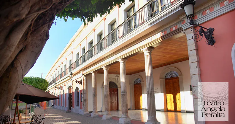
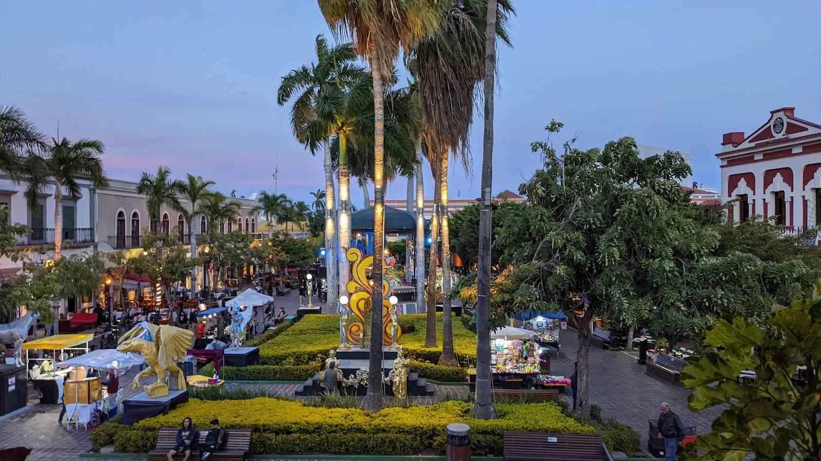
Plazuela Machado is the main square of Mazatlán's historic center, surrounded by 19th-century buildings, restaurants, cafes and galleries.

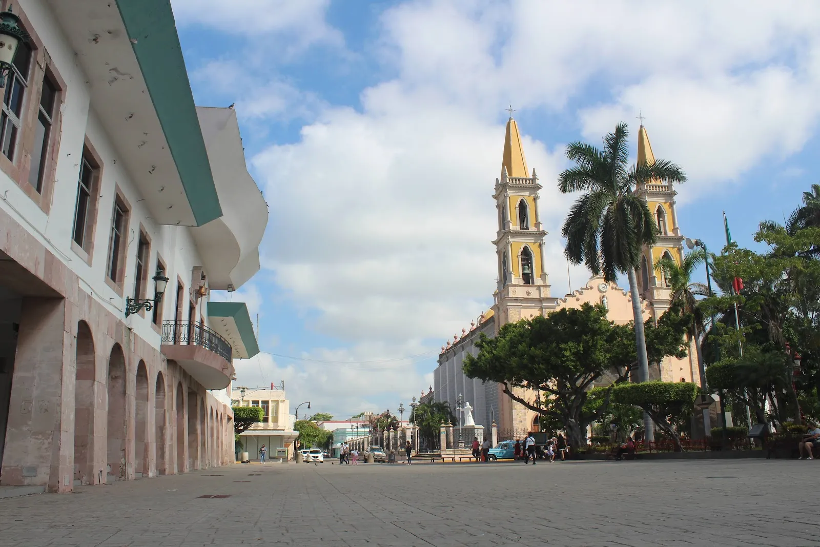
Plazuela Machado is the main square of Mazatlán's historic center, surrounded by 19th-century buildings, restaurants, cafes and galleries. A cast iron bandstand sits in the middle, and the Angela Peralta Theater is next door. By day it is a calm place to walk and photograph the colonial facades, the children's fountain and the church of San José. In the evening the lights come on, restaurants set out tables and live music starts. On weekends the streets around the plaza close to cars, which leaves room to stroll between vendors, artists and performers.

How the square came to be
Plazuela Machado
Plazuela Machado

The plaza is tied to Juan Nepomuceno Machado, a wealthy merchant from the Philippines whom some consider a founding father of Mazatlán. In 1832 the Olas Altas dam was built, and large tracts of land dried up. Machado wanted to use part of that land for a large public plaza.

In the center is a cast iron gazebo, which works as the bandstand. It has been used for almost every kind of music: opera singers, banda, troubadours, jazz, tribute bands, hip hop, African dance and rock and roll. The square was fully restored in 2010.

The buildings around the plaza
Plazuela Machado
Plazuela Machado

Plazuela Machado is small and is bordered by Frías, Constitución, Carnaval and Sixto Osuna streets. It lies inside a historic area of about 20 blocks near the theater. The old houses here are colorful and trimmed with wrought iron and carved stone. The city's architecture shows French, Spanish and British colonial influence.

On the square you can photograph the children's fountain, the bandstand and the church of San José. Some of the older buildings are rough and weathered, and they show how much restoration the neighborhood still needs.

Restaurants and cafes fill the ground floors around the square. The kitchens are Italian, French and Mexican, alongside traditional dishes of the port. Pedro & Lola sits on the northwest corner. Art galleries opened on the square after the first restaurants. Today most spaces around it are taken, and new places are opening on the side streets.

An evening on the plaza

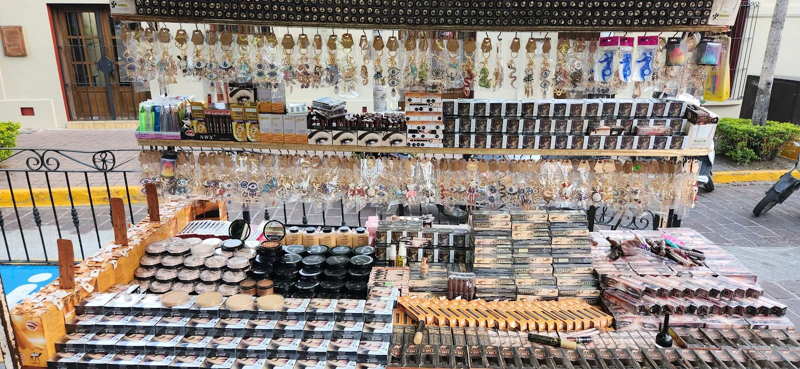
The plaza is open at all hours, but it is at its best after dark. The lights go on, and restaurants put chairs and tables out on the closed streets. Live music plays outside the restaurants. Families, vendors and diners share the space, and an art show sometimes appears among the stalls. Shops sell gifts and souvenirs, and the stalls and galleries offer jewelry and art.

For something sweet, walk up the main street that leads to the plaza. Ice cream de garrafa is sold there, in flavors such as yogurt and blueberries, guayaba and chicle. For breakfast, the Gaia bistrot is a morning stop near the square. El Cielo is a restaurant known for shrimp tacos.

Carnaval and Day of the Dead

Around the turn of the 20th century, Plazuela Machado was the focus of Carnaval. As downtown has been restored, the festivities have returned. During Carnaval a gastronomic fair runs every evening from Friday through Tuesday. Dishes include pescado zarandeado, which is barbecued fish, camarones con mango, which is mango shrimp, and marlín ahumada, which is smoked marlin.

At Day of the Dead, the plaza and the historic center are the hub for decorations, public ofrendas (altars) and community gatherings. The Callejoneada is a nighttime walking parade through the old town with people dressed as Catrinas and traditional banda music. Parades with dancers and skeleton costumes are often held near the plaza and the Angela Peralta Theater.

Walking on from the plaza

The plaza makes a good starting point for a walk through the city. From here you can head south on Avenida Carnaval, past cafes, bakeries and restaurants. At the Mirador la Marea you turn west and reach the coast and the Malecón.

Häufige Fragen

Where is Plazuela Machado?

It is in Mazatlán's historic center, at Constitución s/n, Centro. The Angela Peralta Theater is next to it.

When is the best time to visit Plazuela Machado?

Evening is the best time. The lights are on, restaurants set out tables and live music plays. By day the plaza is quieter, which suits walking and photos.

Is Plazuela Machado wheelchair accessible?

Yes, the entrance is wheelchair accessible, and there is a wheelchair accessible parking lot. The parking is paid.

What can you eat and drink around Plazuela Machado?

Restaurants and cafes serve Italian, French and Mexican food and traditional dishes of the port. Ice cream is sold on the main street leading to the plaza. During Carnaval the gastronomic fair serves pescado zarandeado, mango shrimp and smoked marlin.

What festivals take place at Plazuela Machado?

The plaza is a center of Carnaval, with a gastronomic fair every evening from Friday through Tuesday. It is also the hub of Day of the Dead decorations, ofrendas and the Callejoneada parade.
Weitere Highlights in Mazatlán

Alle entdecken