Reise planen
Sprache: Deutsch
ReiseplanerPlane deine Reise auf einer Karte

Top-Reiseziele

EnglishDeutschFrançaisEspañolPortuguêsPortuguês (BR)Italiano
Reisehinweis · KeniaNairobi liegt in oder nahe einem Gebiet, für das Regierungen von allen außer unbedingt notwendigen Reisen abraten: Eastleigh (Nairobi), Kibera (Nairobi), Mathare (Nairobi), Pangani (Nairobi).Die Empfehlung hängt von Ihrem Reisepass ab. Lesen Sie vor der Buchung die Hinweise Ihrer eigenen Regierung.Offizielle Hinweise
Gebiete mit Warnungen
  • Grenze zu Äthiopien · alle Reisen vermeiden · Spanien, Frankreich, Neuseeland
  • Grenze zum Südsudan · alle Reisen vermeiden · Spanien, Frankreich, Neuseeland
  • Küstengebiete nördlich von Malindi · alle Reisen vermeiden · Kanada, Frankreich, Neuseeland, USA
  • Kreis Garissa · alle Reisen vermeiden · Kanada, Deutschland, Spanien, Italien, Neuseeland, USA
  • Kreis Lamu · alle Reisen vermeiden · Spanien, Neuseeland, USA
  • Kreis Lamu ohne Lamu-Insel und Manda-Insel · alle Reisen vermeiden · Kanada, Deutschland, Frankreich, Vereinigtes Königreich
  • Kreis Mandera · alle Reisen vermeiden · Kanada, Deutschland, Spanien, Italien, Neuseeland, Vereinigtes Königreich, USA
  • Kreis Tana River (ohne Tsavo-Nationalpark) · alle Reisen vermeiden · Italien, USA
  • Kreis Wajir · alle Reisen vermeiden · Kanada, Deutschland, Spanien, Italien, Neuseeland, USA
  • Kreis Baringo · nicht notwendige Reisen vermeiden · Deutschland, Italien
  • Küste zwischen Tana River und Galana River · nicht notwendige Reisen vermeiden · Spanien, Vereinigtes Königreich
  • Küstengebiete des Countys Tana River · nicht notwendige Reisen vermeiden · Kanada, Neuseeland
  • Eastleigh (Nairobi) · nicht notwendige Reisen vermeiden · Spanien, Frankreich, Italien, Neuseeland, USA
  • Kibera (Nairobi) · nicht notwendige Reisen vermeiden · Kanada, Spanien, Frankreich, Neuseeland, USA
  • Mathare (Nairobi) · nicht notwendige Reisen vermeiden · Spanien, Frankreich
  • Nördlicher Teil des Countys Tana River · nicht notwendige Reisen vermeiden · Deutschland, Vereinigtes Königreich
  • Pangani (Nairobi) · nicht notwendige Reisen vermeiden · Frankreich, Italien
  • Turkana County · nicht notwendige Reisen vermeiden · Deutschland, Spanien
  • Bezirk West Pokot · nicht notwendige Reisen vermeiden · Deutschland, Italien, USA

Außerdem von einer Regierung genannt: Gebiete an der Grenze zu Somalia (Neuseeland), Kreis Garissa ohne Garissa-Stadt, Lagdera und Teile von Balambala (Vereinigtes Königreich), Kreis Kilifi nördlich der Straße C103 (USA), Seegebiet bis 72° O und 15° S (Frankreich), Kreis Marsabit innerhalb von 110 km zu den Grenzen zum Südsudan und zu Äthiopien (Kanada), Kreis Marsabit innerhalb von 50 km zur äthiopischen Grenze (USA), Grenzstreifen zu Somalia, bis zu 100 km ins kenianische Inland (Frankreich), Wahlkreise Tarbaj und Wajir East (Vereinigtes Königreich), Kreis Turkana innerhalb von 110 km zu den Grenzen zum Südsudan und zu Äthiopien (Kanada), Kreis Turkana innerhalb von 50 km zur äthiopischen Grenze (USA), Kreis Wajir innerhalb von 60 km zur somalischen Grenze (Vereinigtes Königreich), Westlicher Kreis Turkana (USA), Aride und abgelegene Regionen Nordkenias (Italien), Unterkreise Mukutani, Muchongoi, Bartabwa, Tiaty East und Tiaty West (Spanien), Elgeyo-Marakwet County (Italien), Unterbezirke Marakwet East und Marakwet West in Elgeyo-Marakwet (Spanien), Garissa (Vereinigtes Königreich), Laikipia County (Italien), Unterbezirke Olmoran, Ng'arua und Mukogodo (Laikipia) (Spanien), Insel Lamu (Deutschland), Insel Manda (Deutschland), Marsabit County (Spanien), Mombasa (Italien), Randgebiete des Countys Isiolo (Frankreich), Randgebiete des Countys Turkana (Frankreich), Randgebiete des Countys West Pokot (Frankreich), Randgebiete des Countys Marsabit (Frankreich), Landrouten zwischen Lamu und Malindi (Italien), Samburu County: Gebiete Loroki und Kirisia (Spanien), Unterbezirke Turkana Süd, Turkana Ost und Loima (Spanien), Westlich des Countys Garissa (Frankreich), Westlich des Countys Mandera (Frankreich), Westlich des Bezirks Wajir (Frankreich), Unterbezirke Pokot North und Sigor (West Pokot) (Spanien), Innerhalb von 75 km zur kenianisch-somalischen Grenze (Irland)

RegierungHinweiseAktualisiertHinweise lesen
Vereinigtes Königreich (FCDO)No advice against the whole country (regional advisories)–Hinweise lesen
Vereinigte Staaten (State Dept)Reconsider travel19. Okt. 2026Hinweise lesen
Kanada (Global Affairs)Exercise a high degree of caution (regional advisories)–Hinweise lesen
Deutschland (Auswärtiges Amt)Increased caution nationwide; partial travel warnings for specific areas (regional advisories)19. Okt. 2026Hinweise lesen
Neuseeland (SafeTravel)Exercise increased caution (regional advisories)–Hinweise lesen
Irland (Außenministerium)High Degree of Caution (regional advisories)–Hinweise lesen
Frankreich (Ministerium für Europa und Auswärtige Angelegenheiten)Vigilance renforcée (reste du territoire) (regional advisories)–Hinweise lesen

Täglich anhand der veröffentlichten Hinweise der Regierungen geprüft; zuletzt geprüft am 3. Nov. 2026.RoamLedger fasst offizielle Hinweise zusammen; es handelt sich nicht um Empfehlungen einer Regierung.

a herd of zebra standing on top of a lush green field
Park

Nairobi National Park

Nairobi National Park is a wildlife park on the southern side of Kenya's capital, about 7 km from the city centre.

Nairobi National Park is a wildlife park on the southern side of Kenya's capital, about 7 km from the city centre. It covers 117 square kilometres of open grassland, acacia bush and woodland, and it is Kenya's first national park, opened in 1946. Lions, giraffes, zebras, black rhinos and hippos live here, and more than 400 bird species have been recorded. The rhino sanctuary and the orphan care run by the David Sheldrick Wildlife Trust are the main draws. Plan a game drive early in the day.

Where the park is and how big it is
Nairobi National Park

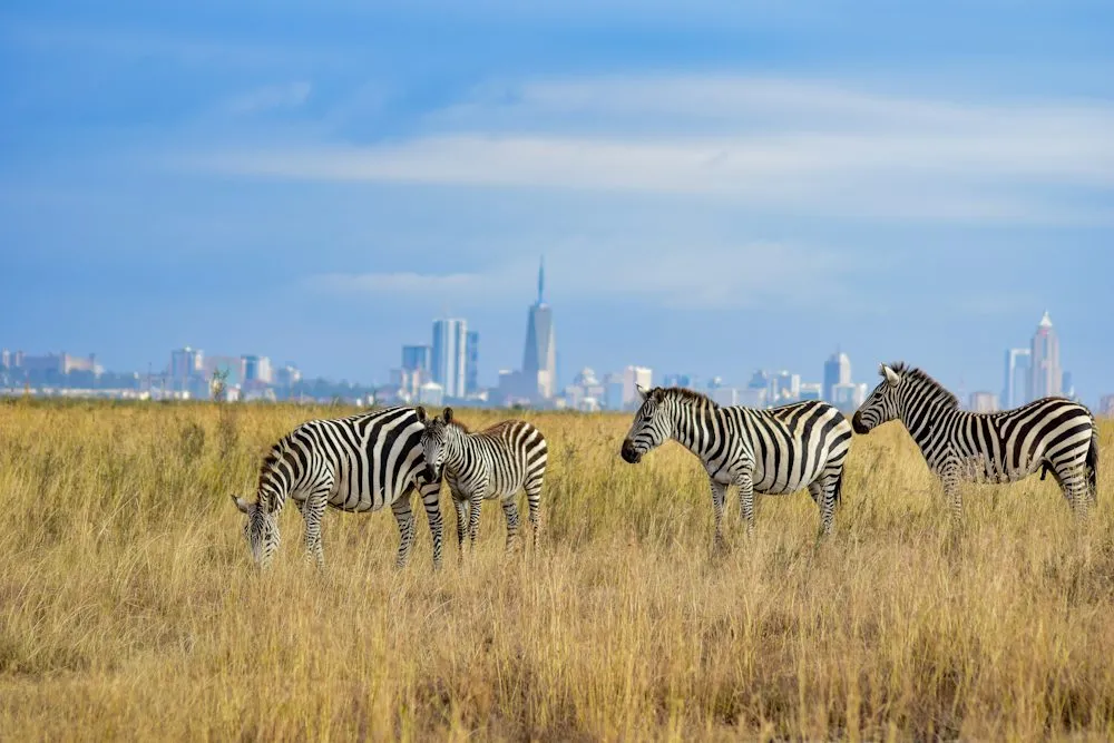
Nairobi National Park lies along Langata Road, about 7 km from the city centre, on the southern side of the capital. It covers 117 square kilometres. Its northern edges run alongside some of Nairobi's busiest roads, and the runway of Jomo Kenyatta International Airport is less than five kilometres from the fence, so planes coming in to land can be seen above the plains.

An electrified fence separates the wildlife from the city. Inside, the land is a mix of open grass plains, valleys, acacia bush and woodland where several rivers meet.

A park with a long history
Nairobi National Park

Opened in 1946, Nairobi National Park was the first national park in Kenya. It was set aside to protect wildlife from hunters and poachers, a job that still shapes how the park is run.

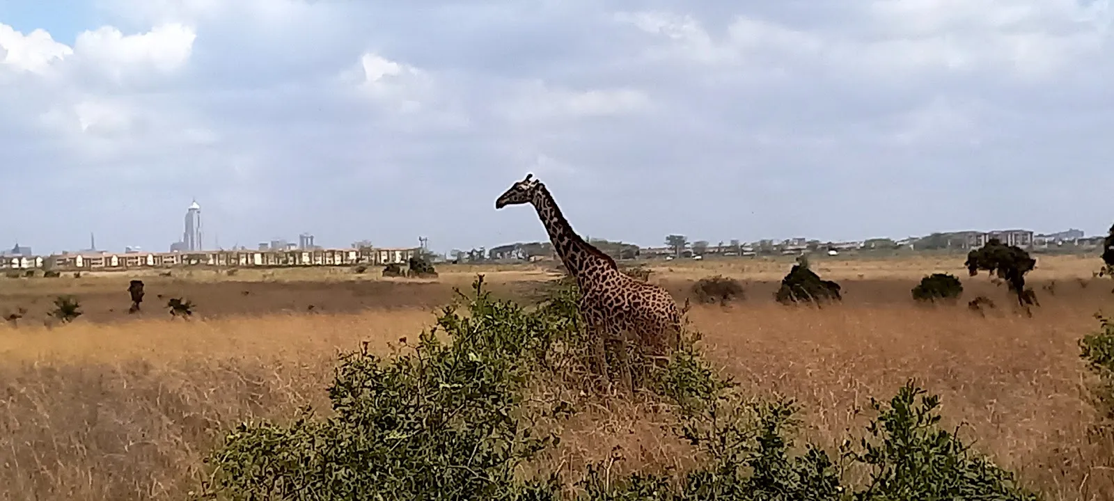
The city has grown up around the park. Housing, schools and busy roads now line parts of its edge, yet the animals have persisted on land their ancestors used for generations.

Wildlife on the plains and in the woodland

Lions, leopards, cheetahs, hyenas, buffalo, giraffes, zebras, wildebeest, eland, gazelles, warthogs, hippos and baboons all live in the park. Around 100 mammal species and more than 400 bird species have been recorded here. Among the birds are ostriches, martial eagles, secretary birds and grey crowned cranes.

Sightings are never certain. Some animals are harder to find on a given day, and lions and rhinos do not always appear on a drive. Early starts give you the best odds.

The rhino sanctuary and the 1989 tusk burning

The park has a rhino sanctuary that protects more than 50 rhinos. The black rhino is critically endangered, and the sanctuary is one of the places in Kenya where it is protected.

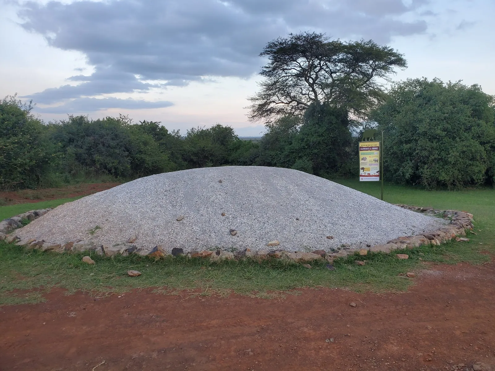
In 1989, President Moi set fire to 12 tons of elephant and rhino tusks to fight poaching and to strengthen Kenya's standing in conservation. A monument marks the ivory burning site inside the park, and visitors can stop there to read about the event.

Orphaned elephants and rhinos at the Sheldrick Trust

The David Sheldrick Wildlife Trust runs an orphanage inside the park. Keepers raise orphaned baby elephants and rhinos, many of which arrive orphaned because of poaching or other human activity.

Visitors can watch the daily feeding sessions and the mud baths. Animals that are rehabilitated here are moved to Tsavo East National Park, where they are released into the wild.

How a visit works

Visitors can take game drives, walk on safari, or stop for a picnic. The park also has walking trails, including one that runs to the hippo pools, hiking trails and three campsites.

The park opens early and closes in the evening. If you are visiting between flights, a driver can take you in from the city and bring you back, which keeps the trip short.

Entry fees and access

Entry fees depend on nationality and age, so check the Kenya Wildlife Service site for current rates before you go.

The entrance and parking lot are wheelchair accessible. The park has public toilets and picnic tables.

Häufige Fragen

Is there an entry fee?

Yes. Fees depend on nationality and age, so check the Kenya Wildlife Service site for current rates before you go.

How long do you need?

Half a day covers a game drive or a walk and a picnic. A few hours is enough for a short visit.

When is the best time to go?

Go early in the morning for better chances of seeing animals and cooler temperatures.

Can you see lions and elephants?

Lions live in the park, but sightings are not guaranteed. The elephants you can see at the David Sheldrick Wildlife Trust are orphans cared for there.

Is the park wheelchair accessible?

The entrance and parking lot are listed as wheelchair accessible.
Weitere Highlights in Nairobi

Alle entdecken