Planeje uma viagem
Idioma: Português (BR)
Planejador de viagensPlaneje sua viagem em um mapa

Principais destinos

EnglishDeutschFrançaisEspañolPortuguêsPortuguês (BR)Italiano
Alerta de viagem · ColômbiaAlguns governos recomendam evitar viagens a partes de Colômbia.Os alertas cobrem apenas estas áreas: Departamento de Arauca, Buenaventura, Departamento de Caquetá (exceto Florencia), Departamento de Casanare, Departamento do Cauca, Departamento do Chocó, Áreas de fronteira com o Equador (profundidade não especificada), Departamento do Guaviare, Departamento do Meta, Departamento de Norte de Santander, Áreas de fronteira com o Panamá (Darién, Chocó), Tumaco, Departamant Valle del Cauca, Takadoù stêr-foñs Venezuela (domder ne vez ket spisaet), Guainía, Departamant Nariño, Antioquia Norzh, Departamant Putumayo, Dehou Bolívar, Dehou Córdoba, Vaupés, Vichada.As recomendações dependem do seu passaporte. Leia a recomendação do governo do seu país antes de reservar.Recomendação oficial
Áreas com alertas
  • Departamento de Arauca · evitar todas as viagens · Canadá, Espanha, Nova Zelândia, Reino Unido, EUA
  • Buenaventura · evitar todas as viagens · Canadá, Nova Zelândia
  • Departamento de Caquetá (exceto Florencia) · evitar todas as viagens · Canadá, Espanha, França, Nova Zelândia
  • Departamento de Casanare · evitar todas as viagens · Espanha, Nova Zelândia
  • Departamento do Cauca · evitar todas as viagens · Canadá, Alemanha, Espanha, Itália, Nova Zelândia, Reino Unido, EUA
  • Departamento do Chocó · evitar todas as viagens · Canadá, Alemanha, Espanha, Nova Zelândia, Reino Unido
  • Áreas de fronteira com o Equador (profundidade não especificada) · evitar todas as viagens · França, Nova Zelândia
  • Departamento do Guaviare · evitar todas as viagens · Canadá, Alemanha, Espanha, França, Nova Zelândia, Reino Unido
  • Departamento do Meta · evitar todas as viagens · Canadá, Espanha, Nova Zelândia
  • Departamento de Norte de Santander · evitar todas as viagens · Canadá, Alemanha, Espanha, Nova Zelândia, Reino Unido, EUA
  • Áreas de fronteira com o Panamá (Darién, Chocó) · evitar todas as viagens · França, Nova Zelândia
  • Tumaco · evitar todas as viagens · Canadá, Nova Zelândia
  • Departamant Valle del Cauca · evitar todas as viagens · Canadá, Alemanha, Itália, Nova Zelândia, EUA
  • Takadoù stêr-foñs Venezuela (domder ne vez ket spisaet) · evitar todas as viagens · França, Nova Zelândia
  • Guainía · evitar viagens não essenciais · Canadá, França, Nova Zelândia
  • Departamant Nariño · evitar viagens não essenciais · Canadá, Alemanha, Espanha, França, Nova Zelândia
  • Antioquia Norzh · evitar viagens não essenciais · Alemanha, França
  • Departamant Putumayo · evitar viagens não essenciais · Canadá, Alemanha, Espanha, França, Nova Zelândia
  • Dehou Bolívar · evitar viagens não essenciais · Alemanha, França, Nova Zelândia, Reino Unido
  • Dehou Córdoba · evitar viagens não essenciais · Alemanha, França, Nova Zelândia, Reino Unido
  • Vaupés · evitar viagens não essenciais · Canadá, França
  • Vichada · evitar viagens não essenciais · Canadá, França, Nova Zelândia

Também indicado por um governo: Áreas de fronteira com o Brasil (França), Rodovia Cali–Popayán–Pasto–Ipiales (França), Região do Catatumbo (Nova Zelândia), Municípios de González e Río de Oro (Cesar) (Canadá), Comunas imediatamente ao sul de Cali (França), Área afetada pelo terremoto (Espanha), Fronteira com o Equador, até 50 km (exceto Ipiales) (Canadá), Montes de María (Espanha), Noroeste de Antioquia (fronteira com o Panamá e golfo de Urabá) (Espanha), Costa do Pacífico (Chocó, Cauca, Valle del Cauca) (França), Fronteira com o Panamá, até 100 km (Canadá), Áreas de fronteira com o Peru (França), Margens do rio Cauca (Sucre, Córdoba, Bolívar, norte de Antioquia) (França), Áreas rurais e montanhosas (Espanha), Takadoù nesañ stêr-foñs Venezuela (Cesar) (Alemanha), Takadoù nesañ stêr-foñs Venezuela (Norte de Santander) (Alemanha), Takadoù nesañ stêr-foñs Venezuela (departamantoù all) (Alemanha), Stêr-foñs Venezuela, a-benn 10 km (EUA), Stêr-foñs Venezuela, a-benn 50 km (ken Cúcuta) (Canadá), Departamant Amazonas (França), Amazonas, a-benn 20 km stêr-foñs Peru (a-gornôg da Puerto Nariño) (Canadá), Antioquia (ken takad metropolitan Medellín) (Nova Zelândia), Strishenn stêr Antioquia–Chocó (Canadá), Rannvro Ariari, suloù Meta (Reino Unido), Bahía Solano (Canadá), Rannvro Bajo Cauca (Reino Unido), Capurganá (Canadá), Cartagena del Chairá (Reino Unido), Cúcuta (Canadá), Reter ha suloù Meta (Alemanha), Reter Valle del Cauca (França), Stêr-foñs Ekwador, a-benn 5 km (Reino Unido), El Doncello (Reino Unido), Florencia (Canadá), Ipiales (Canadá), Jamundí (Reino Unido), La Montañita (Reino Unido), Komunioù Medellín war ar menezioù (França), Nuquí (Canadá), Orito (Reino Unido), Park Broadel Natur Paramillo (Canadá), Paujil (Reino Unido), Popayán (Canadá), Puerto Asís (Reino Unido), Puerto Caicedo (Reino Unido), Puerto Carreño (Reino Unido), Puerto Guzmán (Reino Unido), Puerto Leguízamo (Reino Unido), Puerto Rico (Reino Unido), Quibdó (França), Izrannoù San Jorge ha La Mojana (Sucre) (Nova Zelândia), San Miguel (Reino Unido), San Vicente del Caguán (Reino Unido), Rannvro Sanquianga (Nariño) (Reino Unido), Santander (França), Rannvro Pasifik ar su eus Nariño (Reino Unido), Karterioù labourerien deiziek Bogotá (França), Dehou Sucre (França), Dehou Tolima (Alemanha), Sub-rannvro Sur Cesar (Nova Zelândia), Rannvro Telembi (Nariño) (Reino Unido), Rannvro Urabá (Reino Unido), Valle del Guamuez (Reino Unido), Kengorn Venezuela, 5 km (kement all ar gengorn) (Reino Unido), Kornôg Valle del Cauca (gant Buenaventura) (Reino Unido)

GovernoRecomendaçõesAtualizadoLeia a recomendação
Reino Unido (FCDO)No advice against the whole country (regional advisories)–Leia a recomendação
Estados Unidos (Departamento de Estado)Reconsider travel31 de mar. de 2026Leia a recomendação
Canadá (Global Affairs)Exercise a high degree of caution (regional advisories)–Leia a recomendação
Alemanha (Auswärtiges Amt)Keine Reisewarnung für das ganze Land (regional advisories)13 de out. de 2026Leia a recomendação
Nova Zelândia (SafeTravel)Exercise increased caution (regional advisories)–Leia a recomendação
França (Ministério da Europa e Relações Exteriores)Increased vigilance, with specific areas to avoid (regional advisories)–Leia a recomendação

Verificado diariamente com base nas recomendações publicadas pelos governos; última verificação em 3 de nov. de 2026.RoamLedger resume recomendações oficiais; não são recomendações de nenhum governo.

Parque Nacional Natural Tayrona
Parque

Parque Nacional Natural Tayrona

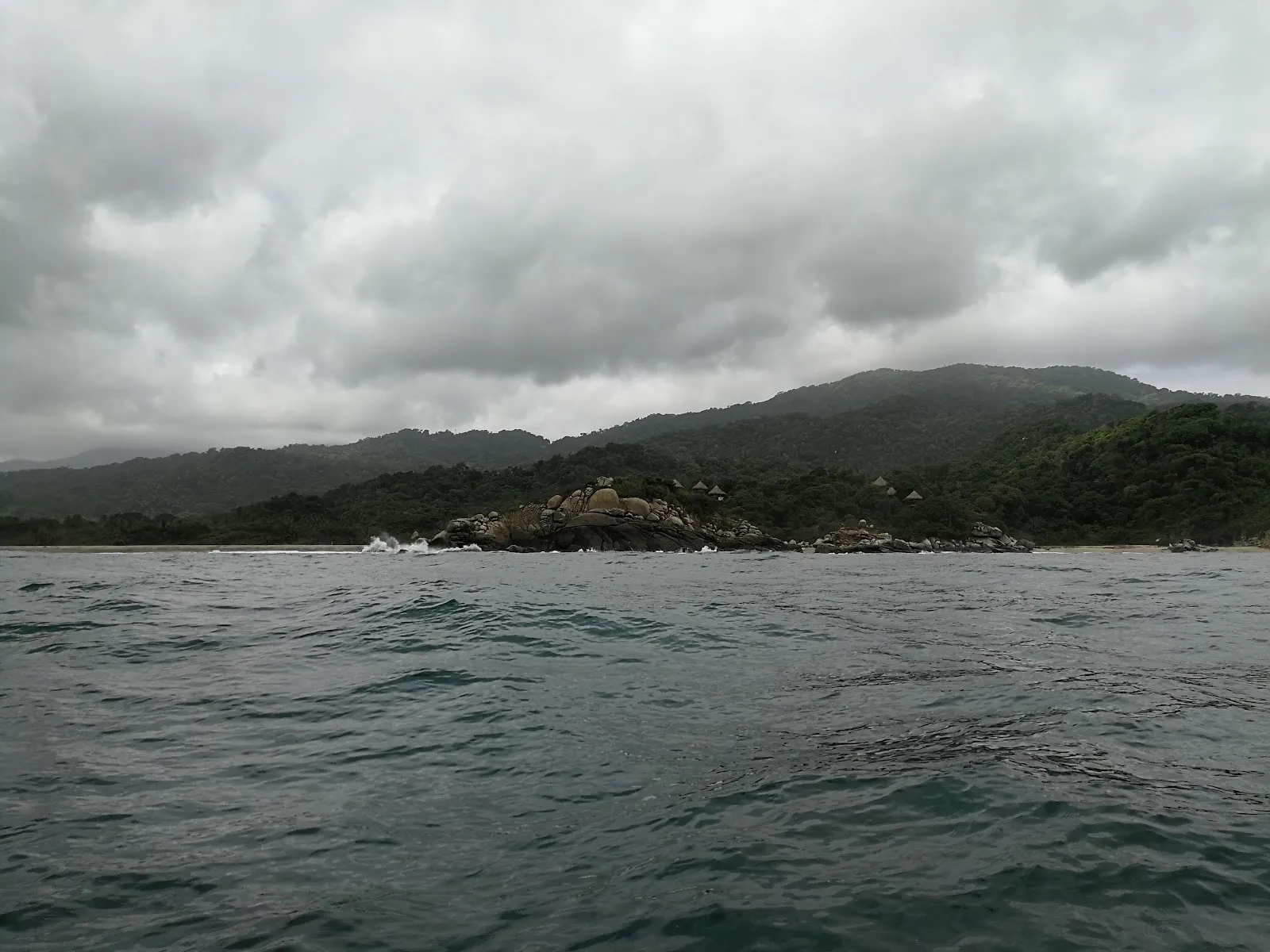
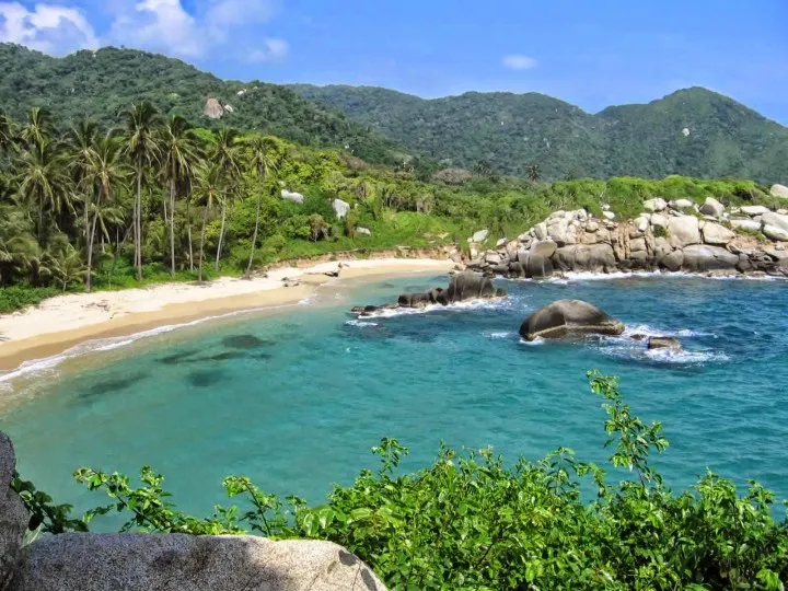
Tayrona National Park is a protected area in Magdalena, Colombia, where jungle-covered mountains, large boulders and golden sand meet the sea.

Tayrona National Park is a protected area in Magdalena, Colombia, where jungle-covered mountains, large boulders and golden sand meet the sea. No road reaches it. You arrive on foot, on horseback or by boat. The most popular route is the walk from the El Zaino entrance to the beach at Cabo San Juan, with food and drink vendors along the trail and a chance of seeing monkeys. Many people sleep a night at a beachside campsite. Heat and humidity are strong, so carry water and pace yourself.

Getting in and getting around
Parque Nacional Natural Tayrona

Steep mountains seal the park off from the main road. It can only be reached on foot, on horseback or by boat, which makes a visit exciting and at times demanding. Day trips are possible, but many people choose to stay overnight.

Arrive with your documents ready. Visitors on foot queue for tickets, and you need your passport, cash and, if you come by vehicle, the license plate number and payment for insurance. Taxis are an easier way to reach the entrance than a private car. The official opening is at 8:00.

No towns lie around the park. The nearest is Santa Marta, so plan your food, cash and transport before you go in. Extra charges such as insurance and the bus are common, and cash is the safest way to pay them.

The walk from El Zaino to Cabo San Juan
Parque Nacional Natural Tayrona

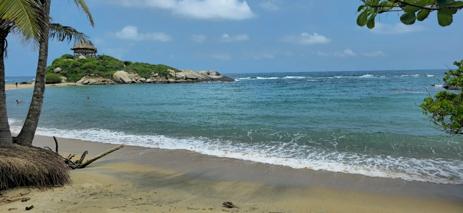
The most popular route starts at the El Zaino entrance and ends at Cabo San Juan. Allow roughly 2 to 3 hours each way. The path is rocky, with many ups and downs, and some boardwalk sections are worn or broken. If you do the full circuit in one day, expect about 6 hours of walking in humid heat, which leaves limited time on the sand.

Vendors along the trail sell drinks, snacks and fresh coconut water. Paletas, the local ice pops, are also sold, and coconut and passion fruit are the flavors to look for. Carry only what you need, because the heat makes a heavy pack tiring.

The trail has narrow spots with good views where people stop for photos, and queues can form there once the crowds arrive. Keep to the right, keep moving on boardwalks, and give way to horses, which share the paths. After rain, mud and horse droppings can make parts of the trail unpleasant, so wear shoes you do not mind getting dirty. The route is demanding and is not suited to people with mobility problems or medical conditions that heat could aggravate.

The beaches

Cabo San Juan and La Piscina are the beaches where you can swim. Signs along the way show where swimming is allowed and where it is not, so follow them. There are no beach chairs, so a towel is useful for lying on the sand. Cabo San Juan is the beach most people walk to, and it is much quieter before the crowds arrive or after noon.

Staying overnight

A couple of beachside campsites let you sleep inside the park, and a hammock stay is one option. Ecohabs Tayrona offers a glamping-style alternative. Staying inside means you can start walking before the 8:00 opening and be at the beaches early, while day visitors are still arriving. In the evening and at dawn the beaches are far emptier. A two-day plan, with one night in the park, suits the distances better than a rushed day trip.

Respecting the park

Indigenous communities live in this area and care for it. Take all your rubbish out with you, keep a respectful distance from animals and follow the signs on swimming and restricted areas. Dress comfortably for heat, and note that cultural expectations about behavior apply on the trails and in the communities you pass.

Perguntas frequentes

How do you get into Tayrona National Park?

The park has no road access. You enter on foot, on horseback or by boat. Many visitors take a taxi to the entrance, which is easier than arriving in a private vehicle.

How long is the walk from El Zaino to Cabo San Juan?

Plan on about 2 to 3 hours each way over rocky, uneven ground. Doing the full circuit in a day means around 6 hours of walking, which leaves little time at the beach.

Can you stay overnight in Tayrona?

Yes. There are beachside campsites, hammock stays and a glamping-style option at Ecohabs Tayrona. Sleeping in the park gives you the beaches and paths before the day crowds arrive.

When is Tayrona least crowded?

Weekdays are quieter than weekends. On the trail, the crush starts shortly after 8:00, so go very early or after noon.

What should you bring to Tayrona?

Bring your passport, cash, water, snacks and a towel. If you drive, bring the license plate number as well. Vendors sell drinks and food on the main trail, but early in the morning the choice can be limited.

Mais atrações imperdíveis em Parque Nacional Tayrona

Explorar tudo